Rivermap
HomeThe Map
List View


 Flusshinweise
Befahrbarkeit
English Summary
Karte Einbetten
Systemstatus
Kontakt und Team
Datenlieferanten
Contributor Agreement
The RCSD
Public licenses
Rivermap Japan
 "Rivermap Supporter" Group
Flusshinweise
Als Grundlage dient wenn immer möglich ein Flussführer.
 RSS-Feed
abonnieren und nichts verpassen.
RSS-Feed
abonnieren und nichts verpassen.
Seite: 1 2 3 4 5 . . . 39 40 41 42 43 44 45 . . . 285 286 287
Resultate 821 - 840 von 5721
Rovana di Campo (CH), Niva - Collinasca
Befahrbarkeit
We had around 3.9, was also a good level.
the two cracks in the cali secion were not runable. (Foto 1)
in the lower half (Foto 2, 3)there is a double hole, which can be quite sticky. you can set up a safty from top river right or check out the left line.
check out the lower george from the „roman“ bridge 300m upstream from the take-our. look-out for the hiking trail.
the two cracks in the cali secion were not runable. (Foto 1)
in the lower half (Foto 2, 3)there is a double hole, which can be quite sticky. you can set up a safty from top river right or check out the left line.
check out the lower george from the „roman“ bridge 300m upstream from the take-our. look-out for the hiking trail.


 • #6576 • 12.05.2025 09:17
Sesia (IT), Alpin Sprint (Otra - Mollia)
Befahrbarkeit
Some changes after the Easter flood, especially in the last part. Worth to have a look where you are not sure
• #6575 • 11.05.2025 23:09Sesia (IT), Balma - Buzzo
 Gefahr vorübergehend
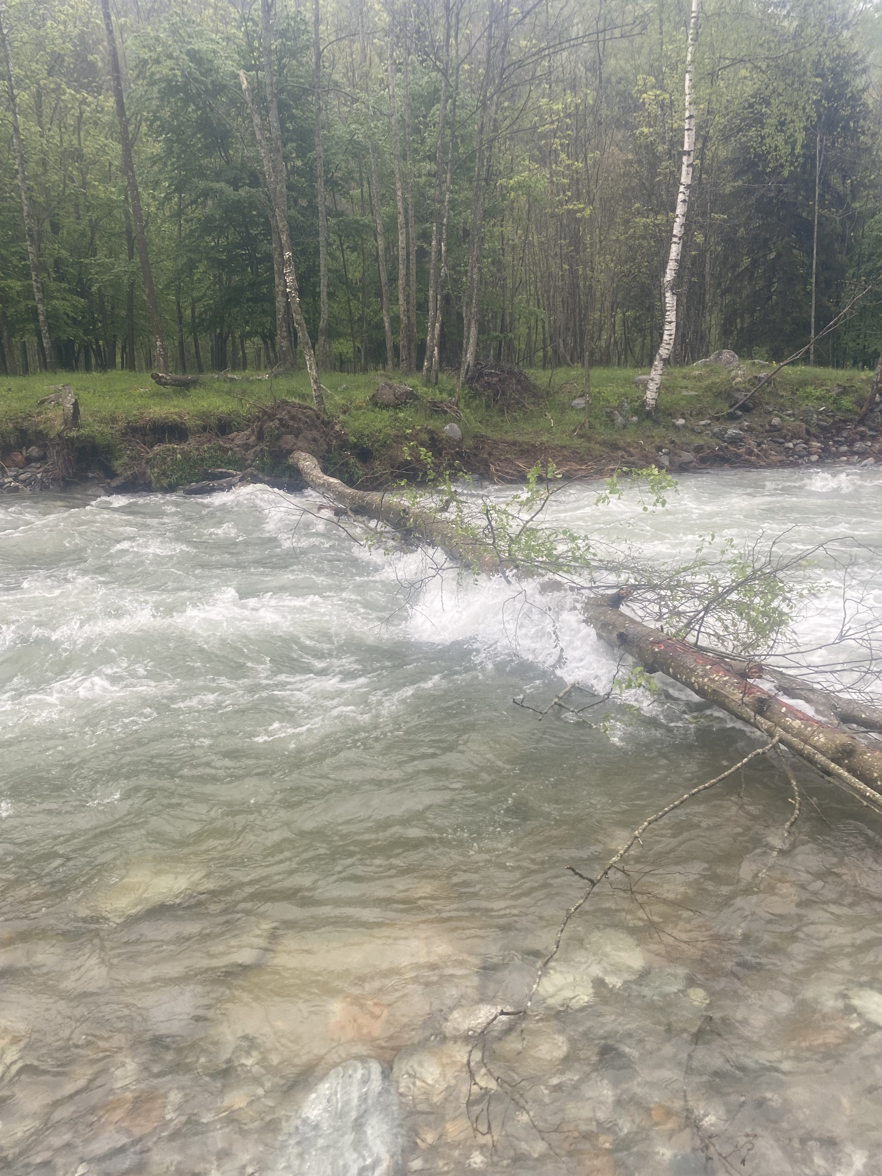
1 km ca after the Vogna’s confluence a large tree block completely the way. Stop in advance and portage.
Few hundreds meters later the river split in some different channels and may they can be unrunnable due log jam
Few hundreds meters later the river split in some different channels and may they can be unrunnable due log jam
 • #6574 • 11.05.2025 23:07
Gallego (ES), Carcavilla Superior - Murillo
Info
https://blog.packrafting.cat/packraft-kayak-de-aguas-bravas-en-el-tramo-clasico-del-rio-gallego
Password: nosvemosenelgallego
Password: nosvemosenelgallego
• #6573 • 11.05.2025 08:22Gallego (ES), Carcavilla Superior - Murillo
Gallego (ES), Presa de la Peña - Carcavilla Superior
Gallego (ES), Presa de la Peña - Carcavilla Superior
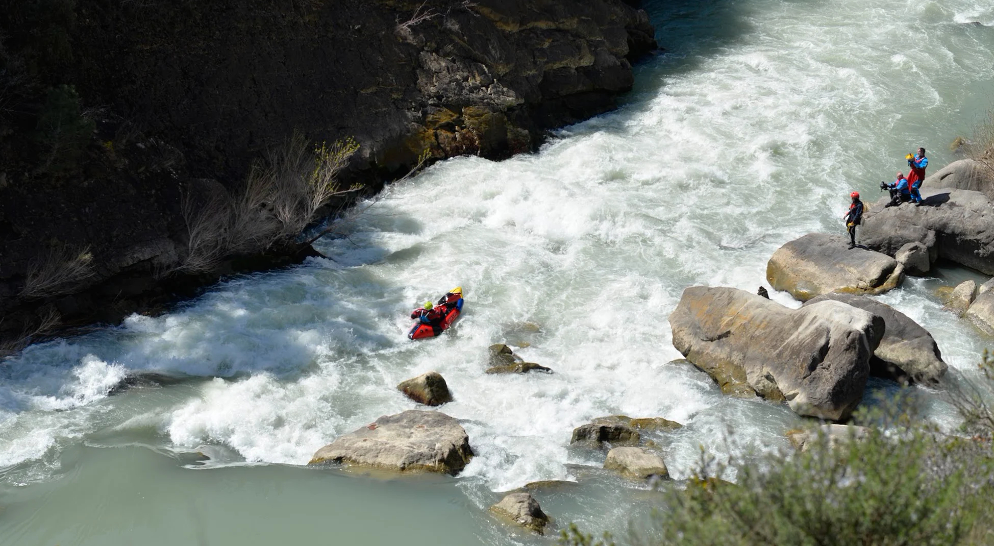
Info
https://blog.packrafting.cat/packraft-kayak-de-aguas-bravas-en-el-tramo-clasico-del-rio-gallego-free
 • #6570 • 11.05.2025 08:17
Boite (IT), Classico (Cortina - San Vito di Cadore)
Befahrbarkeit
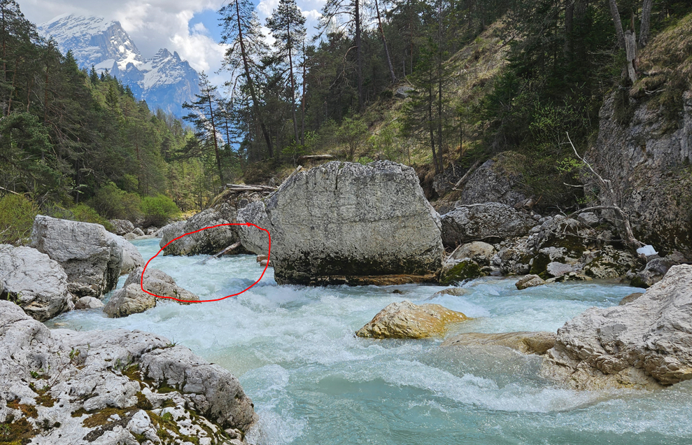
Bei Pegel 17cm Baum quer am Ende eines der Hauptkaterakte. Etwas Unterhalb des Wehres bei Brücke mittiger Schlitz auch durch Baum versperrt.
 • #6569 • 08.05.2025 22:06
Birs (CH), Grellingen - Dornach
Info
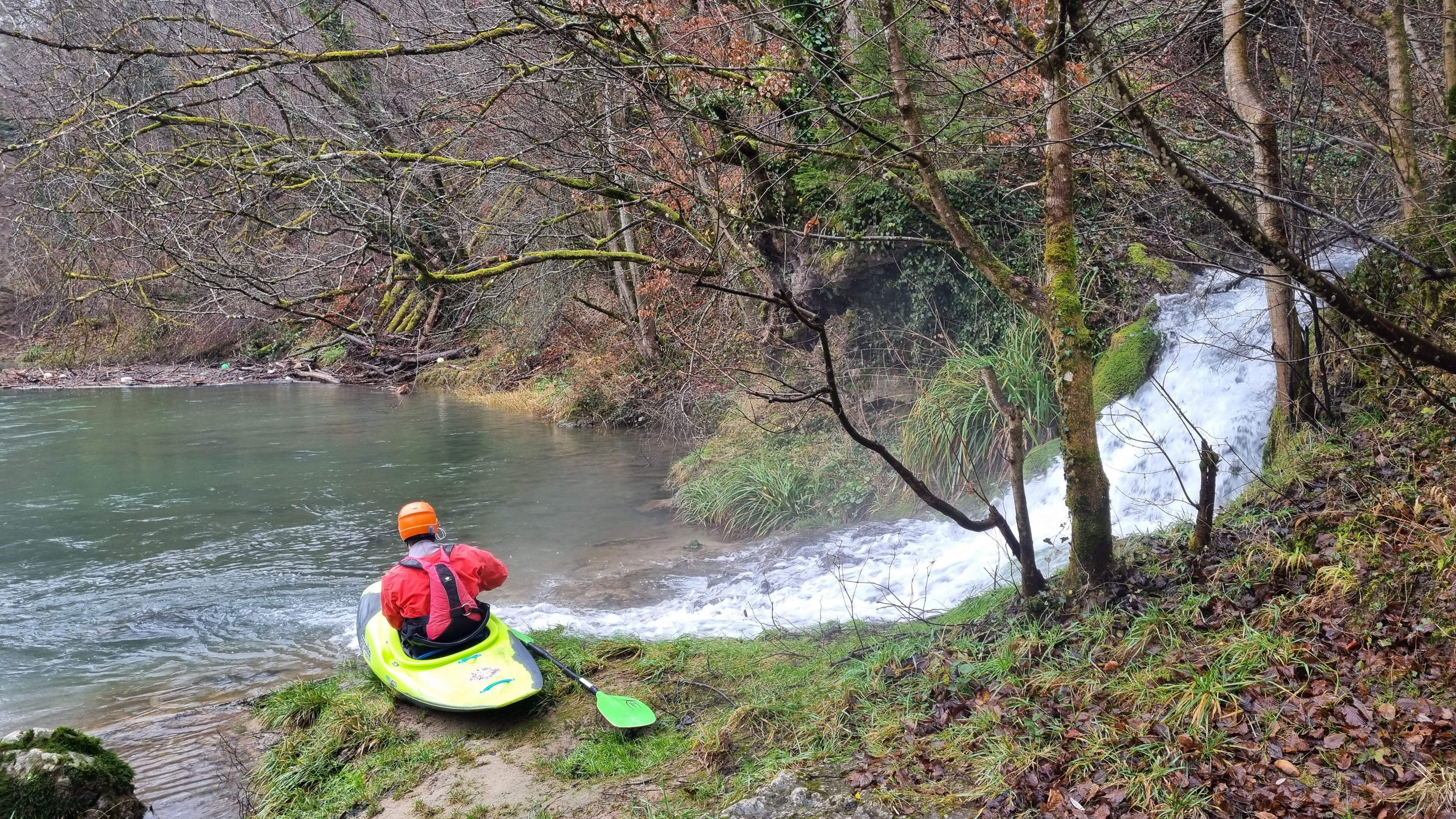
Einstieg unterhalb vom Wehr Büttenen von einem Fussgängersteg über einen kurzen, stark überwachsenen Pfad. Hier befindet sich eine kleine Schlucht mit einigen Stromschnellen. Kurz darauf folgt eine Stufe die vor der Befahrung besichtigt werden sollte.
Bei 47.4494,7.5968 mündet von links der Schlossbach. Hier befindet sich ein alternativer, gut zu erreichender und bequemerer Einstieg (Bild 1).
Kurz darauf folgt bei 47.4544,7.6024 die Schwelle Tugbach. Verblockt, meistens fahrbar. Von der Brücke aus vorher anschauen.
Beim nächsten Fussgängersteg folgt eine weitere Schwelle (47.4566,7.6063). Diese ist grösser und schwieriger als die Vorherige. Steinig und ggF. mit verklemmtem Holz. Unbedingt vom Steg aus vorher ansehen. Bei bei 12m³/s @ Soyhières / 17m³/s @ Münchenstein war sie gut zu fahren (Bild 2).
Unter der Strassenbrücke beim Schloss Angenstein hat es einige schöne Slalomstellen um grosse Blöcke im Fluss (Bild 3).
Bei 47.4729,7.6044 befinden sich links diverse Strukturen im Fluss. Rechts von der Mitte bleiben und über den Schwall fahren.
Als nächstes folgt bei 47.4755,7.6059 der Birsfall Weiden. Steil, stark verblockt mit verklemmtem Holz und generell unsauber. Je nach Wasserstand möglicherweise fahrbar. Besser umtragen. Ausstieg über die Steine rechts.
Ausstieg oberhalb der Fussgängerbrücke beim Schartenflueweg. Fluss links (47.4820,7.6082). Weiter unten folgt das sehr gefährliche Wehr Dornachbrugg gefolgt von der Reinacherheide, wo das Befahren verboten ist.
Bei 47.4494,7.5968 mündet von links der Schlossbach. Hier befindet sich ein alternativer, gut zu erreichender und bequemerer Einstieg (Bild 1).
Kurz darauf folgt bei 47.4544,7.6024 die Schwelle Tugbach. Verblockt, meistens fahrbar. Von der Brücke aus vorher anschauen.
Beim nächsten Fussgängersteg folgt eine weitere Schwelle (47.4566,7.6063). Diese ist grösser und schwieriger als die Vorherige. Steinig und ggF. mit verklemmtem Holz. Unbedingt vom Steg aus vorher ansehen. Bei bei 12m³/s @ Soyhières / 17m³/s @ Münchenstein war sie gut zu fahren (Bild 2).
Unter der Strassenbrücke beim Schloss Angenstein hat es einige schöne Slalomstellen um grosse Blöcke im Fluss (Bild 3).
Bei 47.4729,7.6044 befinden sich links diverse Strukturen im Fluss. Rechts von der Mitte bleiben und über den Schwall fahren.
Als nächstes folgt bei 47.4755,7.6059 der Birsfall Weiden. Steil, stark verblockt mit verklemmtem Holz und generell unsauber. Je nach Wasserstand möglicherweise fahrbar. Besser umtragen. Ausstieg über die Steine rechts.
Ausstieg oberhalb der Fussgängerbrücke beim Schartenflueweg. Fluss links (47.4820,7.6082). Weiter unten folgt das sehr gefährliche Wehr Dornachbrugg gefolgt von der Reinacherheide, wo das Befahren verboten ist.
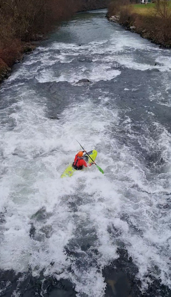
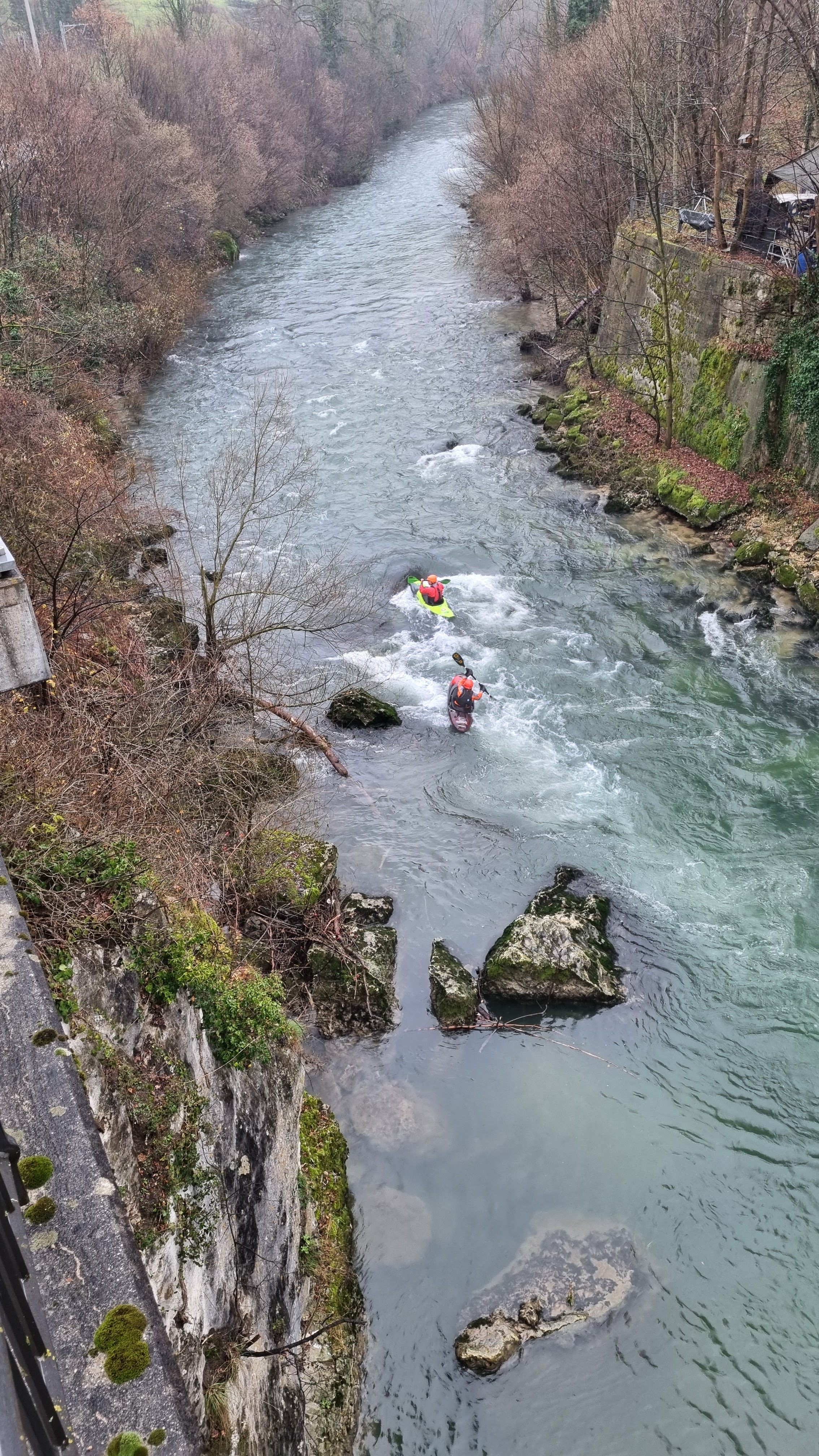 • #6568 • 08.05.2025 19:05
Vedeggio (CH), Camignolo - Lamone
Gefahr vorübergehendPercorso ieri con livello idrometrico a 22. All’altezza del campeggio di Taverne o poco dopo si trova un cavo di acciaio grande come un dito che attraversa tutto il fiume. Con livello 22 bisogna abbassarsi sulla canoa per non prendere il cavo. La causa è un albero caduto che ha tirato giù il cavo.
Inoltre alla fine della lunga rapida a gomito che in fondo gira a sinistra, vicino alla sponda sinistra c’è un tronco sommerso. Con livello 22 si passa sopra sollevando la punta. Lo specifico perché per una pausa si prende proprio la morta a sinistra.
Inoltre alla fine della lunga rapida a gomito che in fondo gira a sinistra, vicino alla sponda sinistra c’è un tronco sommerso. Con livello 22 si passa sopra sollevando la punta. Lo specifico perché per una pausa si prende proprio la morta a sinistra.
• #6567 • 08.05.2025 17:26Maggia (CH), Aurigeno - Avegno
Befahrbarkeit
Bei 35cm3 hat es viele tolle kehrwasser, wellen und Walzen:)

 • #6566 • 08.05.2025 13:50
Weißach (AT), Große Weißachschlucht (Weißach Talbrücke - Bozenau)
Gefahr vorübergehendThis Tree ist after the Weißachstufen. But there are even more trees before... Be carefull, especially at high water...
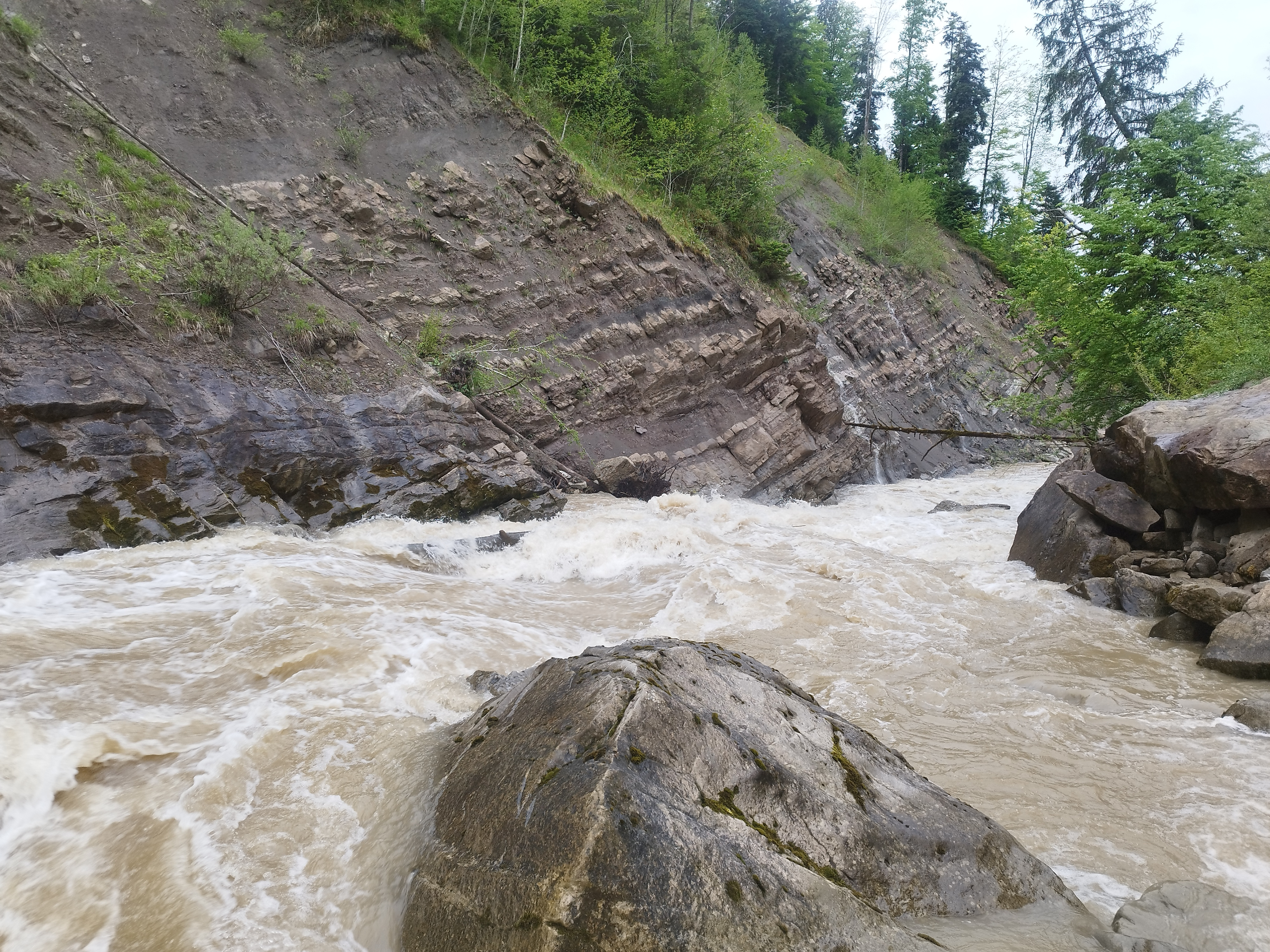 • #6565 • 07.05.2025 20:47
Moesa (CH), Sorte - Cama
Divers
Hi, If you found a KKO spray deck at the takeout of the standard Section of the Moesa in thursday the 1st may 2025... It might bei Mine. I hung it over the guardrail over the bridge. I'd be so thankfull If you called me.... 0049 1734975711 thank you....
• #6564 • 07.05.2025 20:43Giffre (FR), Sixt - Samoëns
GefahrLes crues du printemps charrient beaucoup de graviers (en plus des arbres) qui peuvent changer les rapides de la gorge, en particulier le rouleau peu après l'entrée.
Inspectez la gorge depuis la rive droite et téléphonez à une compagnie de raft locale pour être sûrs de la faisabilité de la gorge.
Ne vous contentez pas de voir que le niveau est au vert !
Inspectez la gorge depuis la rive droite et téléphonez à une compagnie de raft locale pour être sûrs de la faisabilité de la gorge.
Ne vous contentez pas de voir que le niveau est au vert !
• #6563 • 07.05.2025 19:01Travo (FR), Haut (Pont de Chisa - Pont de Ghjineparu)
Bewertung NW-MW-HW
If you go and read the gauge @Chisa, the calibration set before use of the online gauge was:
min 90 cm
med 120 cm
max 150 cm
min 90 cm
med 120 cm
max 150 cm
• #6562 • 07.05.2025 18:25Arachtos (GR), Middle (Ambelochori Bridge/Politsa - Plaka)
GefahrBuilding road till end of Mai 2025. Falling stones
• #6561 • 07.05.2025 09:54Arachtos (GR), Lower (Plaka - Bridge Tzaris/Skoupa)
GefahrBuilding road till end Mai 2025. Falling stones.
• #6560 • 07.05.2025 09:53Birs (CH), Naturschutzgebiet Reinacher Heide - Birskopf
Sesia (IT), Varallo - Doccio
Bewertung NW-MW-HW
Percorso il 2 maggio 2025, idrometro a 140, livello ideale per scendere in sicurezza e divertendosi. Bei treni di onde e rapide non manovriere.
 • #6558 • 07.05.2025 07:34
Verzasca (CH), Obere 2 (Croce - Brione)
Befahrbarkeit
Einige tolle Stellen:)
Dazwischen teils etwas steinig
35m2
Guter Übernachtungsplatz für 24.- pro Camper, inc Parkplatz gebühren im ganzen Tal
https://maps.app.goo.gl/dustUXaVkAnWVkYx8?g_st=com.google.maps.preview.copy
Dazwischen teils etwas steinig
35m2
Guter Übernachtungsplatz für 24.- pro Camper, inc Parkplatz gebühren im ganzen Tal
https://maps.app.goo.gl/dustUXaVkAnWVkYx8?g_st=com.google.maps.preview.copy

 • #6557 • 06.05.2025 16:55
Seite: 1 2 3 4 5 . . . 39 40 41 42 43 44 45 . . . 285 286 287
nach oben