Rivermap
HomeThe Map
List View
Befahrbarkeit
English Summary
Karte Einbetten
Systemstatus
Kontakt und Team
Datenlieferanten
Contributor Agreement
The RCSD
Public licenses
Rivermap Japan
![]() "Rivermap Supporter" Group
"Rivermap Supporter" Group
Flusshinweise
Als Grundlage dient wenn immer möglich ein Flussführer.
Seite: 1 2 3 4 5 . . . 281 282 283
Resultate 1 - 20 von 5642
Kander (CH), Blausee - Kandergrund
Abschnitt nach Kraftwerk. Baum direkt unter der Schlüsselstelle. Ca.14.5 Kubik bei Pegel Frutigen.
 • #7467 • 20.07.2026 19:38
Isabena (ES), Monasterio de Obarra - Puente de Pardinella
Isabena (ES), Puente de Pardinella - Serraduy
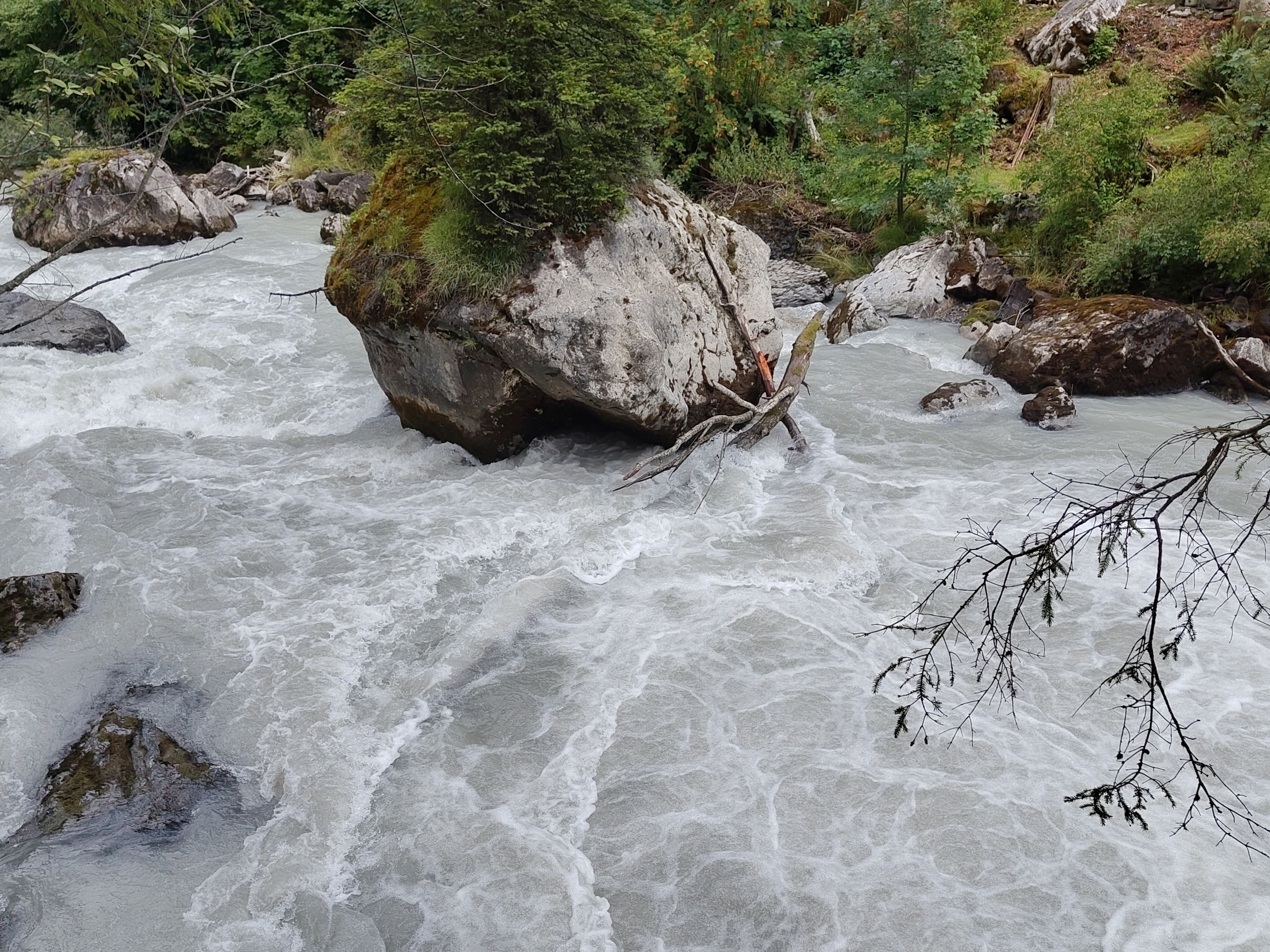
Inn (CH), Giarsun
Divers
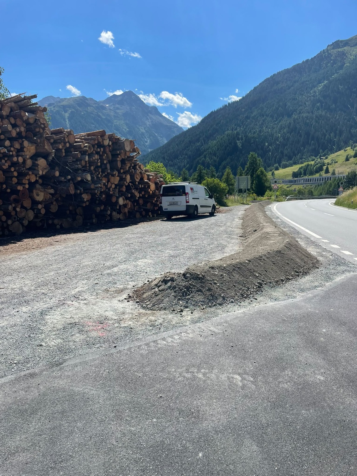
Eingeschränkte Parkiermöglichkeit bei Lavin Holzplatz
Die Gemeinde hat zu unserer Überraschung den Parkplatz stark eingeschränkt mit einem Sicherheitswall aus Sand, der die Ausfahrt an der vorgesehenen Ausfahrt erzwingt. Leider stehen damit nur noch ca. 3 bis 5 Parkplätze zur Verfügung. Ob hier etwas unternommen werden muss, um ein Parkierchaos zu verhindern, ist uns noch nicht klar.
Wir beobachten die Situation und sind, da wir selbst nicht immer vor Ort sind, auch sehr dankbar für Hinweise über Probleme, die sich ergeben, an Hans.
Wir stehen in Kontakt mit der Gemeinde Zernez und werden, falls sich ein eindeutiger Handlungsbedarf ergibt, mit der Gemeinde eine Lösung suchen.
Für die Arbeitsgruppe Inn
Hans
tel. +41 79 652 40 70
 • #7462 • 18.07.2026 17:34
Inn (CH), Suscher Strecke
Divers
Eingeschränkte Parkiermöglichkeit bei Lavin Holzplatz
Die Gemeinde hat zu unserer Überraschung den Parkplatz stark eingeschränkt mit einem Sicherheitswall aus Sand, der die Ausfahrt an der vorgesehenen Ausfahrt erzwingt. Leider stehen damit nur noch ca. 3 bis 5 Parkplätze zur Verfügung. Ob hier etwas unternommen werden muss, um ein Parkierchaos zu verhindern, ist uns noch nicht klar.
Wir beobachten die Situation und sind, da wir selbst nicht immer vor Ort sind, auch sehr dankbar für Hinweise über Probleme, die sich ergeben, an Hans.
Wir stehen in Kontakt mit der Gemeinde Zernez und werden, falls sich ein eindeutiger Handlungsbedarf ergibt, mit der Gemeinde eine Lösung suchen.
Für die Arbeitsgruppe Inn
Hans
tel. +41 79 652 40 70
Die Gemeinde hat zu unserer Überraschung den Parkplatz stark eingeschränkt mit einem Sicherheitswall aus Sand, der die Ausfahrt an der vorgesehenen Ausfahrt erzwingt. Leider stehen damit nur noch ca. 3 bis 5 Parkplätze zur Verfügung. Ob hier etwas unternommen werden muss, um ein Parkierchaos zu verhindern, ist uns noch nicht klar.
Wir beobachten die Situation und sind, da wir selbst nicht immer vor Ort sind, auch sehr dankbar für Hinweise über Probleme, die sich ergeben, an Hans.
Wir stehen in Kontakt mit der Gemeinde Zernez und werden, falls sich ein eindeutiger Handlungsbedarf ergibt, mit der Gemeinde eine Lösung suchen.
Für die Arbeitsgruppe Inn
Hans
tel. +41 79 652 40 70
 • #7461 • 18.07.2026 17:34
Weisse Lütschine (CH), Lauterbrunnen - Zweilütschinen
Divers
Hoi zäme
Schaut doch, dass wenn ihr beim Minigolf parkiert, ihr auch im Bistro etwas konsumiert - so können wir diesen Parkplatz hoffentlich noch länger nutzen!
Schaut doch, dass wenn ihr beim Minigolf parkiert, ihr auch im Bistro etwas konsumiert - so können wir diesen Parkplatz hoffentlich noch länger nutzen!
• #7460 • 17.07.2026 18:11Strandelvi (NO), Moneydrop - Lønavatnet
Info
• #7459 • 17.07.2026 14:19Salza (AT), Mittellauf (Weichselboden - Fachwerk)
In Wildalpen nach der Brücke und dem Pegel teilt sich die Salza in 2 Arme. Der linke Arm ist durch einen Baum versperrt, Lebensgefahr.
• #7458 • 17.07.2026 12:03Cellina (IT), Classico (Confluenza Rio Ferron - Ponte Mezzo Canale)
Bewertung NW-MW-HW
Something changed in the gauge around mid of June 2026. The usual 'no water' level jumped from -2cm to 32cm so the current calibrations are completely off (probably by 35cm, but that still needs to be verified)
• #7457 • 16.07.2026 12:28Cellina (IT), Lesis - Confluenza Rio Ferron
Bewertung NW-MW-HW
Something changed in the gauge around mid of June 2026. The usual 'no water' level jumped from -2cm to 32cm so the current calibrations are completely off (probably by 35cm, but that still needs to be verified)
• #7456 • 16.07.2026 12:28Inn (CH), Brail Schlucht
Bewertung NW-MW-HW
Mir scheint NW bei 7m3/s zu hoch angesetzt. Wir sind Ende Juni bei 6.5m3/s gepaddelt. Das fühlte sich an wie früher ca 10m3/s, ging also noch ohne viel Steinkontakt.
• #7455 • 16.07.2026 09:58Glenner (CH), Peiden - Ilanz
Bewertung NW-MW-HW
NW scheint mir nicht korrekt. Wir sind Mitte Juni bei 6,5m3/s inkl. Wehr gepaddelt. Das fühlte sich an, wie früher 11m3/s. Schlage vor, NW bei ca. 5m3/s anzusetzen.
• #7454 • 16.07.2026 09:52Trysilelva (NO), Femundsundet - Elvbrua
Bewertung WW-Grad
I'd grade this as a class 1-2 (2-3). Its basically flat water with 4 or 5 easy rapids, the hardest is at the road bridge. Which is a class 2-3 (in realtion to Sjoa's Steinholet for example).
• #7453 • 15.07.2026 17:12Sjoa (NO), Åmot
Info
• #7452 • 14.07.2026 09:40Ötztaler Ache (AT), Köfelser Strecke (Brücke - Umhausen)
Info
• #7451 • 14.07.2026 09:38Ötztaler Ache (AT), Obere (Sölden - Bruggen)
Venter Ache (AT), Untere (P4 - Zwieselstein)
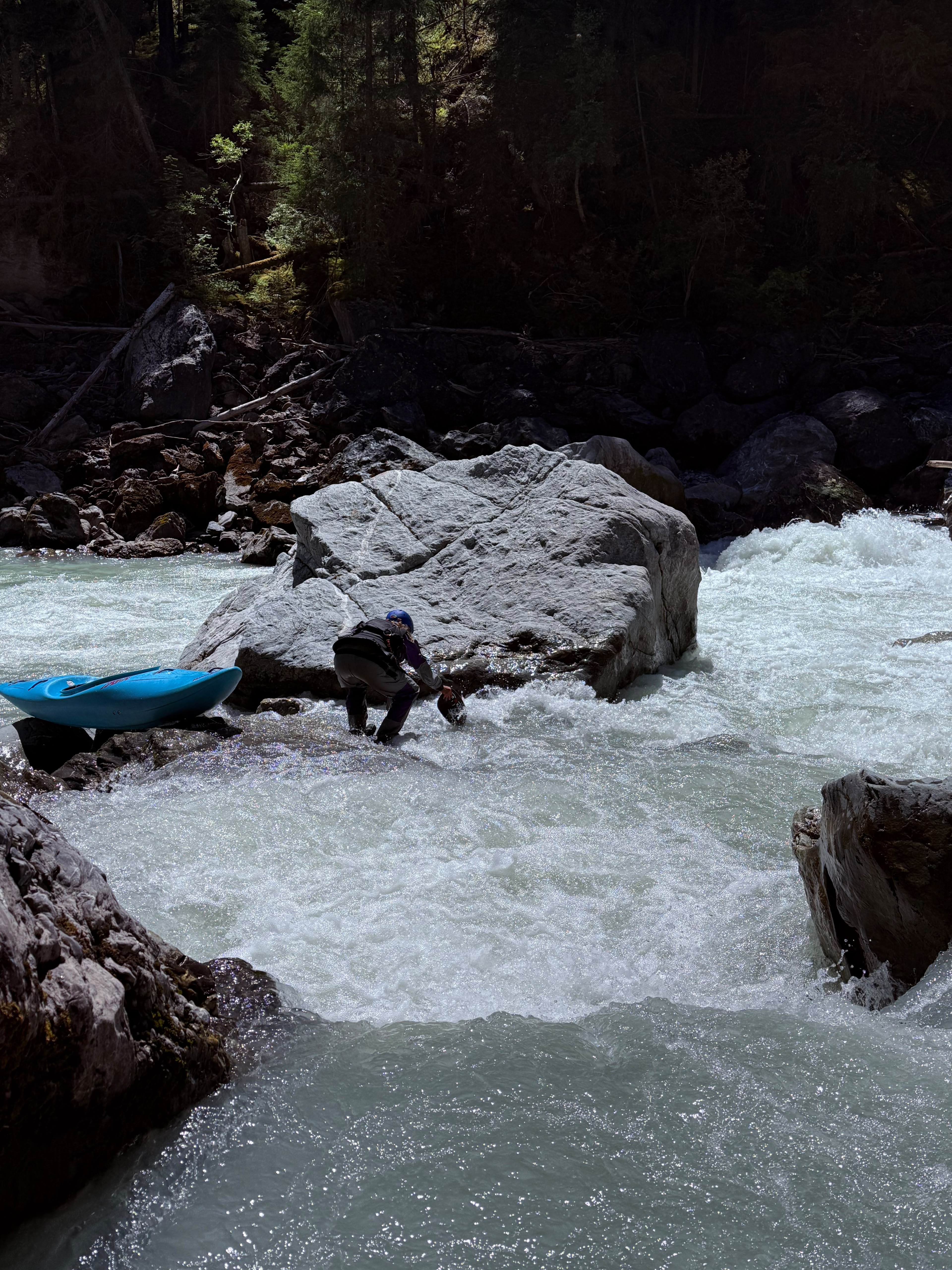
Inn (CH), Ardez
River changed in the spring. Now at the entry after the portage there is a huge syphon (we moved the paddle around underneath). There is no exit on the syphon on the downstream side. If your boat gets pinned, do not swim; a person can get stuck there. picture taken at 15m3/s.
 • #7448 • 13.07.2026 04:15
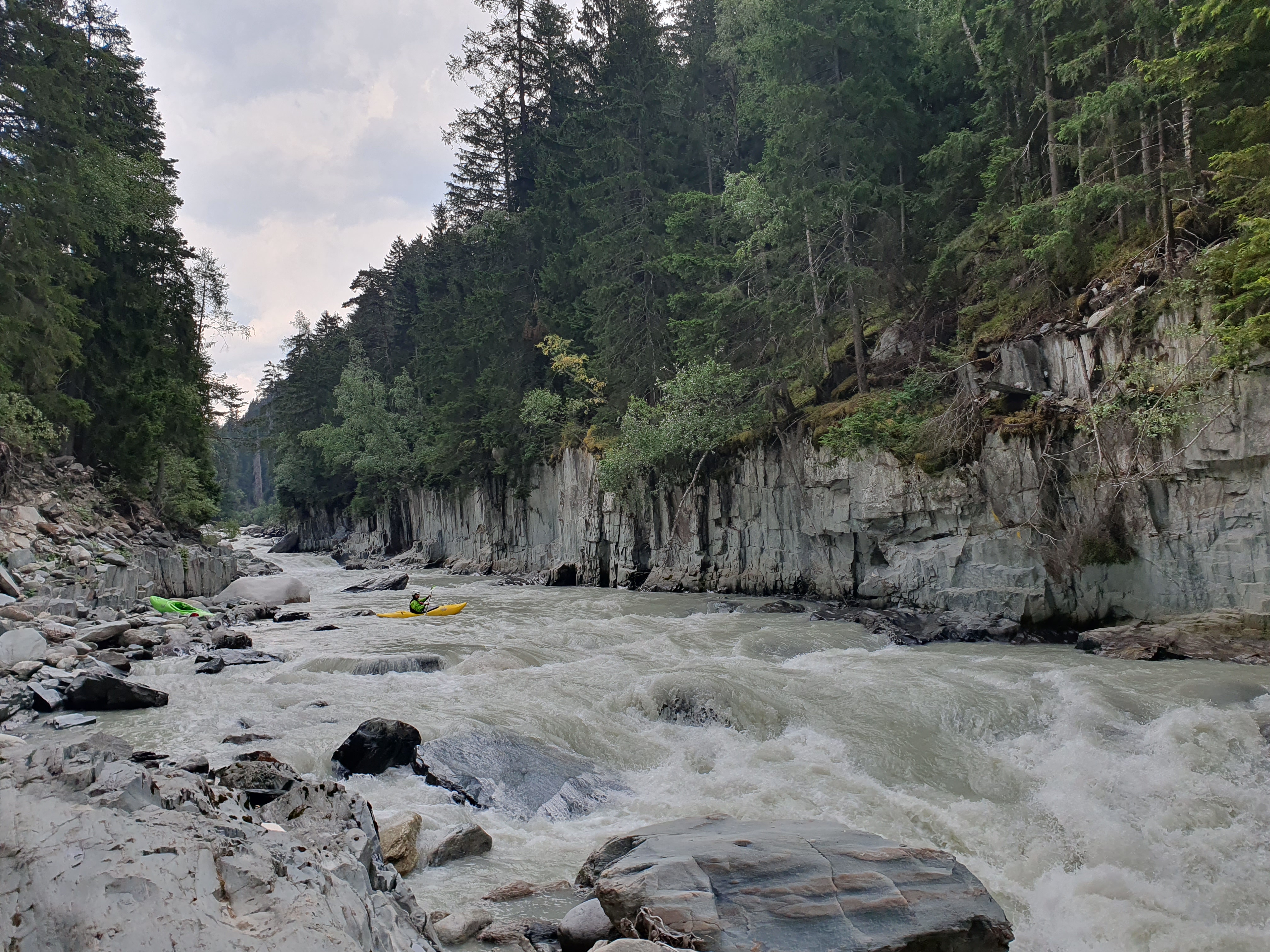
Rhône / Rotten (CH), Untere Rhoneschlucht
Befahrbarkeit
First time for me after the 2024's flood. It changed a lot. A bit less fun and fluid in my opinion.
 • #7447 • 11.07.2026 20:18
Rhône / Rotten (CH), Untere Rhoneschlucht
Bewertung NW-MW-HW
Mit 130 sah es mittel aus (grüne Linie)
 • #7446 • 11.07.2026 20:15
Seite: 1 2 3 4 5 . . . 281 282 283
nach oben