Rivermap
HomeThe Map
List View
Befahrbarkeit
English Summary
Karte Einbetten
Systemstatus
Kontakt und Team
Datenlieferanten
Contributor Agreement
The RCSD
Public licenses
Rivermap Japan
![]() "Rivermap Supporter" Group
"Rivermap Supporter" Group
Flusshinweise
Als Grundlage dient wenn immer möglich ein Flussführer.
Morača: Lower
III 0 km

Morača @ Zlatica 110 cm @ 14.05.2026 12:00
? | ? cm
Resultate 1 - 2 von 2
Info
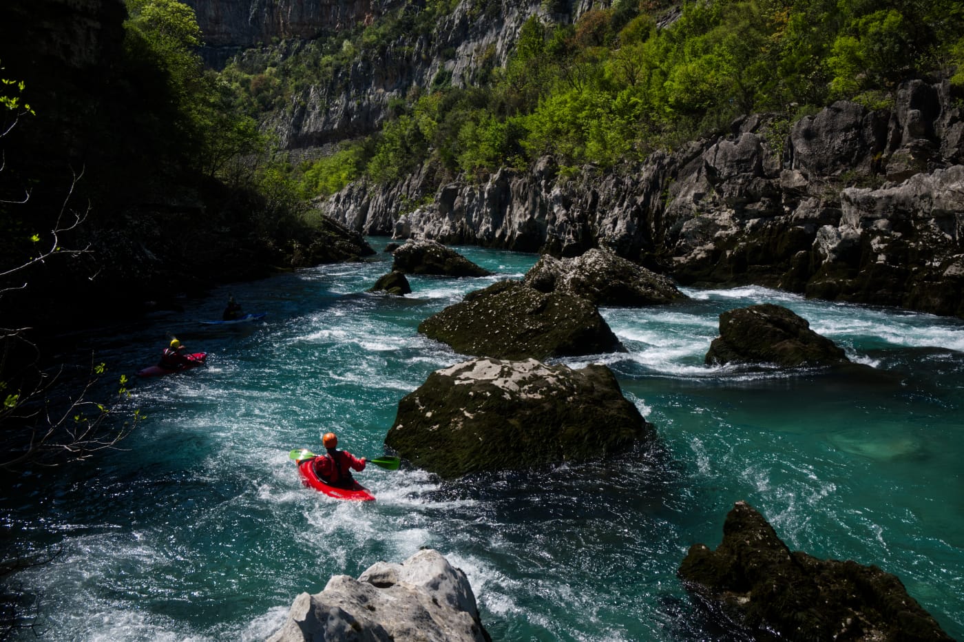
Wir sind diesen Abschnitt am 17.6.2025 bei starkem sommerlichem Niedrigwasser (Pegel Pernica: 33 cm) vom Ausstieg des oberen Abschnittes bei der zweiten Hängebrücke 42.58666, 19.35893 bis zum Camp Titograd 42.48875, 19.30919 gefahren. Vor allem gegen Ende, wenn es mehr über Kiesbänke geht, hatten wir öfter Steinkontakt. Auch wenn dieser Abschnitt nicht so spektakulär wie der Canyon ist, ist er mit seinen Niederklammen und Felslabyrinthen trotzdem ein Highlight!
Nach 0,0 km 42.58666, 19.35893
Einstieg 200 m vor Hängebrücke. Man parkt oben an der Straße und läuft 30 Höhenmeter auf breitem Weg zur Moraca hinunter.
Nach 0,5 km 42.58277, 19.35577
Schwierige Stelle bei einem massiven Querriegel, links umtragbar, bei unserem Wasserstand Wildwasser IV
Nach 8,2 km 42.53081, 19.3462
Autobahnbrücke
Nach 10,0 km 42.51610, 19.34493
Straßenbrücke
Nach 10,3 km 42.51402, 19.34647
Mündung der Mala Rijeka bei einer weiteren Autobrücke
Nach 15,6 km 42.48875, 19.30919
Ausstieg am Camp Titograd

 • #6717 • 01.07.2025 15:33
Info
I paddled this section on April 7th 2024 at a level of 85cm. We put in a bit lower down, at 42.559333,19.340722, where there is a good access to the river from the road and took out a bit earlier at Autocamp Titograd.
At this level the section is mostly WW 2 with some 3. The rock is mostly conglomerate hence there are many big undercuts and siphons. The passages are wide enough to stay clear of them.
At this level the section is mostly WW 2 with some 3. The rock is mostly conglomerate hence there are many big undercuts and siphons. The passages are wide enough to stay clear of them.
 • #5817 • 18.04.2024 18:45