Rivermap
HomeThe Map
List View
Befahrbarkeit
English Summary
Karte Einbetten
Systemstatus
Kontakt und Team
Datenlieferanten
Contributor Agreement
The RCSD
Public licenses
Rivermap Japan
![]() "Rivermap Supporter" Group
"Rivermap Supporter" Group
Flusshinweise
Als Grundlage dient wenn immer möglich ein Flussführer.
Seite: 1 2 3 4 5 . . . 21 22 23 24 25 26 27 . . . 270 271 272
Resultate 461 - 480 von 5438
Inn (CH), Brail Schlucht
Befahrbarkeit
Befahren bei ca. 23 und 20 kubik: der Baum aus #6047 ist immer noch drin, sonst in der Hauptlinie alles frei. Bei den Haifischzähnen ist der linke Durchgang von einem Baum blockiert (siehe Fotos). Dort durch fährt man aber normalerweise eh nicht, bzw. kommt schwer dort hin.
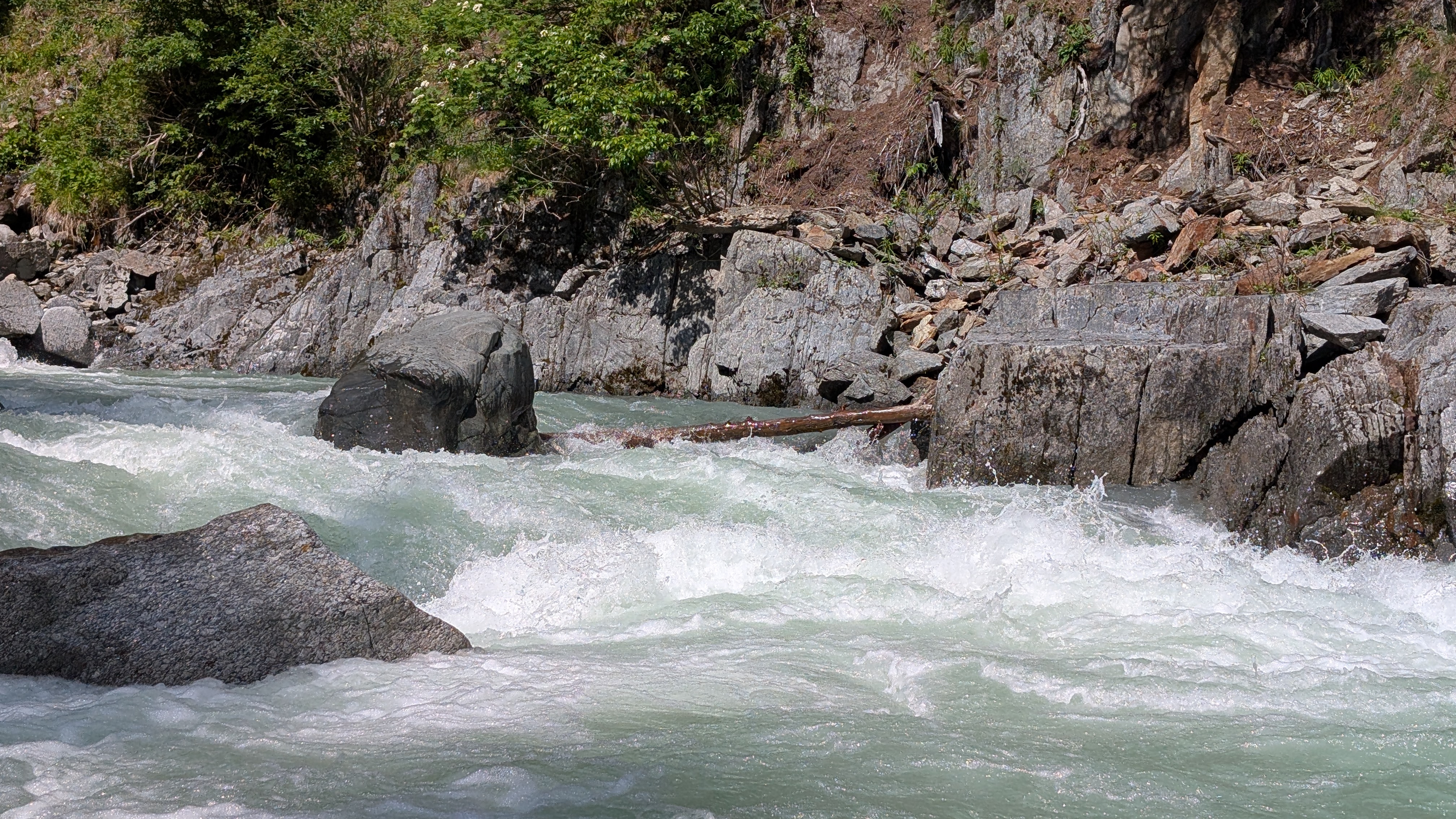
 • #6663 • 10.06.2025 22:42
Sanna (AT), Unterhalb Zusammenfluss - Landeck
Info
Grünes Lendal Mania Paddel gefunden. Gerne per WhatsApp melden, wenns einem gehört. +49 176 30162979
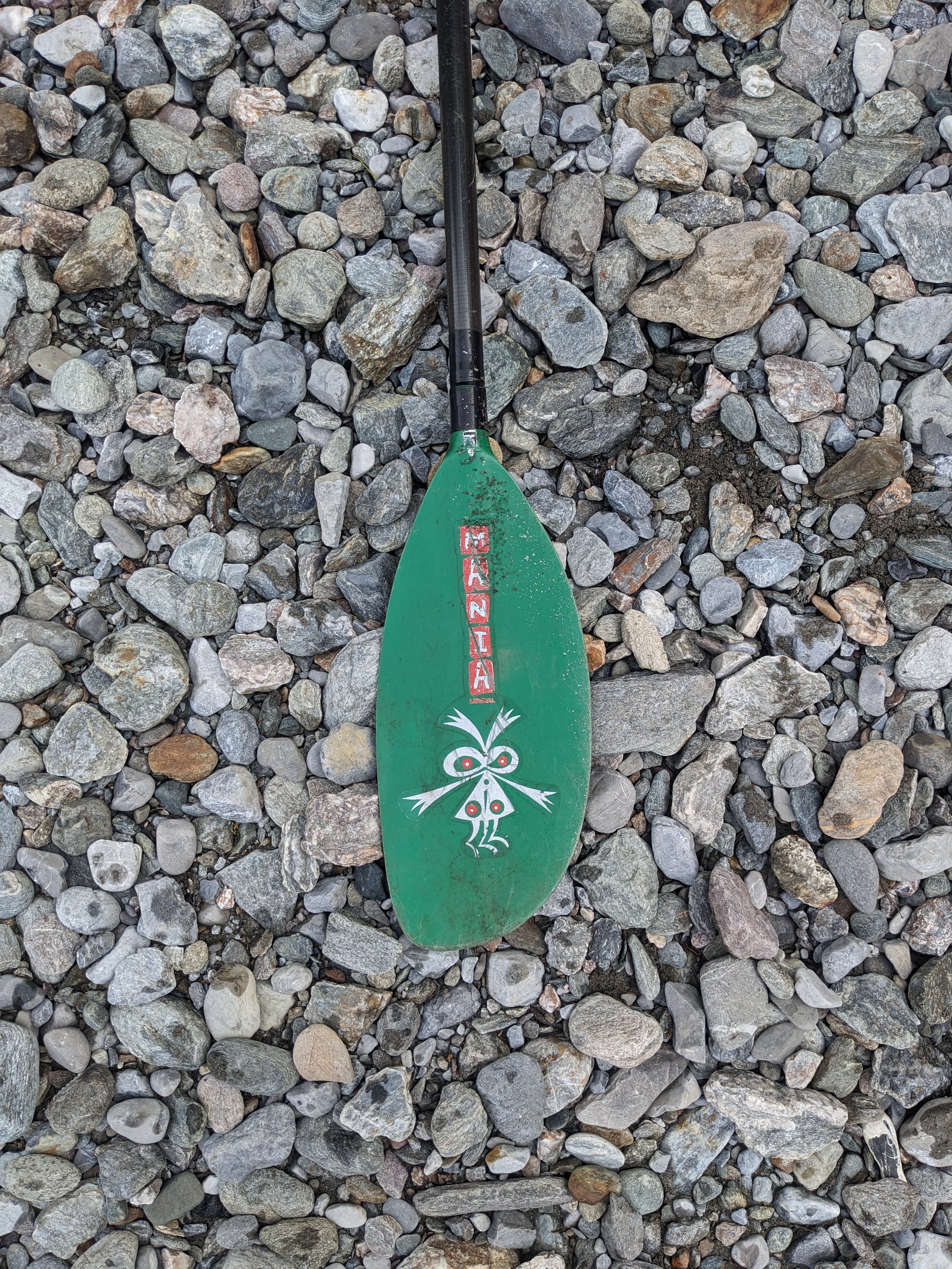 • #6662 • 10.06.2025 16:47
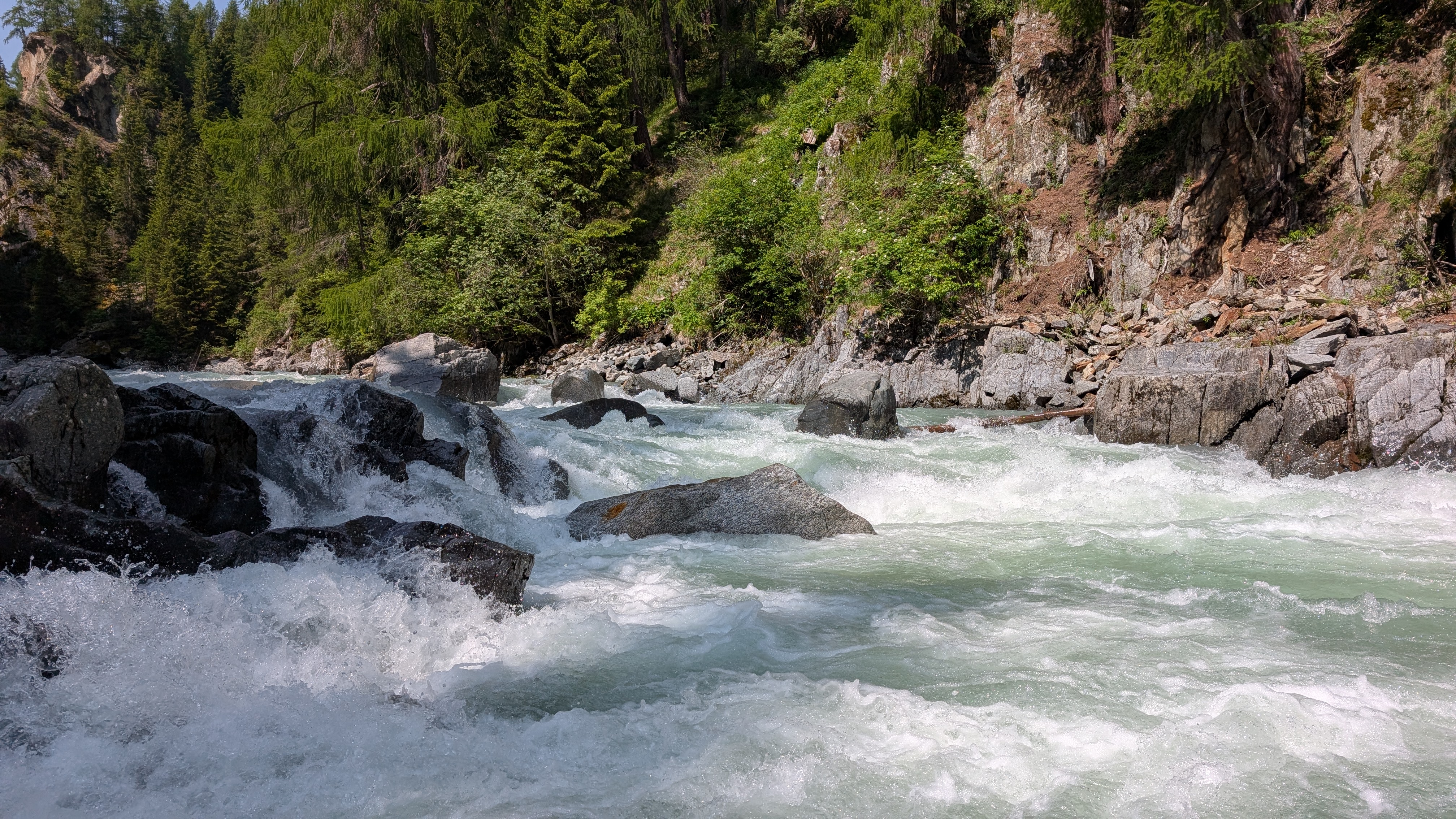
Glenner (CH), Uors - Peiden
Befahrbarkeit
befahren am 8.6. Im Professor Holz in der rechten Durchfahrt. Sonst alles frei.
• #6661 • 10.06.2025 14:14Glenner (CH), Peiden - Ilanz
Befahrbarkeit
Befahren am 8.6. alles frei
• #6660 • 10.06.2025 14:13Sesia (IT), Alpin Sprint (Otra - Mollia)
Bewertung WW-Grad
we ran it yesterday at 70cm.
some rapids are pushy at this flow, some felt a bit low. so probably medium flow is correct.
but: we think the 4/4+ labeling is no more correct. more like a solid 4-5
(imho, almost comparable to lower verzasca in difficulty)
Cheers,
Kilian
some rapids are pushy at this flow, some felt a bit low. so probably medium flow is correct.
but: we think the 4/4+ labeling is no more correct. more like a solid 4-5
(imho, almost comparable to lower verzasca in difficulty)
Cheers,
Kilian
• #6657 • 10.06.2025 11:25Albula (CH), Waldschlucht
Am 9.6.2025 bei ca. 27 m3/s gemäss Hilfspegel gefahren. Baum in Kernstück der Schlucht komplett über den Bach. In der Anfahrt nicht leicht zu sehen. Umtragen schwierig, da der Hang links sehr schlammig. ist
 • #6656 • 09.06.2025 22:27
Saane / Sarine (CH), Camping Le Berceau - Lac du Vernex
Gefahr aufgehoben
Sind heute bei 35 cm gepaddelt und der Baum war weg.
• #6655 • 09.06.2025 20:13Isel (AT), Untere, St. Johann im Walde - Lienz
Befahrbarkeit
Pegelstation in Lienz schein ausgefallen zu sein, stattdessen Pegel bei Brühl. Befahren am 9.6.25 bei ca. 193 cm. Problemlos, ich würde mal behaupten dass wir gutes Mittelwasser hatten
• #6654 • 09.06.2025 19:53Drau (AT), Thal - Gailitzenklamm
Befahrbarkeit
Befahren am 9.6.25 bei Pegel Falkensteinweg von 93 cm... Definitiv kein Hochwasser, sondern eher untere Grenze der Befahrbarkeit...
Aber die Durchfahrten waren alle frei
Aber die Durchfahrten waren alle frei
• #6653 • 09.06.2025 19:46Gyronde (FR), Les Vigneaux - L'Argentière
Befahrbarkeit
Still worth the run. Very easy class 4. I would rate it as class 3+ at around 15cms. Paddled it today. The weir close to the confluence is destroyed and easy to paddle. No worries here.
• #6652 • 09.06.2025 18:58Clarée (FR), Névache - Pamplinet
There is a river wide tree around 600m from the wooden bridge at the top which is hard to see from the water ....it would be a major pinning hazard
Please treat this section with a lot of caution at the moment
Please treat this section with a lot of caution at the moment
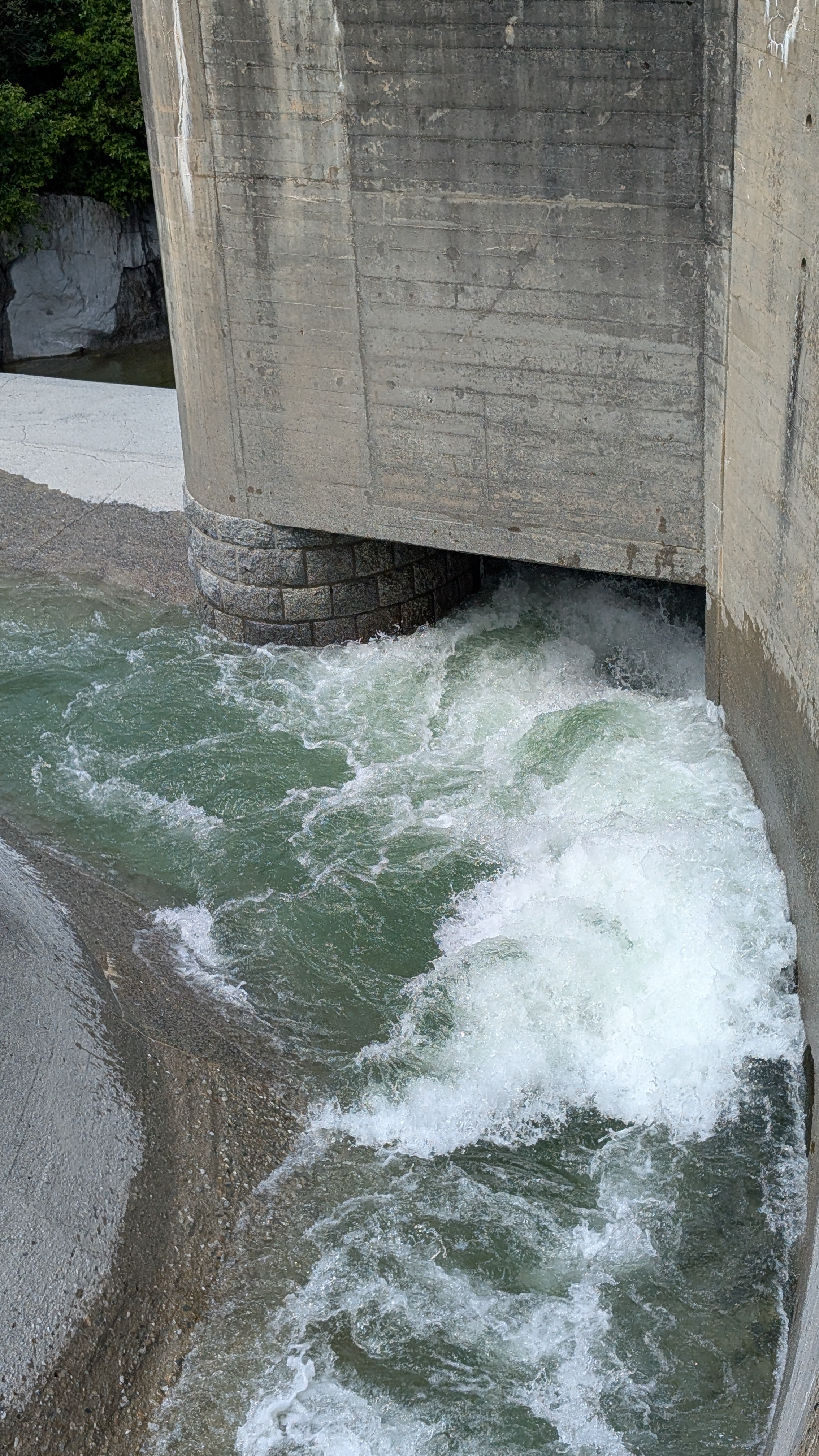
• #6651 • 09.06.2025 17:20Vorderrhein (CH), Trun - Tavanasa
Flash!
Paddel verloren in der Abschlussstelle vor dem Stausee.
Kanu Club Obwalden / Noris Eichenberger
Tel. 0784009289
Kanu Club Obwalden / Noris Eichenberger
Tel. 0784009289
 • #6649 • 09.06.2025 09:17
Gyronde (FR), Les Vigneaux - L'Argentière
Befahrbarkeit
I paddled the upper and lower sections today. The river has changed in a few places and the section below the portage would probably be. Grade 4, but don't understand why this is considered not safe to paddle.
It was read and run boulder garden rapids, all clear of trees, but may vary with levels
It was read and run boulder garden rapids, all clear of trees, but may vary with levels
• #6648 • 08.06.2025 21:52Gyronde (FR), Les Vigneaux - L'Argentière
Locals have confirmed that the river is no longer safe to paddle.
• #6647 • 08.06.2025 21:03Romanche (FR), Séchilienne - La Rochette
Bewertung WW-Grad
le 04/06/2025135 cubes à la station de notre dame de mésage. à ce niveau c'est volume avec un passage 4 rapidement après l'embarquement. Le ressenti sur le parcours était plutôt de 60-70cubes dans la rivière. Parcour intéressant, difficultés en decrescendo, quelques branches pouvant être dangereuses en cas de bains, surtout sur le début du parcours.
• #6646 • 08.06.2025 18:03Brenno (CH), Motto - Malvaglia
Befahrbarkeit
Paddled at 10 qm, everything is free.
• #6643 • 08.06.2025 17:29Medelser Rhein (CH), Parde - Baselgia
Bewertung NW-MW-HW
bei uns haben angezeigte 72cm ca. 4 freien Steinreihen entsprochen (siehe Fotos). Die Stelle mit dem Slide war überspült (siehe Foto). alles ging recht flüssig. evtl. ist MW ok, wir sind allerdings zum ersten Mal gefahren. Grundsätzlich alles frei am 8.6.
 • #6642 • 08.06.2025 16:12
Averser Rhein (CH), Ausserferrera - Schmelzi
Info
30m3 on the upper gauge. good high level

 • #6640 • 08.06.2025 12:55
Gail (AT), Untere, Birnbaum/Nostra - Wehr vor Kötschbach
Befahrbarkeit
Gestern bei 66 cm befahren. Durchfahrten sind alle frei, Bäume können entspannt umfahren werden.
• #6639 • 08.06.2025 10:02Furkareuss (CH), Realp - Andermatt
bei mehr Wasser könnte die Baustelle gefährlich sein, auch schon bei 18m^3/s sollte man besser Flussrichtung links paddeln. Durchfahrt eigentlich problemlos. Die Baustelle durchquert man mit Auto schon beim Hochfahren. Abschnitt 2 Mal gefahren am 7.6.25.
 • #6638 • 08.06.2025 06:38
Seite: 1 2 3 4 5 . . . 21 22 23 24 25 26 27 . . . 270 271 272
nach oben