Rivermap
HomeThe Map
List View
Befahrbarkeit
English Summary
Karte Einbetten
Systemstatus
Kontakt und Team
Datenlieferanten
Contributor Agreement
The RCSD
Public licenses
Rivermap Japan
![]() "Rivermap Supporter" Group
"Rivermap Supporter" Group
Flusshinweise
Als Grundlage dient wenn immer möglich ein Flussführer.
Seite: 1 2 3 4 5 . . . 7 8 9 10 11 12 13 . . . 278 279 280
Resultate 181 - 200 von 5596
Fium Orbo (FR), Défilé de Strette (Parc accrobranche - Pont de Sampolo)
Bewertung NW-MW-HW
Vorschlag NW: 45. Drunter wird es sehr hakelig. Der Schlitz hat einen neuen Stein im Eingang und ist bei 45cm schon problematisch anzufahren.
 • #7220 • 09.04.2026 18:34
Orbe (FR), Bois d Amont - le Cenif
Befahrbarkeit
A San Vittore, 500 metri dopo il ponte, il fiume si divide attorno a una piccola isola. PERCORRERE IL RAMO SINISTRO, che dovrebbe essere quello con la portata maggiore. Non percorrere gli altri rami perché sono stati inseriti dei pennelli con alberi morti che sono pericolosi.
 • #7219 • 08.04.2026 11:18
Entlen (CH), Finsterwald - Entlebuch
Befahrbarkeit
Mit 23m3 eingestiegen pegel schmelzwasser bedingt steigend.
Sehr steinig, viele Bäume und einige umtragungen
Sehr steinig, viele Bäume und einige umtragungen


 • #7217 • 07.04.2026 21:07
Bès (FR), Châtillon en Diois - Pont de Quart
We have paddled total at 10m3. Be careful, trees are blocking the river.
 • #7216 • 07.04.2026 19:14
Fella (IT), Pontebba - Dogna
Gefahr aufgehoben
Strainer removed 200 meters after iron beam. Msg. 29/03/2026
• #7215 • 07.04.2026 17:36Bès (FR), Pont de Boulc - Châtillon en Diois
Befahrbarkeit
9.64 m3
One tree inside
One tree inside
• #7214 • 07.04.2026 15:25Saane / Sarine (CH), Camping Le Berceau - Lac du Vernex
Baum quer über ganze Breite in der Schlucht bei Rossinière. Musste bei Pegel 25cm mühsam umtragen werden.
• #7213 • 07.04.2026 08:20Birs (CH), Naturschutzgebiet Reinacher Heide - Birskopf
In der Stufe bei der Eisenbahnbrücke bei Elektra Birseck liegt ein Baum. Flussseitig rechts bis in die Mitte. Bei 15m³/s nur schwer zu erkennen. Links von der Mitte umfahren.
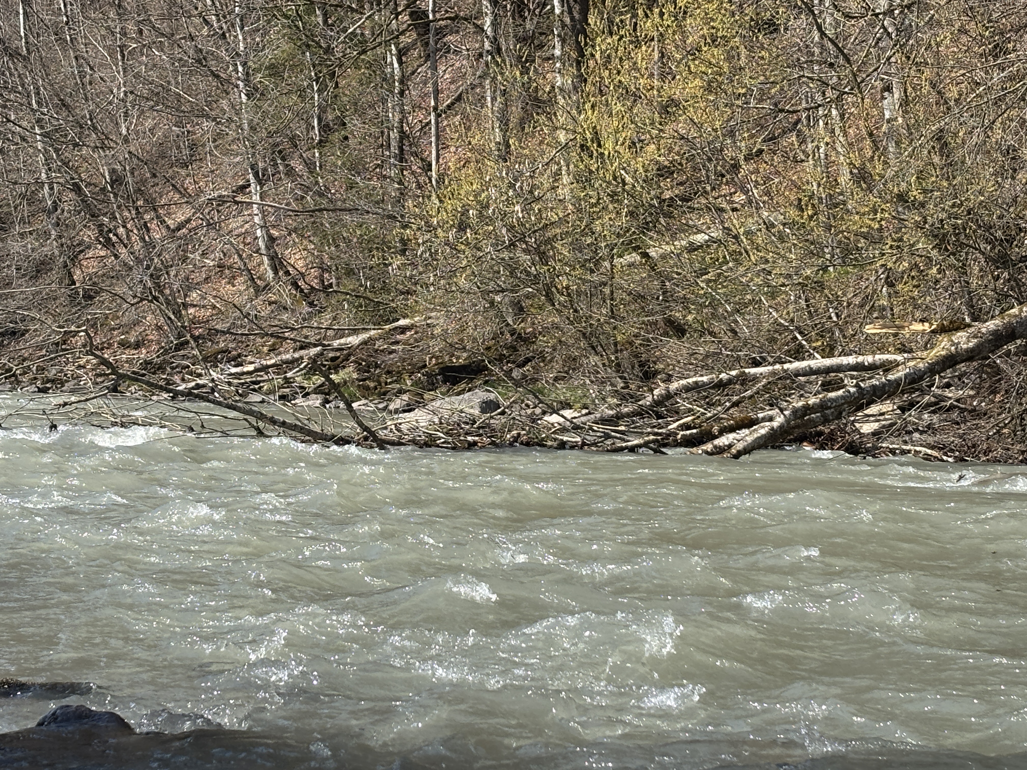
• #7212 • 06.04.2026 22:43Muota (CH), Muotathal, Fussballplatz - Illgau, Holzlagerplatz
Baum über den Bach nach dem Dorf Muotathal, kommt fast über den gesamten Bach. Auf der langen Geraden wo die Steine Anfangen. Foto von heutz ca bei 15m3/s .
 • #7211 • 06.04.2026 18:18
Kleine Emme (CH), Entlebuch - Chappelbodenbrücke
Befahrbarkeit
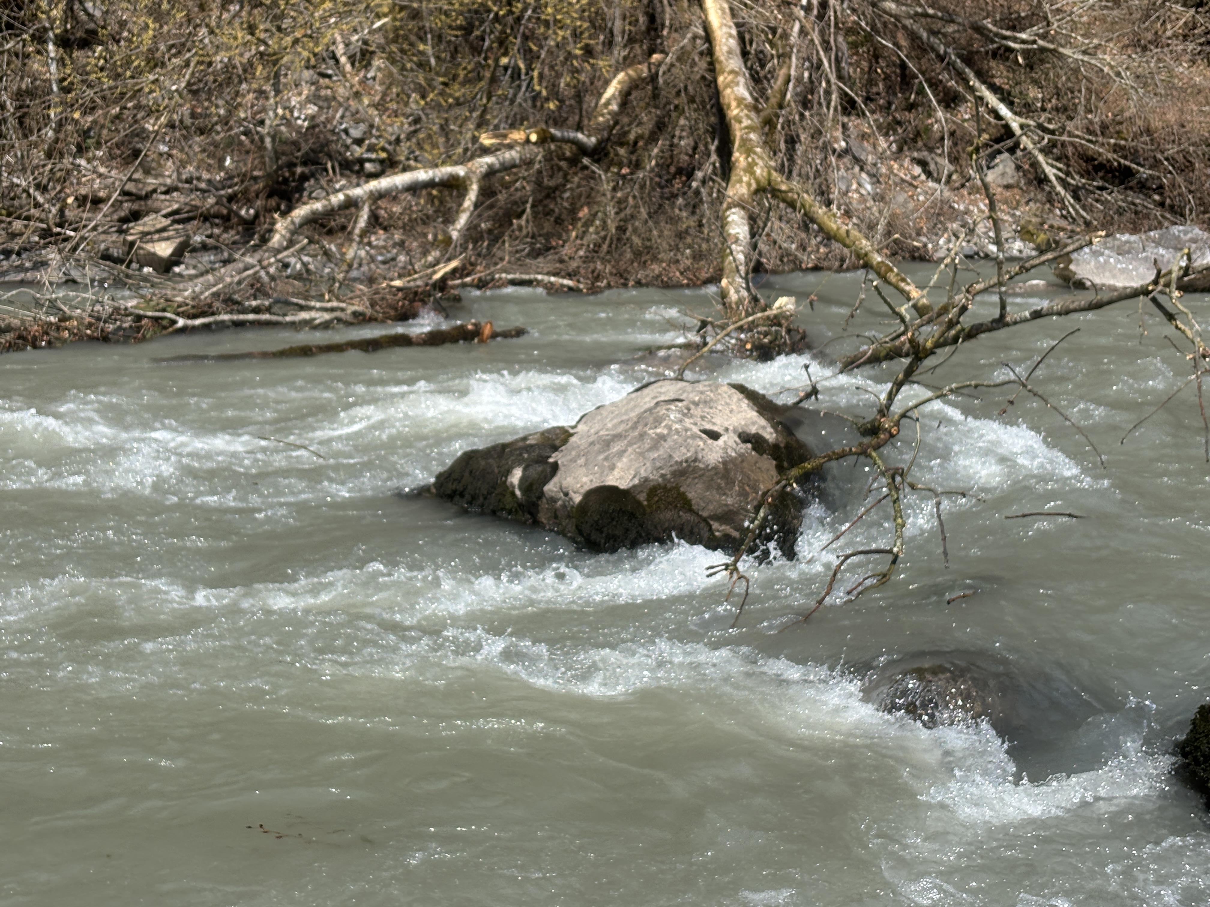
Freie Fahrt.
Der Stamm von der grossen Baumwurzel ist noch da, aber entweder im linken Kanal oder im rechten links gut zu fahren
Der Stamm von der grossen Baumwurzel ist noch da, aber entweder im linken Kanal oder im rechten links gut zu fahren
• #7210 • 06.04.2026 17:39Codi (FR), Pont de Passava sous Quenza - Barrage du Rizzanese
Info
location of the gauging station.
https://maps.app.goo.gl/EPgRRqRgDjhju7vK8
the path to walk down to get to the gauge begins across the street of where the private road comes in.
follow the main path until you see a red dot marker. After that the path slowly begins to descent. Continue to follow the red dot markers to the river and find the gauge a few meters upstream.
and please update on rivermap, if your check the level:)
cheers,
Kilian

 • #7209 • 06.04.2026 12:49
Taravo (FR), Ponte Novu - Pont de Traghjettu Ghjuvanni D26
Befahrbarkeit
all rapids clear and unchanged.
cheers,
Kilian
cheers,
Kilian
• #7208 • 06.04.2026 12:34Tavignano (FR), Gorge (Ernella - Pont de la N200)
Befahrbarkeit
all rapids clear and unchanged
cheers,
Kilian
cheers,
Kilian
• #7207 • 06.04.2026 12:31Golo (FR), Ponte Castirla - Francardo
Befahrbarkeit
all rapids clear and unchanged
cheers,
Kilian
cheers,
Kilian
• #7206 • 06.04.2026 12:30Travo (FR), Haut (Pont de Chisa - Pont de Ghjineparu)
Bewertung NW-MW-HW
i recommend 5,5 cbm/s as the low water cut off.
• #7205 • 06.04.2026 12:28Travo (FR), Haut (Pont de Chisa - Pont de Ghjineparu)
Befahrbarkeit
all rapids clear.
online gauge seems to have changed its Interpretation of the data, or the gauging station has filled with sand or something.
online gauge said we had 4cm more than last year. Reality was about a third less water than last year.
i think a recalibration is necessary.
the 197 cm we had, is imho not enough. Core Rapids are still barely doable, but not pleasant. probably 205 cm should be the new cutoff.
cheers,
Kilian
• #7204 • 06.04.2026 12:24Fium Orbo (FR), Défilé de Strette (Parc accrobranche - Pont de Sampolo)
Befahrbarkeit
all rapids are clear.
syphon rapid from the earlier posts has finally shifted again, and you can now paddle it again at lower levels. syphon still taking most of the water though. take a look first.
waterlevel of sub 40 cm is not recommended.
did it at 38 cm. still goes, but not really fun.
cheers,
Kilian
(earlier version had a typo)
• #7203 • 06.04.2026 11:57Fium Orbo (FR), Défilé de Strette (Parc accrobranche - Pont de Sampolo)
Befahrbarkeit
all rapids are clear.
syphon rapid from the earlier posts has finally shifted again, and you can now paddle it again at lower levels. syphon still taking most of the daher though. take a look first.
waterlevel of sub 40 cm is not recommended.
did it at 38 cm. still goes, but not really fun.
cheers,
Kilian
syphon rapid from the earlier posts has finally shifted again, and you can now paddle it again at lower levels. syphon still taking most of the daher though. take a look first.
waterlevel of sub 40 cm is not recommended.
did it at 38 cm. still goes, but not really fun.
cheers,
Kilian
• #7202 • 06.04.2026 11:53Codi (FR), Pont de Passava sous Quenza - Barrage du Rizzanese
Befahrbarkeit
ran it yesterday (05.04)
all rapids are clear.
level was 42 cm, quite low but runnable.
rapids are still decent, the in between sections are extra scrapy though.
cheers,
Kilian
all rapids are clear.
level was 42 cm, quite low but runnable.
rapids are still decent, the in between sections are extra scrapy though.
cheers,
Kilian


 • #7201 • 06.04.2026 11:45
Urnäsch (CH), Obere Urnäschschlucht (Zürchersmühle - Hundwiler Brücke)
Gefahr aufgehoben
Die Schlucht ist frei. Wir haben ein paar Äste aus dem Schluchteingang geräumt und konnten dann bei gut Wasser problemlos fahren.
• #7200 • 05.04.2026 21:31Seite: 1 2 3 4 5 . . . 7 8 9 10 11 12 13 . . . 278 279 280
nach oben