Rivermap
HomeThe Map
List View


 Flusshinweise
Befahrbarkeit
English Summary
Karte Einbetten
Systemstatus
Kontakt und Team
Datenlieferanten
Contributor Agreement
The RCSD
Public licenses
Rivermap Japan
 "Rivermap Supporter" Group
Flusshinweise
Als Grundlage dient wenn immer möglich ein Flussführer.
 RSS-Feed
abonnieren und nichts verpassen.
RSS-Feed
abonnieren und nichts verpassen.
Seite: 1 2 3 4 5 . . . 177 178 179 180 181 182 183 . . . 285 286 287
Resultate 3581 - 3600 von 5721
Saine (FR), Source - Foncine le Bas (pont D437)
Befahrbarkeit
18.4.2018
7 cumecs at Syam, rising later. This seemed somewhat below MW.
One blocking tree, 50 below the source. Shortly after that some tight wire across the river at chest height.
Otherwise all good.
We didn't think it was worth portaging the last weir for the last drop before the the bridge, so we got out just above it.
7 cumecs at Syam, rising later. This seemed somewhat below MW.
One blocking tree, 50 below the source. Shortly after that some tight wire across the river at chest height.
Otherwise all good.
We didn't think it was worth portaging the last weir for the last drop before the the bridge, so we got out just above it.
 • #2828 • 20.04.2018 13:27
Doubs (FR), Gorges du Fourperet (Barrage - Usine Électrique)
Befahrbarkeit
19.4.2018
4 cumecs on the gauge, slightly dropping. All good, but a *little* more water would be nice.
4 cumecs on the gauge, slightly dropping. All good, but a *little* more water would be nice.
• #2827 • 20.04.2018 10:59Alb (DE), Ibachmündung - Tiefenstein
Info
CrowdWater is a University of Zurich "citizen science" project to collect hydrological data. Their project is a bit confusing but there is something that could be useful to us.
I have created a Crowdwater spot for us with a reference photo of the Alb pegelstein.
https://www.spotteron.com/crowdwater/spots/28068
- Get the Crowdwater app and get a login.
- When you are at the spot, take a photo of the Pegelstein from the opposite bank.
- Upload the photo to Crowdwater.
Most simply, I think that everyone will be able to see the sequence of photos for the spot.
Crowdwater will compare your photo with the reference photo to derive a sequence of water level values. I don't think those numbers will be useful for us. But the idea is very cool and I would be interested to see it in action.
I have created a Crowdwater spot for us with a reference photo of the Alb pegelstein.
https://www.spotteron.com/crowdwater/spots/28068
- Get the Crowdwater app and get a login.
- When you are at the spot, take a photo of the Pegelstein from the opposite bank.
- Upload the photo to Crowdwater.
Most simply, I think that everyone will be able to see the sequence of photos for the spot.
Crowdwater will compare your photo with the reference photo to derive a sequence of water level values. I don't think those numbers will be useful for us. But the idea is very cool and I would be interested to see it in action.
• #2825 • 18.04.2018 07:59Alb (DE), Tiefenstein - Albbruck
Info
CrowdWater is a University of Zurich "citizen science" project to collect hydrological data. Their project is a bit confusing but there is something that could be useful to us.
I have created a Crowdwater spot for us with a reference photo of the Alb pegelstein.
https://www.spotteron.com/crowdwater/spots/28068
- Get the Crowdwater app and get a login.
- When you are at the spot, take a photo of the Pegelstein from the opposite bank.
- Upload the photo to Crowdwater.
Most simply, I think that everyone will be able to see the sequence of photos for the spot.
Crowdwater will compare your photo with the reference photo to derive a sequence of water level values. I don't think those numbers will be useful for us. But the idea is very cool and I would be interested to see it in action.
I have created a Crowdwater spot for us with a reference photo of the Alb pegelstein.
https://www.spotteron.com/crowdwater/spots/28068
- Get the Crowdwater app and get a login.
- When you are at the spot, take a photo of the Pegelstein from the opposite bank.
- Upload the photo to Crowdwater.
Most simply, I think that everyone will be able to see the sequence of photos for the spot.
Crowdwater will compare your photo with the reference photo to derive a sequence of water level values. I don't think those numbers will be useful for us. But the idea is very cool and I would be interested to see it in action.
• #2824 • 18.04.2018 07:58Thur (CH), Oberste (Stein - Neu St.Johann)
 Gefahr vorübergehend
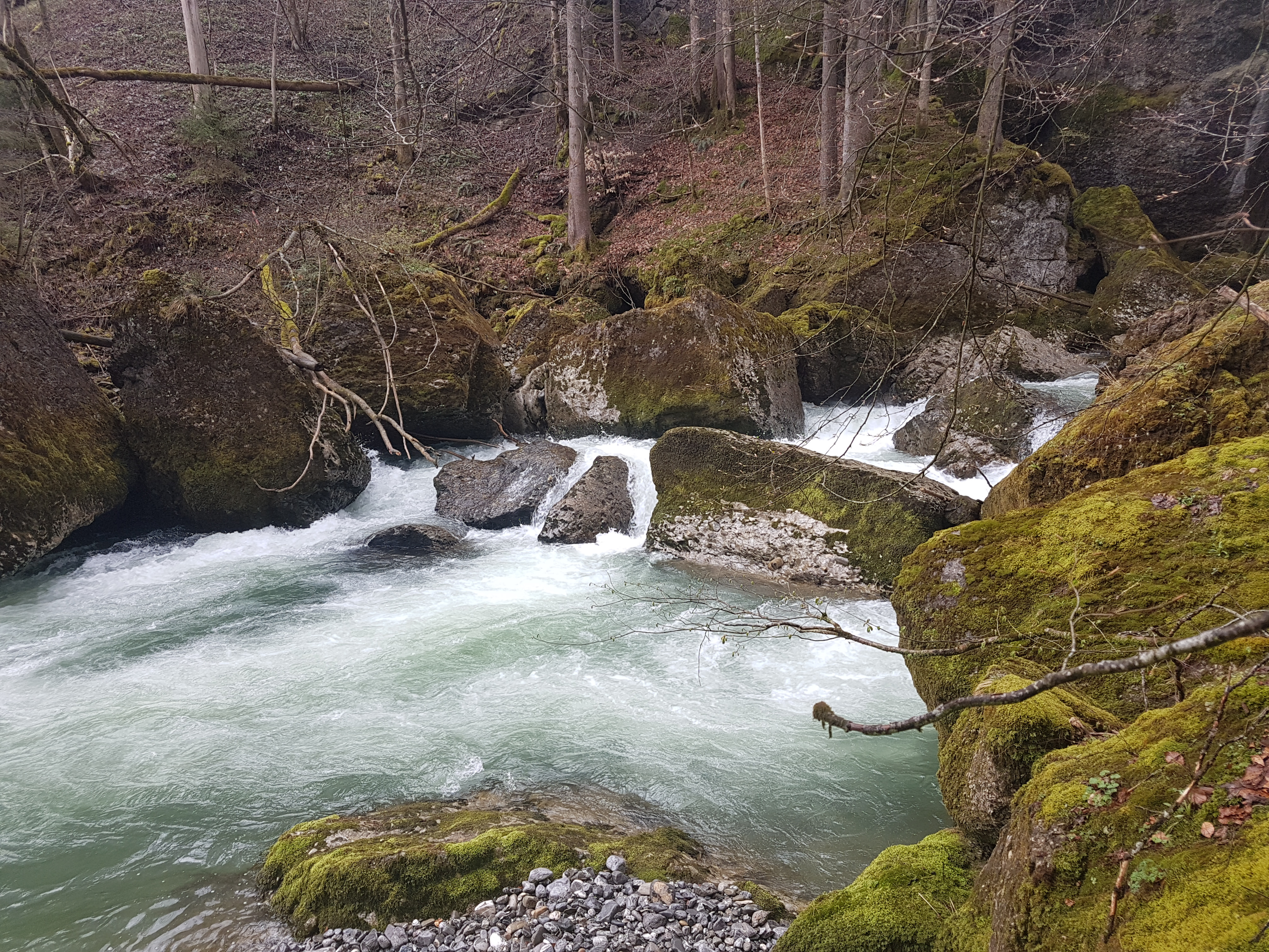
Sehr viel Holz am herumliegen aber meistens fahrbar
 • #2822 • 17.04.2018 07:40
Doubs (FR), Slalom Goumois
Gefahr aufgehoben
Seile und Holz geräumt
• #2819 • 16.04.2018 11:12Seez (CH), Mels - Walenstadt
Valserine (FR), Sous Niaizet - La Rivière
Info
The section above, then this section, and then on to Chézery-Forens
https://vimeo.com/68838510
https://vimeo.com/68838510
• #2816 • 13.04.2018 22:00Valserine (FR), Niaizet - 300m plus bas
Info
This section, and then on to Chézery-Forens
https://vimeo.com/68838510
https://vimeo.com/68838510
• #2815 • 13.04.2018 21:59Valserine (FR), La Rivière - Chézery
Linth (CH), Rüti - Betschwanden
Befahrbarkeit
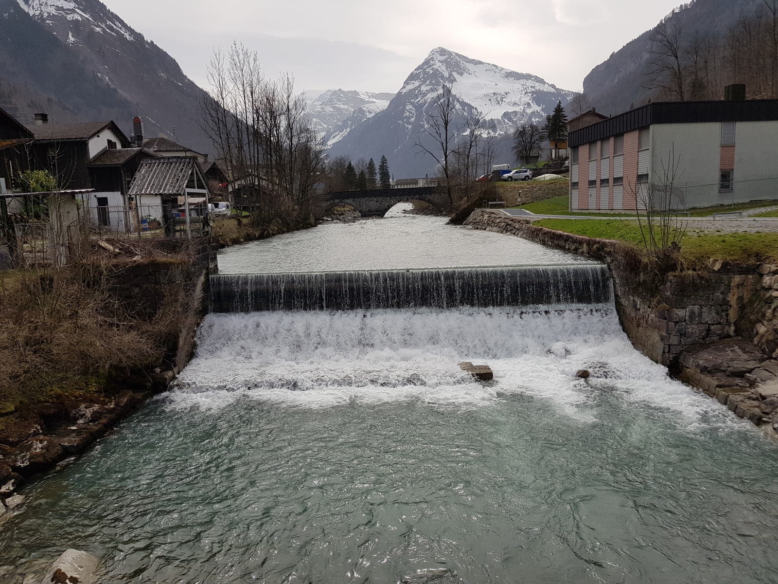
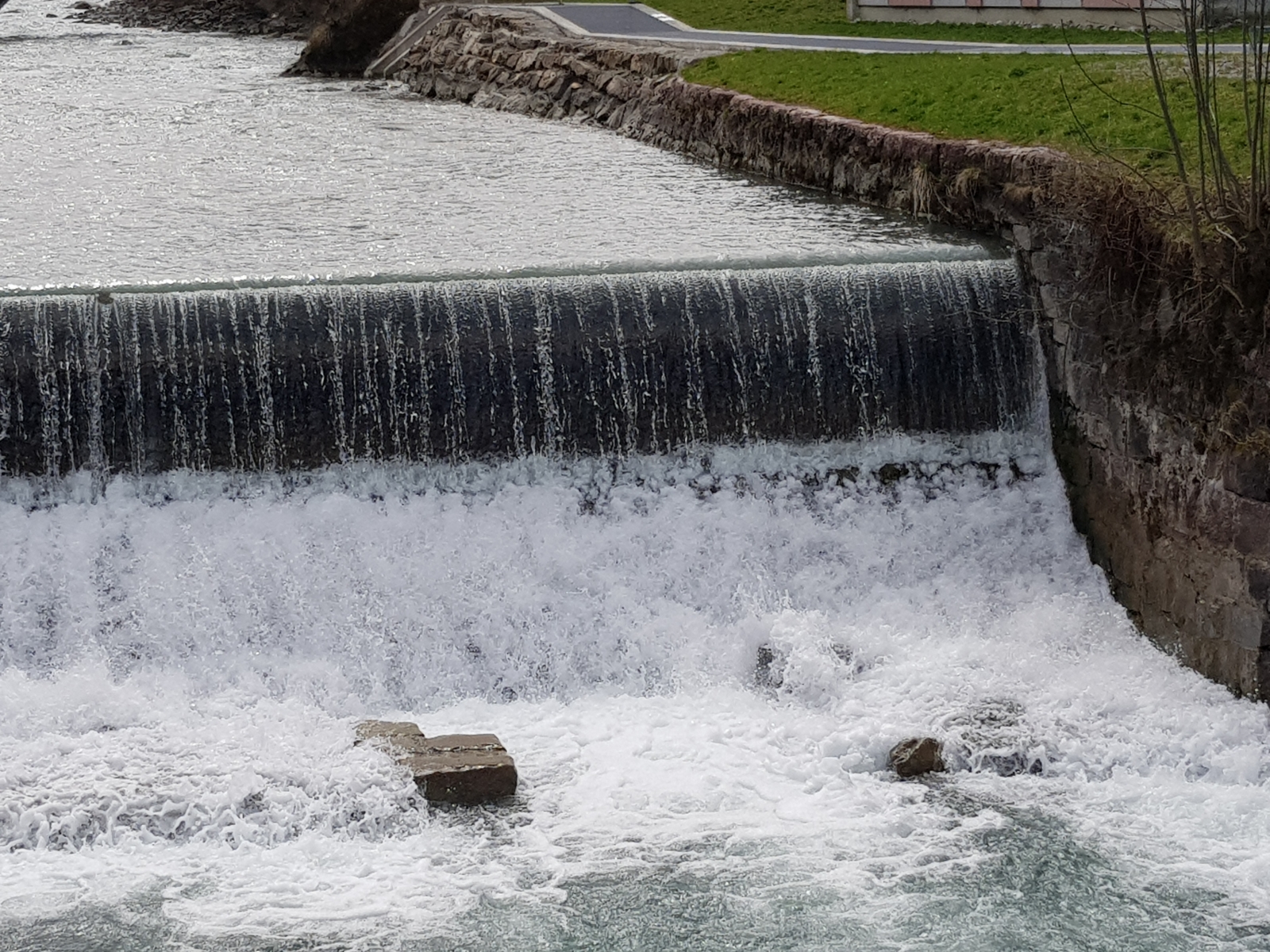
Ergänzend zum vorherigen Eintrag noch zwei Fotos bei wenig Wasser, welche zeigen weshalb rechts von der Mitte gefahren werden sollten
 • #2812 • 13.04.2018 11:08
Linth (CH), Schwanden - Ennenda
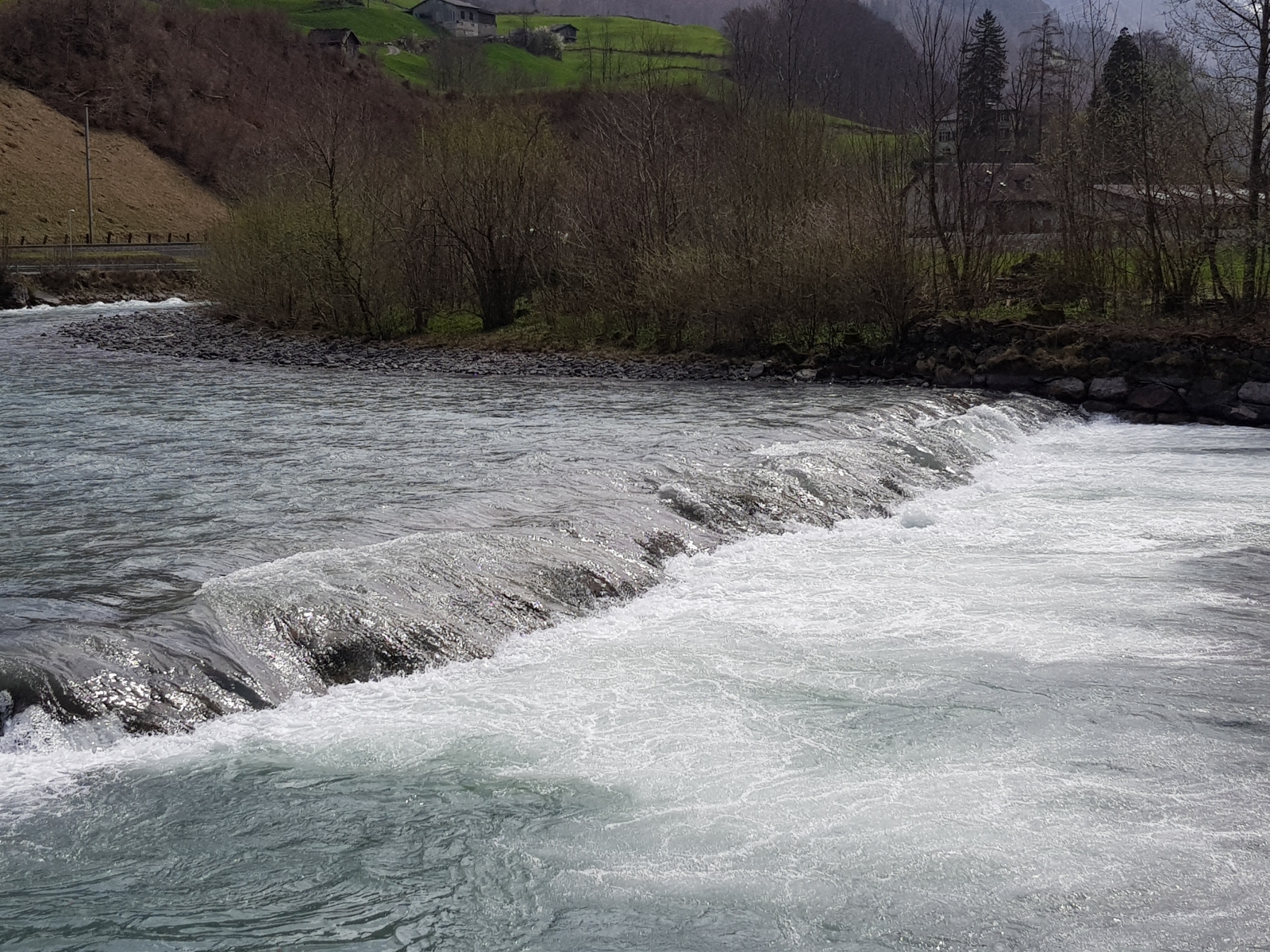
GefahrDas alte Läderachwehr vor Ennenda hat sich wieder stärker ausgebildet und dürfte bei mehr Wasser rückläufig werden.
 • #2811 • 13.04.2018 11:04
Doubs (FR), Slalom Goumois
Gefahr aufgehoben
Seile und Holz geräumt. Strecke 3x bei 35m3 gefahren und einiges Keilholz entfernt. Ein ganzes Spannseil der Slalomanlage wurde tage zuvor bereits geborgen.
• #2810 • 12.04.2018 22:07Loue (FR), Mouthier - Vuillafans
Ardèche (FR), Aubenas (pont Jaune) - Vogüe
Info
Der beste Einstieg ist am Bürgermeisteramt („Mairie“) am Espace Deydier in Ucel
44.626083, 4.397322
44.626083, 4.397322
• #2808 • 09.04.2018 19:01Ardèche (FR), Aubenas (pont Jaune) - Vogüe
Bewertung NW-MW-HW
Die Kalibrierung des Pegels grob falsch.
NW=10cbm/s
MW=50cbm/s
HW=200cbm/s
NW=10cbm/s
MW=50cbm/s
HW=200cbm/s
• #2807 • 09.04.2018 19:00Ardèche (FR), Pont de Labeaume - Lalevade
Bewertung NW-MW-HW
die Kalibrierung des Pegels ist grob falsch.
NW=10cbm/s
MW=40cbm/s
HW=100cbm/s
NW=10cbm/s
MW=40cbm/s
HW=100cbm/s
• #2806 • 09.04.2018 18:59Vorderrhein (CH), Ilanz - Versam
Gefahr aufgehoben
Baum links, ca 500m nach schwarzem Loch (nach der grossen Linkskurve in der folgenden Schwallstrecke): ist grösstenteils rausgesägt. Stellt keine Gefahr mehr dar (reicht wenig in den Uferbereich links, gut sichtbar und nicht in der Strömung)
 • #2804 • 08.04.2018 14:31
Gravona (FR), Bocognano (Passerelle après Busso) - Tavera (Pont de Vignale)
Bewertung NW-MW-HW
Recieved 7.4.18: "Done the upper gravona today... Level says medium, but it should not be less water than today, 145cm should be close to low water"
• #2802 • 08.04.2018 00:31Vecchio (FR), Bas (Pont de Noceta - Pont d'Ajuinta)
Bewertung NW-MW-HW
Bei 210 gefahren, noch kein wirkliches HW Gefühl.
• #2801 • 06.04.2018 09:06Seite: 1 2 3 4 5 . . . 177 178 179 180 181 182 183 . . . 285 286 287
nach oben