Rivermap
HomeThe Map
List View


 Flusshinweise
Befahrbarkeit
English Summary
Karte Einbetten
Systemstatus
Kontakt und Team
Datenlieferanten
Contributor Agreement
The RCSD
Public licenses
Rivermap Japan
 "Rivermap Supporter" Group
Flusshinweise
Als Grundlage dient wenn immer möglich ein Flussführer.
 RSS-Feed
abonnieren und nichts verpassen.
Seite: 1 2 3 4 5 . . . 286 287 288
Resultate 21 - 40 von 5743
Murg (DE), Mittlere (Kirschbaumwassen - Forbach)
Info
Bitte neuen Ausstieg an der mittleren Murg beachten. Der Ausstieg befindet sich nach dem letzen Rapid der mittleren Murg (unter dem alten Hotel) noch vor dem Kraftwerk auf der rechten Flußseite.
48.66769, 8.353870
https://maps.app.goo.gl/gevKnpj9bNVJHq5b6
48.66769, 8.353870
https://maps.app.goo.gl/gevKnpj9bNVJHq5b6
 • #7594 • 26.10.2026 10:07
Soča (SI), Prima Gola/Bunker Run (Lepena - Zmuklica)
Flash!
Yesterday, October 25th, we lost a red kayak in the Bunker gorge.
Exo T-Rex, red color, modified seat.
If somebody is able to recover it, we offer reward.
Please call +393387659585
Exo T-Rex, red color, modified seat.
If somebody is able to recover it, we offer reward.
Please call +393387659585
• #7591 • 26.10.2026 09:48Murg (DE), Mittlere (Kirschbaumwassen - Forbach)
 Gefahr vorübergehend
Heute bei ca. 50m3 gepaddelt. Es hat in der mittleren Murg einige Bäume die aber alle gut sichtbar und umfahrbar waren. Das Wehr in Kirschbaumwasen ist ja weiterhin offen. Also müssen auf den Pegel aktuell 20m3 hinzu addiert werden.
• #7590 • 25.10.2026 19:51Ubaye (FR), Infrans du bas (Le Lauzet - Le Lac)
Krottenbach (AT),
Birs (CH), Naturschutzgebiet Reinacher Heide - Birskopf
Befahrbarkeit
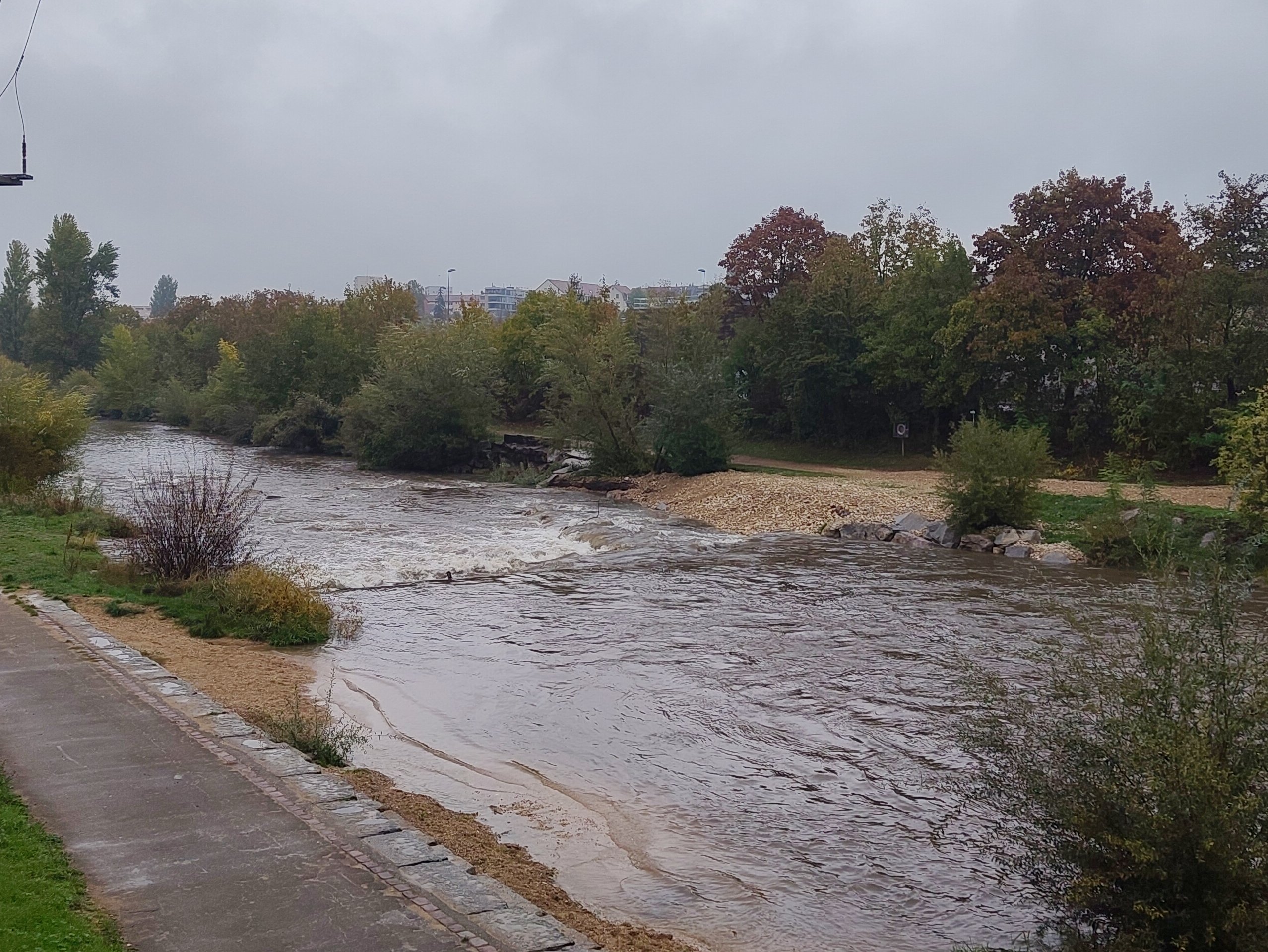
Foto of the 2nd step at St. Jakob after the recent construction. Water pushed the the left now, room for fish on the right. 17m³/s.
 • #7587 • 18.10.2026 12:52
Ödenseetraun (AT),
Bewertung NW-MW-HW
Despite the warnings and the circumstances for that section I would sign, there's a new gauge that is direct on that section. Maybe someone is able to calibrate this section with the closeby gauge at https://egov.stmk.gv.at/at.gv.stmk.hydavis-p/pub/praesentation/index.xhtml?messcode=2002&ansichtstyp=karte&stationsstatus=ONLINE
• #7586 • 14.10.2026 14:31Inn (AT), Unteres Gericht (Fliess - Urgen)
Inn (AT), Urgen - Landeck
Inn (AT), Urgen - Landeck
Inn (AT), Unteres Gericht (Fliess - Urgen)
Rothbach (DE), Waldschlucht
Ubaye (FR), Sortie des gorges de St.Paul - Jausiers
Sitter (CH), Obere Sitterschlucht (Appenzell - Haslen)
Befahrbarkeit
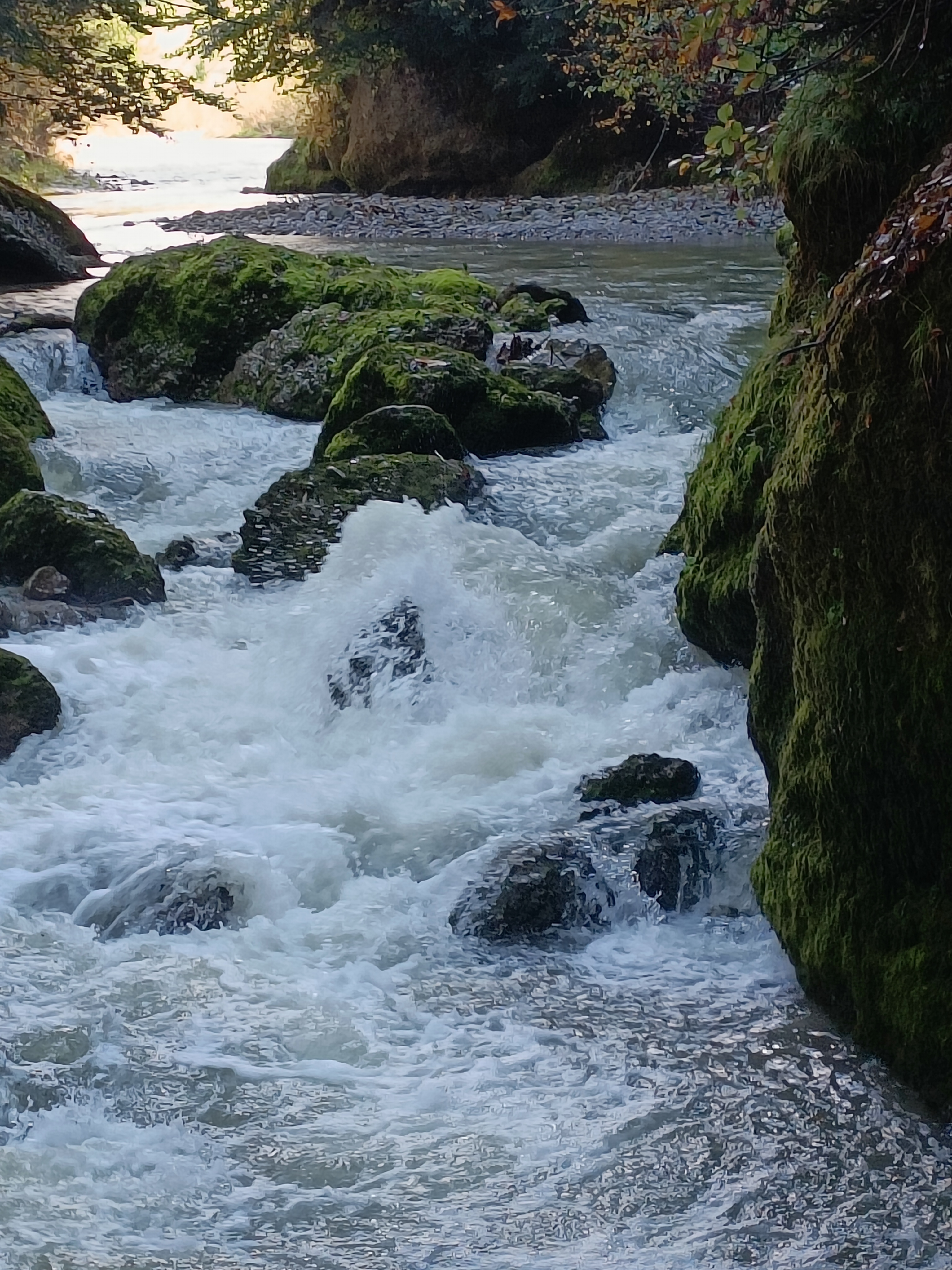
Befahrung heute bei 4.2 m3/s. Die Stelle vor dem Schlitz, die normalerweise ganz links gefahren wird, sah ungemütlich aus wegen Steinen in der Landung (siehe Foto). Wir sind mittig auf dem Felsen wieder eingestiegen. Das Kehrwasser gleich danach (links vor dem Schlitz) war fast nicht vorhanden. Der Schlitz selber war aber gut fahrbar. Einige Bäume im Bach aber umfahrbar. Bei der Baustelle am Ausstieg ist die Durchfahrt aktuell frei, ist aber ein Fahrverbot.
 • #7579 • 09.10.2026 20:30
Idrjica (SI), Idrija - Otalež
Info
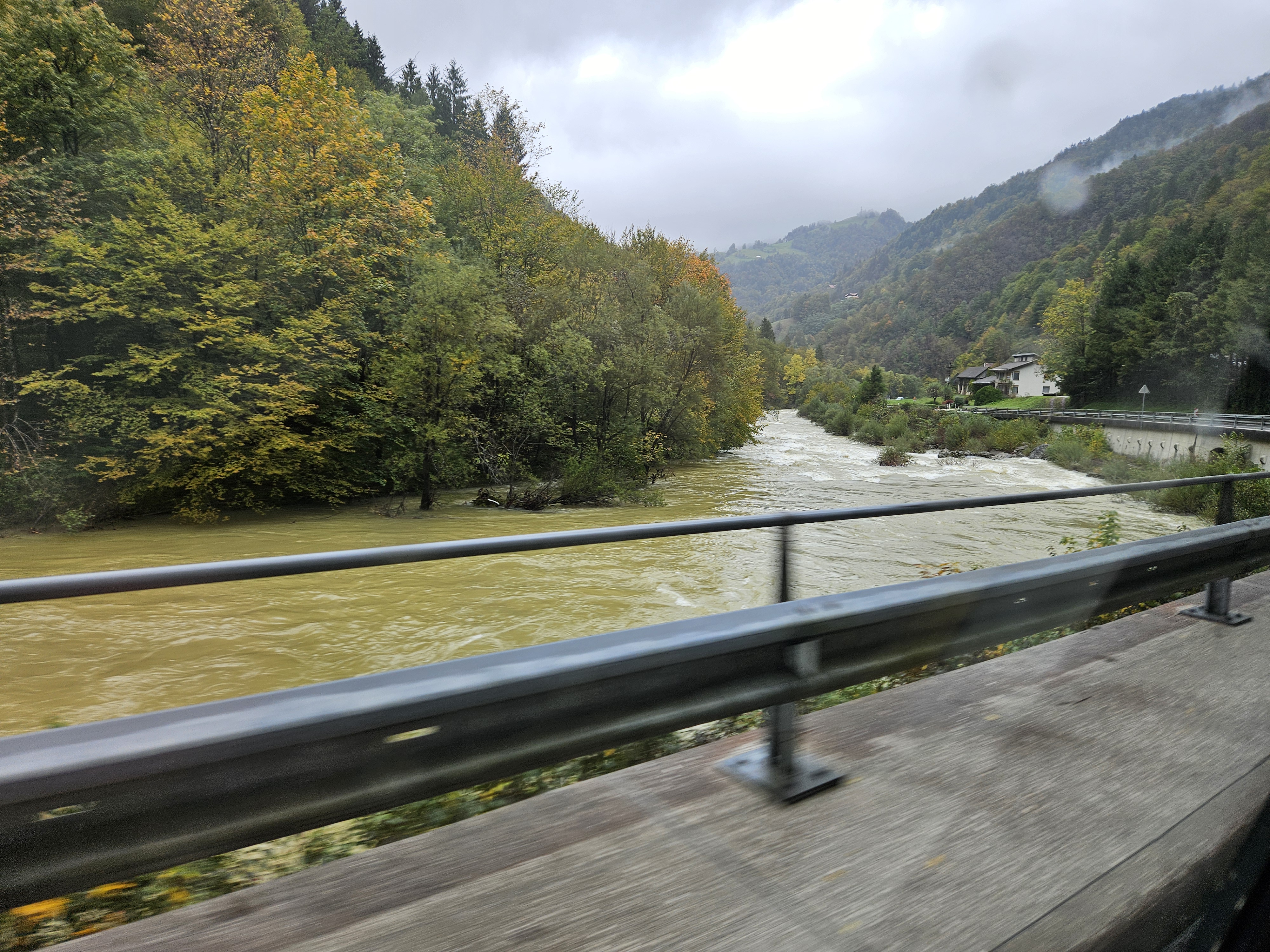
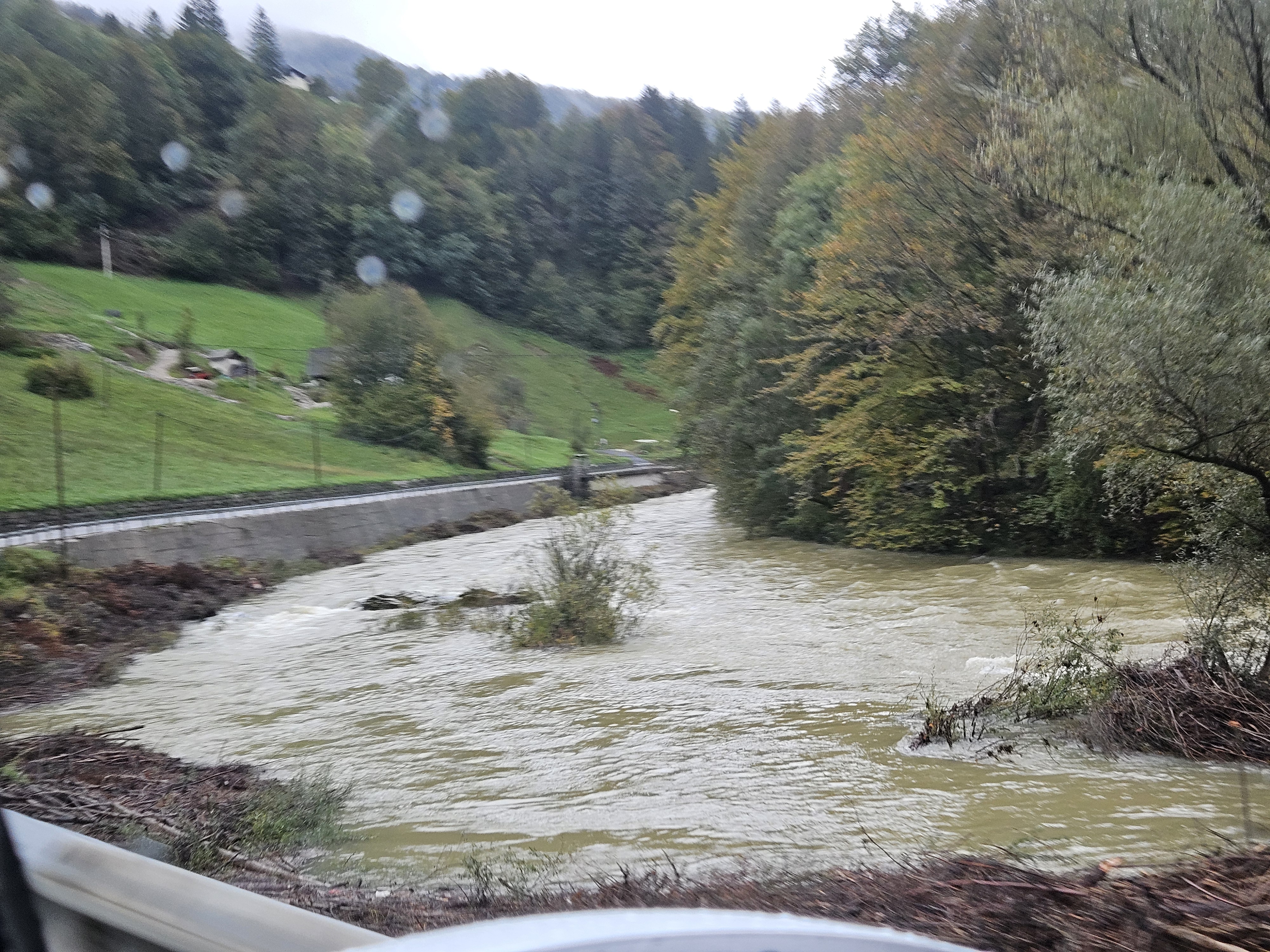
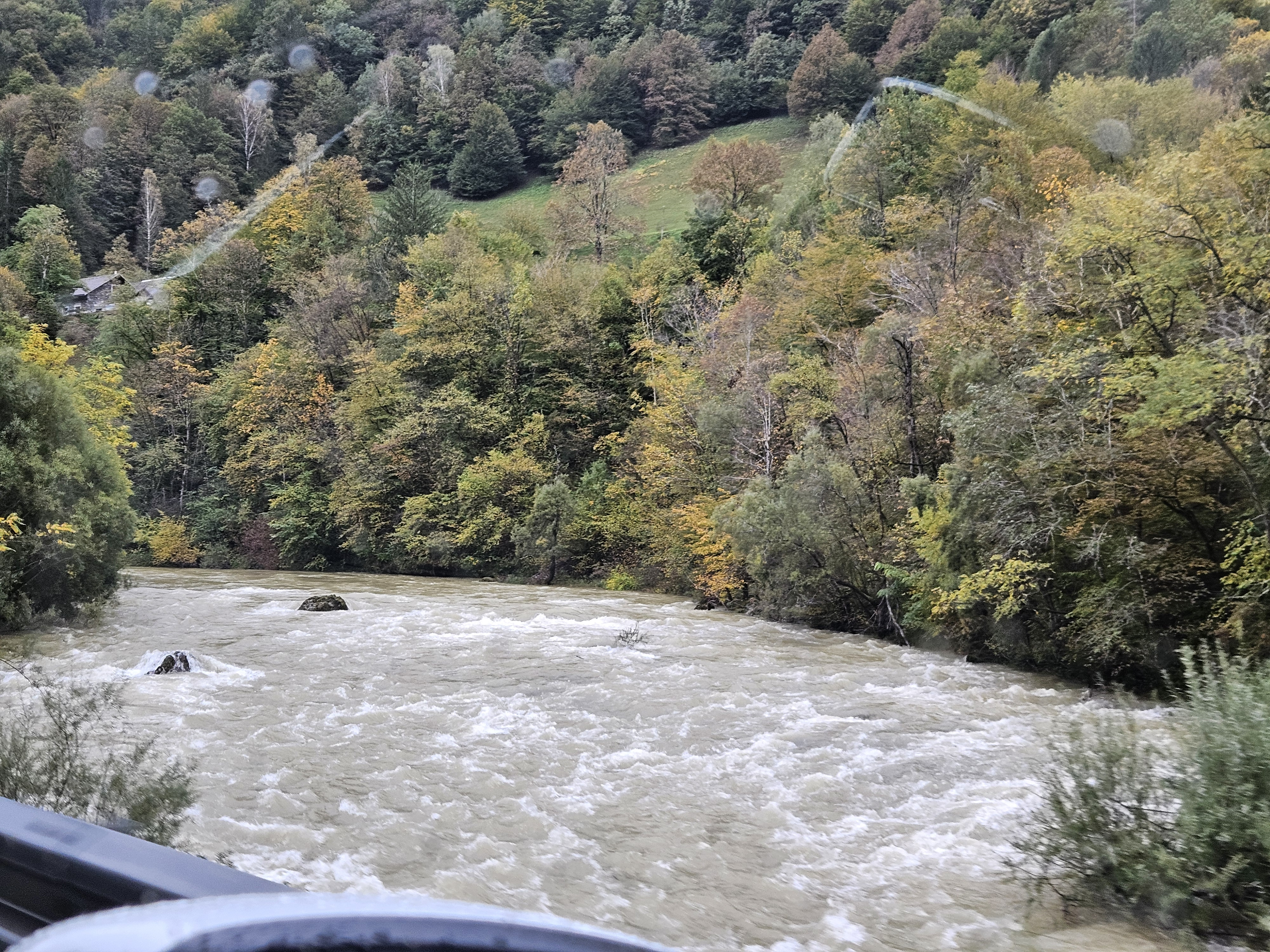
At 85 m3/s the section took 1 hour to paddle.
Put-in below the Dam as shown on rivermap. There is access to the river downstream of the Garage between road and river.
Put-out 100m before the second of two identical bridges on riverleft.
At this discharge there are some big holes you want to avoid. But there is always a clean and obvious line around them. There are nice big wave trains. Eddies partly between the trees, so be careful when approaching the river banks. Outside of bends with dangerous trees, watch out.
WW II-III still holds at this discharge.
Pictures shown in downstream direction. Typical rapids.
There is one rapid in the lower half, that has three big holes and is alittle more tricky but still with an obvious line.
Put-in below the Dam as shown on rivermap. There is access to the river downstream of the Garage between road and river.
Put-out 100m before the second of two identical bridges on riverleft.
At this discharge there are some big holes you want to avoid. But there is always a clean and obvious line around them. There are nice big wave trains. Eddies partly between the trees, so be careful when approaching the river banks. Outside of bends with dangerous trees, watch out.
WW II-III still holds at this discharge.
Pictures shown in downstream direction. Typical rapids.
There is one rapid in the lower half, that has three big holes and is alittle more tricky but still with an obvious line.
 • #7578 • 09.10.2026 19:04
Isel (AT), Hintere Isel
Divers
extended and definitely the last take-out before the gorge starts is at: 47.01300,12.39810 . Acessable only by feet.
• #7577 • 08.10.2026 15:54Birs (CH), Welle Redingbrücke, Basel
Info
The BAFU forecast graphs are now available here ...
https://data.bs.ch/explore/assets/visualisation-100272/view/
https://data.bs.ch/explore/assets/visualisation-100272/view/
• #7576 • 08.10.2026 15:01Trisanna (AT), Ischgl - See
Ubaye (FR), Ex-infrans (La Fresquière - Le Martinet)
Info
Im Juli 26 nach dem Erdrutsch vom Zubringer in la Fresquière. Steinig(er) am Anfang. Ca 14 m3.
https://youtu.be/iEKBHM2FcAU
https://youtu.be/iEKBHM2FcAU
• #7574 • 07.10.2026 20:15Calancasca (CH), Aquino - Buseno
Gefahr vorübergehendLe recenti disavventure geologiche hanno reso impraticabile la Calancasca da Arvigo fino al lago di Buseno. Oltre ai danni causati da alcune frane sono in corso dei lavori per la messa in sicurezza della strada.
• #7572 • 05.10.2026 15:17Seite: 1 2 3 4 5 . . . 286 287 288
nach oben