Rivermap
HomeThe Map
List View


 Flusshinweise
Befahrbarkeit
English Summary
Karte Einbetten
Systemstatus
Kontakt und Team
Datenlieferanten
Contributor Agreement
The RCSD
Public licenses
Rivermap Japan
 "Rivermap Supporter" Group
Flusshinweise
Als Grundlage dient wenn immer möglich ein Flussführer.
 RSS-Feed
abonnieren und nichts verpassen.
Seite: 1 2 3 4 5 . . . 173 174 175 176 177 178 179 . . . 286 287 288
Resultate 3501 - 3520 von 5743
Toce (IT), Crodo - Pontemaglio
Info
We did this section yesterday (14 June 2018), it was great, some nice, busy grade 4 rapids, some shallow grade 3 boogie and a grade 5 feature. The water level was around 90cm with a spike up to about 110cm.
Its important to know that the river can rise rapidly without warning, this happened to us, luckily at the time we were on the bridge scouting the grade 5 feature, the river came up significantly within a couple of minutes, pretty scary if you are in your boat in the middle of the river above a rapid (especially the grade 5 rapid!), so be aware of this and make sure you pull your boat up high when you get out to scout things.
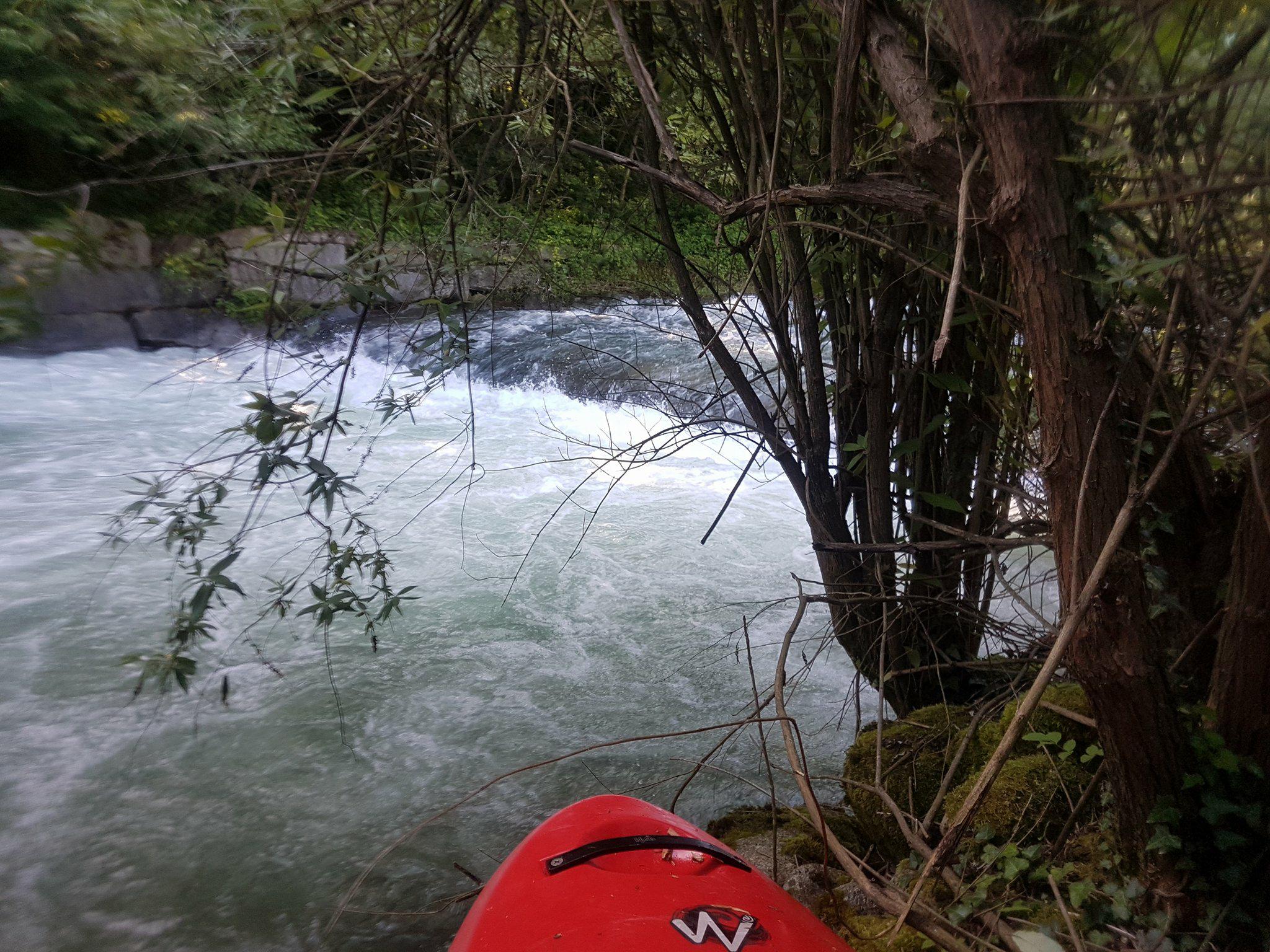
There are many small islands covered in trees on the river, and multiple times the river splits into 2,3 or 4 channels around these islands so its hard to know which channel to take, we got it wrong a couple of times and had to fight through the trees (not easy its very thick) to find a better way. You must also be careful of the water flowing into these trees.
We put in and took off in slightly different places as stated in the info, our put in was 46.231436, 8.327333, and our take out was 46.172427, 8.315399, both places are easy to find, suitable parking and easy access to the river and the take out bridge is easily seen from the river.
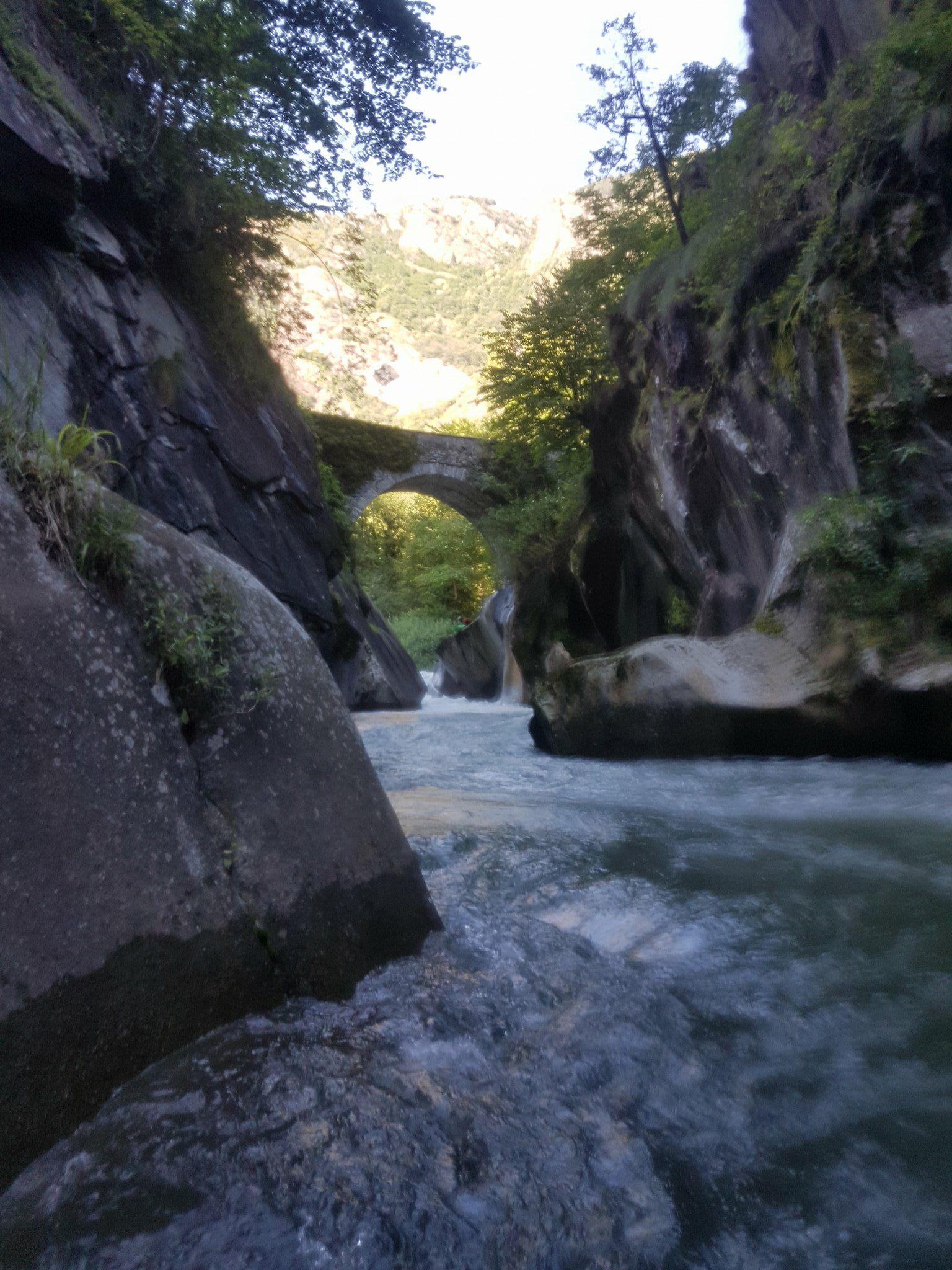
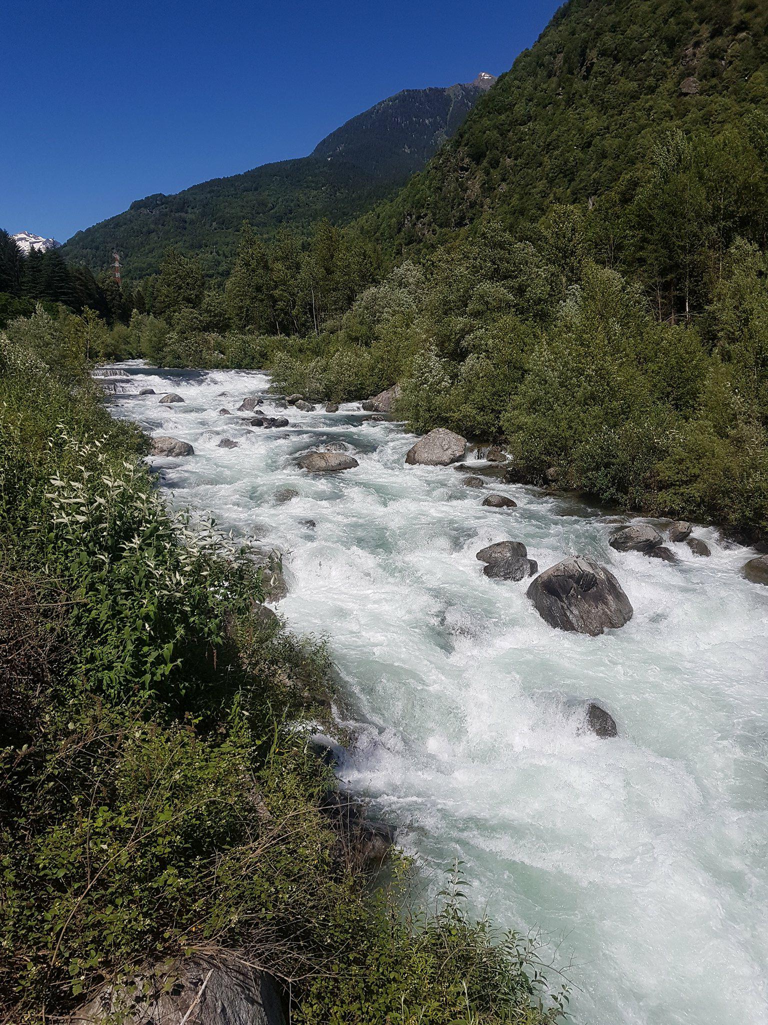
The river starts nicely with some grade 3/4 fun, all pretty clean and fun we just boat scouted and eddy hopped at this water level. Then there is a long grade 4 rapid that starts at a partial concrete weir, we could stand on the weir on river right and climb up on the wall to scout it, the water goes down a big tongue on the left but at the flow we had (90cm) it wasn't safe to run so we climbed below the weir and ran the rest of the rapid. There are a few man made weirs on the river so be careful whenever you see a horizon line. After that it became more grade 2/3 and shallow for a long time and many tree islands to navigate. Immediately after a tree island you see a stone arch bridge and directly under this is the grade 5 feature, you can easily look at it when you drive the shuttle before getting on, its location is 46.182408, 8.323171, we walked around it and seal-launched back in from river left under the bridge (thats pretty cool) into a beautiful gorge, its only 150m long and no more big rapids in it. After the gorge there is another tree island we went right but there is a small, 1 foot high (I think natural) weir towards the bottom that is hard to see, we managed to stop right above it and portage it in the tree island (not fun), if you stayed straight and kept your nose up with speed I would say you would get straight over it no problem but the boil line was about 2 or 3 meters from the weir so it would defiantly hold you in there in your boat for the rest of the day so treat it with caution, or take the left channel around the tree island.
Hope that info helps you, its a great river, enjoy
The river starts really nicely with
Its important to know that the river can rise rapidly without warning, this happened to us, luckily at the time we were on the bridge scouting the grade 5 feature, the river came up significantly within a couple of minutes, pretty scary if you are in your boat in the middle of the river above a rapid (especially the grade 5 rapid!), so be aware of this and make sure you pull your boat up high when you get out to scout things.
There are many small islands covered in trees on the river, and multiple times the river splits into 2,3 or 4 channels around these islands so its hard to know which channel to take, we got it wrong a couple of times and had to fight through the trees (not easy its very thick) to find a better way. You must also be careful of the water flowing into these trees.
We put in and took off in slightly different places as stated in the info, our put in was 46.231436, 8.327333, and our take out was 46.172427, 8.315399, both places are easy to find, suitable parking and easy access to the river and the take out bridge is easily seen from the river.
The river starts nicely with some grade 3/4 fun, all pretty clean and fun we just boat scouted and eddy hopped at this water level. Then there is a long grade 4 rapid that starts at a partial concrete weir, we could stand on the weir on river right and climb up on the wall to scout it, the water goes down a big tongue on the left but at the flow we had (90cm) it wasn't safe to run so we climbed below the weir and ran the rest of the rapid. There are a few man made weirs on the river so be careful whenever you see a horizon line. After that it became more grade 2/3 and shallow for a long time and many tree islands to navigate. Immediately after a tree island you see a stone arch bridge and directly under this is the grade 5 feature, you can easily look at it when you drive the shuttle before getting on, its location is 46.182408, 8.323171, we walked around it and seal-launched back in from river left under the bridge (thats pretty cool) into a beautiful gorge, its only 150m long and no more big rapids in it. After the gorge there is another tree island we went right but there is a small, 1 foot high (I think natural) weir towards the bottom that is hard to see, we managed to stop right above it and portage it in the tree island (not fun), if you stayed straight and kept your nose up with speed I would say you would get straight over it no problem but the boil line was about 2 or 3 meters from the weir so it would defiantly hold you in there in your boat for the rest of the day so treat it with caution, or take the left channel around the tree island.
Hope that info helps you, its a great river, enjoy
The river starts really nicely with
 • #2963 • 15.06.2018 08:53
Birs (CH), Welle Joggeli, Basel
Bewertung NW-MW-HW
13.06.2018
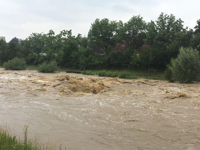
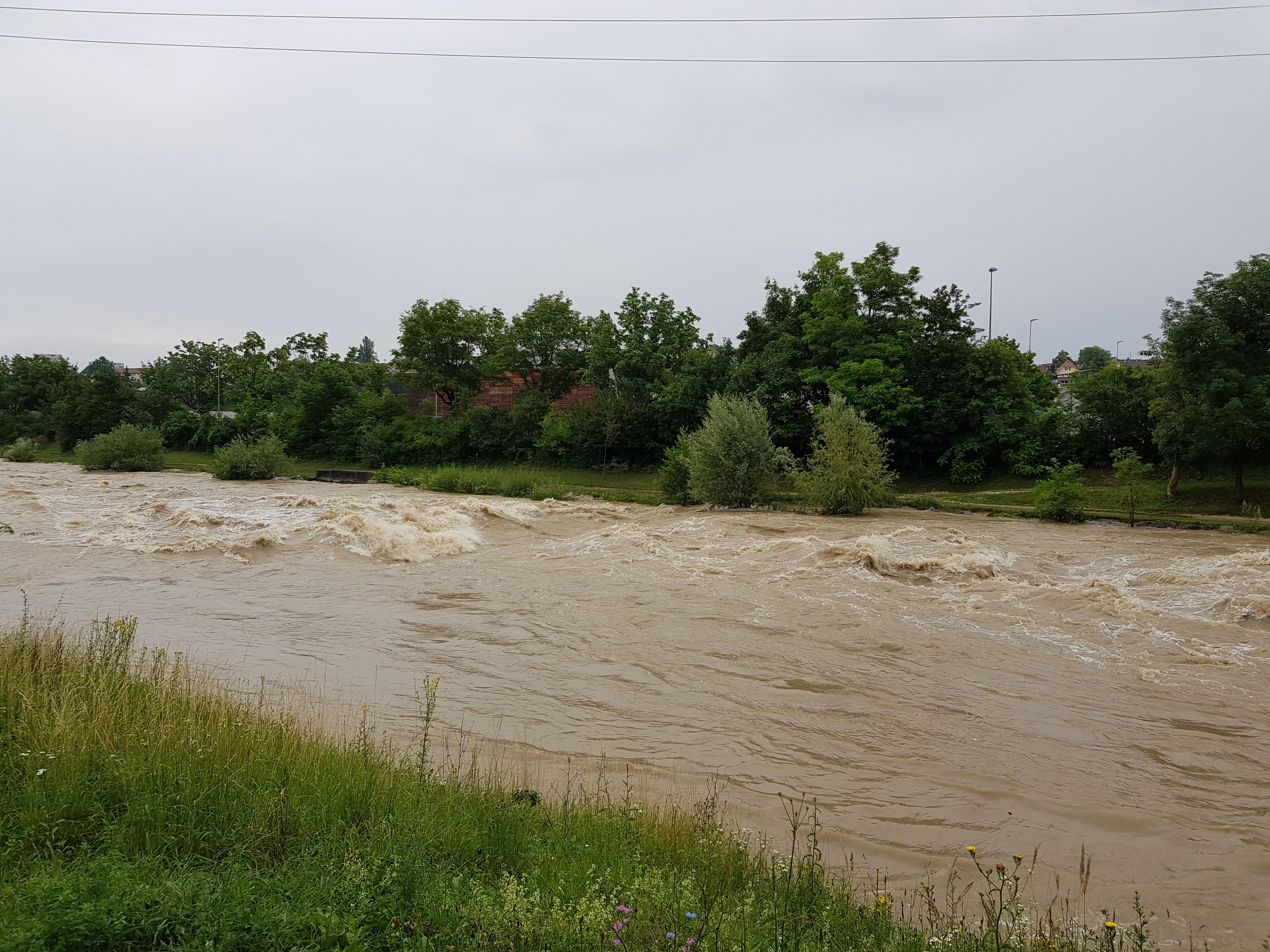
High of 185 m³/s, dropping through the day.
The callibration worked perfectly.
High of 185 m³/s, dropping through the day.
The callibration worked perfectly.
 • #2962 • 15.06.2018 08:25
Birs (CH), Welle Redingbrücke, Basel
Info
For a BAFU alarm for Soyhières send an SMS to number 9234, with the message body
START Q 2478 ALARM 40.0
This is an approximate warning that the Münchenstein, Hofmatt will reach 60 cumecs in about 3 hours.
https://www.bafu.admin.ch/bafu/de/home/themen/wasser/zustand/daten/messwerte-zum-thema-wasser-beziehen/aktuelle-hydrologische-daten-beziehen.html
START Q 2478 ALARM 40.0
This is an approximate warning that the Münchenstein, Hofmatt will reach 60 cumecs in about 3 hours.
https://www.bafu.admin.ch/bafu/de/home/themen/wasser/zustand/daten/messwerte-zum-thema-wasser-beziehen/aktuelle-hydrologische-daten-beziehen.html
• #2961 • 13.06.2018 22:29Birs (CH), Welle Redingbrücke, Basel
Info
Peak flow at Basel is, generally and approximately,:
- 6hrs later than peak at Moutier
- 3hrs later than peak at Soyhières
- 6hrs later than peak at Moutier
- 3hrs later than peak at Soyhières
• #2958 • 13.06.2018 08:40Kleine Ohe (DE), B533-Run
Bewertung NW-MW-HW
LW: 5 m³/s
MW: 8 m³/s
HW: 12 m³/s
MW: 8 m³/s
HW: 12 m³/s
• #2956 • 12.06.2018 21:59Obertalbach (AT), Obertalbachklamm
 Gefahr vorübergehend
Quote:
Obertalbachgorge is for shure not as popular as its neighbor the Untertalbach. Its way more alpine and has tricky trees sometimes and hard scouts / portages sometimes. Even its hard work if you dont know the right eddys to scout the crux rapids. So take some time for the first try and dont run around blind corners ;)
Today where about 3 easy portages and one exhausting one, as there was no way to portage the tree on riverlevel. So we had to hike up the steep forrest 50 meters, 3 Meters river downstream, and the 50 meters down again.
with video of the conditions at the moment:
https://vimeo.com/274272732
Obertalbachgorge is for shure not as popular as its neighbor the Untertalbach. Its way more alpine and has tricky trees sometimes and hard scouts / portages sometimes. Even its hard work if you dont know the right eddys to scout the crux rapids. So take some time for the first try and dont run around blind corners ;)
Today where about 3 easy portages and one exhausting one, as there was no way to portage the tree on riverlevel. So we had to hike up the steep forrest 50 meters, 3 Meters river downstream, and the 50 meters down again.
with video of the conditions at the moment:
https://vimeo.com/274272732
• #2955 • 12.06.2018 21:41Rabbies (IT), Tassè - Pondasio
Info
https://www.youtube.com/watch?v=o3MaZ6tTdLU a video while the hydroplant was not working. As usual it's not running until 1of May. In that case Rabbies is already running at 28cm.
• #2954 • 12.06.2018 21:28Weißenbach (AT), Klamm (Chorinsky Klause - vor Mündung Traun)
Saane / Sarine (CH), Camping Le Berceau - Lac du Vernex
Gefahr aufgehoben
Bäume in 3 ter Schlucht sind weg.
• #2948 • 10.06.2018 12:17Inn (CH), Giarsun
Befahrbarkeit
Befahren am 02.06.2018 bei 81Kubik. Alles gut zu fahren. Von dem Loch rechts Ende Treppenhaus sollte man sich jedoch fernhalten.
• #2943 • 04.06.2018 11:32Inn (CH), Ardez
Befahrbarkeit
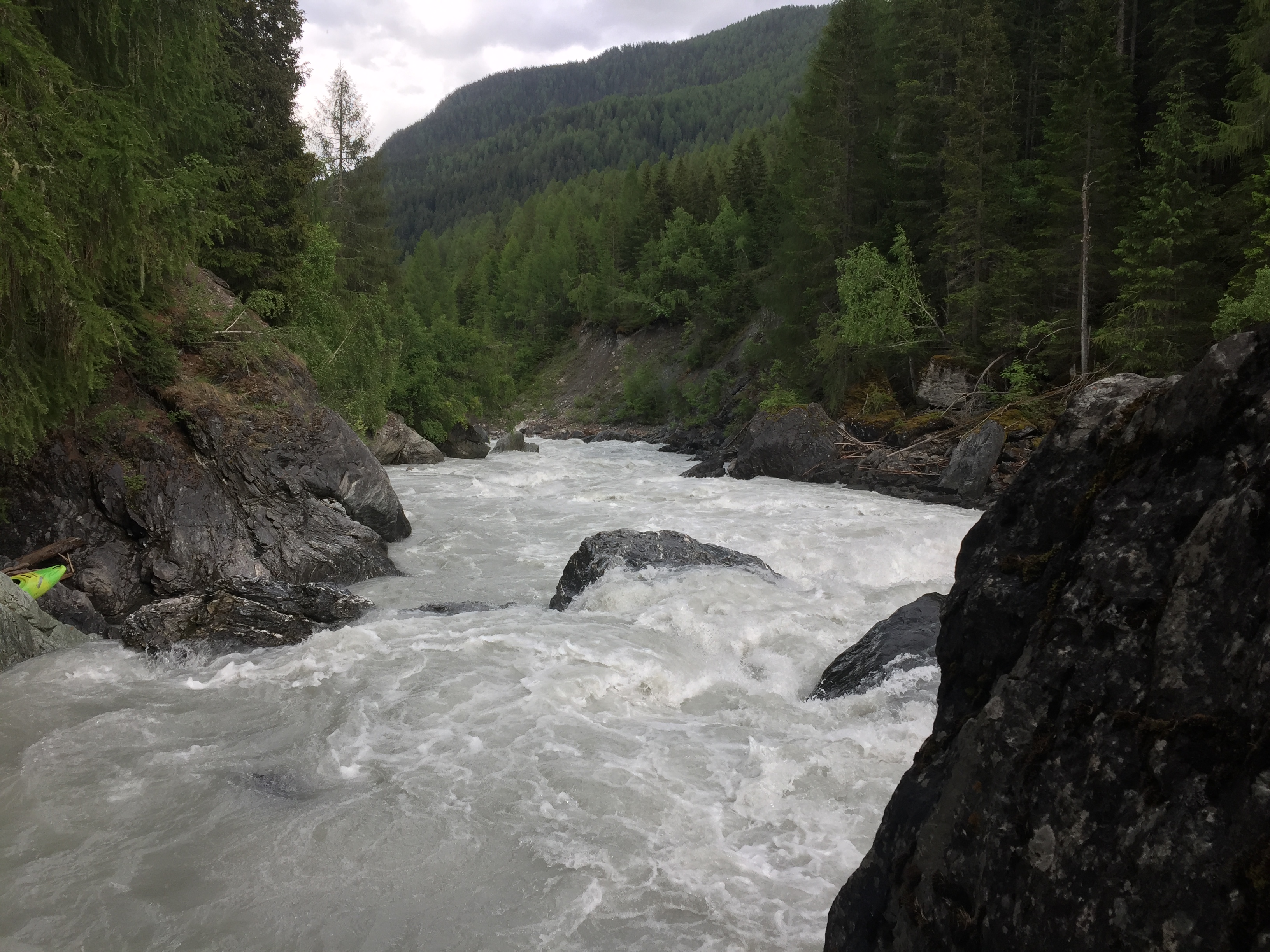
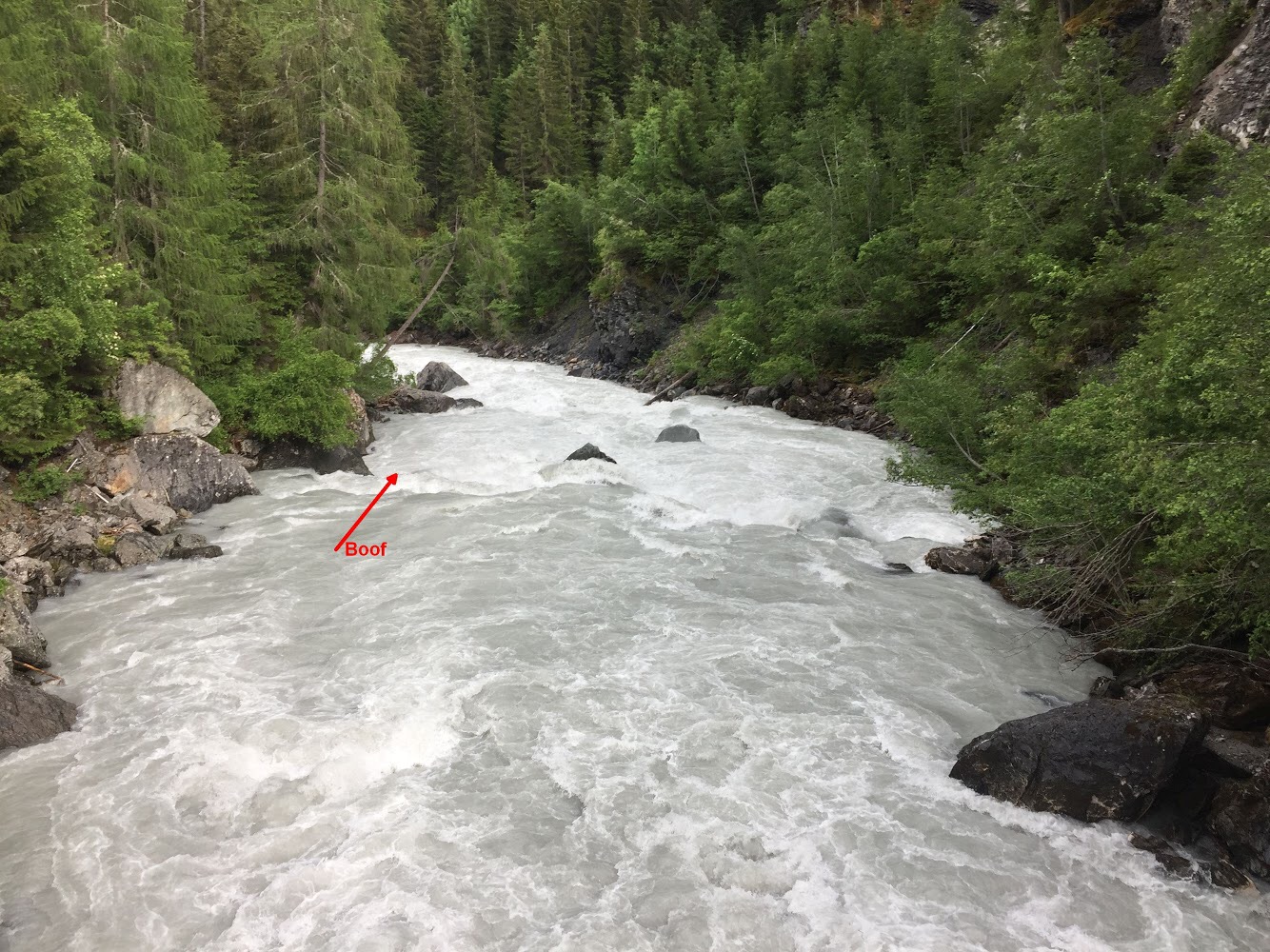
Befahren am 02.06.2018 bei 81 kubik. Noch gut zu fahren, aber gar nicht so spaßig, da viele Features überspült sind.
Himmelsgucker sind wir ganz links gefahren (Bild 2).
Himmelsgucker sind wir ganz links gefahren (Bild 2).
 • #2942 • 04.06.2018 11:27
Furkareuss (CH), Realp - Andermatt
Gefahr aufgehoben
Durchfahrten Frei und sonniges Wetter
• #2940 • 03.06.2018 19:04Medelser Rhein (CH), Parde - Baselgia
Bewertung NW-MW-HW
Pegelbewertung aus Beitrag #485 stimmt für Nicht-Norweger. Die neuere Bewertung passt nicht ansatzweise zu den restlichen Beschreibungen im Gebiet. Und falls das ein 4er mit 5er Stellen ist, ist der untere Glenner ein 2er mit 3er Stellen.
• #2939 • 03.06.2018 15:37Glenner (CH), Peiden - Ilanz
GefahrAm Ende der Schlitz-Stromstelle liegt eine umgestürzte Stahlbetonmauer im Bach. Vorsicht vor Armiereisen und scharfen Bruchkanten. Schwimmer im Schlitz werden ohne guten Wurfsackwerfer am Ufer ziemlich sicher über das Ding gezogen.
• #2938 • 02.06.2018 17:05Glenner (CH), Uors - Peiden
GefahrIm Bereich des Felssturzes (grosser neuer Block im Bach) ist der gesamte linke Hang in Bewegung. Man sieht von der Strasse aus Risse im Gelände, ein Absturz grösserer Mengen an Gestein ist absehbar. Man sollte den Abschnitt meiden und sich nicht unnötig dort aufhalten.
• #2937 • 02.06.2018 16:41Medelser Rhein (CH), Parde - Baselgia
Flash!
Werner Powerhouse carbon lost on Cristalina 31.05.2018, If found contact +41764737981
• #2936 • 01.06.2018 09:14Urnäsch (CH), Oberste
Sitter (CH), Untere Sitterschlucht (Haslen - St. Gallen)
Info
Sitter Wehr St.Gallen 21.12.2008
https://www.youtube.com/watch?v=DjtzYvo9N_0
km 5.1 gemäss SKV Flussführer 1991: ein verfallenes Wehr im Anschluss an eine verblockte Schwallstrecke gewährt nur bei niedrigem Wasserstand einen Durchschlupf durch einen niedrigen, kurzen Tunnel (bei Hochwasser unfahrbar). Rechtzeitig rechts ausbooten und allenfalls umtragen.
https://www.youtube.com/watch?v=DjtzYvo9N_0
km 5.1 gemäss SKV Flussführer 1991: ein verfallenes Wehr im Anschluss an eine verblockte Schwallstrecke gewährt nur bei niedrigem Wasserstand einen Durchschlupf durch einen niedrigen, kurzen Tunnel (bei Hochwasser unfahrbar). Rechtzeitig rechts ausbooten und allenfalls umtragen.
 • #2934 • 01.06.2018 08:48
Necker (CH), Oberster (Brücke - Schwanzbrugg)
Info
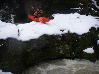
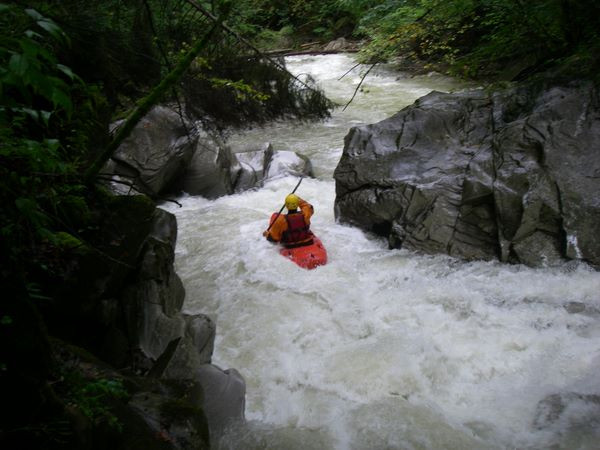
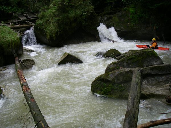
Eindrücke aus dem Jahre 2008, alle Bilder hier: https://www.twf.ch/bilder-2008-oberer-necker/
 • #2933 • 01.06.2018 08:36
Thur (CH), Welle Bürglen
Seite: 1 2 3 4 5 . . . 173 174 175 176 177 178 179 . . . 286 287 288
nach oben