Rivermap
HomeThe Map
List View
Befahrbarkeit
English Summary
Karte Einbetten
Systemstatus
Kontakt und Team
Datenlieferanten
Contributor Agreement
The RCSD
Public licenses
Rivermap Japan
![]() "Rivermap Supporter" Group
"Rivermap Supporter" Group
Flusshinweise
Als Grundlage dient wenn immer möglich ein Flussführer.
Seite: 1 2 3 4 5 . . . 163 164 165 166 167 168 169 . . . 271 272 273
Resultate 3301 - 3320 von 5450
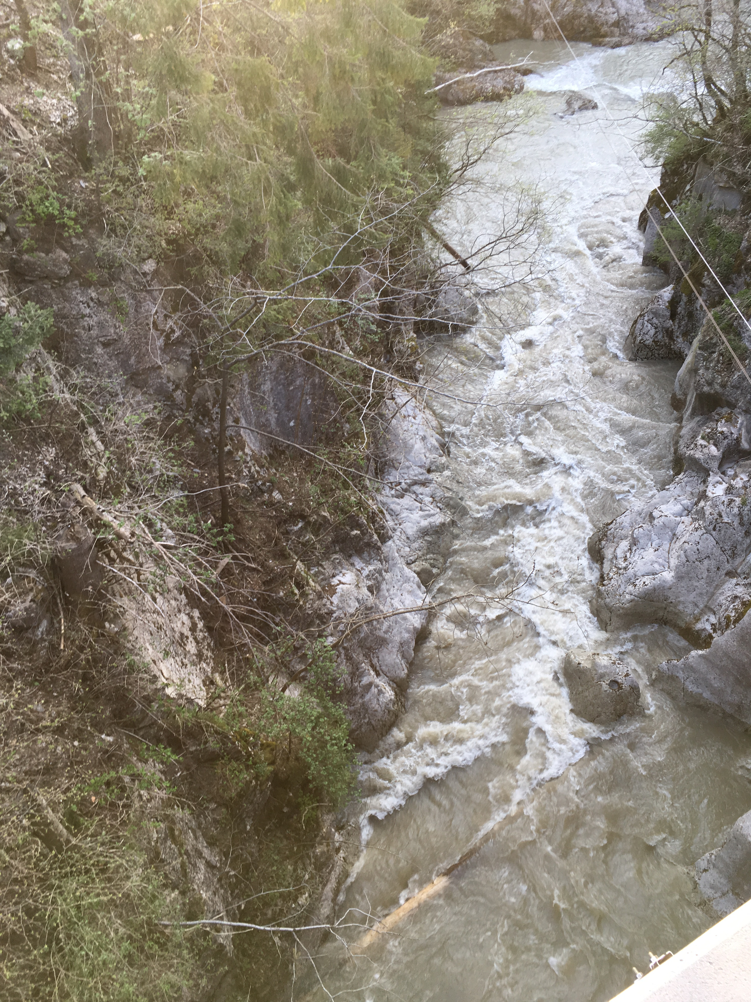
Ribo (CH), Vergeletto - 300m vor Brücke Strasse Onsemone-Spruga
Info
Befahren am 22.04.2018, Verzasca 31 Kubik steigend. Schmelzwasser Tagesgang 30 Kubik min, 50 Kubik max -> unteres MW.
Zwangspassage frei ( falls es trocken ist, kann man beim Rapid vorher rechts hochklettern und ein Blick in die Zwangspassage werfen) .
Es hat immer mal wieder Holz im Fluss und am Ufer liegt auch noch einiges rum. Kurz Scouten ist ratsam.
Zwangspassage frei ( falls es trocken ist, kann man beim Rapid vorher rechts hochklettern und ein Blick in die Zwangspassage werfen) .
Es hat immer mal wieder Holz im Fluss und am Ufer liegt auch noch einiges rum. Kurz Scouten ist ratsam.


 • #2837 • 23.04.2018 12:19
Ribo (CH), Oberster (Strassenende - oberer Steg)
Info
Lavertezzo Pegel bei 33 Kubik. Zu wenig Wasser.
"... einige schöne Slides, aber alle haben fiese Unterspülungen am Ende, 2-3 Fälle sind auch zu finden, aber schwierig zum Scouten, noch weiter oben, wird er Bach eng und sehr verblockt und geröllig." [kopiert aus Beitrag #771 vom 01.05.2012 Oberer Ribo]
"... einige schöne Slides, aber alle haben fiese Unterspülungen am Ende, 2-3 Fälle sind auch zu finden, aber schwierig zum Scouten, noch weiter oben, wird er Bach eng und sehr verblockt und geröllig." [kopiert aus Beitrag #771 vom 01.05.2012 Oberer Ribo]

 • #2836 • 23.04.2018 11:58
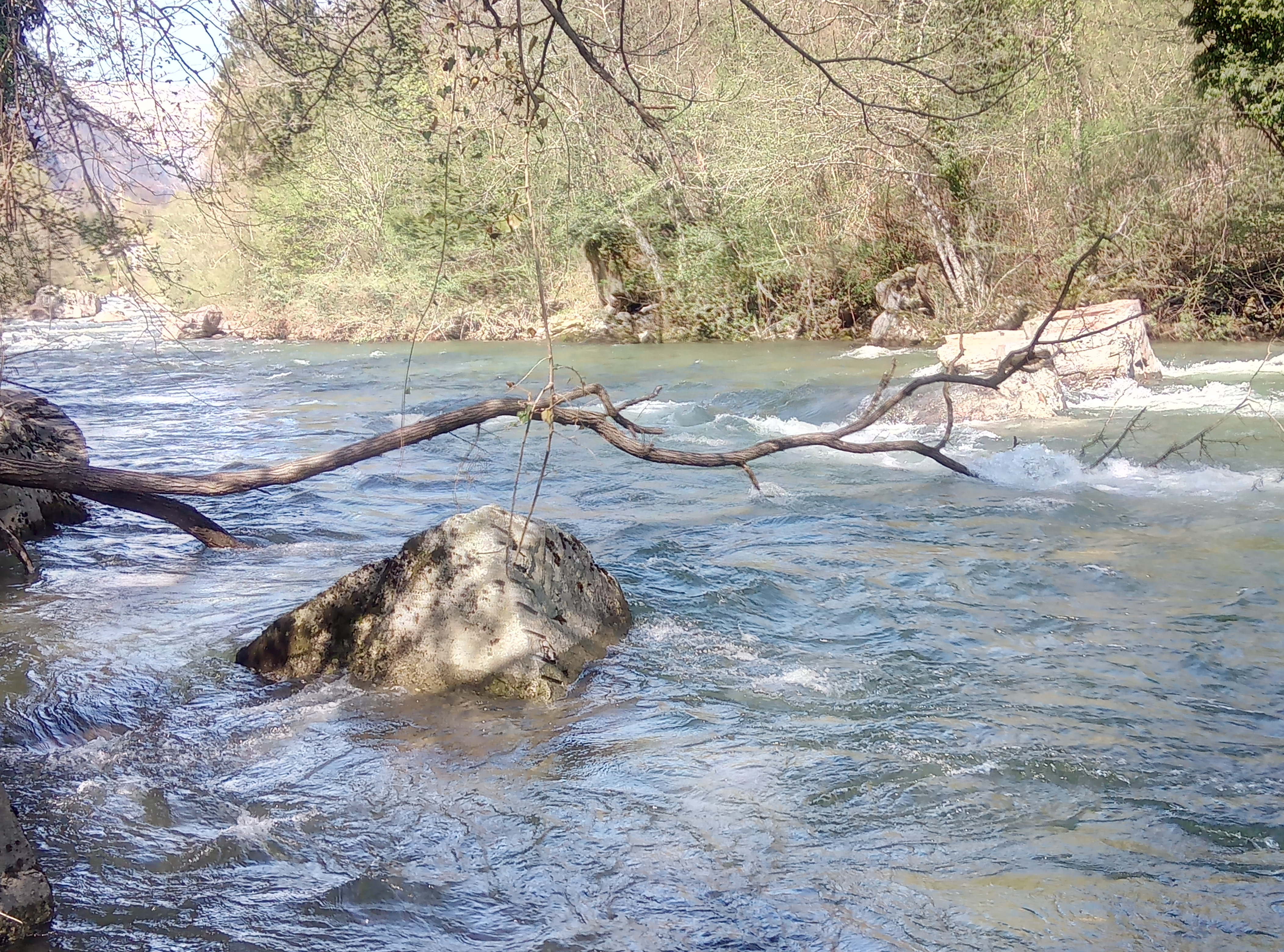
Ribo (CH), Oberer (Steg - Vergeletto)
Bewertung NW-MW-HW
Befahren am 22.04.2018 am späten Nachmittag.
Lavertezzo Pegel 38 Kubik steigend. Schmelzwasser Tagesgang 30 Kubik min, 50 Kubik max.
Unterstes NW. Nicht lustig, aber fahrbar.
Es hat ein paar alte Eisenträger im Fluss, aber nichts allzu kritisches.
Lavertezzo Pegel 38 Kubik steigend. Schmelzwasser Tagesgang 30 Kubik min, 50 Kubik max.
Unterstes NW. Nicht lustig, aber fahrbar.
Es hat ein paar alte Eisenträger im Fluss, aber nichts allzu kritisches.
• #2835 • 23.04.2018 11:38Grosse Emme (CH), Räbeli - Sorbach
Fahrverbot
Updates zum Räbloch:
http://www.wochen-zeitung.ch/Details/das-raebloch-muss-entstopft-werden-die-frage-ist-wie
http://www.wochen-zeitung.ch/Details/das-raebloch-muss-entstopft-werden-die-frage-ist-wie
• #2834 • 23.04.2018 08:20Saane / Sarine (CH), Camping Le Berceau - Lac du Vernex
The wood that was blocking the entrance has now moved a few meters lower. Both at 6 and 10 cubic there is no clear pass around it. There is another large piece that covers the whole river 30m below. At 10cubic water partially covers it, at 6 cubic it does not.
 • #2832 • 22.04.2018 21:11
Muota (CH), Muotathal, Fussballplatz - Illgau, Holzlagerplatz
Auf dem Abschnitt zwischen Vordere Brücke und Selgis/Holzbrücke hat es am Ende des WW III Kataraktes (der einzige Katarakt nach dem Muotastein) einen Baum mit Ästen im mittleren Flussbereich. Rechts umfahrbar.
• #2831 • 21.04.2018 18:46Moesa (CH), Sorte - Cama
100m nach dem sog. "Doppel S" (zwischen Brücke Norantola und Brücke Cama): Durchfahrt rechts blockiert durch Baum im Wasser.
 • #2830 • 21.04.2018 16:34
Fier (FR), Dingy - Pont de Brogny
Befahrbarkeit
Der Eknstieg ist bei der Brücke nach Dingy-Saint-Clair. Es gibt viele andere Saint-Clair..
Der Pegel bei der alten Brücke hat 20 angezeigt. Rivermap ca. 25. Wir hatten einen schönen Wasseratand. Alles fahrbar II-III. Der Katarakt am Anfang kann von der Strasse auf der linken Flussseite angesehen werden, wenn mann flussabwärts fährt.
Wir schätzen die HW- Marke von Rivermap als zu tief ein. Es waren noch viele Kiesbänke da. Am Ufer sieht man Spuren, dass der Fluss häufig 1m mehr Wasser führt.
• #2829 • 20.04.2018 21:41Saine (FR), Source - Foncine le Bas (pont D437)
Befahrbarkeit
18.4.2018
7 cumecs at Syam, rising later. This seemed somewhat below MW.
One blocking tree, 50 below the source. Shortly after that some tight wire across the river at chest height.
Otherwise all good.
We didn't think it was worth portaging the last weir for the last drop before the the bridge, so we got out just above it.
• #2828 • 20.04.2018 13:27Doubs (FR), Gorges du Fourperet (Barrage - Usine Électrique)
Befahrbarkeit
19.4.2018
4 cumecs on the gauge, slightly dropping. All good, but a *little* more water would be nice.
4 cumecs on the gauge, slightly dropping. All good, but a *little* more water would be nice.
• #2827 • 20.04.2018 10:59Alb (DE), Ibachmündung - Tiefenstein
Info
CrowdWater is a University of Zurich "citizen science" project to collect hydrological data. Their project is a bit confusing but there is something that could be useful to us.
I have created a Crowdwater spot for us with a reference photo of the Alb pegelstein.
https://www.spotteron.com/crowdwater/spots/28068
- Get the Crowdwater app and get a login.
- When you are at the spot, take a photo of the Pegelstein from the opposite bank.
- Upload the photo to Crowdwater.
Most simply, I think that everyone will be able to see the sequence of photos for the spot.
Crowdwater will compare your photo with the reference photo to derive a sequence of water level values. I don't think those numbers will be useful for us. But the idea is very cool and I would be interested to see it in action.
• #2825 • 18.04.2018 07:59Alb (DE), Tiefenstein - Albbruck
Info
CrowdWater is a University of Zurich "citizen science" project to collect hydrological data. Their project is a bit confusing but there is something that could be useful to us.
I have created a Crowdwater spot for us with a reference photo of the Alb pegelstein.
https://www.spotteron.com/crowdwater/spots/28068
- Get the Crowdwater app and get a login.
- When you are at the spot, take a photo of the Pegelstein from the opposite bank.
- Upload the photo to Crowdwater.
Most simply, I think that everyone will be able to see the sequence of photos for the spot.
Crowdwater will compare your photo with the reference photo to derive a sequence of water level values. I don't think those numbers will be useful for us. But the idea is very cool and I would be interested to see it in action.
I have created a Crowdwater spot for us with a reference photo of the Alb pegelstein.
https://www.spotteron.com/crowdwater/spots/28068
- Get the Crowdwater app and get a login.
- When you are at the spot, take a photo of the Pegelstein from the opposite bank.
- Upload the photo to Crowdwater.
Most simply, I think that everyone will be able to see the sequence of photos for the spot.
Crowdwater will compare your photo with the reference photo to derive a sequence of water level values. I don't think those numbers will be useful for us. But the idea is very cool and I would be interested to see it in action.
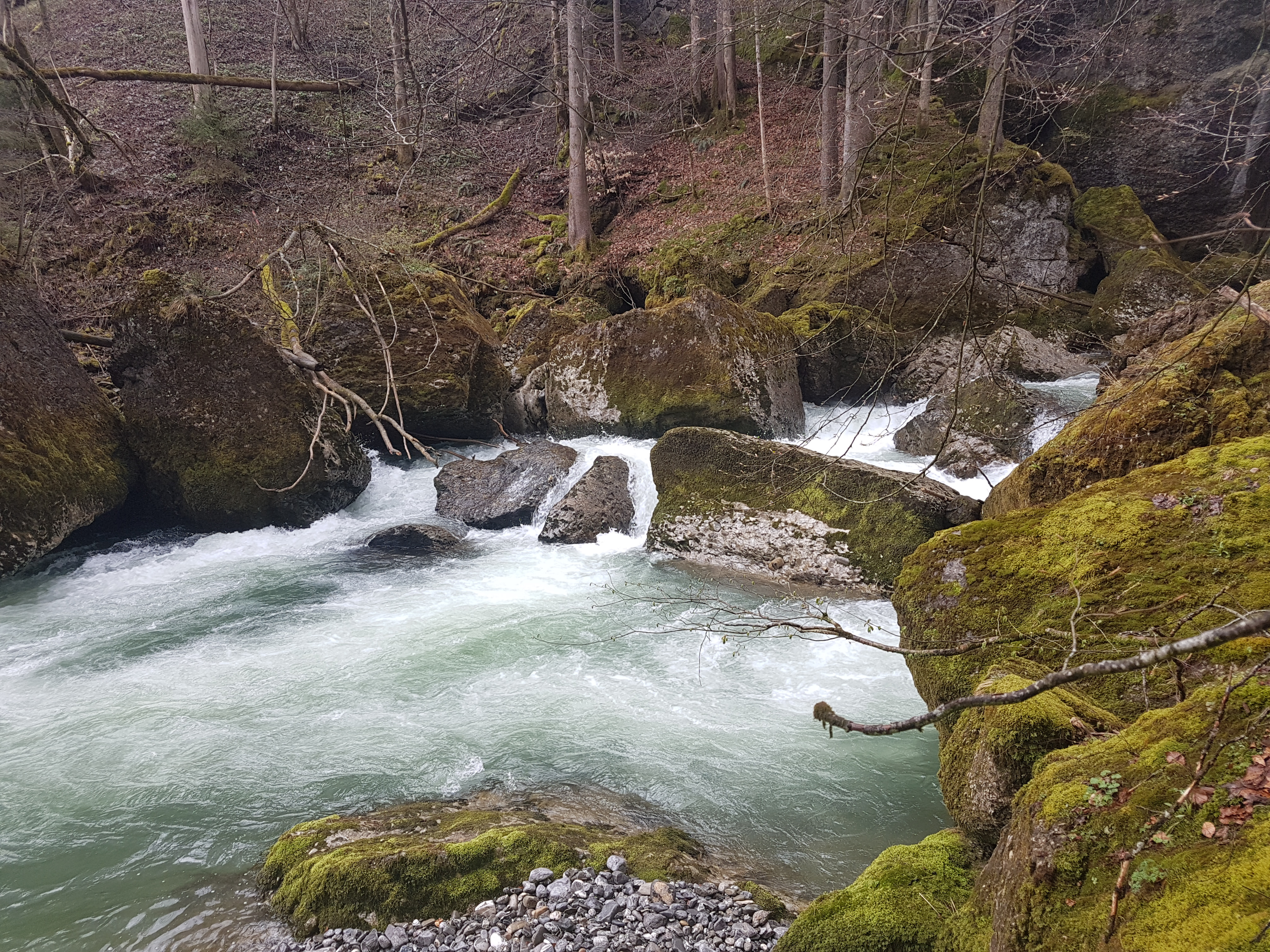
• #2824 • 18.04.2018 07:58Thur (CH), Oberste (Stein - Neu St.Johann)
Sehr viel Holz am herumliegen aber meistens fahrbar
 • #2822 • 17.04.2018 07:40
Doubs (FR), Slalom Goumois
Gefahr aufgehoben
Seile und Holz geräumt
• #2819 • 16.04.2018 11:12Seez (CH), Mels - Walenstadt
Valserine (FR), Sous Niaizet - La Rivière
Info
The section above, then this section, and then on to Chézery-Forens
https://vimeo.com/68838510
https://vimeo.com/68838510
• #2816 • 13.04.2018 22:00Valserine (FR), Niaizet - 300m plus bas
Info
This section, and then on to Chézery-Forens
https://vimeo.com/68838510
https://vimeo.com/68838510
• #2815 • 13.04.2018 21:59Valserine (FR), La Rivière - Chézery
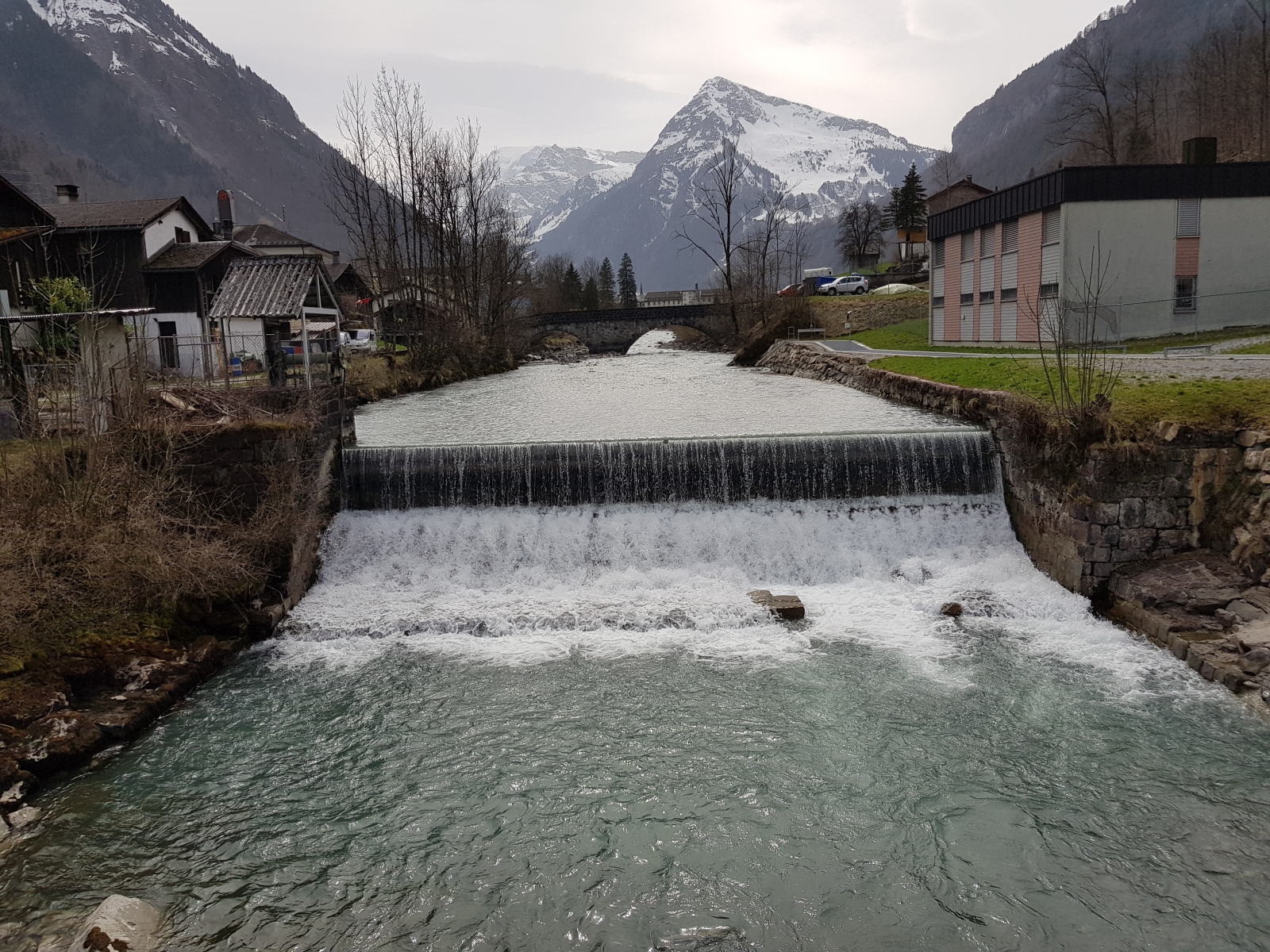
Linth (CH), Rüti - Betschwanden
Befahrbarkeit
Ergänzend zum vorherigen Eintrag noch zwei Fotos bei wenig Wasser, welche zeigen weshalb rechts von der Mitte gefahren werden sollten
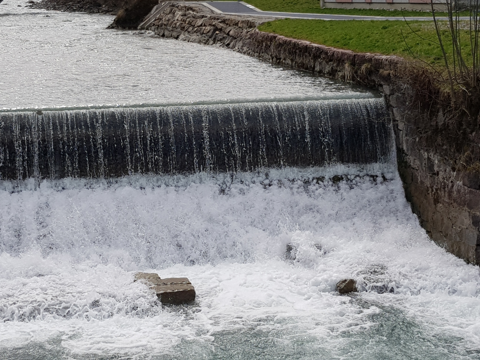 • #2812 • 13.04.2018 11:08
Linth (CH), Schwanden - Ennenda
Das alte Läderachwehr vor Ennenda hat sich wieder stärker ausgebildet und dürfte bei mehr Wasser rückläufig werden.
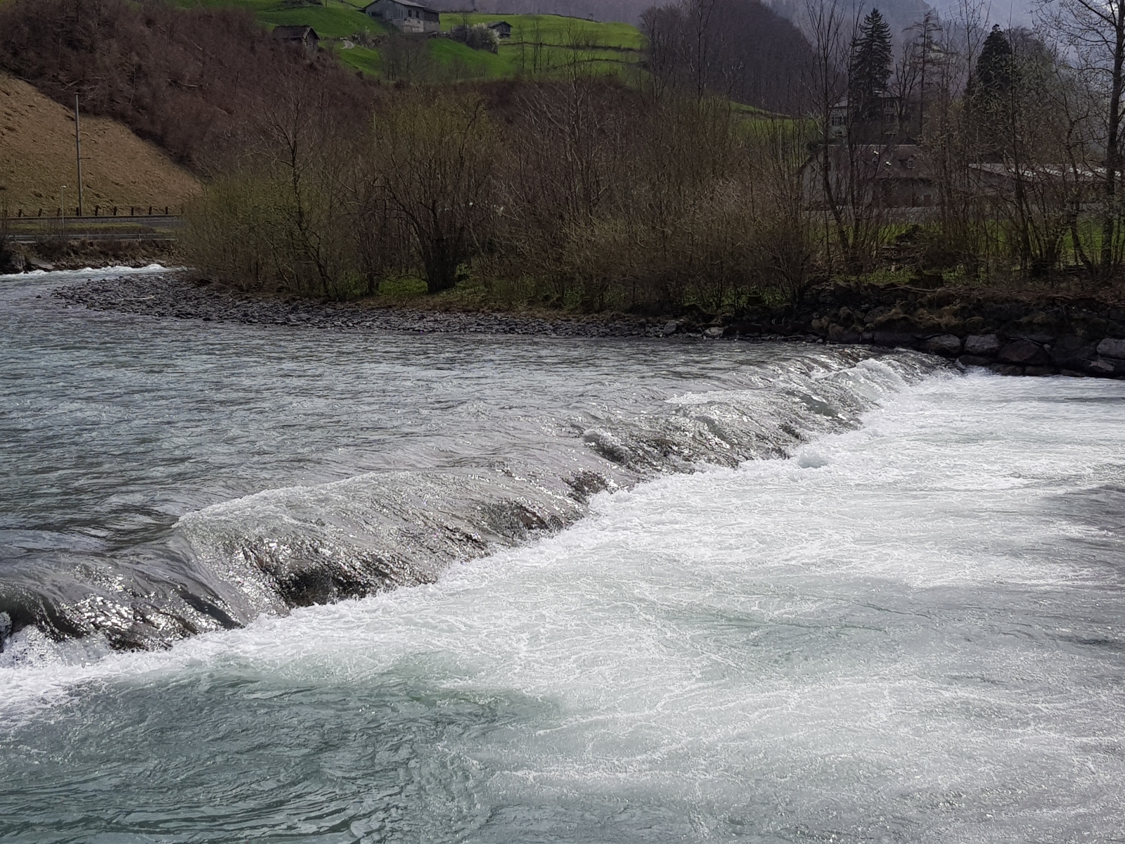 • #2811 • 13.04.2018 11:04
Seite: 1 2 3 4 5 . . . 163 164 165 166 167 168 169 . . . 271 272 273
nach oben