Rivermap
HomeThe Map
List View
Befahrbarkeit
English Summary
Karte Einbetten
Systemstatus
Kontakt und Team
Datenlieferanten
Contributor Agreement
The RCSD
Public licenses
Rivermap Japan
![]() "Rivermap Supporter" Group
"Rivermap Supporter" Group
Flusshinweise
Als Grundlage dient wenn immer möglich ein Flussführer.
Seite: 1 2 3 4 5 . . . 114 115 116 117 118 119 120 . . . 271 272 273
Resultate 2321 - 2340 von 5450
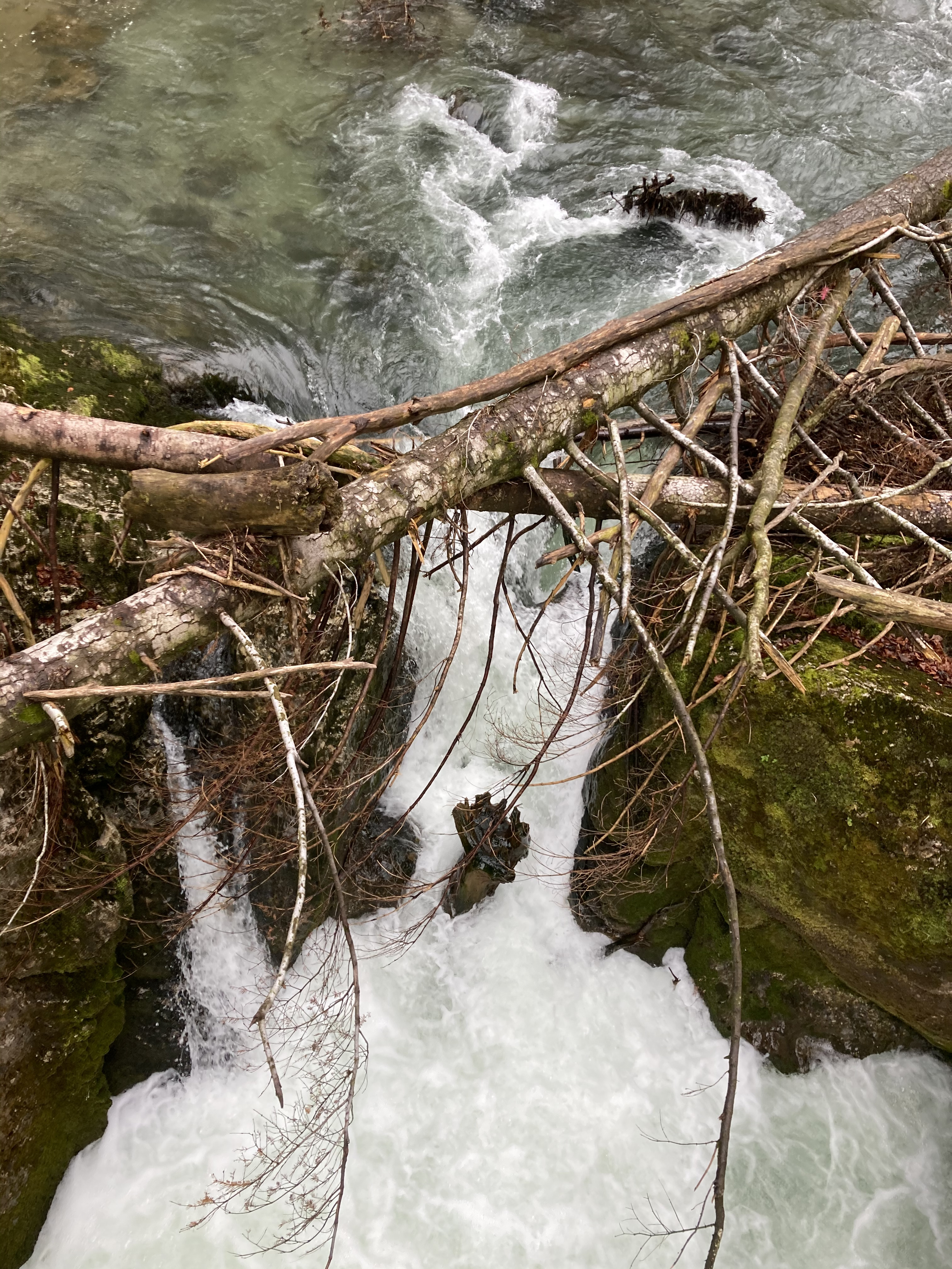
Thur (CH), Obere (Mühlau - Schwarzenbach)
Baum kurz vor dem Indianerfels. Sieht einfach aus, ist bei 35 kubik aber trotzdem angespült.
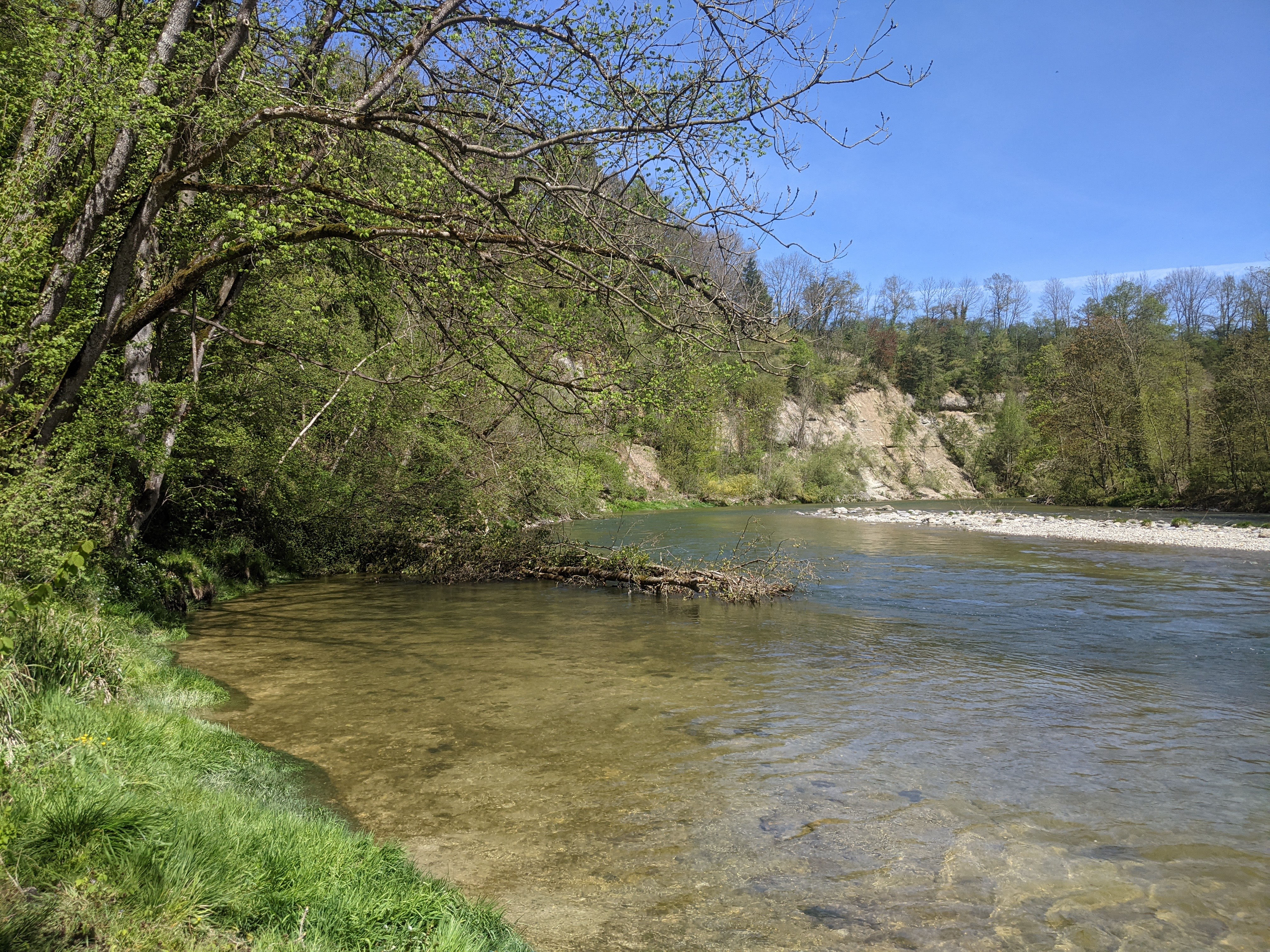
 • #4260 • 08.05.2021 19:37
Sense (CH), Guggersbach - Ruchmüli
Flash!
Haben ein gelbes Necky Kayak gefunden. Besitzer bitte per eMail melden für weitere Infos.
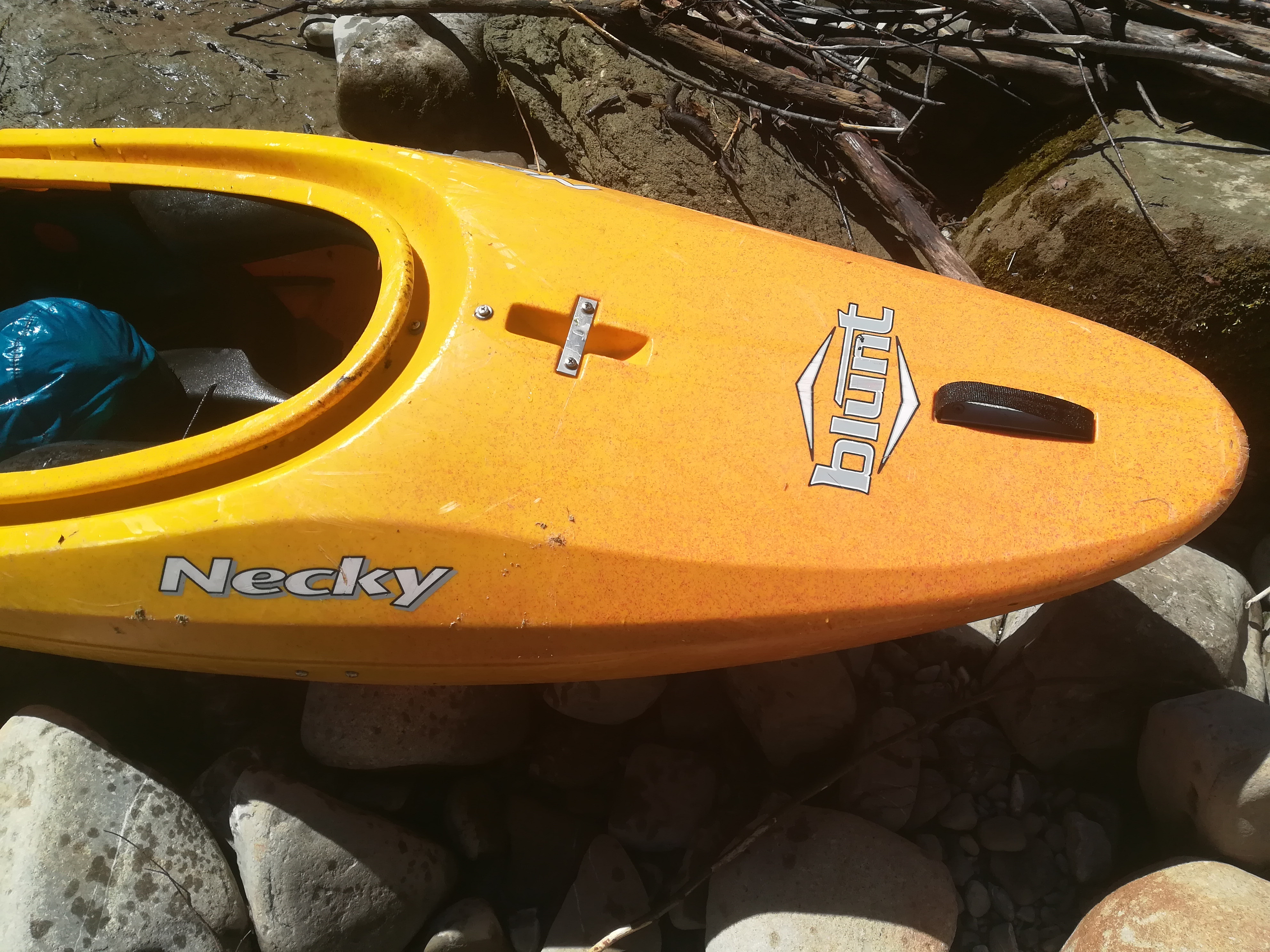 • #4259 • 08.05.2021 16:02
Aubach (AT),
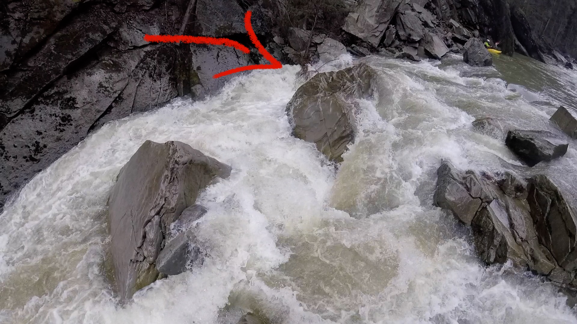
Verzasca (CH), Mittlere (Brione - Aquino)
Walze im Labyrinth (gut von Strassenbrücke sichtbar) wird ab 20m3 ziemlich sticky. Schlecht absicherbar.
• #4256 • 06.05.2021 12:26Verzasca (CH), Obere 2 (Croce - Brione)
Befahrbarkeit
Befahren am 2.5.2021. Pegel mittlere= 26m3, untere=37m3. NW aber noch gut fahrbar. WW3-4 mit 3x IV


 • #4255 • 06.05.2021 12:16
Ostrach (DE), Aueleklamm (E-Werk - Guferbrücke)
Befahrbarkeit
Ostrach@Reckenberg. Baum vor der 3. Stelle nach dem Klammeingang, links bei 8,5 kubic möglich zu umtragen, etwas Kletterei - Kehrwasser auf der rechten und linken Seite vor der Stelle zum besichtigen. Ansonsten freie Fahrt!
• #4254 • 04.05.2021 21:09Reuss (CH), Amsteg Autobahnrastplatz - Erstfeld
Gefahr aufgehoben
Alle Baustellen zw. Amsteg und Erstfeld beendet.
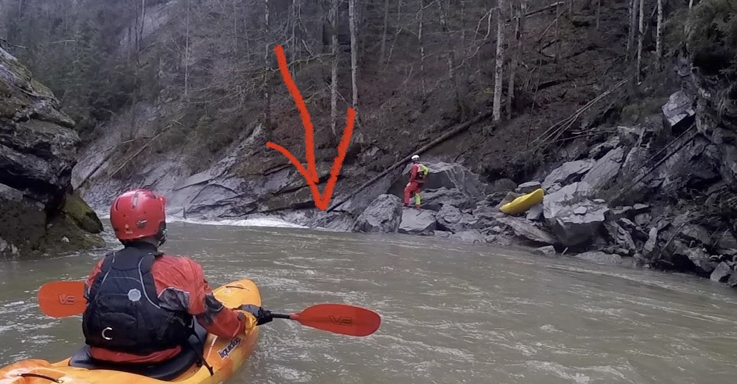
• #4253 • 04.05.2021 15:52Glenner (CH), Peiden - Ilanz
Befahrbarkeit
In der Waldschlucht bei der Bachteilung hat's den Glenner ein bisschen umgebaut und links monentan einen Baum im Wasser. Schlitz und Galerie sind wie letztes Jahr. Bei 13m3, anfangs Mai 2021. https://vimeo.com/544758367
• #4252 • 04.05.2021 09:03Reuss (CH), Amsteg Autobahnrastplatz - Erstfeld
Gefahr aufgehoben
Stahlseile entfernt
• #4250 • 03.05.2021 21:58Reuss (CH), Amsteg Autobahnrastplatz - Erstfeld
Gefahr aufgehoben
Baum entfernt
• #4249 • 03.05.2021 21:55Reuss (CH), Obere Welle (Fällbaum), Bremgarten
Fahrverbot
The annual openings and closings of the Fällbaum weir are carried out by the Pontonier-Fahrverein Bremgarten.
The weir is generally opened around the beginning of May, however a suitable water level is required, so no specific date can be set.
The closure takes place around the end of September, again depending on water levels.
The opening and closing of the weir is usually communicated via the website of the Pontonier-Fahrverein https://www.pontoniere-bremgarten.ch/
Some photos of the 2019 closure operation are here:
https://www.pontoniere-bremgarten.ch/2019/10/fallbaum-geschlossen-2/
• #4248 • 03.05.2021 13:33Breitach (AT), Obere (Schwarzachmündung/Schwendeschlucht - Breitachklamm)
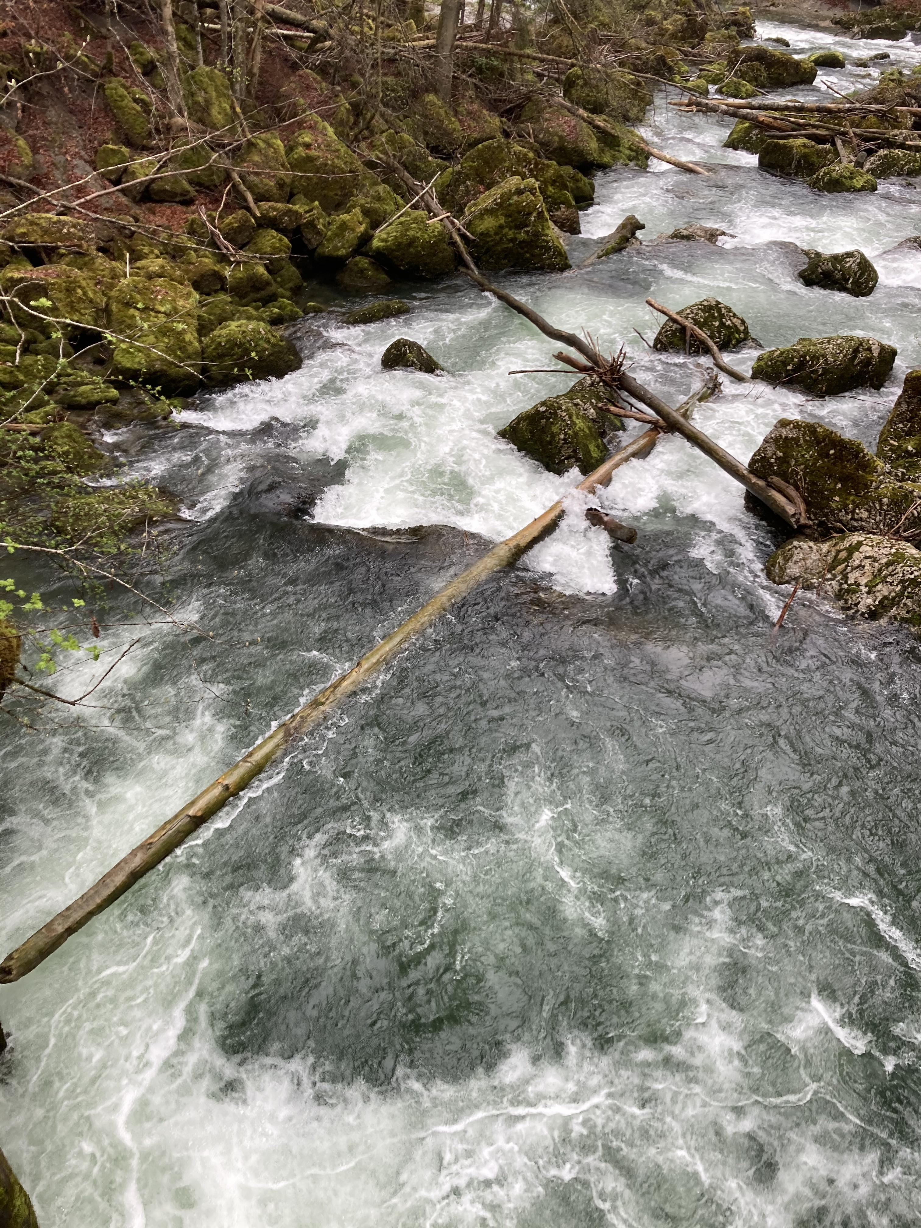
Grosse Emme (CH), Bumbach - Räbeli
Befahrbarkeit
Tree on the far right. Portage on the left hand side possible.
 • #4244 • 02.05.2021 16:29
Thur (CH), Oberste (Stein - Neu St.Johann)
Allgemein viel Holz in der Schlucht, beim zweiten kleineren Fall unter Brückli steckt ein Holzstamm drin.
 • #4243 • 02.05.2021 09:14
Dranse (FR), Centrale électrique de Bioge - 800m sous le pont de la D902
The take out of the portage is in the cave around 1km after the put-in, with more than 30m^3/s you can take the chicken in the cave and with less than 15m^3/s you will need to partage a bit longer there is a rock that block the exit (see by yourself when starting the portage).
• #4239 • 30.04.2021 12:58Dranse (FR), Centrale électrique de Bioge - 800m sous le pont de la D902
Bewertung NW-MW-HW
BE - 8m^3/s
ME - 25m^3/s
HE - 40m^3/s
With 30m^3/s everything is still as usual the river is still class IV+ it is defenitly not the max. It is just more continuous but a chicken line appeared in the cave of the protage.
ME - 25m^3/s
HE - 40m^3/s
With 30m^3/s everything is still as usual the river is still class IV+ it is defenitly not the max. It is just more continuous but a chicken line appeared in the cave of the protage.
• #4238 • 30.04.2021 12:50Saane / Sarine (CH), Camping Le Berceau - Lac du Vernex
There is a tree in the Chaudanne gorge that you need to check from the bride at 46.464315, 7.098460 you can easily pass under at low water but with the melting season incoming be careful
• #4236 • 29.04.2021 15:39Aubonne (CH), Poudrerie - Lac
Info
Beautiful natural section, with rapids class II-III.
There is a 2m dam here 46.470843, 6.405768. It can be slided, but dirty landing on rocks. Portage possible both sides.
There is some tree on the river, not difficult to avoid, but some can be dangerous by high water.
There is a 2m dam here 46.470843, 6.405768. It can be slided, but dirty landing on rocks. Portage possible both sides.
There is some tree on the river, not difficult to avoid, but some can be dangerous by high water.
• #4229 • 27.04.2021 11:00Walchen (AT), untere Klamm
Gefahr aufgehoben
Last gorge/ last drop before the lower Walchen ends in the lake is free. The tree has bern removed by a group today.
• #4224 • 25.04.2021 21:52Saane / Sarine (CH), Saanen - Camping Le Berceau
Bewertung NW-MW-HW
BE should be around 1m^3/s and with this level you don’t hit that much rocks. The Saane is navigable pretty much everyday of the year. It is a very good section for clubs.
• #4222 • 25.04.2021 10:06Seite: 1 2 3 4 5 . . . 114 115 116 117 118 119 120 . . . 271 272 273
nach oben