Rivermap
HomeThe Map
List View


 Flusshinweise
Befahrbarkeit
English Summary
Karte Einbetten
Systemstatus
Kontakt und Team
Datenlieferanten
Contributor Agreement
The RCSD
Public licenses
Rivermap Japan
 "Rivermap Supporter" Group
Flusshinweise
Als Grundlage dient wenn immer möglich ein Flussführer.
 RSS-Feed
abonnieren und nichts verpassen.
RSS-Feed
abonnieren und nichts verpassen.
Seite: 1 2 3 4 5 . . . 8 9 10 11 12 13 14 . . . 285 286 287
Resultate 201 - 220 von 5721
Reuss (CH), Göschenen - Wassen
Befahrbarkeit
Sind gestern Abend ab Autobahn-Viadukt gepaddelt. Pegel war so ca. 115cm, was wir als Medium Low einstufen würden. Alles gut fahrbar.
Achtsam beleiben, da es starke Pegelschwankungen in kürzester Zeit geben kann.
Achtsam beleiben, da es starke Pegelschwankungen in kürzester Zeit geben kann.
 • #7335 • 28.05.2026 09:23
Venter Ache (AT), Untere (P4 - Zwieselstein)
Befahrbarkeit
heute gefahren bei 88cm. alles frei, lawine in Bodenegg ist auch problemlos "durchfahrbar"
• #7334 • 27.05.2026 18:39Inn (CH), Giarsun
Befahrbarkeit
Heute gefahren bei 45m3/s. alles frei
• #7333 • 27.05.2026 18:37Verdon (FR), Grand Canyon (Point Sublime - Lac de Sainte Croix)
Gefahr aufgehoben
Imbut pas plus bouché que d'habitude
• #7332 • 27.05.2026 16:07Sesia (IT), Alpin Sprint (Otra - Mollia)
Flash!
Left a pretty new level six sprayskirt at takeout there on Monday the 25th. The people from Alpin Rider found it and put it on the mailbox, where someone then took it. If you have it or know who does, I'd appreciate to get it back.
+41791050428
+41791050428
• #7331 • 27.05.2026 14:45Guisane (FR), Chantemerle - Briançon
Befahrbarkeit
Gauge is probably not working fine. 26.05 17.00 looks more like HW. middle part continuous -IV, only read and run scouting not possible - very few eddys.
• #7330 • 26.05.2026 20:13Biaysse (FR), Pont des Oules - Freissinière
 Gefahr vorübergehend
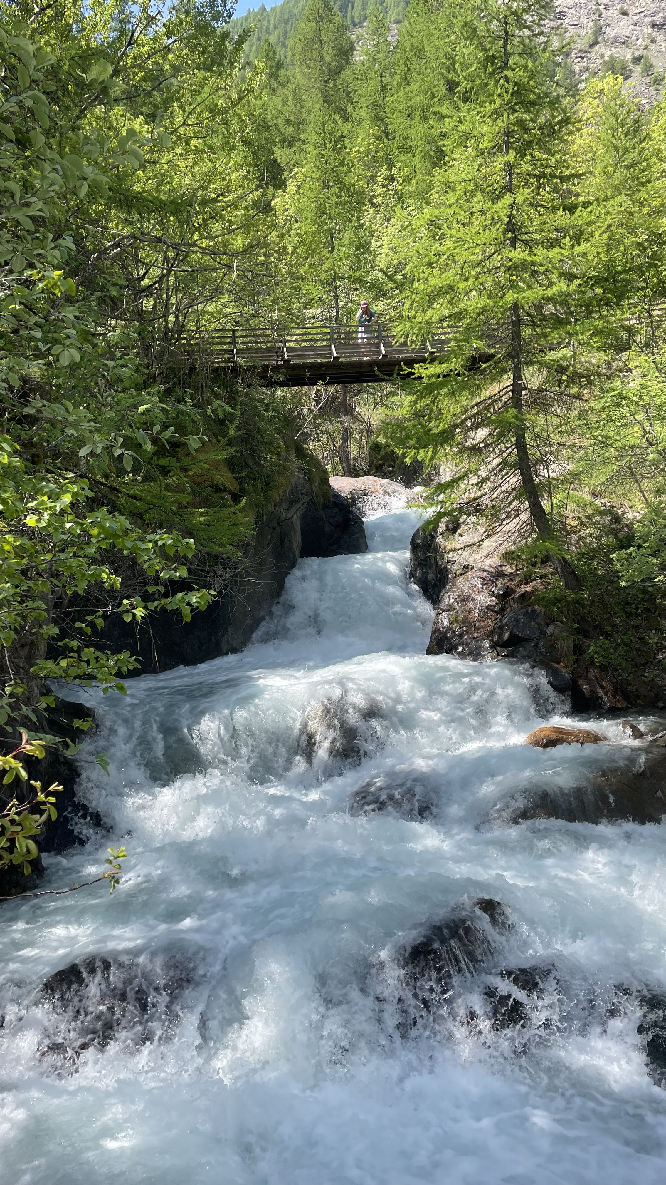
Scouted today, we'd say it's unrunnable, nearly every rapid we saw has a dangerous tree in line, sometimes no way to stop before. Some flat sections look clean...
Triple drop on Torrent des Oules, at the start, looks good though
Triple drop on Torrent des Oules, at the start, looks good though
 • #7329 • 26.05.2026 18:42
Ötztaler Ache (AT), Obere (Sölden - Bruggen)
Gefahr vorübergehendSteel cable still there. It spans from left to right and is under the water in the river center. It can be passed on the very right side, at our waterlevel.
Except that everything was fine at 95cm today.
Except that everything was fine at 95cm today.
• #7328 • 26.05.2026 16:12Weisse Lütschine (CH), Lauterbrunnen - Zweilütschinen
Befahrbarkeit
Wir sind diesen Abschnitt plus Dangelstutz über Pfingsten ein paar Mal bei Pegeln zwischen 9 bis 13.5 kubik gepaddelt. Alle Stellen waren gut fahrbar.
Die klemmgefährliche Verblockung aus Hinweis #7268 ging bei diesen Pegeln gut von links kommend nach rechts.
Die Eingangsrutsche ins Schlachthaus sah holpriger als aus als sie sich dann angefühlt hat. Hier nur aufpassen, dass man danach wieder links rüber kommt.
Schlitz ist frei und die Doppelstufe ging gut über das letzte Kehrwasser rechts. Dangelstutz so wie immer.
Bei 13 kubik war schon deutlich mehr los, daher passt die obere Grenze für MW bei 12 kubik ganz gut. 6 kubik für die untere Grenze ist wahrscheinlich etwas niedrig.
Die klemmgefährliche Verblockung aus Hinweis #7268 ging bei diesen Pegeln gut von links kommend nach rechts.
Die Eingangsrutsche ins Schlachthaus sah holpriger als aus als sie sich dann angefühlt hat. Hier nur aufpassen, dass man danach wieder links rüber kommt.
Schlitz ist frei und die Doppelstufe ging gut über das letzte Kehrwasser rechts. Dangelstutz so wie immer.
Bei 13 kubik war schon deutlich mehr los, daher passt die obere Grenze für MW bei 12 kubik ganz gut. 6 kubik für die untere Grenze ist wahrscheinlich etwas niedrig.
• #7327 • 26.05.2026 08:47Dora Baltea (IT), Leverogne - Chavonne
Stura di Valgrande (IT), Cantoira - Confluenza
Vorderrhein (CH), Ilanz - Versam
Gefahr aufgehoben
Tree is gone.
• #7324 • 25.05.2026 19:04Albula (CH), Waldschlucht
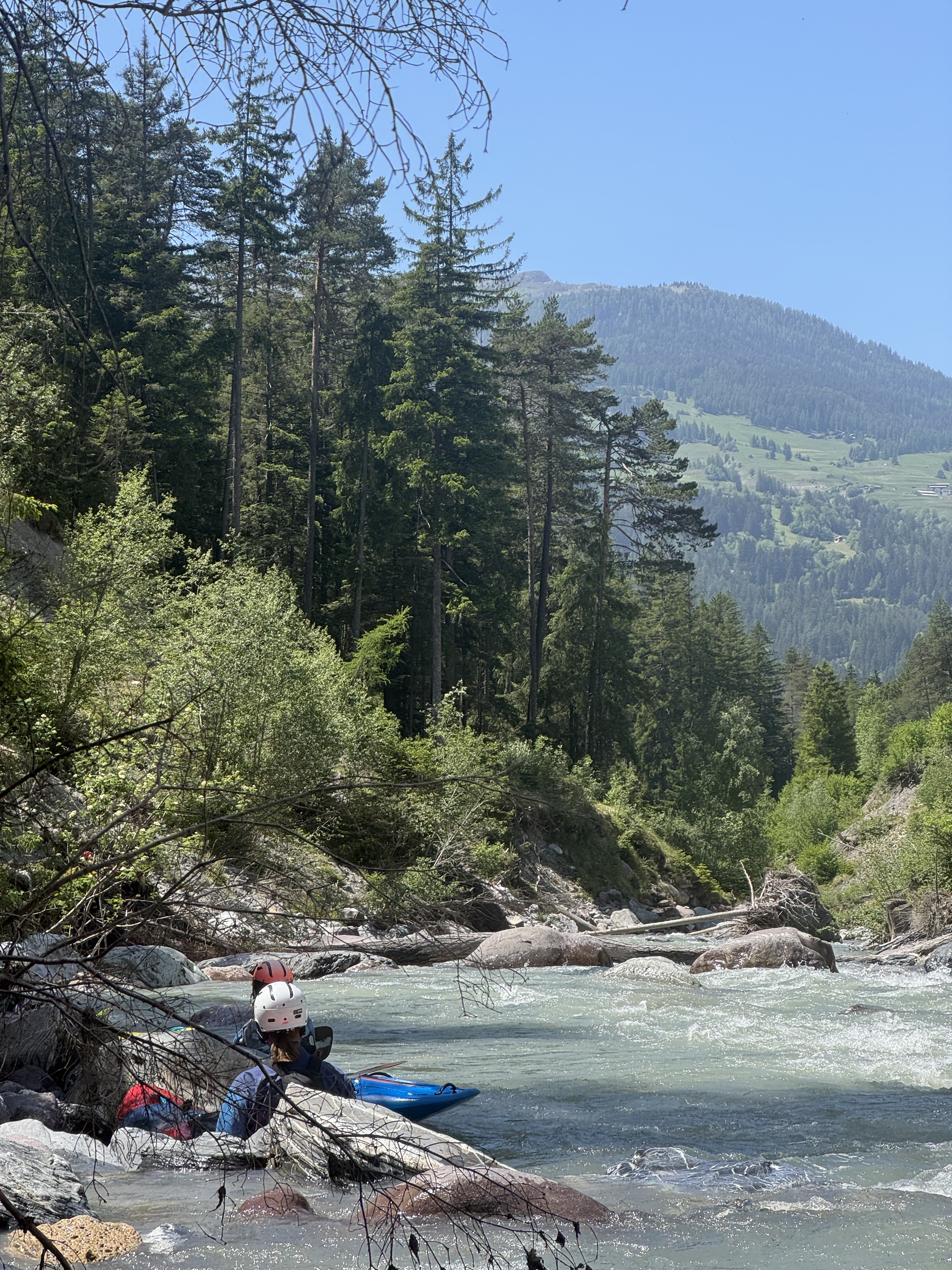
Gefahr vorübergehendDicker Baumstamm quer, ganzer Fluss versperrt. Umtragen links. Kettensäge nötig…
nach der „ersten Stelle“ der Waldschlucht.
Befahren ab Landwasser PP, bei 8.5 m3/s des Landwasser-Pegels. Unterste Grenze (!) für Befahrung der Strecke bis zur Waldschlucht.
25.5.26
nach der „ersten Stelle“ der Waldschlucht.
Befahren ab Landwasser PP, bei 8.5 m3/s des Landwasser-Pegels. Unterste Grenze (!) für Befahrung der Strecke bis zur Waldschlucht.
25.5.26
 • #7323 • 25.05.2026 14:29
Saane / Sarine (CH), Camping Le Berceau - Lac du Vernex
Gefahr aufgehoben
Der Baum ist definitv weg :) also freie Fahrt.
• #7322 • 24.05.2026 21:20Guisane (FR), Chantemerle - Briançon
Info
Ran at 5cms according to gauge, looked more like 10-15, MW. No dangerous trees.
There is no "X" on this section. There are three places marked as "weirs", but all are passable, third one actually has a purpose-built passage.
There is no "X" on this section. There are three places marked as "weirs", but all are passable, third one actually has a purpose-built passage.
• #7321 • 24.05.2026 18:54Vorderrhein (CH), Ilanz - Versam
Befahrbarkeit
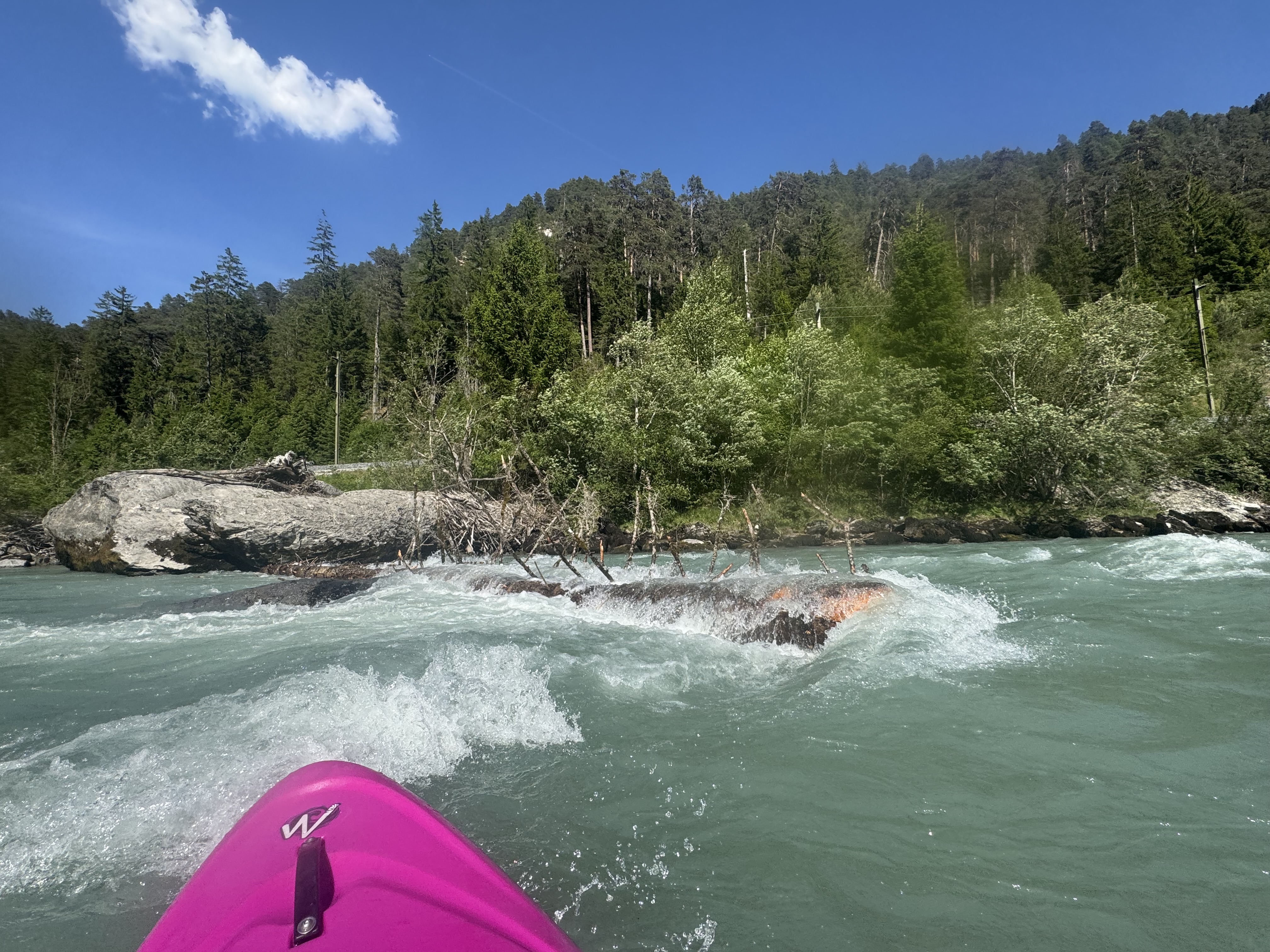
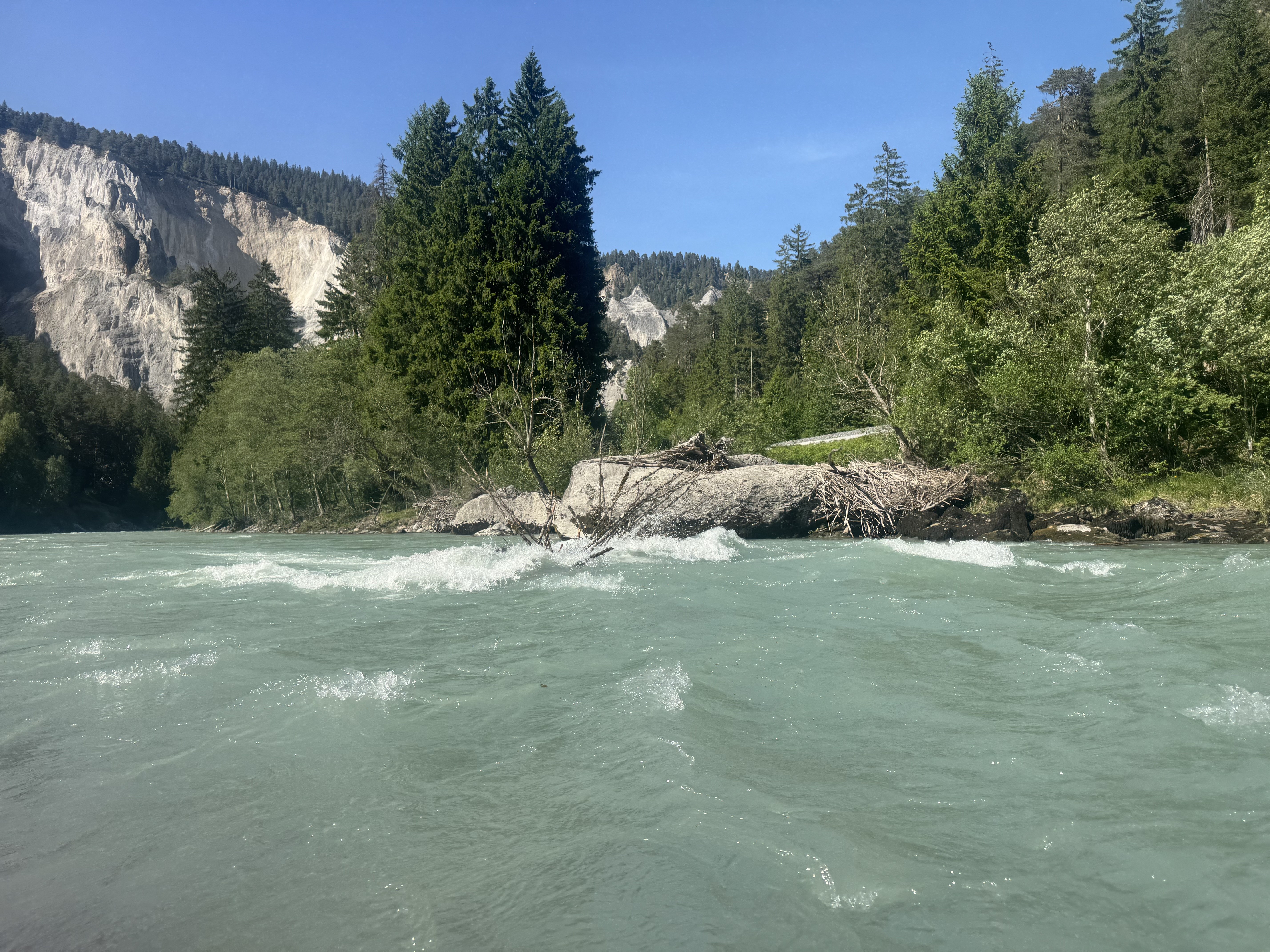
Take care after the black hole, just before Versam. There is a big ugly tree over the river in main current. You can pass on the river left. See pictures.
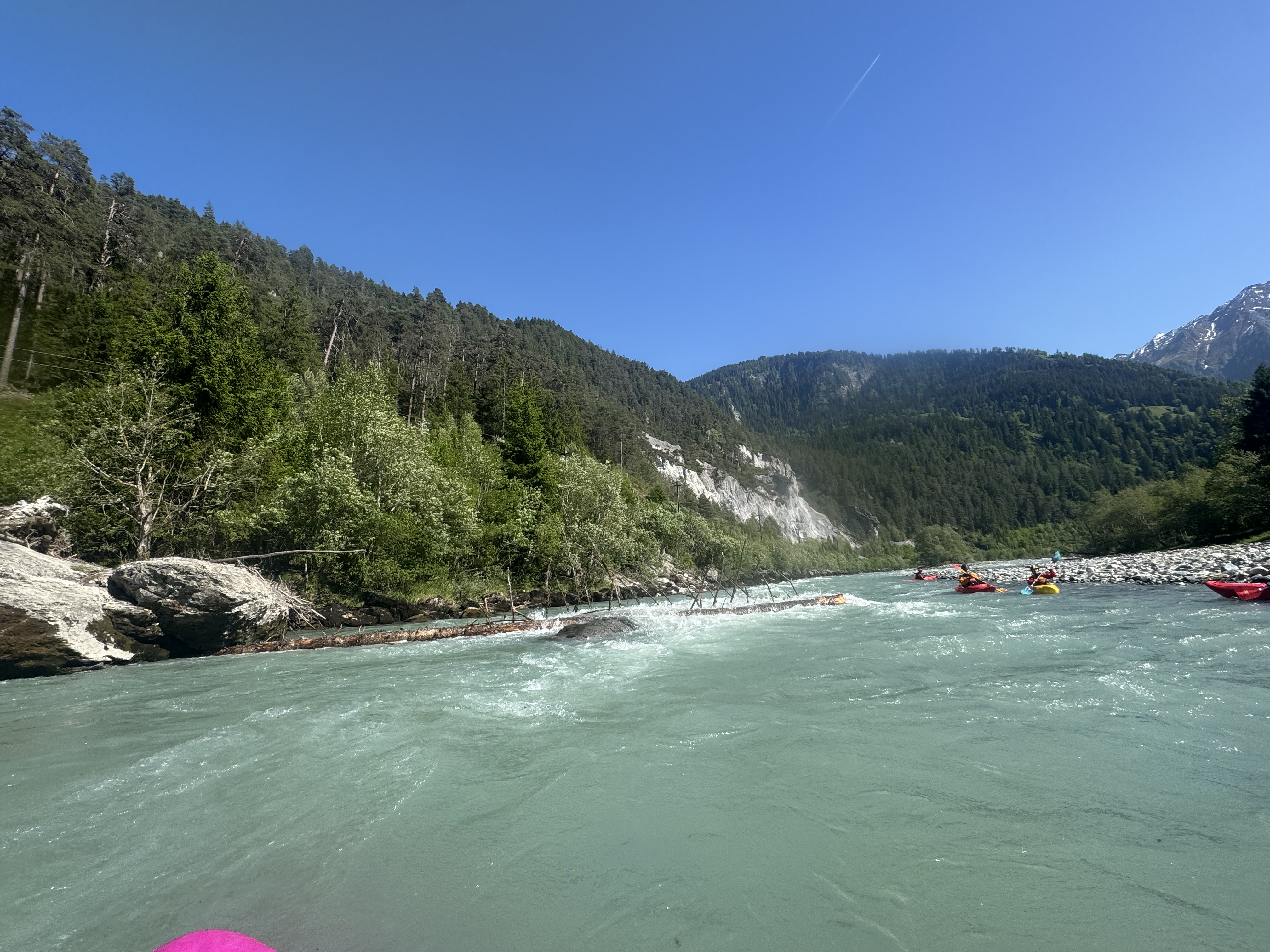 • #7320 • 24.05.2026 18:38
Kiene (CH), Kiental - Kien
Gefahr vorübergehendTree from last comment still there confirm there is not so much Eddies. In a pickle you could maybe squeeze by on river left (not recommended though. Portage is eqsiest on left bank but hard to find an eddy. Stop wat in time!
Rest of the run was quite clean.
Nice section although short
Rest of the run was quite clean.
Nice section although short
• #7319 • 23.05.2026 15:58Venter Ache (AT), Untere (P4 - Zwieselstein)
Gefahr vorübergehendAm Ende von Bodeneg befindet sich eine Lawine die ein Siphon formt. Am bestens einmal bei der Anfahrt ansehen. Zum Umtragen an der ersten Brücke in Bodenegg aussteigen. (46.9276732, 10.9993442)
Alles andere ist problemlos mit langem Hals zu umfahren.
Alles andere ist problemlos mit langem Hals zu umfahren.
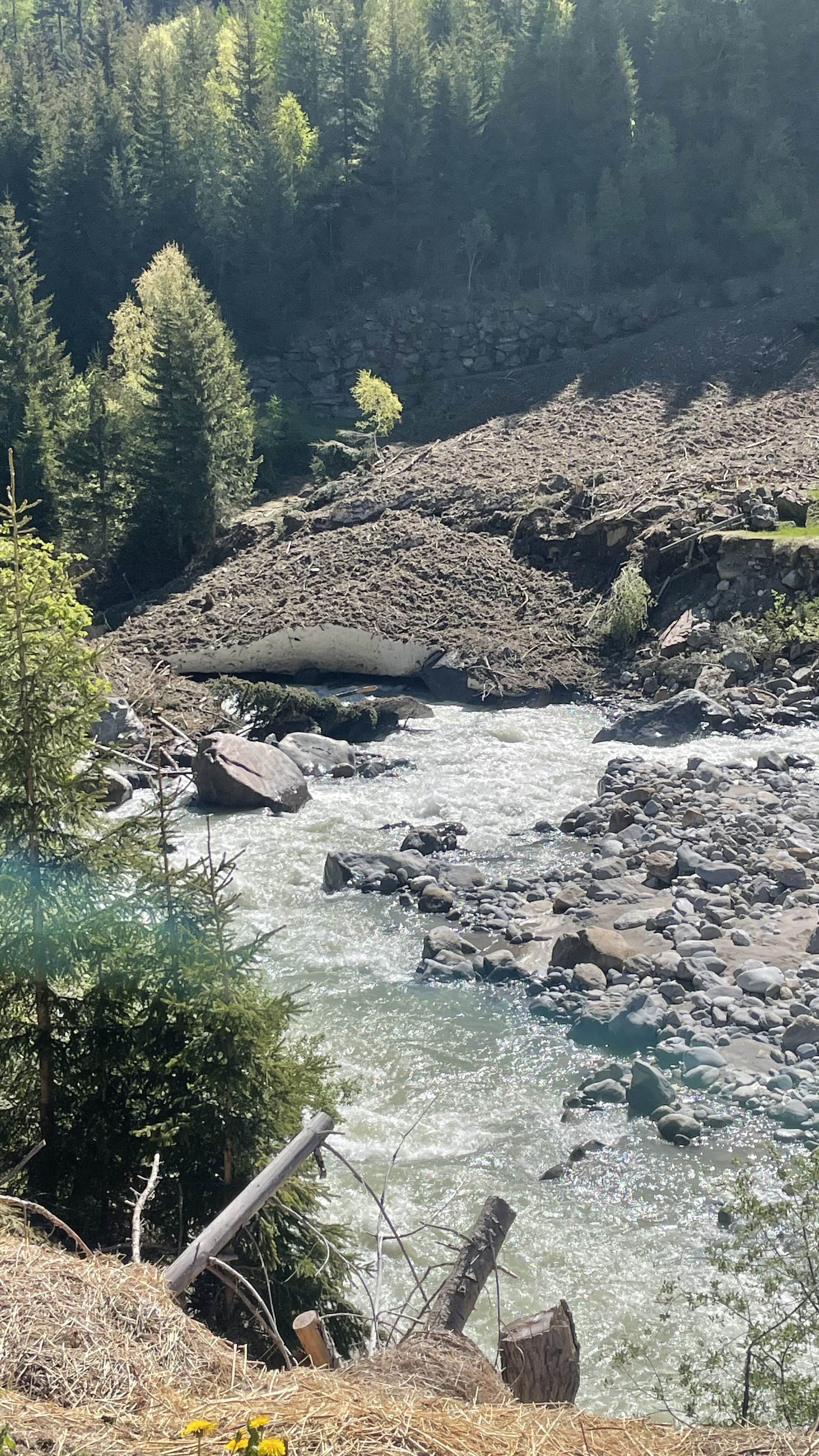
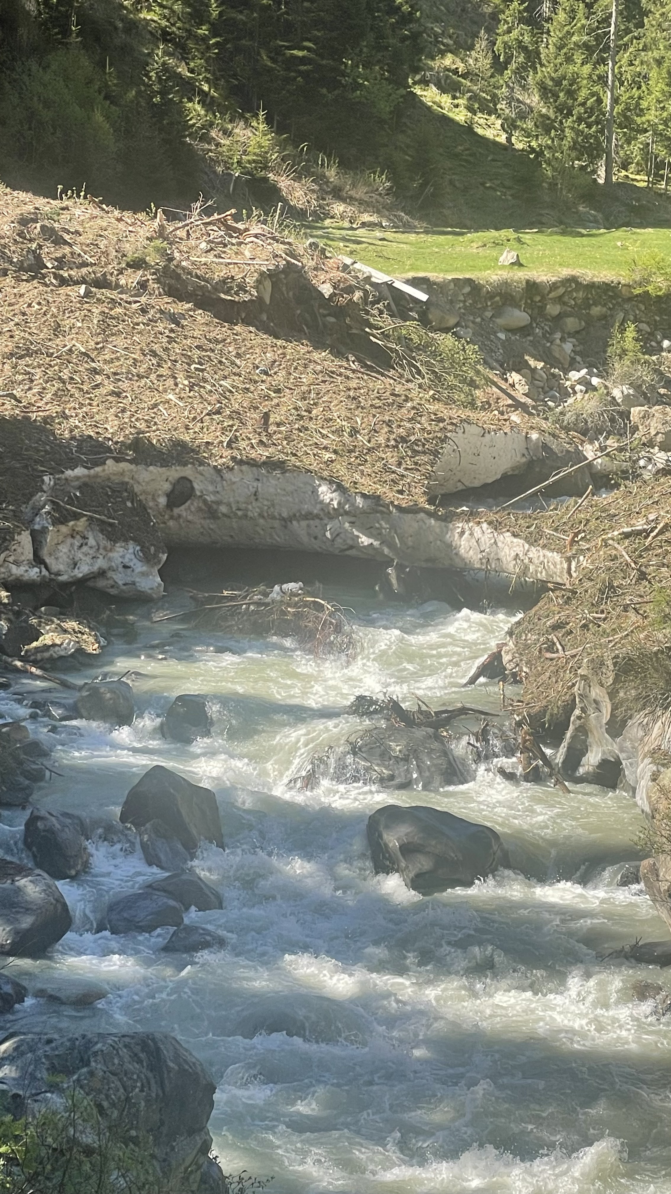 • #7318 • 23.05.2026 15:35
Reuss (CH), Göschenen - Wassen
Bewertung NW-MW-HW
Messstation wurde neu positioniert. Kalibrierungswerte sind noch provisorisch und mit Vorsicht zu geniessen. Bitte hier melden, wenn Befahurngsberichte vorliegen.
• #7316 • 21.05.2026 21:26Vésubie (FR), Saint-Jean la Rivière - le Cros d'Utelle
Bewertung WW-Grad
Classe III
• #7315 • 21.05.2026 04:35Seite: 1 2 3 4 5 . . . 8 9 10 11 12 13 14 . . . 285 286 287
nach oben