Rivermap
HomeThe Map
List View
Befahrbarkeit
English Summary
Karte Einbetten
Systemstatus
Kontakt und Team
Datenlieferanten
Contributor Agreement
The RCSD
Public licenses
Rivermap Japan
![]() "Rivermap Supporter" Group
"Rivermap Supporter" Group
Flusshinweise
Als Grundlage dient wenn immer möglich ein Flussführer.
Seite: 1 2 3 4 5 6 7 8 9 . . . 278 279 280
Resultate 101 - 120 von 5596
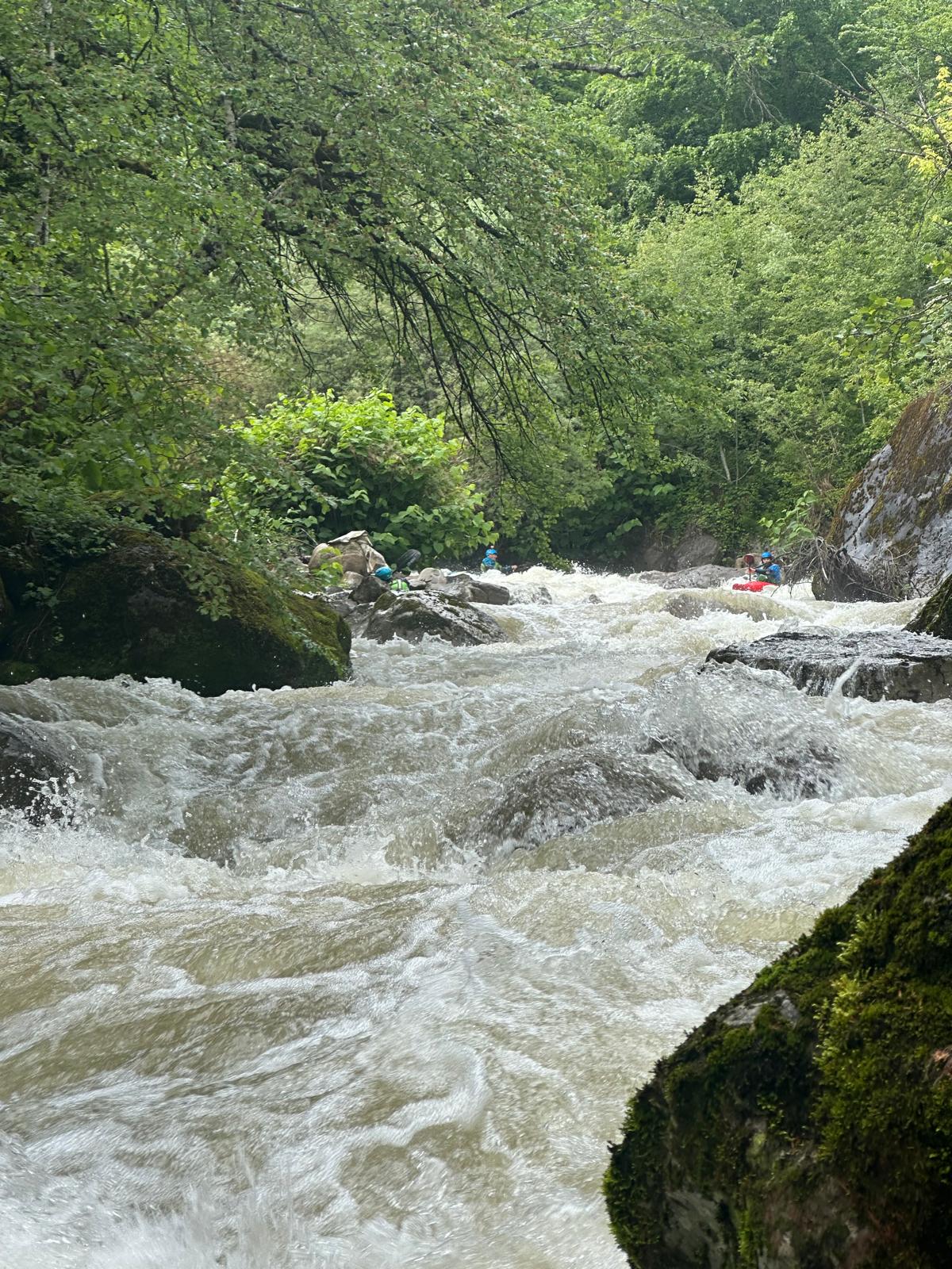
Saine (FR), Montliboz - Syam
Befahrbarkeit
Paddled this section and the upper Saine gorge today (17 May) at 11,5 m3 (Syam). Low water, but still a fine run. Upper section all clean, lower gorge has some trees in Mikado rapid and a tree in the 4m drop. Both could be runnable but the lines are sketchy at low levels.

 • #7307 • 17.05.2026 19:47
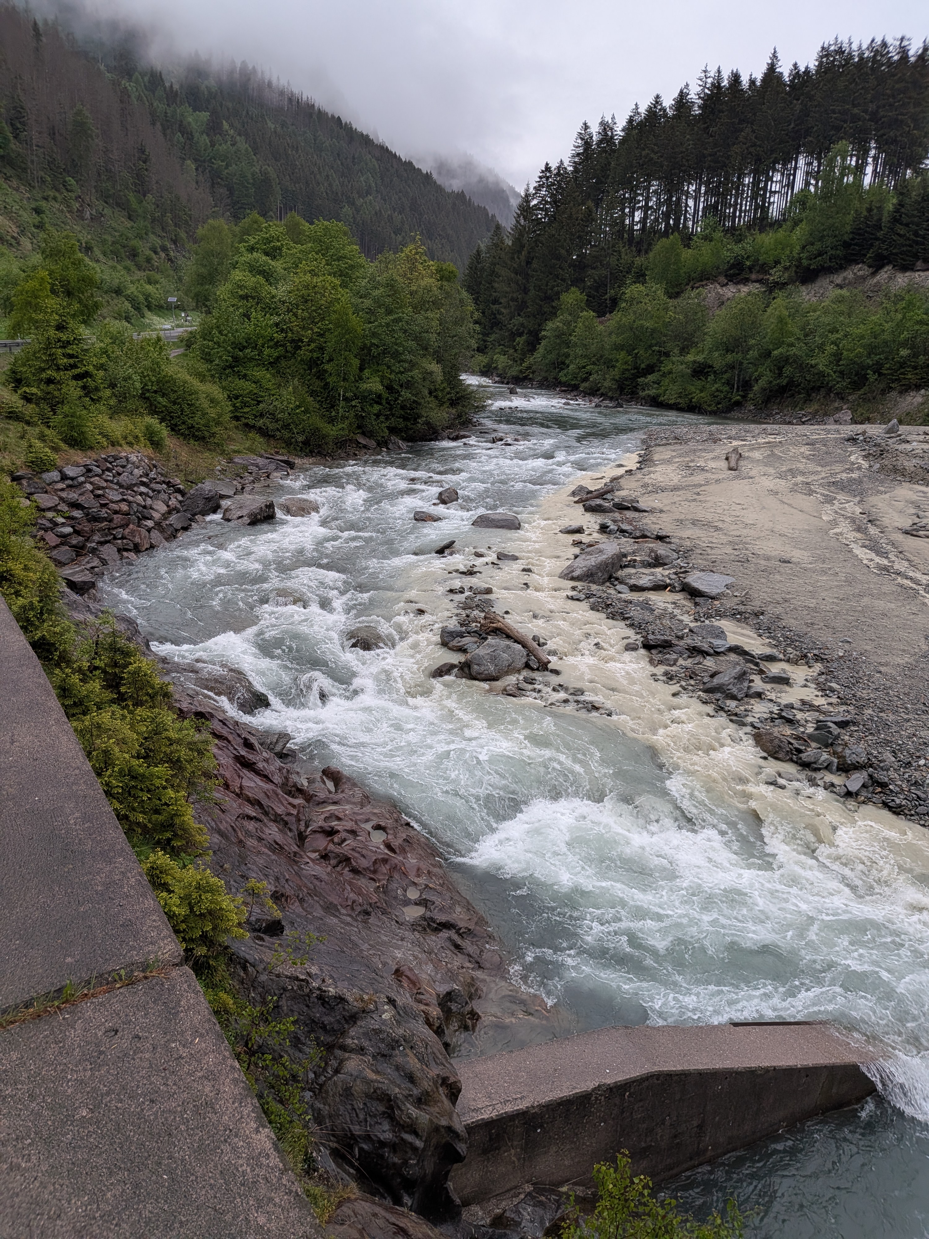
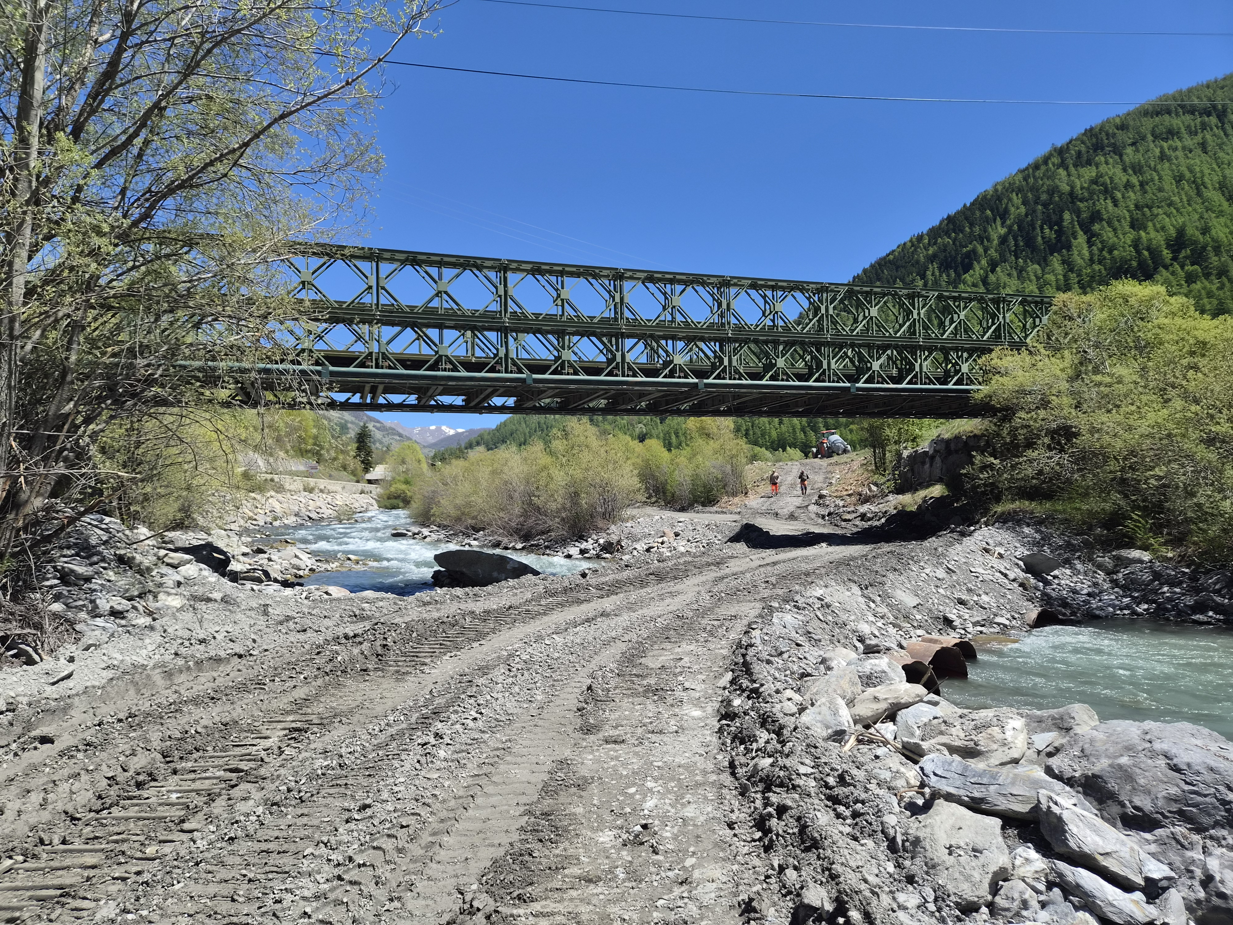
Glenner (CH), Peiden - Ilanz
Befahrbarkeit
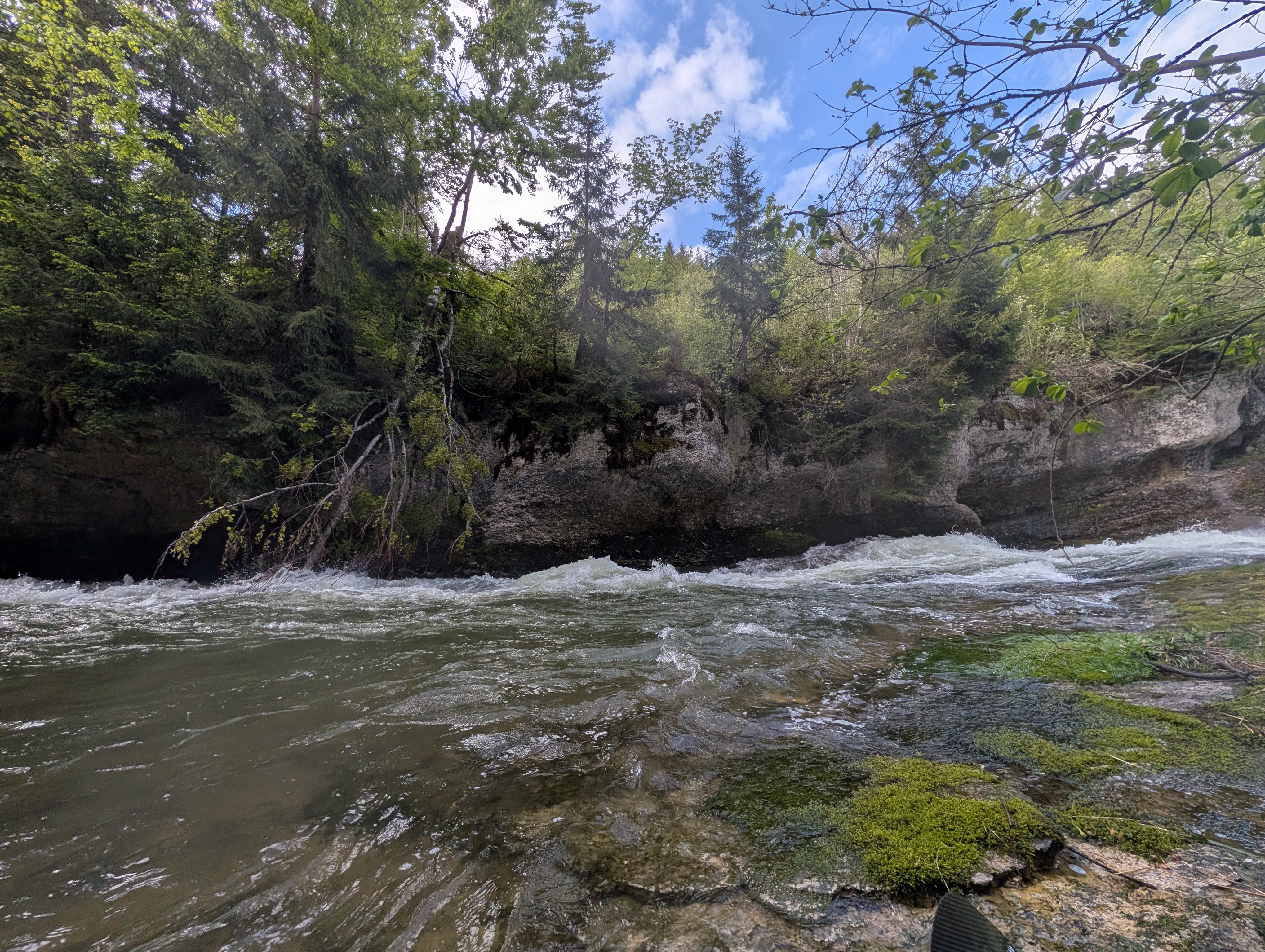
Glenner gestern und heute bei ca. 4.5 m3 befahren - ging noch erstaunlich gut und flüssig. Einzig die Stelle ausgangs Waldschlucht war holprig, da sicher der Bach in einige kleine Arme unterteilt (Foto).

 • #7306 • 17.05.2026 19:07
Var (FR), Gorges de Daluis (Guillaumes - Daluis)
Befahrbarkeit
Fiume pulito, discesa senza grandi notizie di nota, nessun pericolo, nessun albero né ramo. Discesa del 03/05/2026.
• #7305 • 17.05.2026 14:28Dranse (FR), Centrale électrique de Bioge - 800m sous le pont de la D902
Bewertung NW-MW-HW
30m3/s is defenitly not HW. It is more likely upper MW
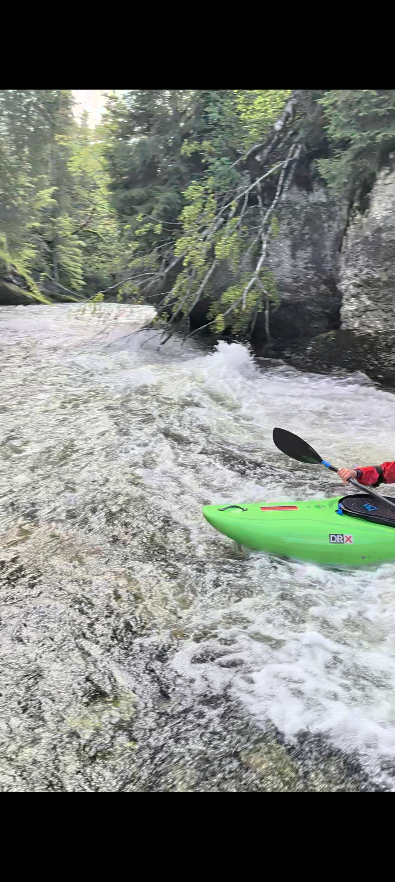
• #7304 • 17.05.2026 14:10Dranse de Morzine (FR), Après le tunnel des Tines - Baume
Wir sind am 16.26 den Abschnitt gefahren.
Schöne Fahrt, aber 2 Bäume, die man umtragen muss (der erste links, ohne aussteigen; der zweite rechts)
Schöne Fahrt, aber 2 Bäume, die man umtragen muss (der erste links, ohne aussteigen; der zweite rechts)

 • #7303 • 17.05.2026 07:38
Ara (ES), Torla - Broto
Bewertung NW-MW-HW
Mai 2026, section classique magnifique
Niveau 50cm à Broto, échelle (plus précise que celle affichée ici : https://www.saihebro.com/tiempo-real/grafica-senal-A383K17NRIO1-nivel-ara-en-broto-r)
ME/BE, ça racle un peu mais ça passe partout et ça reste technique, il faut pas bcp moins.
Niveau 50cm à Broto, échelle (plus précise que celle affichée ici : https://www.saihebro.com/tiempo-real/grafica-senal-A383K17NRIO1-nivel-ara-en-broto-r)
ME/BE, ça racle un peu mais ça passe partout et ça reste technique, il faut pas bcp moins.
• #7302 • 16.05.2026 20:57Neste d'Aure (FR), Saint-Lary - Arreau
Bewertung WW-Grad
Mai 2025, 155cm à l'échelle.
Pas de danger tout est navigable.
Attention le bas (après Arreau) est souvent retenu par un barrage (la jauge est dessus, on ne voit pas les lâchers).
Cotation à revoir, c'est plutôt II-III avec un ou deux passage III+ dans les gorges.
Pas de danger tout est navigable.
Attention le bas (après Arreau) est souvent retenu par un barrage (la jauge est dessus, on ne voit pas les lâchers).
Cotation à revoir, c'est plutôt II-III avec un ou deux passage III+ dans les gorges.
• #7301 • 16.05.2026 20:50Nive d'Esterençuby (FR), Source de la Nive - St Michel
Info
Fait ce jour avec Pau/SAM/Urtipual
150cm à l'échelle, en descente depuis 240cm 24h avant.
Bon niveau, peut se faire à plus ou un peu moins.
Embarquement au pont à 3km après Esterençuby. Avant faisable mais un arbre en travers oblige un portage.
Un arbre dans la gorge qui oblige une chicken pass plein gauche.
150cm à l'échelle, en descente depuis 240cm 24h avant.
Bon niveau, peut se faire à plus ou un peu moins.
Embarquement au pont à 3km après Esterençuby. Avant faisable mais un arbre en travers oblige un portage.
Un arbre dans la gorge qui oblige une chicken pass plein gauche.
• #7300 • 16.05.2026 20:47Doubs (FR), Gorges du Fourperet (Barrage - Usine Électrique)
Hanging tree at the end of the first slide. Easy to avoid by keeping left at the end of the rapid.
 • #7299 • 16.05.2026 20:25
Weißach (AT), Große Weißachschlucht (Weißach Talbrücke - Bozenau)
Just before the WW V rapid, we came across a very fresh landslide (47,4861212, 9,8861608). We walked on the left bank site, however if you can portage earlier on the right that might be better. We needed to do a traverse to the other side to inspect and/or portage the next rapid. Right after the big rapid, older threes blocked the whole width of the river. Take care there.

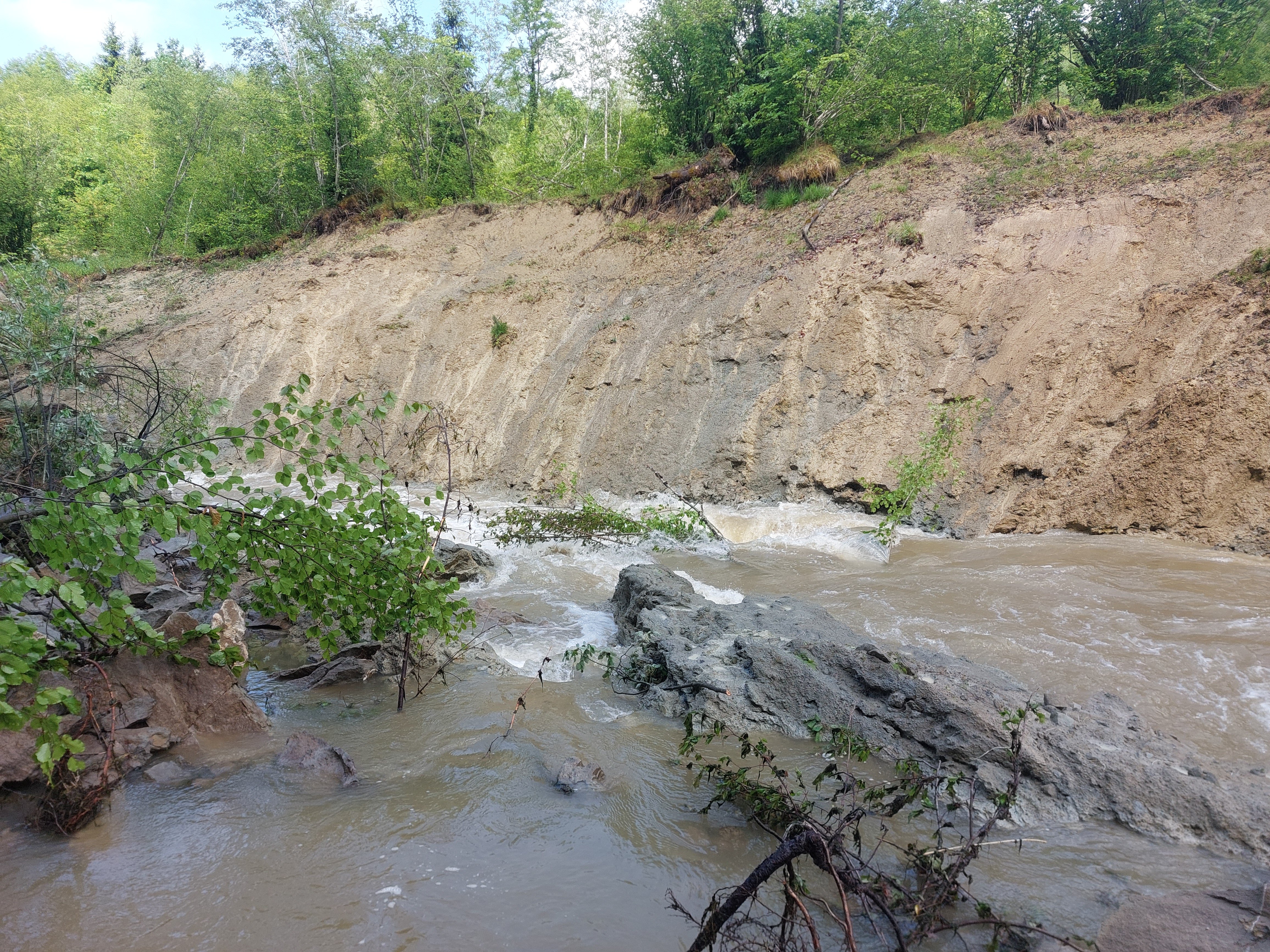 • #7298 • 16.05.2026 14:37
Isel (AT), Iselkatarakt
Befahrbarkeit
ran i today. every thing is free, except for one small Branche standing upright in one of the many small drops after the Main rapid. not too dangerous and you can paddle around it easily, but it is a small nuisance at low water.
imo 115cm is still fine for the main rapid and acceptable for the rest.
cheers,
Kilian
imo 115cm is still fine for the main rapid and acceptable for the rest.
cheers,
Kilian
 • #7297 • 16.05.2026 13:58
Menoge (FR), Saint Andre de Boëge - Pont de Fillinges
Info
We paddled the Menoge with 15m3/s. I would say this is medium water, definitely not high. Prepare and beware for trees.
 • #7296 • 15.05.2026 18:31
Areuse (CH), Mitte Schlucht - Boudry
Weiterhin Bäume in der letzten Schlucht. Bei 16 cms knapp zu unterrollen
 • #7295 • 15.05.2026 17:14
Kiene (CH), Kiental - Kien
Heute bei 110cm gefahren. Einstieg nach dem Steillstück an Brücke. Ca 300m später in einer Linkskurve nach einer Stelle, wo sich der Fluss teilt, Baum im Fluss!!! Unfahrbar!!!
Sehr spät zu sehen und wenige bis keine Kehrwässer mehr vorhanden!!!
Fahrt danach abgebrochen.
Wir haben ein Werner Shogun verloren. Falls es gefunden wird, gerne Hinweis an stephan_hohmann@web.de
Sehr spät zu sehen und wenige bis keine Kehrwässer mehr vorhanden!!!
Fahrt danach abgebrochen.
Wir haben ein Werner Shogun verloren. Falls es gefunden wird, gerne Hinweis an stephan_hohmann@web.de
• #7294 • 12.05.2026 21:15Entschlige (CH), Achseten - Frutigen
Ca. 1km unterhalb Achseten, 100m unterhalb der Bogenbrücke, Baumhindernis, zum Teil überspült und
schlecht erkennbar.
Umtragemöglichkeit orografisch rechtsufrig. AKT
schlecht erkennbar.
Umtragemöglichkeit orografisch rechtsufrig. AKT
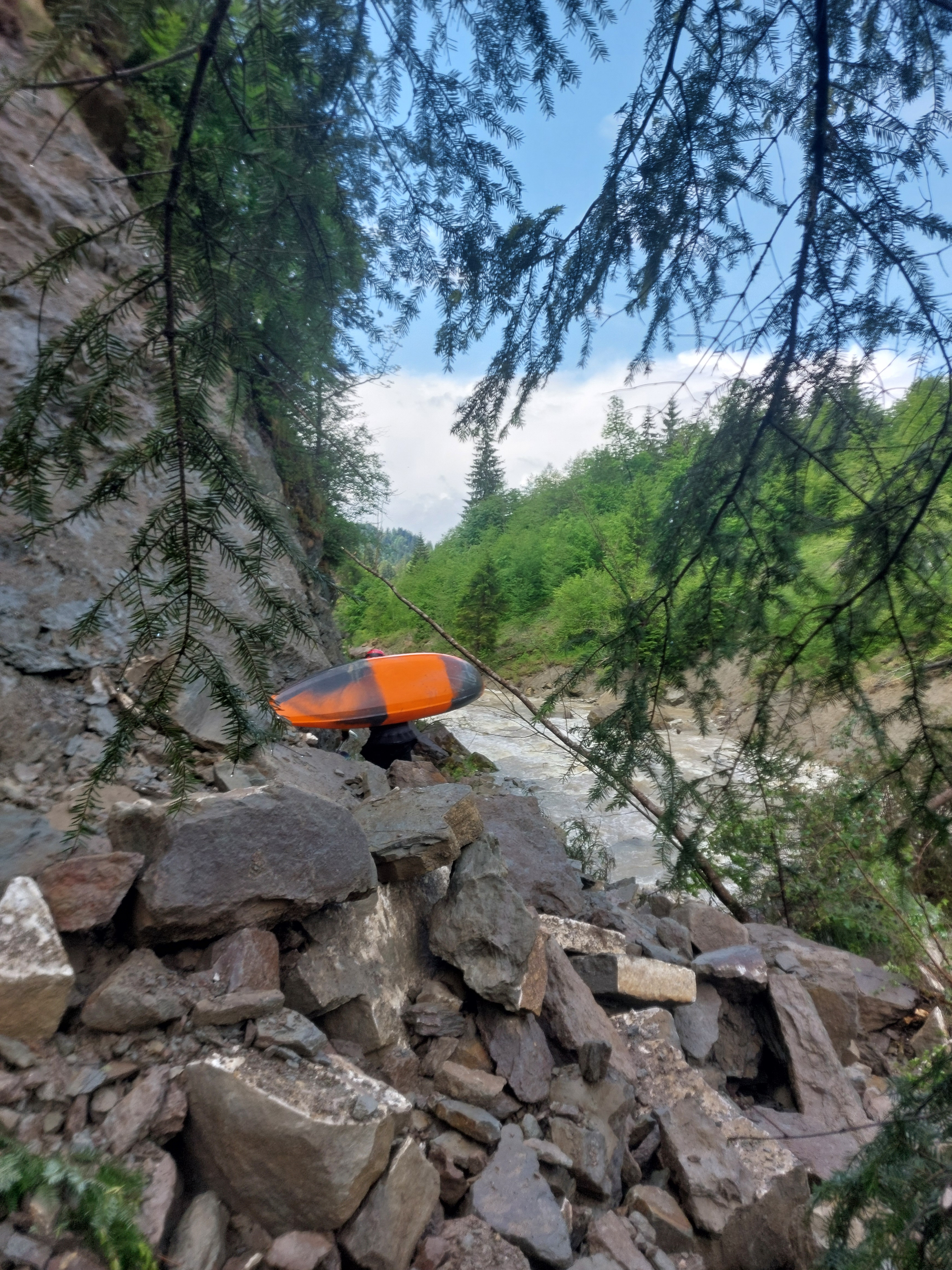
• #7293 • 12.05.2026 20:45Guil (FR), Aiguilles - Château Queyras
Short after put in, river totally blocked under the Pont Du Rochas, because of construction works
 • #7292 • 12.05.2026 13:28
Dranse (FR), Centrale électrique de Bioge - 800m sous le pont de la D902
Befahrbarkeit
ran it on 02.05.2026.
all free and good to go.
when the river turns sharp left and suddenly becomes engorged, thats your sign you arriving at the V+ syphon rapid. easy portage on the left. or chicken line on the right side, if the water level is high enough.
right after the syphon rapid, 90% of the river goes into another syphon on the right side. the water is quite calm though, so just take the left channel and you're fine.
overall, quality whitewater!!!
Cheers,
Kilian
• #7291 • 11.05.2026 22:20Dranse (FR), 800m sous le pont de la D902 - Base de raft
Befahrbarkeit
ran it on 02.05.2026
all free and good to go.
however, there is one huge rock wall on the river left that is dangerously undercut. luckily the river splits right before it and you can easily take the right channel. its also during a flat section. but if you go with beginners, be on the lookout early and guide to the river right channel.
wonderful section btw. more like class 3 imho, but quality whitewater.
• #7290 • 11.05.2026 22:17Saane / Sarine (CH), Camping Le Berceau - Lac du Vernex
Befahrbarkeit
tree from #7235 was still there on the 03.05.2026.
we had 38 cm and still could go over it with a bit of speed. i recon it might even go as far down as 35 cm.
also, its probably quite safe to swim, as it has no branches and the water is deep and there are no more rapids after it. so risk is probably minimal.
after further review of my GoPro footage, i believe the Must-run can be skipped by a brave seal launch on the left. also you can set some safety from the same point. however, if you swim, you gonna do the whole short gorge including the large churn hole/colk.
cheers,
Kilian
• #7289 • 11.05.2026 22:13Lütschine (CH), Zweilütschinen - Bönigen
Befahrbarkeit
ran it on 1 of May. alle clear.
cheers,
Kilian
cheers,
Kilian
• #7288 • 11.05.2026 22:06Seite: 1 2 3 4 5 6 7 8 9 . . . 278 279 280
nach oben