Rivermap
HomeThe Map
List View
Befahrbarkeit
English Summary
Karte Einbetten
Systemstatus
Kontakt und Team
Datenlieferanten
Contributor Agreement
The RCSD
Public licenses
Rivermap Japan
![]() "Rivermap Supporter" Group
"Rivermap Supporter" Group
Flusshinweise
Als Grundlage dient wenn immer möglich ein Flussführer.
Seite: 1 2 3 4 5 . . . 200 201 202 203 204 205 206 . . . 271 272 273
Resultate 4041 - 4060 von 5445
Weisse Lütschine (CH), Lauterbrunnen - Zweilütschinen
Divers
Just before the dam, there is a red and white "no-entry sign" on the right side of the river. You can also see it from the road. After this sign, you have time to find a eddy on the right.
 • #1975 • 12.05.2016 19:51
Areuse (CH), Mitte Schlucht - Boudry
Befahrbarkeit
We ran this section with approximately 13m3/s on the 4th of May 2016. In the middle of the section, there was a class V drop with a siphon in the middle which we had to carry on the left.
Otherwise everything went fine. There was a tree at the entrance of the gorge but it was under water with this level. There are some trees at the end of the gorge too, but the water is flat.
Be careful, some parts of the gorge cannot be seen from outside and it is not possible to carry the entrance rapid of the gorge where the tree is (the walls are completely vertical). Once you are in the gorge, you have to finish running it.
• #1974 • 12.05.2016 19:26Thur (CH), Obere (Mühlau - Schwarzenbach)
Befahrbarkeit
Die Prallwand bzw die Unterspülung Loch unter der Schwarzenbachbrücke hat sich verändert. Die Stufe oberhalb des "Loch" ist zT zusammengebrochen. Ein Teil des Unterspülungsdach ist abgebrochen. Dies ergibt nun je nach Wasserstand eine gut fahrbare Zunge über das ganze Loch. Ein weiterer Abschnitt des Unterspülungsdachs weist Risse auf und wird mit der Zeit auch abbrechen.
Die 2. alte Stufe unterhalb der Strassenbrücke ist zT aufgebrochen was bei 20m3 eine gute Spielstelle aufweist. Achtung. Inmitten dieser Stelle kommen nun alte Eisen und Betonreste zum Vorschein welche sehr schlecht zu erkennen sind.
Die 2. alte Stufe unterhalb der Strassenbrücke ist zT aufgebrochen was bei 20m3 eine gute Spielstelle aufweist. Achtung. Inmitten dieser Stelle kommen nun alte Eisen und Betonreste zum Vorschein welche sehr schlecht zu erkennen sind.

 • #1970 • 11.05.2016 20:58
Thur (CH), Obere (Mühlau - Schwarzenbach)
Gefahr aufgehoben
Baum nicht mehr vorhanden
• #1969 • 11.05.2016 19:59Zinkenbach (AT), Klamm (Zinkenbachfall - Forsthaus)
Divers
Parken sollte man beim Park (Arboretum) und dann die Boote schultern. Bei einem Abzweig nach der Engstelle der Forststraße links hochgehen und flussab rechts bleiben. Entweder man fährt den Fall (Tiefe beachten!) oder man seilt nach dem Fall bei geeigneter Stelle die Boote ab (etwas tricky die Stelle zu finden).
• #1968 • 11.05.2016 12:40Fermersbach (AT),
Divers
Von Brandau über die Vordersbachau bis zu einer geeigneten Einstiegstelle, z.B. der Hauptklause. (ca. 1,5 Std)
• #1967 • 11.05.2016 12:38Dürrach (AT),
Divers
Ab dem Fahrverbot und Parkplatz in Fall (N47.569218, E11.534015) trägt man die Boote ca. 4km zum Einstieg. Alternativ kann man sich die ersten 2 KM sparen indem man auf dem Sylvensteinsee zur Mündung der Dürrach paddelt und steil zur Brücke hochträgt.
Der Einstieg der Dürrach befindet sich flussrechts bei der Brücke. Die Boote sollten über das Geröll abgeseilt werden.
Der Einstieg der Dürrach befindet sich flussrechts bei der Brücke. Die Boote sollten über das Geröll abgeseilt werden.
• #1966 • 11.05.2016 12:08Ostrach (DE), Aueleklamm (E-Werk - Guferbrücke)
Divers
Der Einstieg zur Befahrung befindet sich bei N47.453297, E10.435401 3,5km vom Autofahrverbot entfernt. Entweder man trägt das Boot ab dem Verbot die Giebelstraße zum Einstieg oder man frägt den Busfahrer ob die Boote mitgenommen werden können.
Der Busparkplatz befindet sich hier: N47.474098, E10.417192.
Busfahrplan findet man hier: http://www.wechs.net/busverkehr/
In der Regel hat der Bus eine Vorrichtung hinten um Kajaks zu transportieren. Man sollte sich beim Fahrer erkundigen.
Der Busparkplatz befindet sich hier: N47.474098, E10.417192.
Busfahrplan findet man hier: http://www.wechs.net/busverkehr/
In der Regel hat der Bus eine Vorrichtung hinten um Kajaks zu transportieren. Man sollte sich beim Fahrer erkundigen.
• #1965 • 11.05.2016 11:57Moesa (CH), Sorte - Cama
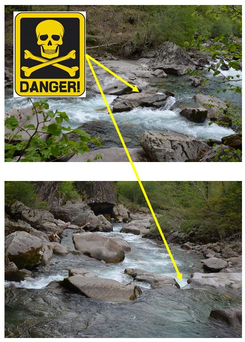
Tödliche Gefahr zwischen Sorte und Norantola - kurz vor dem Schlitz bei wenig Wasser - Verklemmgefahr! Tödlicher Unfall von gestern, Fr. 6.05.2016.
----------------
Ein Kommentar zu diesem Hinweis, erhalten per E-Mail:
"Vielleicht ist es hilfreich wenn ihr wisst, dass der Unfall sich bei ca 15 Kubik (Lumino) ereignet hat. Die Steinplatte links von dem Verklemmunfall ist dann gerade überspühlt. Ich denke es sind ca 5-8cm der Steinplatte bedeckt. Die Steinplatte fällt leicht nach rechts in die Verklemmungsstelle ab.
Unbedingt die linke Linie bei dem Wasserstand wählen."
 • #1964 • 10.05.2016 14:48
Reuss (CH), Amsteg - Autobahnrastplatz
Die Stufe verändert sich im Moment sehr stark. Anscheinend haben sich ein paar Steine seit den letzten Fotos hinter die Stufe bewegt. Bei 40m3 ist die Stufe nicht befahrbar, evt. knapp links.
Fotos dankend erhalten von Wasserland.
Fotos dankend erhalten von Wasserland.


 • #1961 • 09.05.2016 13:32
Urnäsch (CH), Oberste
Befahrbarkeit
Der folgende Abschnitt der Urnäsch wurde bei einem Wasserstand von 2m3 mit einer Canyoningausrüstung begangen und angesehen:
Strecke: 1. Stufe nach der Autobrücke Rossfall bis Kraftwerk Fischegg.
Die 2. Stufe ist nicht befahrbar wegen eines Abbruches der Nagelfluhwand.
Alle weiteren Stufen sind zT mit Holz gefüllt und daher nicht befahrbar.
Wer die Strecke trotzdem befahren möchte dem empfehle ich einen maximalen Wasserstand von 4-6m3. Es ist aber mehr ein Fahren, Tragen und Schleppen.
• #1958 • 06.05.2016 11:57Ribo (CH), Vergeletto-Schlucht
Ribo (CH), Vergeletto - 300m vor Brücke Strasse Onsemone-Spruga
Mattervispa (CH), Breitmatten - Mattsand
Matte: Zermatt nach Täsch:
Eine Lawine versperrt die Durchfahrt nach der "Schlangengrube" Schlucht(IV-V)kurz vor Täsch. Anhalten rechts im Kehrwasser ohne Probleme bei NW. Die Schlucht befindet sich ca 300m nach Meiggern und ist von aussen nicht einsehbar. Die Schlucht sollte nur bei einem minimalen Wasserstand befahren werden. Zwischen Zermatt und Täsch hat es im Moment noch etwas Holz im Fluss durch die Lawinen im Winter. Aus Sicherheitsgründen habe ich die Schlucht im Moment nicht befahren.
Lawine Position: 46° 2'55.29"N/ 7°46'8.02"E
Die Strecke Zermatt nach Täsch ist im Moment sonst befahrbar. Ein minimaler Pegel ist die 1. Steinreihe bei der Brücke zur Bar "Harries" in Zermatt. Mit der zusätzlichen Wasserzuleitung des Findelbachwerks Ausgang Zermatt (ca 2m3 je nach Tageszeit)ist die Matte knapp befahrbar.
 • #1952 • 01.05.2016 12:50
Rovana di Campo (CH), Niva - Collinasca
Verzasca (CH), Untere (Aquino - Staustufe)
Info
Pretty good guide with pictures:
http://www.awetstate.com/VerzascaL.html
http://www.awetstate.com/VerzascaL.html
• #1949 • 01.05.2016 11:15Lutzbach (AT), Oberer
Ein Baum leigt quer über dem Bach. Er kan beidseitig gut umtragen werden und ist gut vorher zu erkennen.
• #1947 • 30.04.2016 21:15Loire (FR), Rieutord - La Palisse
Befahrbarkeit
Nice run on the 10/04/2016. Middle-Low level:
5.75m3/s in Vals on the Volane, 7.5m3/s in Meyras on the Ardèche.
We scouted three rapids: 2 rapids where class V (easy to carry on the right) and one is a class VI (carry on the right). One of us ran the full section without carrying.
A wonderful run in a remote area. This is a must!
5.75m3/s in Vals on the Volane, 7.5m3/s in Meyras on the Ardèche.
We scouted three rapids: 2 rapids where class V (easy to carry on the right) and one is a class VI (carry on the right). One of us ran the full section without carrying.
A wonderful run in a remote area. This is a must!
• #1946 • 30.04.2016 21:15Vedeggio (CH), Isone - Schluchtausgang
Loue (FR), La source de la Loue - Mouthier (usine électrique)
A tree in the second to last slide before the power-station (100m above). Otherwise we cleaned everything.
The powerstation is working normally now (18m3/s), 7 - 11 - 14 looks correct
The powerstation is working normally now (18m3/s), 7 - 11 - 14 looks correct
• #1941 • 25.04.2016 18:08Seite: 1 2 3 4 5 . . . 200 201 202 203 204 205 206 . . . 271 272 273
nach oben