Rivermap
HomeThe Map
List View
Befahrbarkeit
English Summary
Karte Einbetten
Systemstatus
Kontakt und Team
Datenlieferanten
Contributor Agreement
The RCSD
Public licenses
Rivermap Japan
![]() "Rivermap Supporter" Group
"Rivermap Supporter" Group
Flusshinweise
Als Grundlage dient wenn immer möglich ein Flussführer.
Seite: 1 2 3 4 5 . . . 173 174 175 176 177 178 179 . . . 271 272 273
Resultate 3501 - 3520 von 5450
Maggia (CH), Cevio - Aurigeno
Bewertung NW-MW-HW
Gepaddelt bei 70m^3 fallend. Das wäre ein guter Mittelwasserpegel. Kaum steinkontakt, wuchtig und schön. WW 2-3. (Pegel unten ca 350m^3) Das untere stück beim Camping (nächste strecke auf Rivermap) ist dann sehr wuchtig und WW 4-5
 • #2599 • 11.09.2017 08:48
Ill (AT), Ill Katarakt
Befahrbarkeit
alles frei!
• #2598 • 09.09.2017 16:07Ill (AT), St. Gallenkircher (Gant - Galgenul)
Befahrbarkeit
Alles frei!
• #2597 • 09.09.2017 16:06Lutzbach (AT), Oberer
Derzeit liegen 2 nennenswerte Bäume im oberen Lutzbach.
1. Baum in Stelle vor der Straßenbrücke: Bei nicht zu hohen Wasserständen kann dieser evtl. unterfahren werden. Der Baum ist von der Straße und vom Fluss aus gut sichtbar
2. Baum in 2. Katarakt. Der Baum ist nur vom Ufer aus zu sehen uns muss umtragen werden.
1. Baum in Stelle vor der Straßenbrücke: Bei nicht zu hohen Wasserständen kann dieser evtl. unterfahren werden. Der Baum ist von der Straße und vom Fluss aus gut sichtbar
2. Baum in 2. Katarakt. Der Baum ist nur vom Ufer aus zu sehen uns muss umtragen werden.


 • #2596 • 09.09.2017 15:55
Lutzbach (AT), Oberer
Gefahr aufgehoben
Der 2. Katarakt ist wieder entschäft.
Der Felsen der den Siphon gebildet hat ist weggespült worden :-)
(Achtung dennoch wegen Baum siehe extra Hinweis)
Der Felsen der den Siphon gebildet hat ist weggespült worden :-)
(Achtung dennoch wegen Baum siehe extra Hinweis)
 • #2595 • 09.09.2017 15:39
Lutzbach (AT), Oberer
Info
Alternativausstieg:
Wenn man nur den oberen Lutzbach fahren will und sich vorab schon sicher ist dass man den 2. Katarakt nicht fährt (deutlich schwerer), kann es sinnvoll sein am Alternativausstieg auszusteigen. Bis hierhin könnte man alternativ z.B. mehrfach fahren.
Link zum Alternativausstieg:
https://tools.retorte.ch/map/?swissgrid=2790855,1235677&zoom=18&map=hybrid
• #2594 • 09.09.2017 15:29Reuss (CH), Pfaffensprung - Meitschligen
Genauere Informationen zur Pegelsituation auf der Gotthardreuss auf Grund der Abschaltung des KW Amsteg bis 6. Oktober 2017.
Wir waren gestern Pfaffensprung bis Schluchteingang gefahren und ich habe heute noch mit dem KW Wassen telefoniert.
Die Situation ist die folgende:
• KW Amsteg ist ausser Betrieb bis 6. Oktober. Es fliesst kein Wasser durch die Druckrohre, die nach Amsteg gehen. Der Stausee Pfaffensprung ist geleert.
• Die KWs Wassen und Göschenen produzieren normal weiter Strom. Das Wasser von der Stromproduktion max. ca. 20m3 fliesst direkt unter der Strassenbrücke unterhalb Pfaffensprung in die Reuss und fliesst ins natürliche Bachbett.
• hinzukommt in der Schlucht noch das Wasser des Fellibach, das auch nicht mehr durch die Rohre fliesst.
Bitte beachtet folgendes:
• die zusätzlichen 20m3 machen die Strecke Pfaffensprung bis Schluchteingang (Munitionsdepot zu einer sehr schönen sportlichen Fahrt unter fairen Bedingungen. Dies ist jedoch für gute Fahrer. Schwimmen sollte keine Option sein.
• die 20m3 in der Schlucht ist meiner Ansicht nach nur etwas für sehr gute Fahrer. (ich zähle mich nicht dazu) s. Foto 2
• da das Wasser fast hauptsächlich direkt aus den Turbinen kommt, musst du damit rechnen, dass der Pegel plötzlich auf ca. 20m3 ansteigt oder auf das Minimum sinkt. d.h.: steige auch bei wenig Wasser nur in die Schlucht ein, wenn du bereit bist, diese bei 20m3 zu fahren!

 • #2593 • 07.09.2017 09:41
Guiers Mort (FR), St.Pierre de Chartreuse - Pont Péran
Info
The Guiers Mort station is stopped for approx. 3 months. On going works in the gauge area.
La station du Guiers Mort est arrêtée depuis lundi 4 septembre en raison des travaux réalisés sur le seuil dans le cadre de la continuité écologique.
Ceci pour une période d'environ 3 mois.
La station du Guiers Mort est arrêtée depuis lundi 4 septembre en raison des travaux réalisés sur le seuil dans le cadre de la continuité écologique.
Ceci pour une période d'environ 3 mois.
• #2591 • 05.09.2017 16:51Guiers Mort (FR), Pont de St.Bruno - Tunnel Fourvoirie
Info
The Guiers Mort station is stopped for approx. 3 months. On going works in the gauge area.
La station du Guiers Mort est arrêtée depuis lundi 4 septembre en raison des travaux réalisés sur le seuil dans le cadre de la continuité écologique.
Ceci pour une période d'environ 3 mois.
La station du Guiers Mort est arrêtée depuis lundi 4 septembre en raison des travaux réalisés sur le seuil dans le cadre de la continuité écologique.
Ceci pour une période d'environ 3 mois.
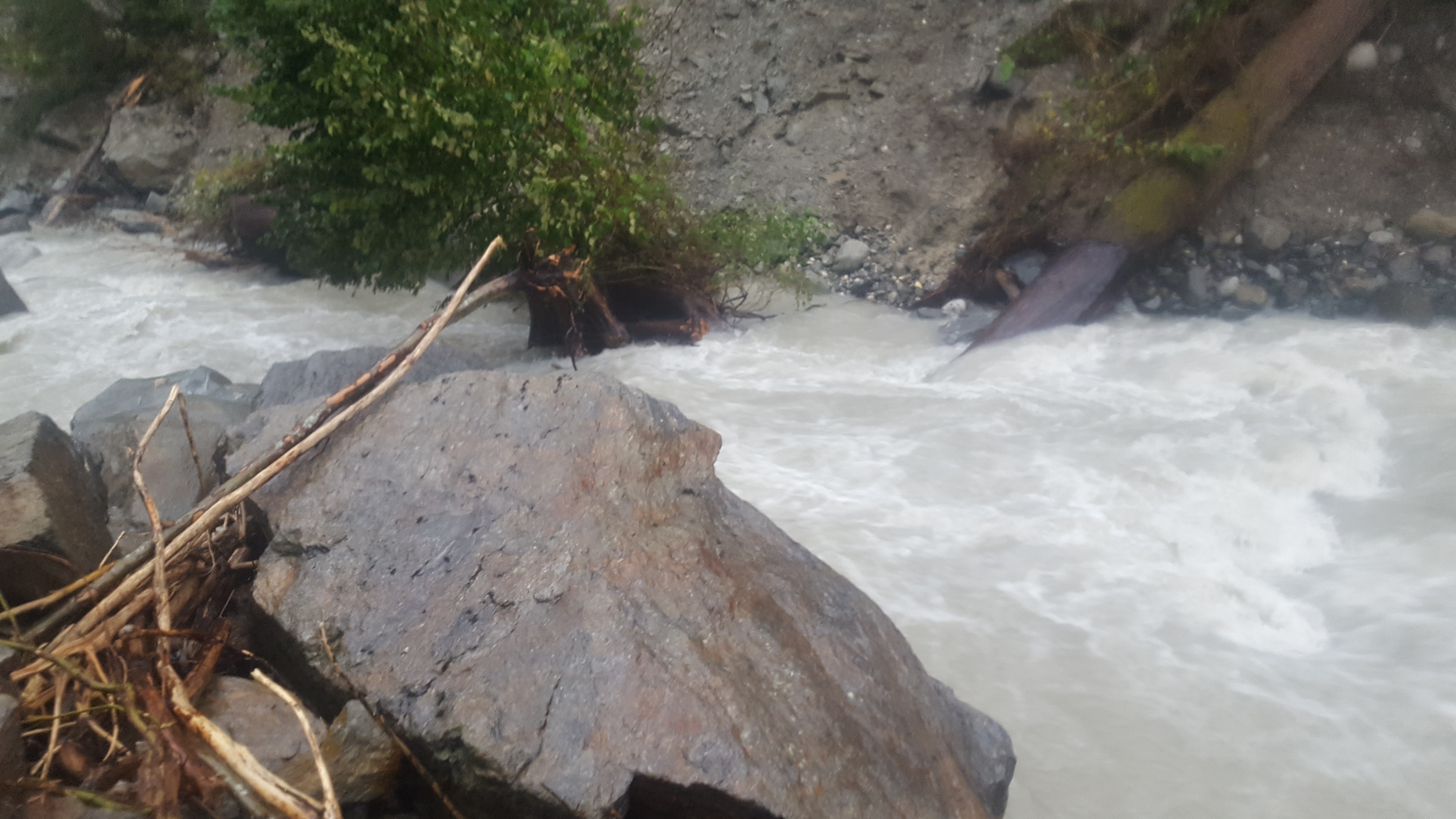
• #2590 • 05.09.2017 16:50Hinterrhein (CH), Roffla-Schlucht
Befahrbarkeit
Pics from today 9h30 at the first rapids (~500m above the normal put-in), looks like still at a runnable level.
The gorge was run at a very good level yesterday.
The gorge was run at a very good level yesterday.
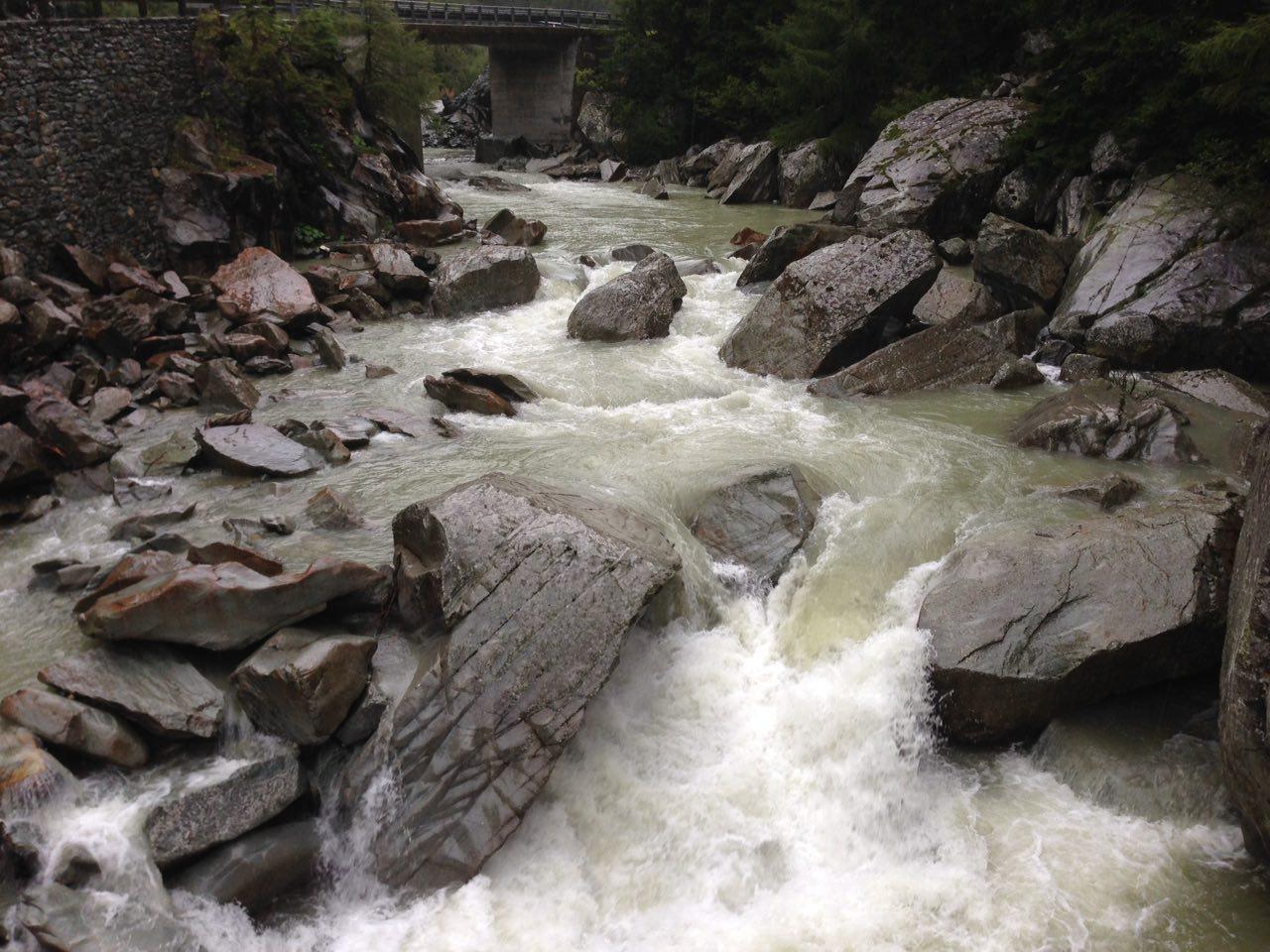
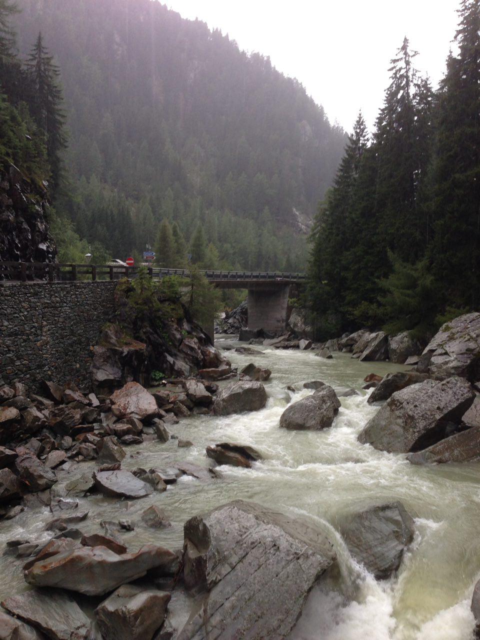
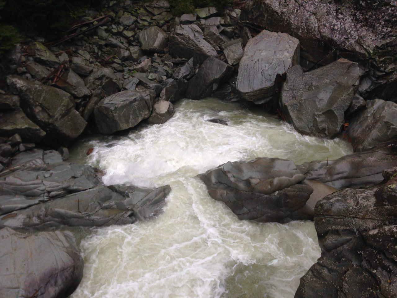 • #2589 • 02.09.2017 11:29
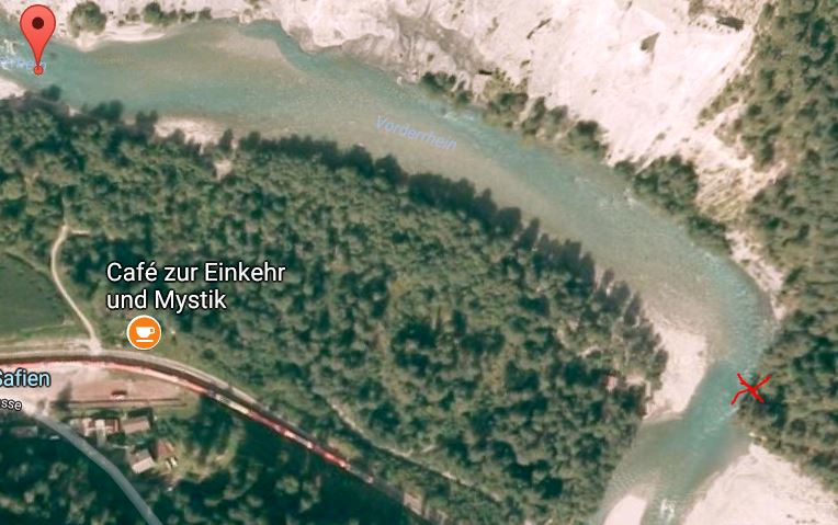
Vorderrhein (CH), Versam - Reichenau
Unmittelbar nach der ersten Rechtskurve nach dem Einstieg bei Versam Station hat es auf der linken Seite gleich unter dem Seilbahnkabel ein Baum, der längs zur Felswand liegt und die ganze Höhle verdeckt.
Für Schwimmer, die die Rechtskurve herabschwimmen (was doch immer wieder vorkommt) bedeutet der Baum ein erhebliches Risiko, da die ganze Strömung draufzieht.
Für Schwimmer, die die Rechtskurve herabschwimmen (was doch immer wieder vorkommt) bedeutet der Baum ein erhebliches Risiko, da die ganze Strömung draufzieht.
 • #2588 • 01.09.2017 19:35
Ruetz (AT), Ruetzschlucht
Gefahr aufgehoben
Looks like there was a new landslide on the right side of te river. About halfway. Be carefull. 28-8-2017. Gauge 119.
 • #2587 • 29.08.2017 12:42
Rhône / Rotten (CH), Susten - Sierre
Flash!
Verlorene Werner Player (orange Farbe) am 25. August 2017 zwischen Susten and Salgesh.
Pagaie Werner Player orange perdue sur le Rhône entre Susten et Salgesh.
Lost Werner Player orange on the 25/08/17 between Susten and Salgesh.
Pagaie Werner Player orange perdue sur le Rhône entre Susten et Salgesh.
Lost Werner Player orange on the 25/08/17 between Susten and Salgesh.
• #2585 • 26.08.2017 12:55Weisse Lütschine (CH), Lauterbrunnen - Zweilütschinen
Gefahr aufgehoben
baeume sind raus
• #2584 • 24.08.2017 13:49Weisse Lütschine (CH), Lauterbrunnen - Zweilütschinen
Achtung Baum!!!
Beim Einstieg ist vor der Brücke ein Baum quer über den Fluss, nich fahrbar!
Ca 200m nach der Brücke kommt ein 2ter, kann man bei Pegel 11.5 noch knapp drüberziehen, jedoch nur Flussrichtung links, rechts ist alles voll mit Ästen!!! Bei niedrigerem Pegel unbedingt vor dem Einstieg kurz anschauen gehen und sonst unterhalb einsteigen, fussweg rechte flussseite 200m runtertragen ohne Problem!
Stay Safe!!
Sharon Hägler

 • #2582 • 21.08.2017 10:27
Kander (CH), Reutigen - Einigen
Befahrbarkeit
13. Aug 2017.
Pegel Kander Hondrich: 40m3
Pegel Simme Heidenweideli 15m3
geschätzter Abfluss unter Stausee Wimmis ca 15m3
Total also für den Durchstich ca 50-55m3.
Befahrung mit Kanadier Solo, 13 Fuss.
Für diese Art von Bootstyp gilt für die Schlucht ganz klar WW IV.
Kanadier: NW 10-15 MW 40, HW 50m3
WW Kajak: NW 15, MW 45, HW ab 50m3
Die Strecke bis zur Mündung der Kander ist ohne Probleme zu befahren. Die alten Blockwürfe sind ohne Probleme zu befahren weisen aber verblockten Charakter auf. Dieser Streckenabschnitt ist schnell und hat Wuchtwasser Charakter. Bei einer Kenterung wird es hart ans Ufer zu kommen.
Nach dem Zusammenfluss mit der Kander wird das Wuchtwasser sehr stark. Die Aussenkurven sind unterspült, haben extrem pulsierende Polster welche drücken. Diese sind absolut zu meiden.
Einfahrt Schlucht unterhalb Autobahn Brücke:
Das alte Wehr ist kurz und heftig. Die Steine darin schlecht von oben zu sehen und dementsprechend muss hart gearbeitet werden um das Boot links oder rechts zu versetzen. Wer hier kentert, hat verloren. Kurz danach kommt eine fast rechtwinklige Linkskurve mit Prallwand. Bei 50m3 ist wirklich ganz links nah am Ufer zu fahren, sonst ist mann in der Unterspülung.
Danach folgt der Eingang in die Schlucht mit einer Rechtskurve. Die Unterspülte Wand links ist abgebrochen und liegt nun zur Hälfte im Fluss. Daher wird der Fluss nun rechts in eine Unterspülung gedrückt.
Am besten wird mittig rechts befahren, ABER, die Steine im Wasser bilden keine direkte Duchfahrt und ein Hängenbleiben (Stecken) ist gegeben. Ein seitliches Versetzen mit einem Kanadier ist an der obersten Grenze des machbaren. Als Alternative kann links auf die Steine im CRASH angelandet werden (siehe Fotos) um das Ganze zu beobachten. Danach kann ganz der Wand entlang im leichten Kehrwasser hinaufgepaddelt werden, um dann in die Verblockung einzufahren.
Wer den Durchstich links nimmt, und das sieht absolut einfach aus..., läuft Gefahr an den Steinen hängen zu bleiben und wird von der Strömung quer in die Unterspülung mit den Bäumen darin gezogen.
Auf den weiteren 300 meter ist die Kander schnell und ein paar grosse Steine bilden zwar eine leichte Verblockung, die Strömung zieht aber genau immer auf die Steine, was alles nicht einfacher macht.
Wer im Kanadier die Kanderschlucht befahren möchte muss sich bewusst sein, dass ein Fehler unverzeilich ist. Ein falsches Boot (zu lang, schlecht zu beschleunigen, etc) verzeiht nichts. Ab und zu mal WW III gefahren zu haben und vielleicht mal WW IV: vergiss es.
Ich spreche hier nicht nur für Kanadier Fahrer. Das gilt auch für WW Kajak Fahrer.
Grüsse Patrick Kanuschule Schweiz


 • #2577 • 14.08.2017 14:59
Glenner (CH), Peiden - Ilanz
Befahrbarkeit
trotz extrem viel Material, dass seit dem letzten Unwetter aufgeschichtet am Rand liegt war der Glenner im unteren Abschnitt baumfrei.
Vorsicht vor dem Siphon am Ende der Galeriestrecke. Der Flussverlauf ist hier jetzt links, so dass bis zur Kurve direkt in Richtung des Siphons gefahren wird.
Vorsicht vor dem Siphon am Ende der Galeriestrecke. Der Flussverlauf ist hier jetzt links, so dass bis zur Kurve direkt in Richtung des Siphons gefahren wird.
• #2576 • 14.08.2017 10:50Loisach (AT), Mittlere
Befahrbarkeit
Wir sind den Abschnitt am 13. 8. gefahren. Aufgrund zahlreicher Holzversperrungen mussten die Boote etwa eine 3/4 Stunde getragen, bzw. durch urwaldartiges Gebüsch gezogen werden. Wildwassertechnisch über weite Strecken uninteressant. außerdem bittet der Bayerische Kanuverband aus ökologischen Gründen (Vogelschutz) ganzjährig auf eine Befahrung dieses Abschnitts zu verzichten. Für uns war es die letzte Befahrung, da wirklich nicht lohnend.
• #2575 • 13.08.2017 23:08Lammer (AT), Lammeröfen
Befahrbarkeit
Super nice section. It is close to be a full must run. Nothing difficult at 60cm
• #2574 • 11.08.2017 14:23Untertalbach (AT), Untertalbachklamm
Befahrbarkeit
One run with 120cm on the Enns gauge(Schladming) there was 110 under the bridge at the take out on the Untertalbach.
Big water level, close to be the maximum. Everything is very continuous but super nice.
Another run with 110cm on the Enns gauge,(Schladming) there was 110 under the bridge at the take out on the Untertalbach.
Medium, high water level
This section is amazing. Everything is runnable, scoutable and carriable. You can scout everything before the put in and it is an advice if you don't know the river, especially if the water level is high. There is a path ,sometime on the left bank, sometimes on the right bank.
Be careful for sleeping, try to be hidden, the inhabitants of the valley aren't encouraging wild camping.
• #2573 • 11.08.2017 14:22Seite: 1 2 3 4 5 . . . 173 174 175 176 177 178 179 . . . 271 272 273
nach oben