Rivermap
HomeThe Map
List View


 Flusshinweise
Befahrbarkeit
English Summary
Karte Einbetten
Systemstatus
Kontakt und Team
Datenlieferanten
Contributor Agreement
The RCSD
Public licenses
Rivermap Japan
 "Rivermap Supporter" Group
Flusshinweise
Als Grundlage dient wenn immer möglich ein Flussführer.
 RSS-Feed
abonnieren und nichts verpassen.
RSS-Feed
abonnieren und nichts verpassen.
Seite: 1 2 3 4 5 . . . 172 173 174 175 176 177 178 . . . 284 285 286
Resultate 3481 - 3500 von 5720
Birs (CH), Welle Redingbrücke, Basel
Info
Peak flow at Basel is, generally and approximately,:
- 6hrs later than peak at Moutier
- 3hrs later than peak at Soyhières
- 6hrs later than peak at Moutier
- 3hrs later than peak at Soyhières
 • #2958 • 13.06.2018 08:40
Kleine Ohe (DE), B533-Run
Bewertung NW-MW-HW
LW: 5 m³/s
MW: 8 m³/s
HW: 12 m³/s
MW: 8 m³/s
HW: 12 m³/s
• #2956 • 12.06.2018 21:59Obertalbach (AT), Obertalbachklamm
 Gefahr vorübergehend
Quote:
Obertalbachgorge is for shure not as popular as its neighbor the Untertalbach. Its way more alpine and has tricky trees sometimes and hard scouts / portages sometimes. Even its hard work if you dont know the right eddys to scout the crux rapids. So take some time for the first try and dont run around blind corners ;)
Today where about 3 easy portages and one exhausting one, as there was no way to portage the tree on riverlevel. So we had to hike up the steep forrest 50 meters, 3 Meters river downstream, and the 50 meters down again.
with video of the conditions at the moment:
https://vimeo.com/274272732
Obertalbachgorge is for shure not as popular as its neighbor the Untertalbach. Its way more alpine and has tricky trees sometimes and hard scouts / portages sometimes. Even its hard work if you dont know the right eddys to scout the crux rapids. So take some time for the first try and dont run around blind corners ;)
Today where about 3 easy portages and one exhausting one, as there was no way to portage the tree on riverlevel. So we had to hike up the steep forrest 50 meters, 3 Meters river downstream, and the 50 meters down again.
with video of the conditions at the moment:
https://vimeo.com/274272732
• #2955 • 12.06.2018 21:41Rabbies (IT), Tassè - Pondasio
Info
https://www.youtube.com/watch?v=o3MaZ6tTdLU a video while the hydroplant was not working. As usual it's not running until 1of May. In that case Rabbies is already running at 28cm.
• #2954 • 12.06.2018 21:28Weißenbach (AT), Klamm (Chorinsky Klause - vor Mündung Traun)
Saane / Sarine (CH), Camping Le Berceau - Lac du Vernex
Gefahr aufgehoben
Bäume in 3 ter Schlucht sind weg.
• #2948 • 10.06.2018 12:17Inn (CH), Giarsun
Befahrbarkeit
Befahren am 02.06.2018 bei 81Kubik. Alles gut zu fahren. Von dem Loch rechts Ende Treppenhaus sollte man sich jedoch fernhalten.
• #2943 • 04.06.2018 11:32Inn (CH), Ardez
Befahrbarkeit
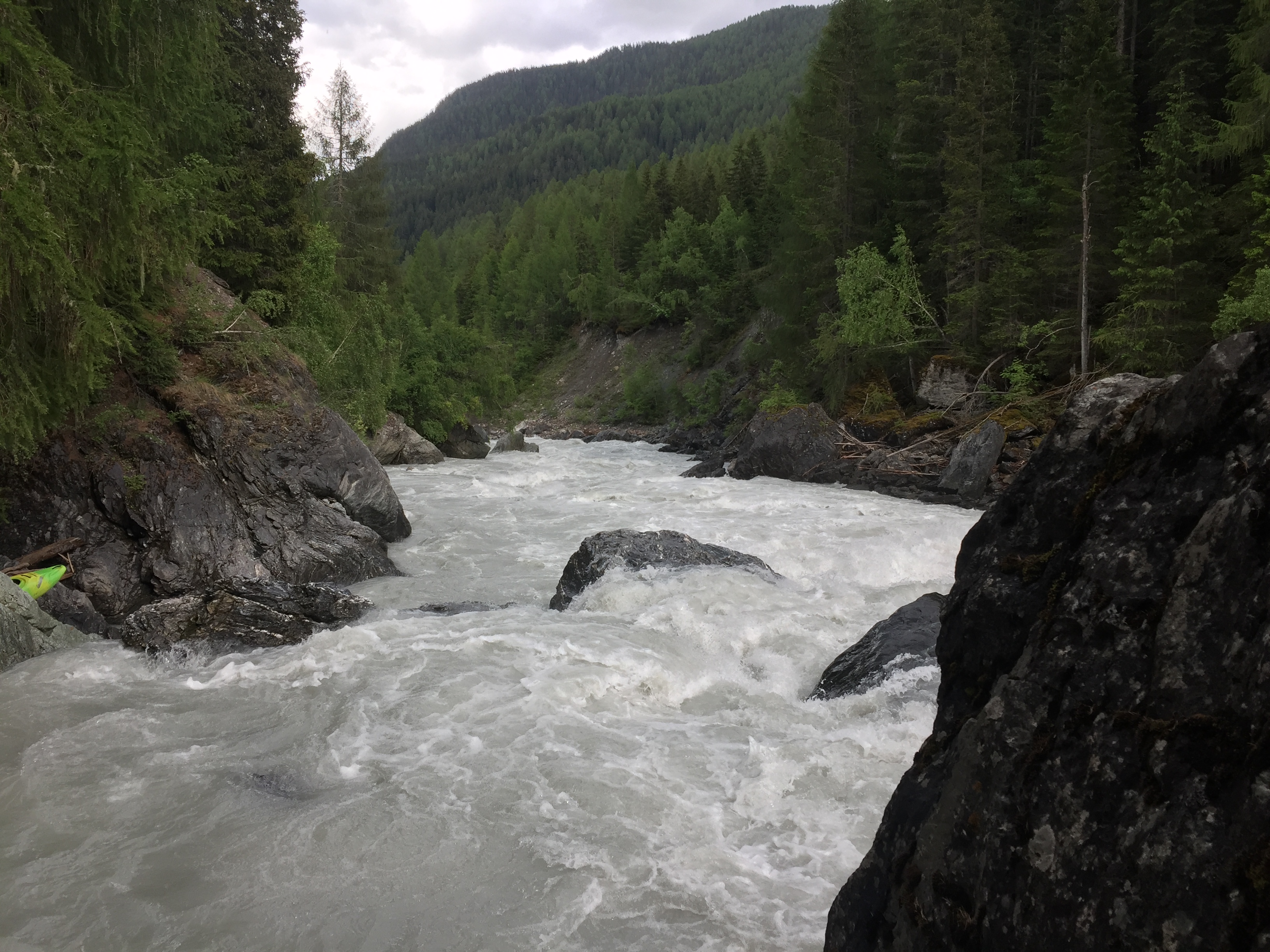
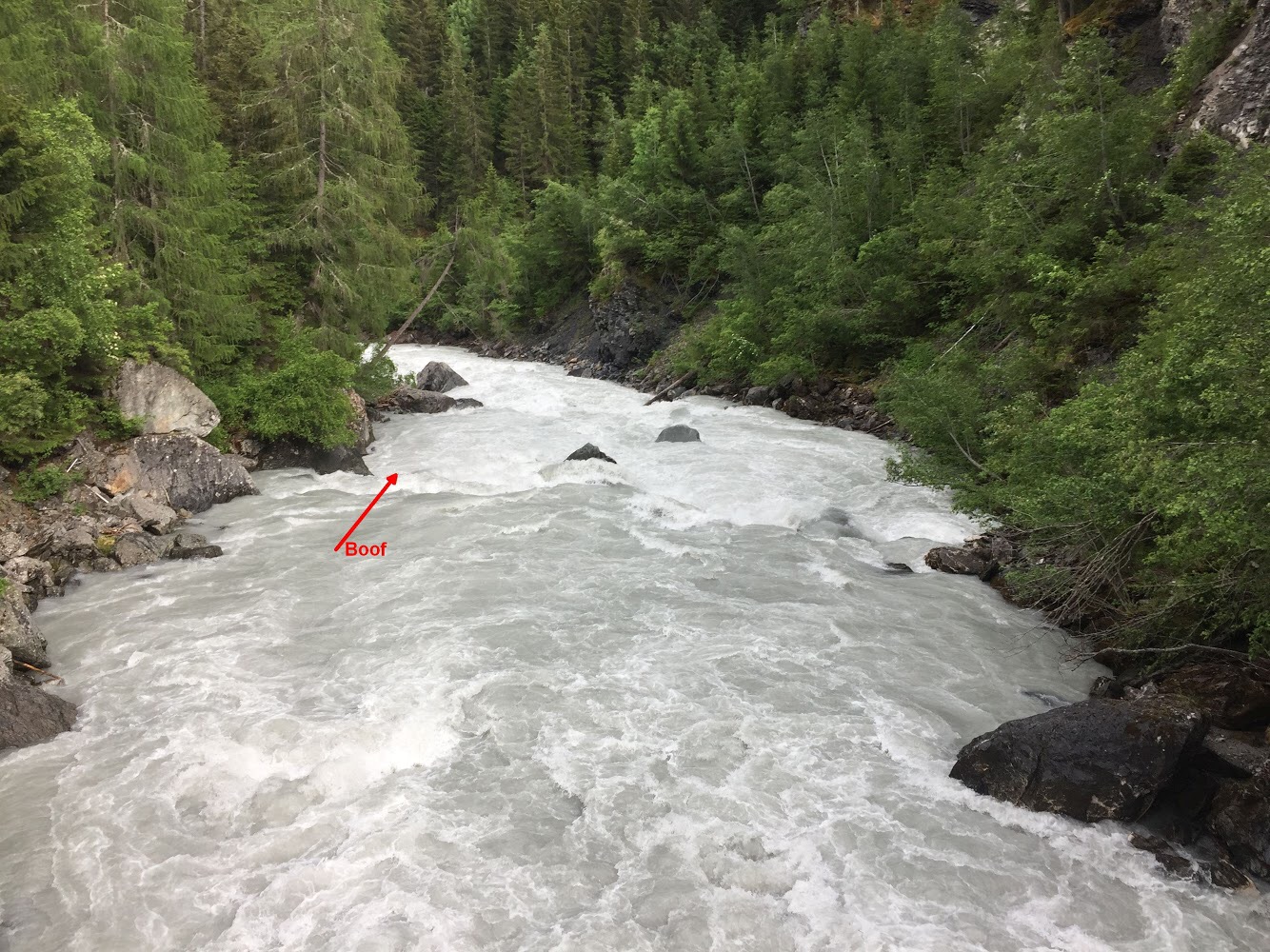
Befahren am 02.06.2018 bei 81 kubik. Noch gut zu fahren, aber gar nicht so spaßig, da viele Features überspült sind.
Himmelsgucker sind wir ganz links gefahren (Bild 2).
Himmelsgucker sind wir ganz links gefahren (Bild 2).
 • #2942 • 04.06.2018 11:27
Furkareuss (CH), Realp - Andermatt
Gefahr aufgehoben
Durchfahrten Frei und sonniges Wetter
• #2940 • 03.06.2018 19:04Medelser Rhein (CH), Parde - Baselgia
Bewertung NW-MW-HW
Pegelbewertung aus Beitrag #485 stimmt für Nicht-Norweger. Die neuere Bewertung passt nicht ansatzweise zu den restlichen Beschreibungen im Gebiet. Und falls das ein 4er mit 5er Stellen ist, ist der untere Glenner ein 2er mit 3er Stellen.
• #2939 • 03.06.2018 15:37Glenner (CH), Peiden - Ilanz
GefahrAm Ende der Schlitz-Stromstelle liegt eine umgestürzte Stahlbetonmauer im Bach. Vorsicht vor Armiereisen und scharfen Bruchkanten. Schwimmer im Schlitz werden ohne guten Wurfsackwerfer am Ufer ziemlich sicher über das Ding gezogen.
• #2938 • 02.06.2018 17:05Glenner (CH), Uors - Peiden
GefahrIm Bereich des Felssturzes (grosser neuer Block im Bach) ist der gesamte linke Hang in Bewegung. Man sieht von der Strasse aus Risse im Gelände, ein Absturz grösserer Mengen an Gestein ist absehbar. Man sollte den Abschnitt meiden und sich nicht unnötig dort aufhalten.
• #2937 • 02.06.2018 16:41Medelser Rhein (CH), Parde - Baselgia
Flash!
Werner Powerhouse carbon lost on Cristalina 31.05.2018, If found contact +41764737981
• #2936 • 01.06.2018 09:14Urnäsch (CH), Oberste
Sitter (CH), Untere Sitterschlucht (Haslen - St. Gallen)
Info
Sitter Wehr St.Gallen 21.12.2008
https://www.youtube.com/watch?v=DjtzYvo9N_0
km 5.1 gemäss SKV Flussführer 1991: ein verfallenes Wehr im Anschluss an eine verblockte Schwallstrecke gewährt nur bei niedrigem Wasserstand einen Durchschlupf durch einen niedrigen, kurzen Tunnel (bei Hochwasser unfahrbar). Rechtzeitig rechts ausbooten und allenfalls umtragen.
https://www.youtube.com/watch?v=DjtzYvo9N_0
km 5.1 gemäss SKV Flussführer 1991: ein verfallenes Wehr im Anschluss an eine verblockte Schwallstrecke gewährt nur bei niedrigem Wasserstand einen Durchschlupf durch einen niedrigen, kurzen Tunnel (bei Hochwasser unfahrbar). Rechtzeitig rechts ausbooten und allenfalls umtragen.
 • #2934 • 01.06.2018 08:48
Necker (CH), Oberster (Brücke - Schwanzbrugg)
Info
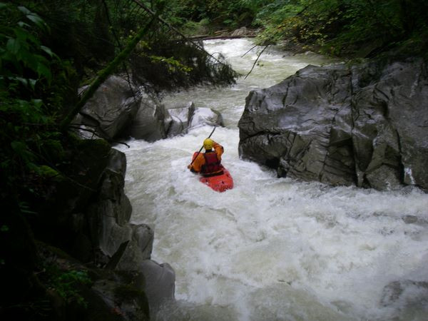
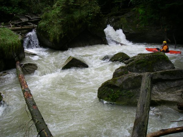
Eindrücke aus dem Jahre 2008, alle Bilder hier: https://www.twf.ch/bilder-2008-oberer-necker/
 • #2933 • 01.06.2018 08:36
Thur (CH), Welle Bürglen
Muota (CH), Muotathal, Fussballplatz - Illgau, Holzlagerplatz
Info
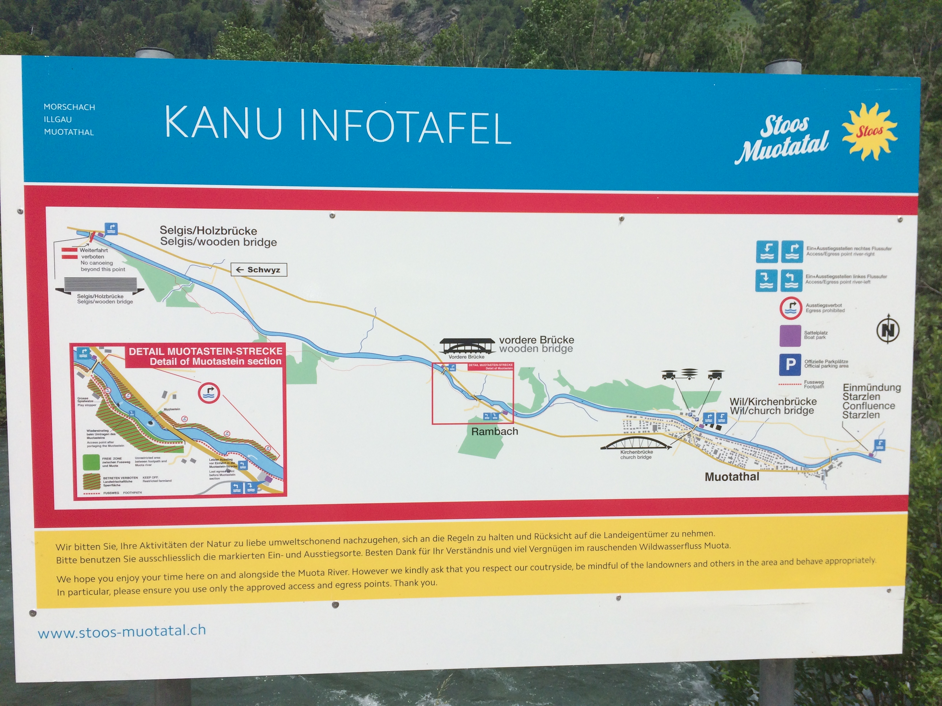
Kanu Infotafel mit Details zu Einstiegen, Muotastein und Ausstieg
Standort: 46.97766,8.73528
Standort: 46.97766,8.73528
 • #2931 • 01.06.2018 08:12
Muota (CH), Muotathal, Fussballplatz - Illgau, Holzlagerplatz
Fahrverbot
Diese Woche 30.5. - 3.6.18 Kanu WM auf der Strecke http://www.wm-muota2018.ch/home/
• #2930 • 30.05.2018 08:38Breitach (DE), Klammende - Fischen
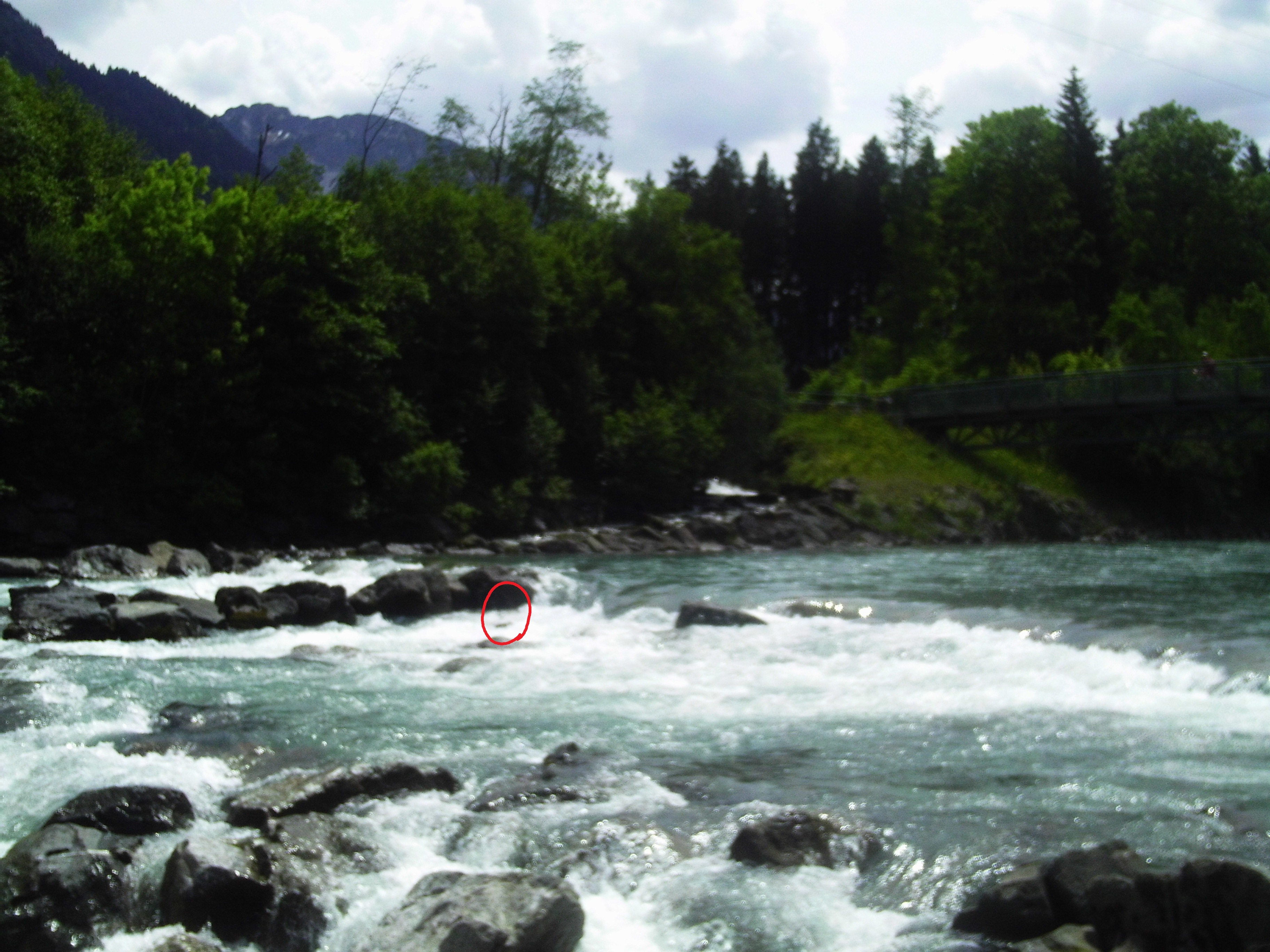
Gefahr vorübergehendBaum im Kanonenrohr
 • #2929 • 28.05.2018 18:27
Seite: 1 2 3 4 5 . . . 172 173 174 175 176 177 178 . . . 284 285 286
nach oben