Rivermap
HomeThe Map
List View


 Flusshinweise
Befahrbarkeit
English Summary
Karte Einbetten
Systemstatus
Kontakt und Team
Datenlieferanten
Contributor Agreement
The RCSD
Public licenses
Rivermap Japan
 "Rivermap Supporter" Group
Flusshinweise
Als Grundlage dient wenn immer möglich ein Flussführer.
 RSS-Feed
abonnieren und nichts verpassen.
RSS-Feed
abonnieren und nichts verpassen.
Seite: 1 2 3 4 5 . . . 115 116 117 118 119 120 121 . . . 284 285 286
Resultate 2341 - 2360 von 5720
Tresa (CH), PonteTresa - Fornasette
Befahrbarkeit
The tree is still there. It is before Ponte Cremenaga bridge. Two streams, on the left (smaller) is OK, while on the right the tree blocks the whole passage. It is dangerous. The rapid close to the tunnel has now a huge three locked in the middle over two rocks. The tree doesn't cross the river but the roots makes a dangerous syphon. Bette to have a view from the street before. The line to go is on the left and the difficulties are around III+ / IV grade. All the rest is easy with a few rapids where it could reach WW 2. Level 17 m3.
 • #4626 • 22.11.2021 09:26
Loisach (AT), Obere
Befahrbarkeit
The flow is incorrect atm.
• #4625 • 21.11.2021 22:51Dürrach (AT),
Befahrbarkeit
The flow is incorrect atm.
• #4623 • 21.11.2021 22:49Vorderrhein (CH), Madernal - Cumpadials
Info
Disentis bis und mit Madernal im Sommer 2021 nach dem Umbau der IV-Stelle bei Madernal. 30m3 in Tavanasa.
https://youtu.be/XzmlewEyGyk
https://youtu.be/XzmlewEyGyk
• #4620 • 21.11.2021 11:12Vorderrhein (CH), Disentis - Madernal
Info
Disentis bis und mit Madernal im Sommer 2021 nach dem Umbau der IV-Stelle bei Madernal. 30m3 in Tavanasa.
https://youtu.be/XzmlewEyGyk
https://youtu.be/XzmlewEyGyk
• #4619 • 21.11.2021 11:11Ticino (CH), Oberer 2 (Fontana - Airolo)
Bewertung NW-MW-HW
Quick link to the new gauge ...
https://rivermap.org/redirectRz.php?uuid=7ab70813-35c6-30d6-a8a4-e344864d2c51&units=flow
https://rivermap.org/redirectRz.php?uuid=7ab70813-35c6-30d6-a8a4-e344864d2c51&units=flow
• #4618 • 10.11.2021 14:53Sanna (AT), Unterhalb Zusammenfluss - Landeck
Maggia (CH), Aurigeno - Avegno
Bewertung NW-MW-HW
Besser den Pegel Maggia@Lodano als Direktmessung unter https://www.oasi.ti.ch/web/dati/idrologia.html nehmen. Kanuschule Schweiz Safety Team
• #4616 • 01.11.2021 11:36Melezza (CH), Golino - Losone
Bewertung NW-MW-HW
Eine bessere Direktmessung via Pegel Maggia@Locarno - Maggia@Lodano
• #4615 • 01.11.2021 11:35Moesa (CH), Sorte - Cama
Bewertung NW-MW-HW
Direkter Pegel bei Roveredo unter https://www.gr.ch/DE/institutionen/verwaltung/ekud/anu/aktuelles/umweltbeobachtung/hydrodaten/Seiten/Hydrodaten.aspx#/
Pegelwerte müssen neu angepasst werden: Idee: NW neu etwa 2-3m3
Pegelwerte müssen neu angepasst werden: Idee: NW neu etwa 2-3m3
• #4613 • 01.11.2021 11:26Moesa (CH), Cama - Roveredo
Bewertung NW-MW-HW
Direkter Pegel bei Roveredo unter https://www.gr.ch/DE/institutionen/verwaltung/ekud/anu/aktuelles/umweltbeobachtung/hydrodaten/Seiten/Hydrodaten.aspx#/
Pegelwerte müssen angepasst werden: Idee NW neu etwa 8-10m3
Kanuschule Schweiz /Safety Team
Pegelwerte müssen angepasst werden: Idee NW neu etwa 8-10m3
Kanuschule Schweiz /Safety Team
• #4612 • 01.11.2021 11:23Ticino (CH), E.W. Ritom - Rodi-Fiesso
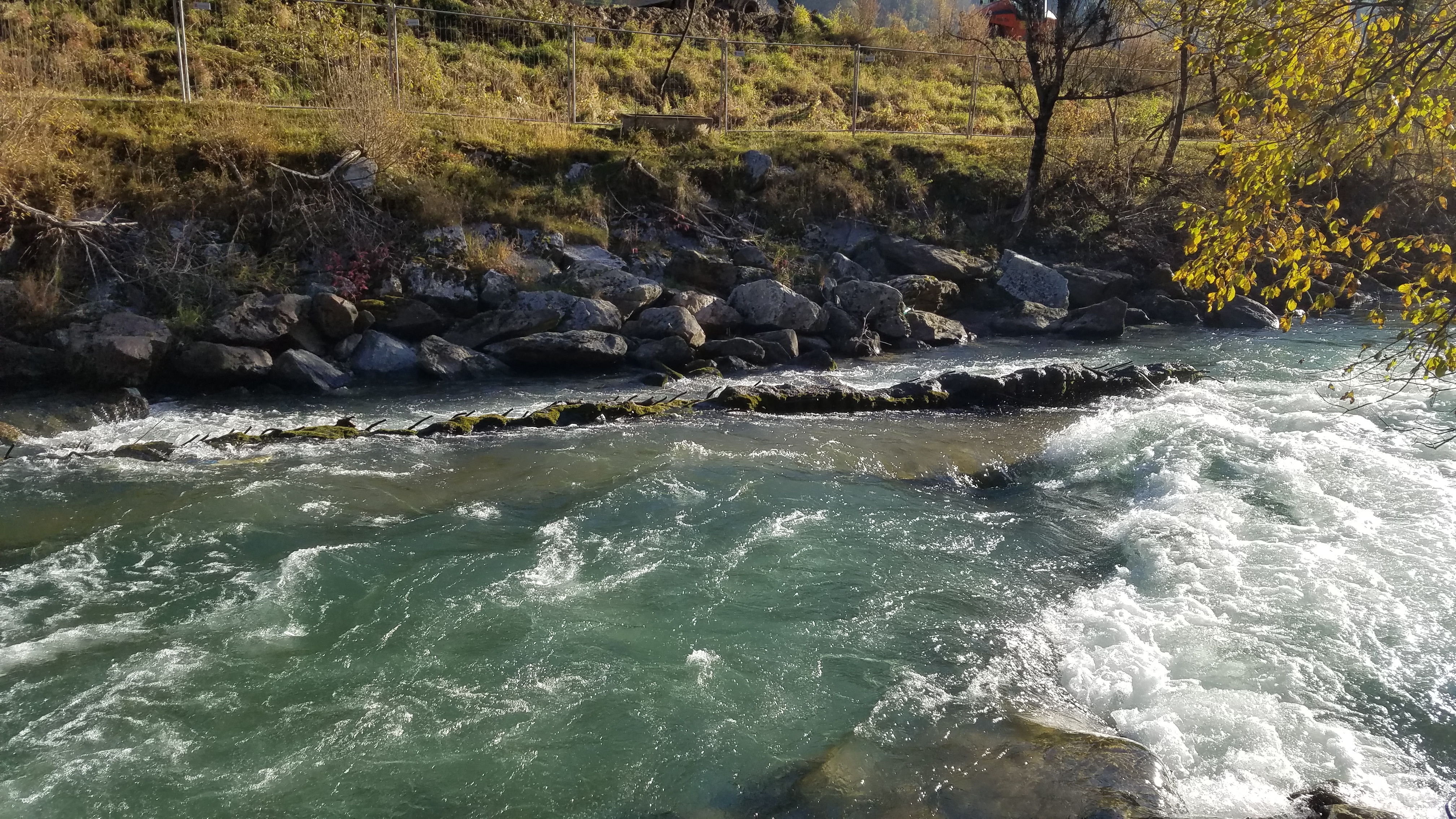
 Gefahr
Betonmauer und herausstehende Eisen links. 46°30′04.261″N 8°43′27.199″E. Kurz vor Autobahnausfahrt Brücke Quinto. Photo bei ca. 6m3. Kanuschule Schweiz /Safety Team
 • #4611 • 01.11.2021 11:18
Ticino (CH), E.W. Ritom - Rodi-Fiesso
Gefahr vorübergehendAutobahnbrücke Airolo Flugplatz 46°30′43.129″N 8°42′12.274″E. Bauarbeiten und Gerüste unter Brücke. Gefahr des Kopfanschlagen. Nach Brücke Gerüstteile im Wasser welche durch das Hochwasser abgerissen worden sind. Kanuschule Schweiz Safety Team
• #4610 • 01.11.2021 11:13Ticino (CH), E.W. Ritom - Rodi-Fiesso
Bewertung NW-MW-HW
In Piotta wird ein neues Ausgleichsbecken gebaut. Nach dem Bau wird nach Wassergesetz (Fische und Ufererodierung) ein regelmässiges Wasserablassen ohne Schwankung von bis zu 7m3 vorgegeben. Bis zu 12m3 werden aus dem Ausgleichsbecken zurück in den Ritomsee gepumpt. Eine Befahrung wird dann immer möglich sein. Pegelwerte generell Ticino@Piotta und theoretisch 7m3. Daher sollte der Pegel NW angepasst werden, da Ticino@Piotta als Referenz und nicht direkter Pegel ist. Kanuschule Schweiz /Safety Team.
• #4609 • 01.11.2021 11:08Ticino (CH), Stalvedro - E.W. Ritom
Bewertung NW-MW-HW
Befahrung schon bei 4m3 möglich ab Schlucht Stalveredo.
• #4608 • 01.11.2021 10:48Ticino (CH), Oberer 1 (Bedretto - Fontana)
Bewertung NW-MW-HW
Direkter Pegel am Fluss bei Bedretto unter https://www.oasi.ti.ch/web/dati/idrologia.html. Hier gilt etwa: NW 2-3 /MW 4-6 / HW 8. Pegel muss sicher noch hier angepasst werden. Kanuschule Schweiz
• #4607 • 01.11.2021 10:46Ticino (CH), Oberer 2 (Fontana - Airolo)
Bewertung NW-MW-HW
Direkter Pegel am Fluss bei Bedretto unter https://www.oasi.ti.ch/web/dati/idrologia.html. Hier gilt etwa: NW 2-3 /MW 4-6 / HW 8. Pegel muss sicher noch hier angepasst werden. Kanuschule Schweiz /Safety Team
• #4606 • 01.11.2021 10:45Weisse Lütschine (CH), Lauterbrunnen - Zweilütschinen
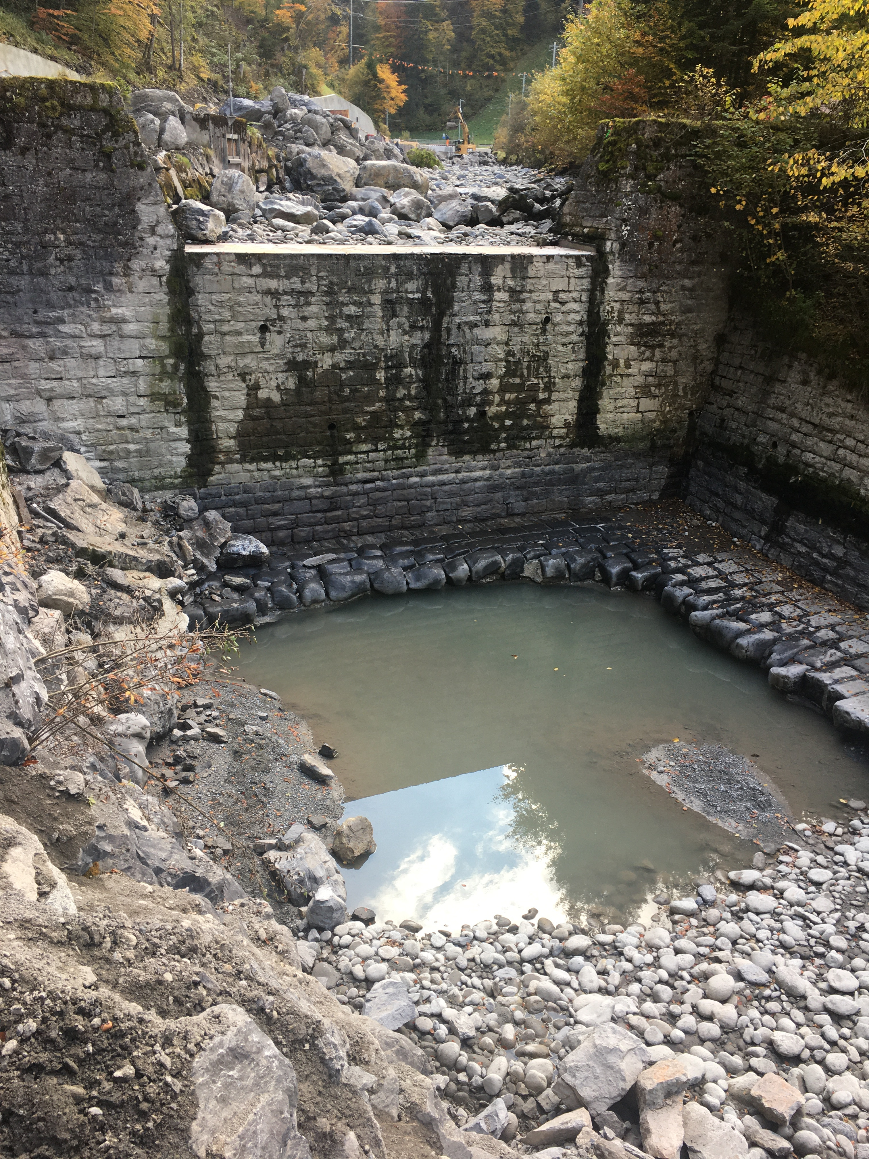
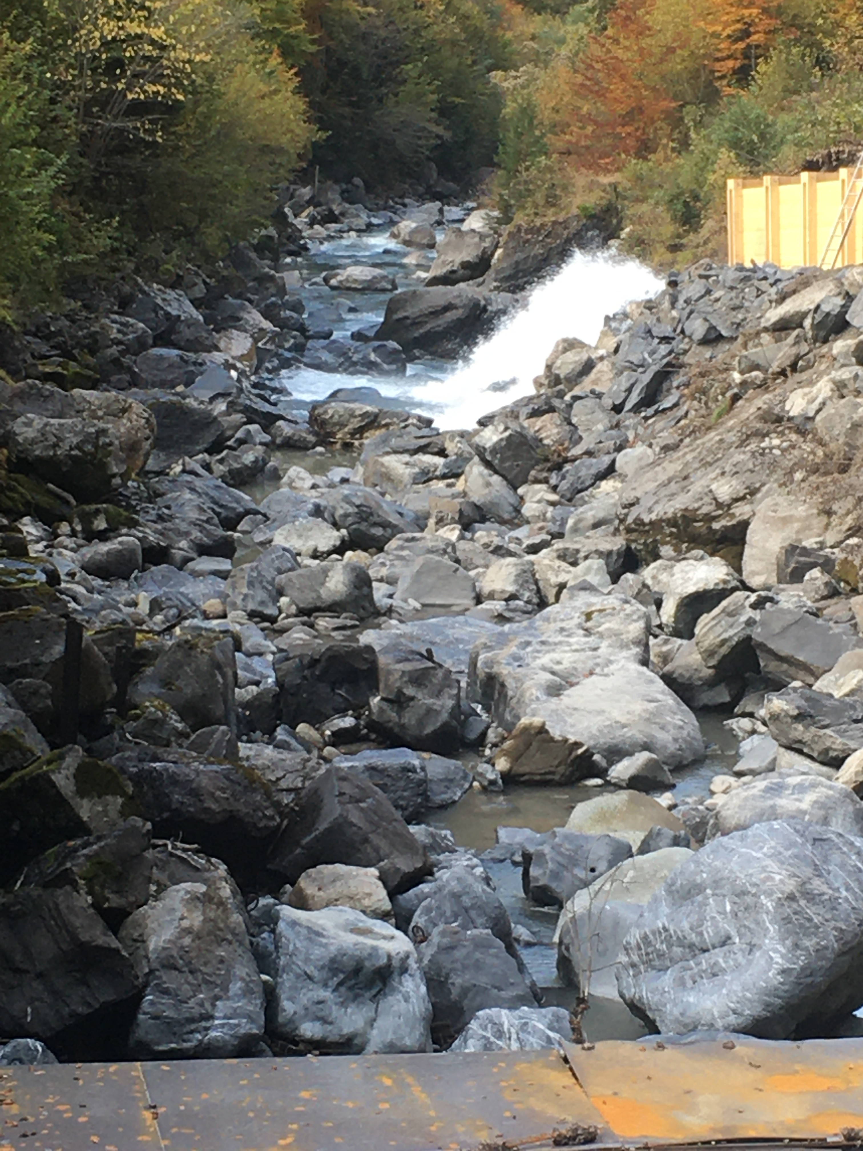
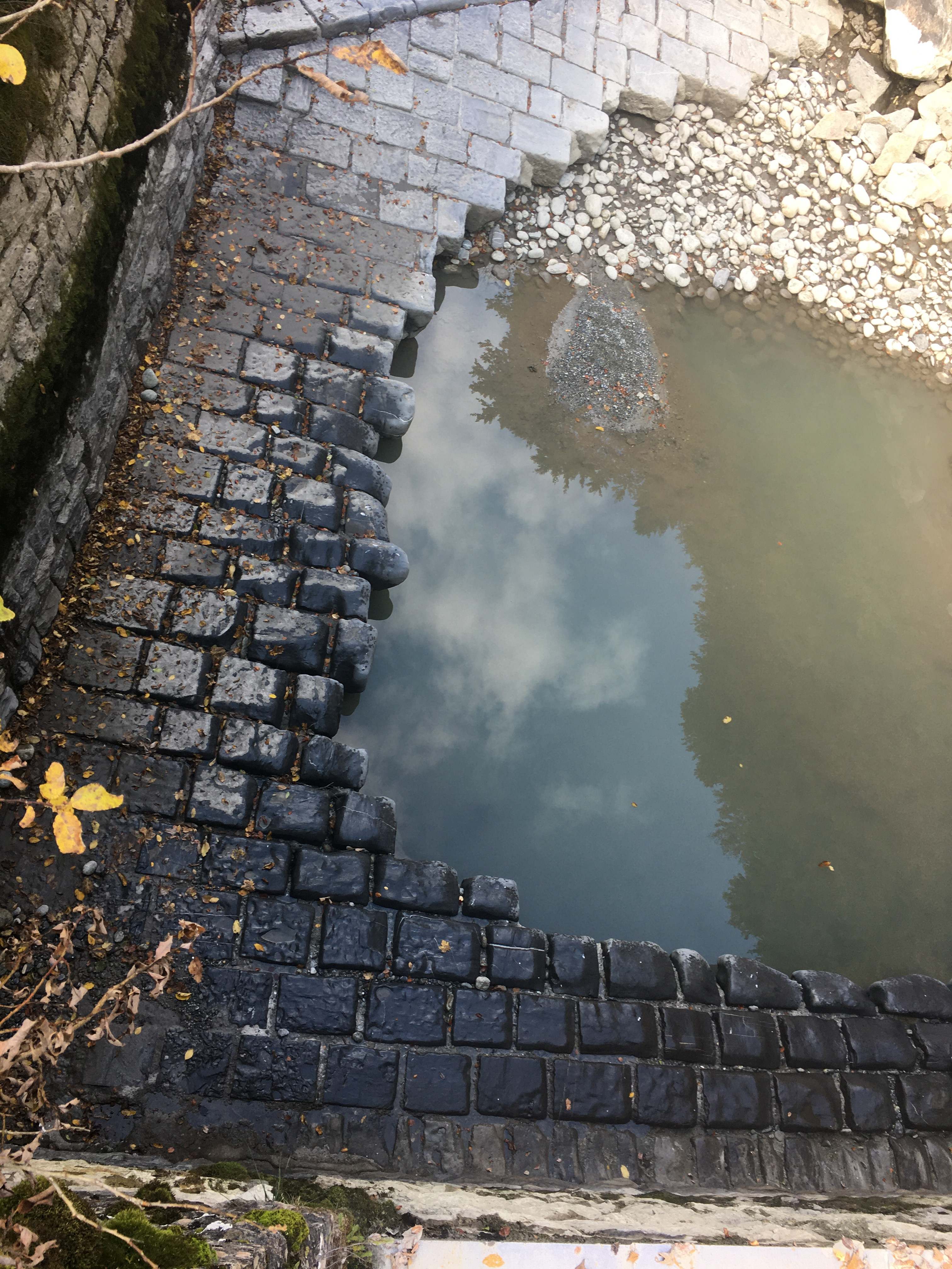
Gefahr vorübergehendDie Bauarbeiten am Sandweidli Wehr haben begonnen und werden zu Beginn der Schneeschmelze 2022 abgeschlossen sein. AKT
 • #4605 • 28.10.2021 16:50
Fella (IT), Pontebba - Dogna
Info
Gestern bei -125 gefahren .
Ist noch einigermaßen gut machbar.
Erste Passage bei Pontebba gut zu fahren, aber unbedingt besichtigen und Sichern! Groer Stein inm ausgang ist unterspült und die linke spur ist nicht fahrbar!!
Das Wehr unter der Autobahnbrücke sollte auf keinen Fall befahren werden ist mit Eisen gespickt, besonders das unterwasser!
Ansonsten ein schöner Bach ohne massen Andrang.
Ist noch einigermaßen gut machbar.
Erste Passage bei Pontebba gut zu fahren, aber unbedingt besichtigen und Sichern! Groer Stein inm ausgang ist unterspült und die linke spur ist nicht fahrbar!!
Das Wehr unter der Autobahnbrücke sollte auf keinen Fall befahren werden ist mit Eisen gespickt, besonders das unterwasser!
Ansonsten ein schöner Bach ohne massen Andrang.
 • #4604 • 23.10.2021 16:48
Orbe (FR), Bois d Amont - le Cenif
Befahrbarkeit
Befahrung am 10.10.2021 bei 2m2. Generell Ok aber zum Teil verwachsen /verlandet und sumpfig. Bäume quer und verwesende Tierkadaver im Wasser.
• #4603 • 19.10.2021 13:41Seite: 1 2 3 4 5 . . . 115 116 117 118 119 120 121 . . . 284 285 286
nach oben