Rivermap
HomeThe Map
List View


 Flusshinweise
Befahrbarkeit
English Summary
Karte Einbetten
Systemstatus
Kontakt und Team
Datenlieferanten
Contributor Agreement
The RCSD
Public licenses
Rivermap Japan
 "Rivermap Supporter" Group
Flusshinweise
Als Grundlage dient wenn immer möglich ein Flussführer.
 RSS-Feed
abonnieren und nichts verpassen.
RSS-Feed
abonnieren und nichts verpassen.
Seite: 1 2 3 4 5 . . . 85 86 87 88 89 90 91 . . . 285 286 287
Resultate 1741 - 1760 von 5721
San Bernardino (IT), Sbarramento sopra Rovegro - Centralina Cossogno
Bewertung NW-MW-HW
The gauge is located downstream of the takeout and downstream of the release of the power station (located at the takeout).
Therefore what the gauge indicates is heavily influenced by how much water is released by the power station: reason why the gauge is flagged as "indirect".
Because of that we keep receiving oscillating reports about the minimum level: sometimes it's 190, sometimes it's 200 and sometimes it's 210.
It's not that the gauge keeps shifting, it's about how much water the power station is releasing.
The best way to address this would be to check how much water the power plant is releasing at the time of the run, and then add a note about it with something like:
- no water release: minimum is 190
- power plant is releasing some water: minimum is 200
- power plant is fully releasing: minimum is 210
Therefore what the gauge indicates is heavily influenced by how much water is released by the power station: reason why the gauge is flagged as "indirect".
Because of that we keep receiving oscillating reports about the minimum level: sometimes it's 190, sometimes it's 200 and sometimes it's 210.
It's not that the gauge keeps shifting, it's about how much water the power station is releasing.
The best way to address this would be to check how much water the power plant is releasing at the time of the run, and then add a note about it with something like:
- no water release: minimum is 190
- power plant is releasing some water: minimum is 200
- power plant is fully releasing: minimum is 210
 • #5389 • 21.07.2023 21:13
Thierseer Ache (AT), Landl - Gasthaus Wachtl
Isar (AT), Isarburg (Sylvensteinspeicher - Arzbach)
Isar (AT), Obere (Scharnitz - Camping Isarhorn)
Ammer (AT), Untere
Dranse (CH), Sembrancher - Martigny-Croix
Gefahr aufgehoben
Trees strainer about 200m after the gorge are gone, it's clean.
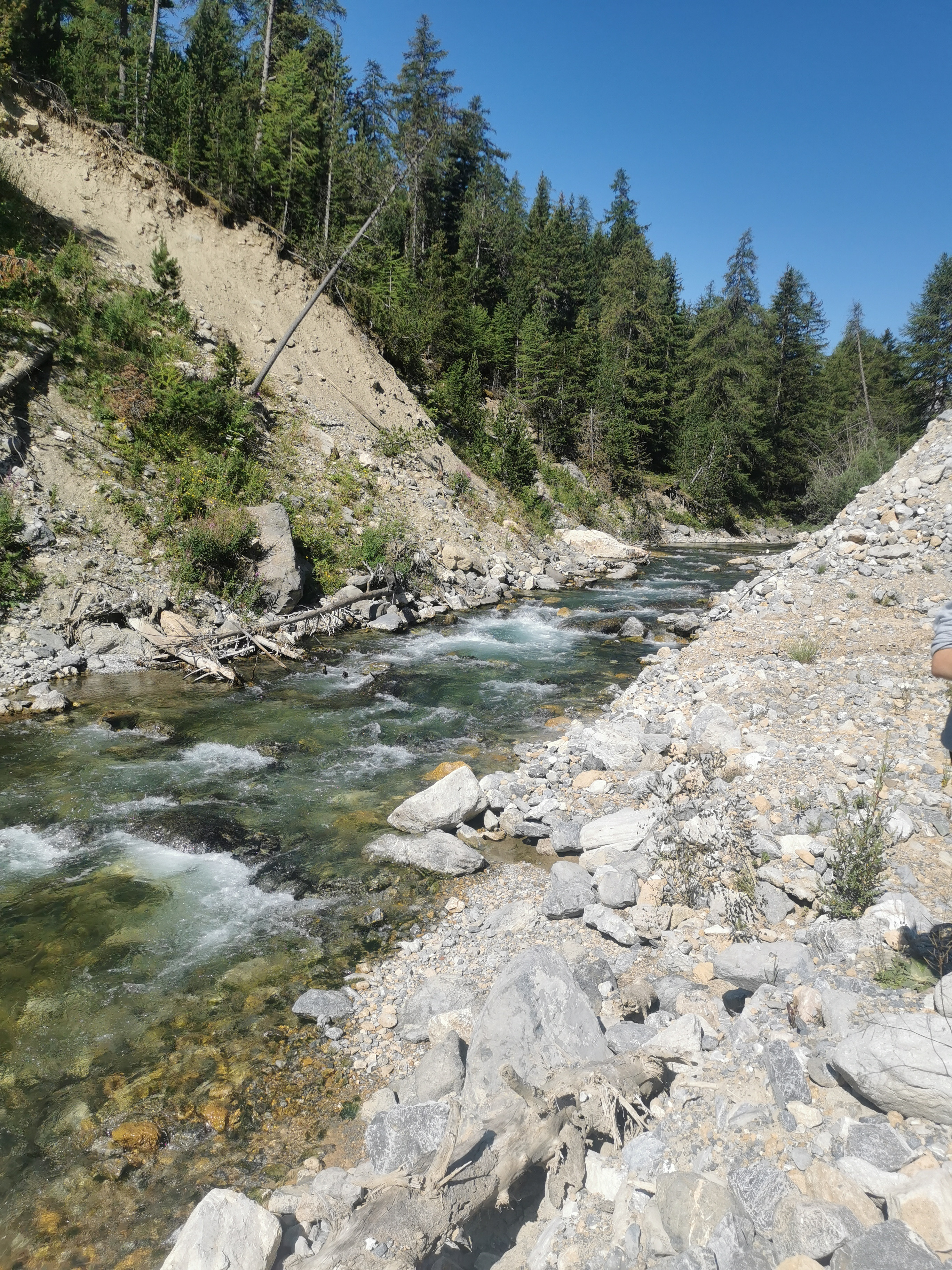
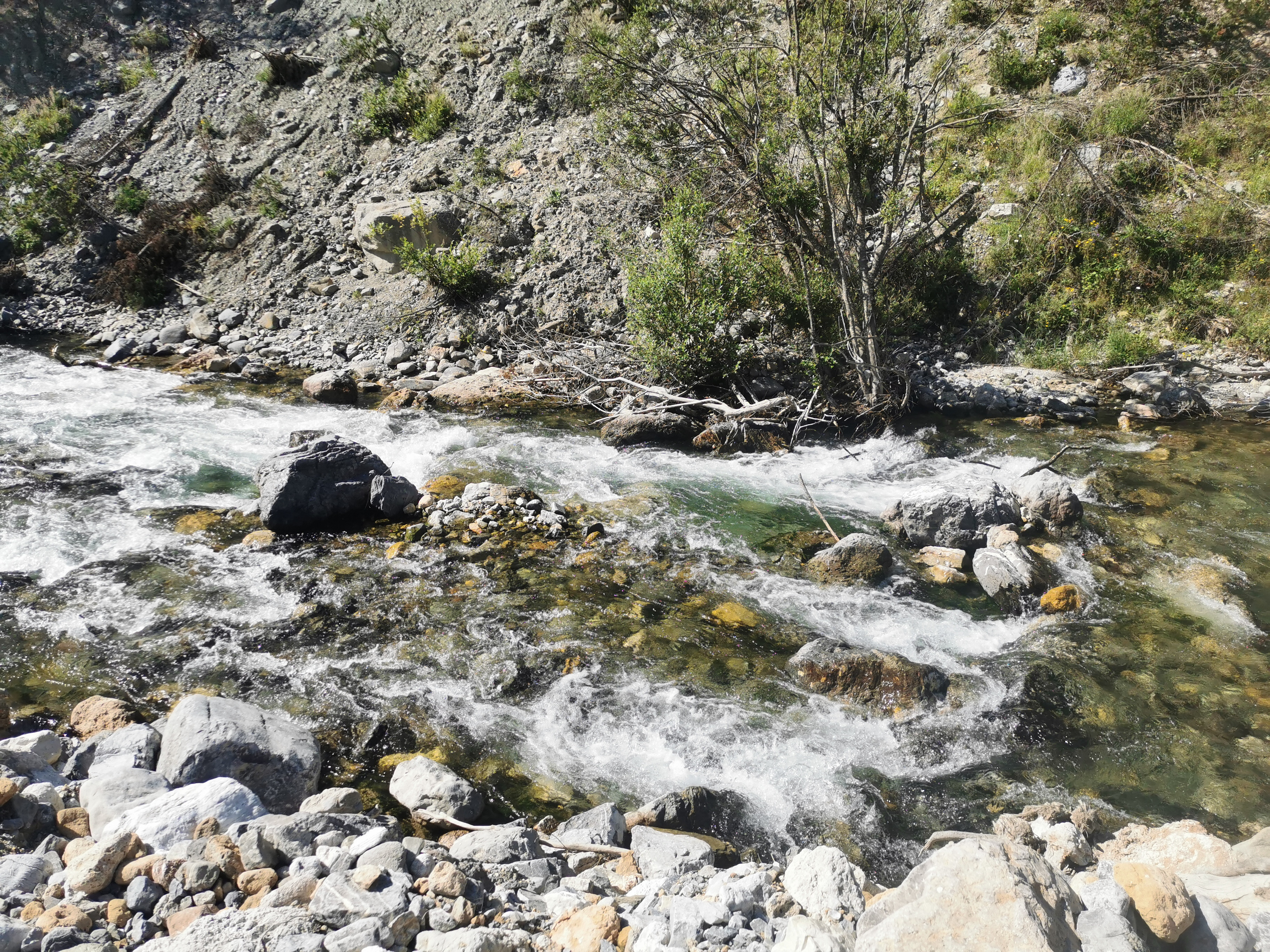
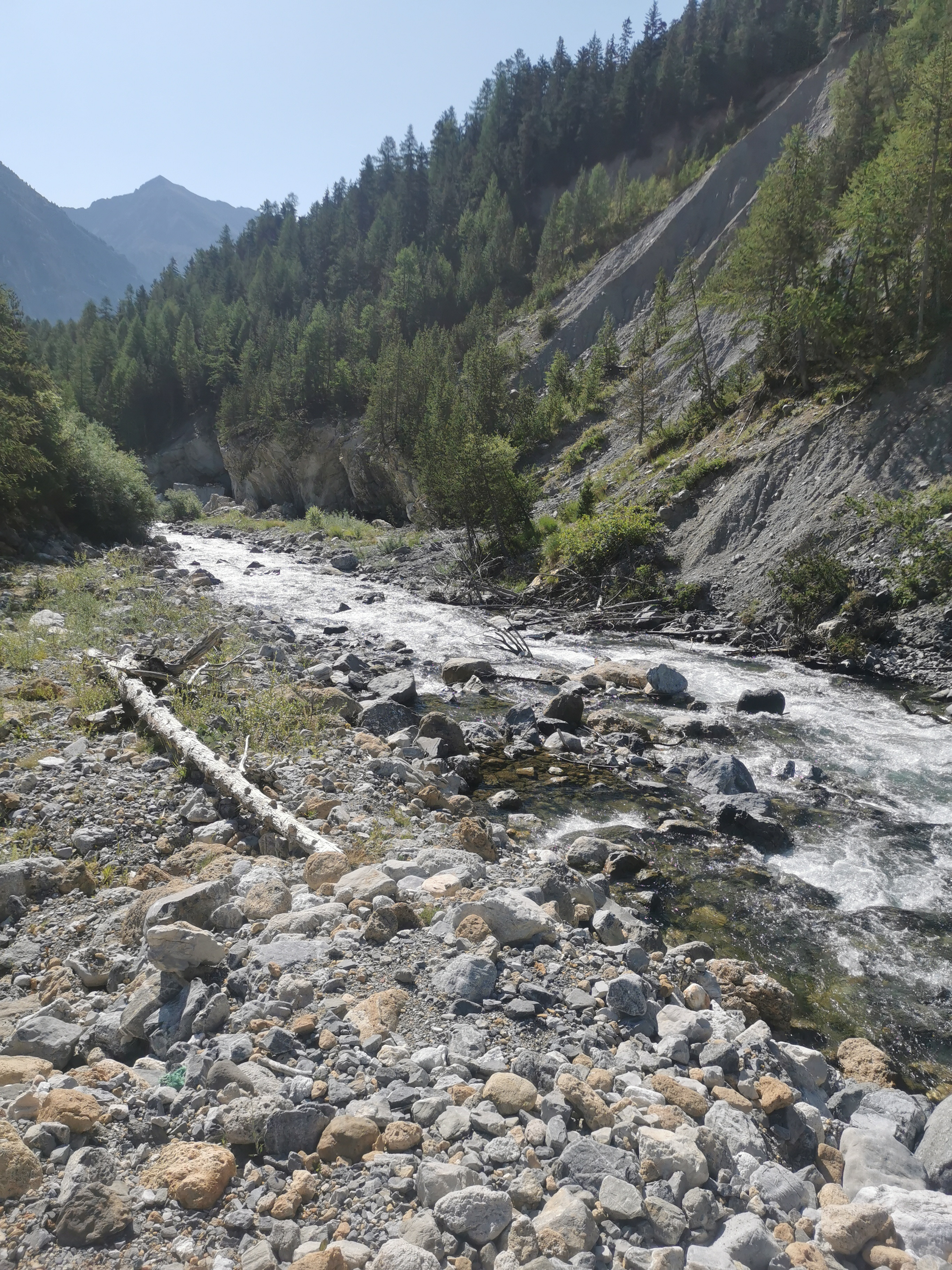
• #5383 • 20.07.2023 12:05Clarée (FR), Névache - Pamplinet
Bewertung NW-MW-HW
Aufgenomme Fotos bei Hilfstation Guisanne 7.8m3/s, was MW wäre, Fluss hat aber NW.
Pegel bei Embrun 31m3/s, was vermutlich im Sommer mehr Relevanz hat (NW bei 80m3/s gem. frührer Eintrag)
Standort Aufnahmen 45.0161204, 6.6359581.
Pegel bei Embrun 31m3/s, was vermutlich im Sommer mehr Relevanz hat (NW bei 80m3/s gem. frührer Eintrag)
Standort Aufnahmen 45.0161204, 6.6359581.
 • #5382 • 20.07.2023 11:46
Kiene (CH), Kiental - Kien
Flash!
Werner odachi paddel mit 3 gelben streifen am schaft in der hälfte verloren. Falls es jemand findet oder ortet bitte +41 79 918 74 53 kontaktieren.
Besten dank im voraus, Rene
Besten dank im voraus, Rene
• #5380 • 18.07.2023 11:16Maè (IT), Canyon
Befahrbarkeit
Unverständlich, dass es zur Mae kaum Meldungen gibt... Wir waren wieder dort - letzten Samstag und es ist immer ein erhebendes Gefühl. Aktuell gibt es nur eine kleine Baumversperrung, die ganz einfach überhoben werden kann. Bis auf ein paar fahrbare Bäume, wo Vorsicht geboten ist, ist der Canyon ansonsten frei.
Videolink wird demnächst folgen.
Videolink wird demnächst folgen.
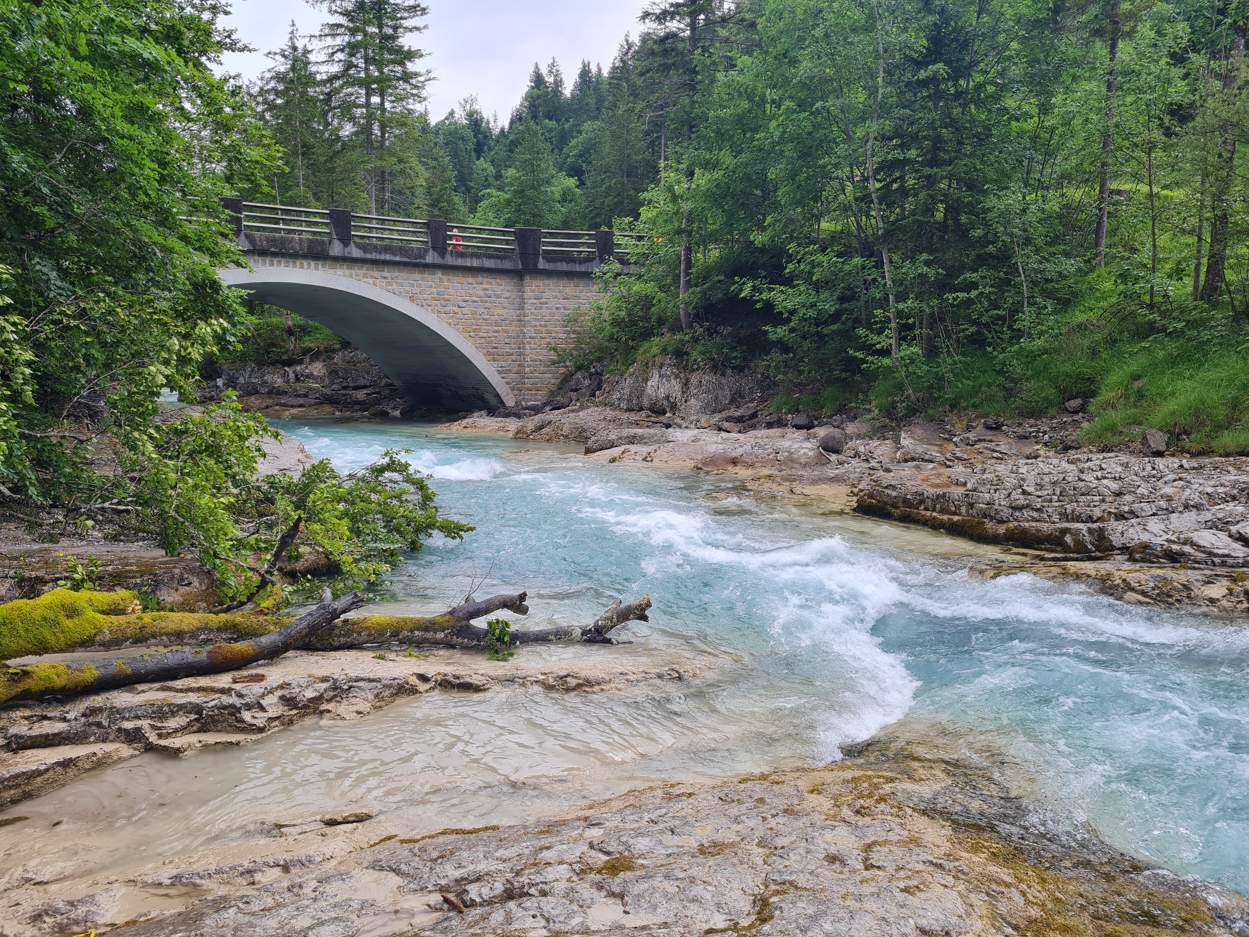
• #5379 • 17.07.2023 20:27Rißbach (AT), Standard (Hinterriß - Klamm)
Gefahr aufgehoben
Das gröbste vom Baum haben wir weggesägt.
 • #5378 • 16.07.2023 10:26
Inn (CH), Ardez
Gefahr aufgehoben
Baum aus #5376 wurde bereits heute ans Ufer gezogen und etwas Flussabwärts deponiert. Normale Hauptroute ist frei.
• #5377 • 14.07.2023 23:58Inn (CH), Ardez
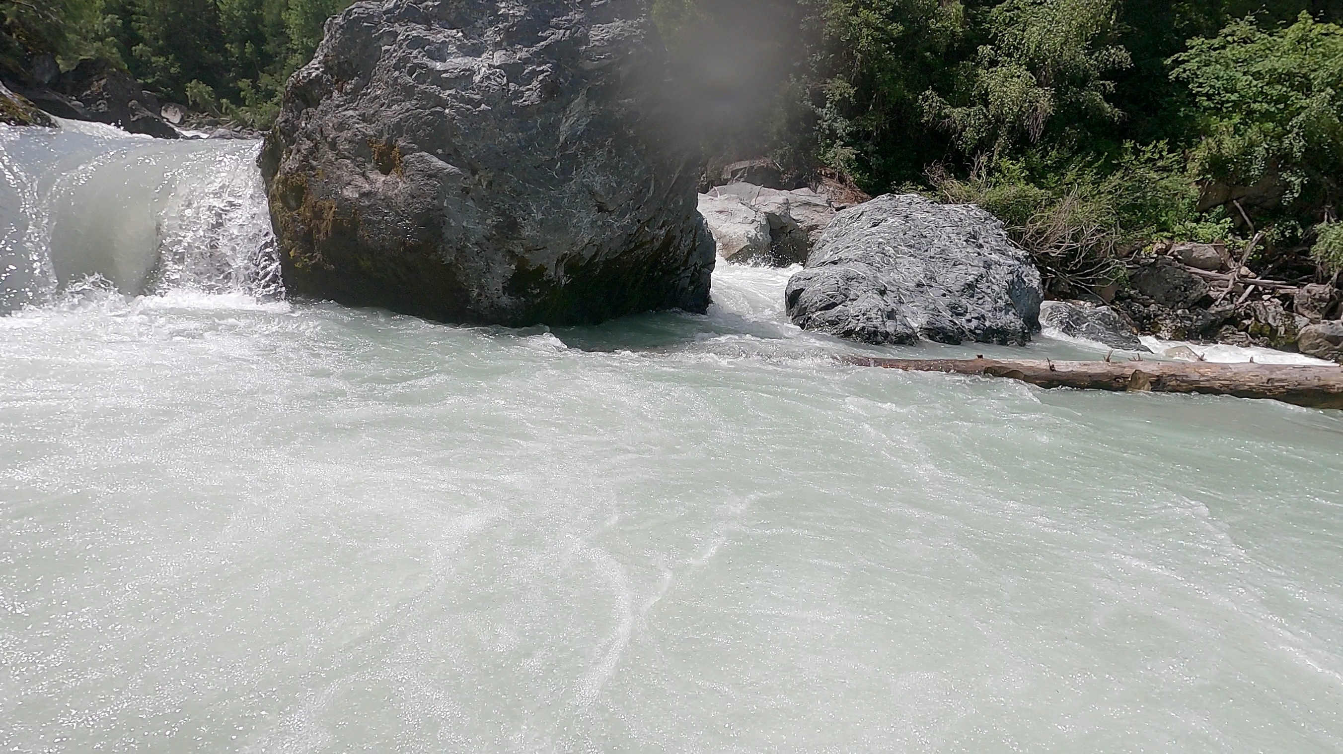
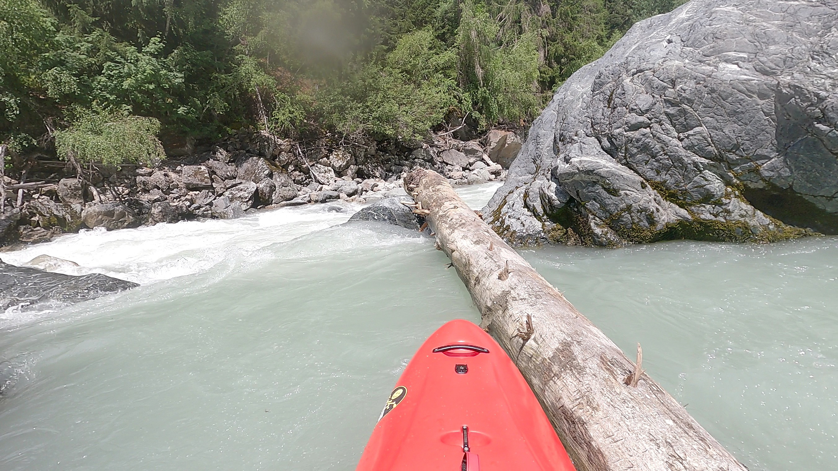
 Gefahr vorübergehend
200m nach dem Bockschlitz (Ausfahrt Labyrinth?) befindet sich ein Baum. Die schmale Einfahrt ist dadurch nicht betroffen. Bei 24m3 liess sich der Baum knapp umfahren; die Eifahrt in die Hauptströmung war so noch mit weniger Anlauf möglich.
 • #5376 • 14.07.2023 22:07
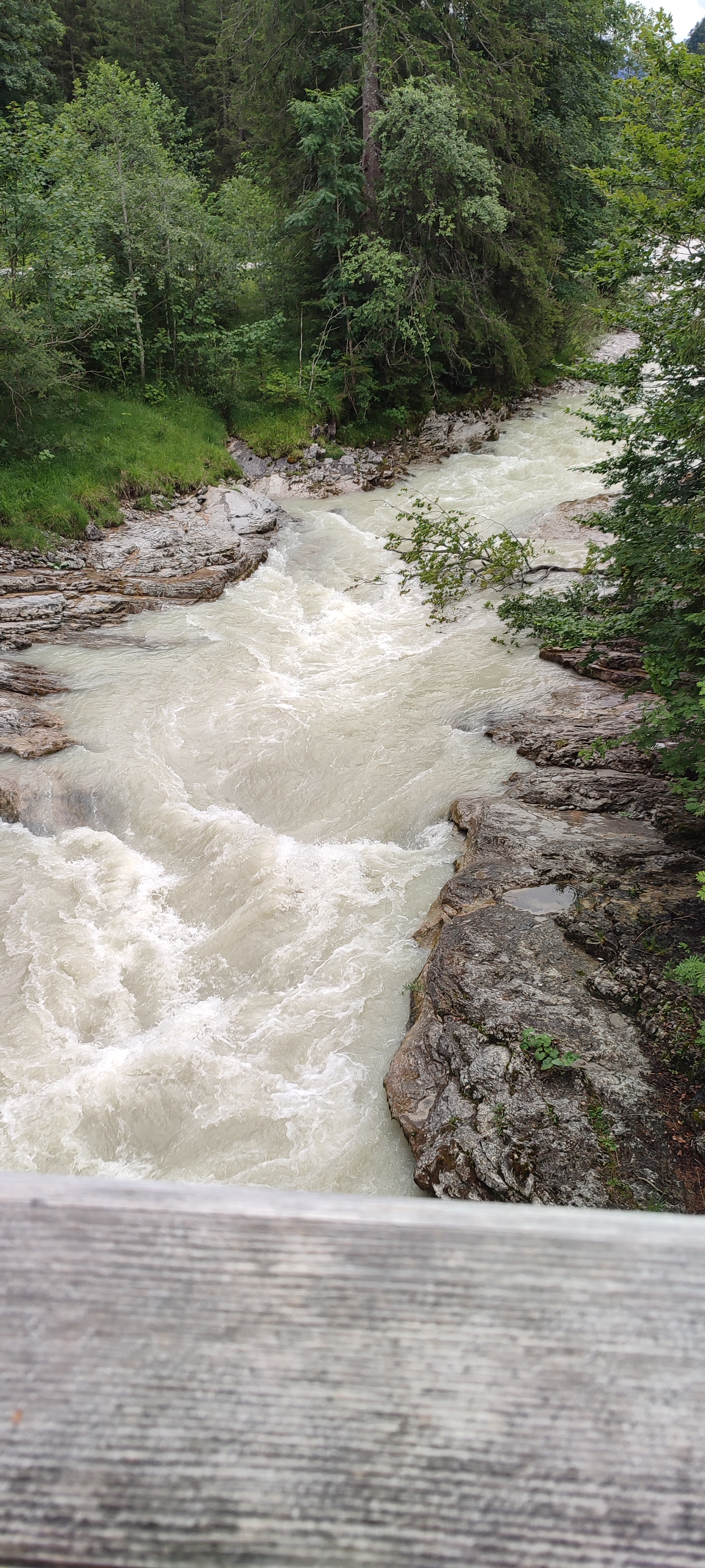
Rißbach (AT), Standard (Hinterriß - Klamm)
Gefahr vorübergehendAlbero poco prima del primo ssbarco possibile
 • #5375 • 14.07.2023 12:57
Birs (CH), Naturschutzgebiet Reinacher Heide - Birskopf
Info
Hier gibt es surfbar Wellen bei Hochwasser.
(47.49775,7.60587)
Es gibt jedoch Bestimmungen bezüglich des Bankzugangs. Siehe ...
http://www.naturschutzdienst-bl.ch/index.php/portraet/dokumentation
... und verschiedene Schilder vor Ort.
(47.49775,7.60587)
Es gibt jedoch Bestimmungen bezüglich des Bankzugangs. Siehe ...
http://www.naturschutzdienst-bl.ch/index.php/portraet/dokumentation
... und verschiedene Schilder vor Ort.
• #5374 • 13.07.2023 15:30Ramsauer Ache (AT), Marxenklamm
Info
Befahren im Juni 2023; Hilfspegel zeigte MW, effektiv war's aber Niedrigstwasser.
https://www.youtube.com/watch?v=iygPk6H8Itw
https://www.youtube.com/watch?v=iygPk6H8Itw
• #5371 • 12.07.2023 10:37Moesa (CH), Sorte - Cama
Bewertung NW-MW-HW
Confermo livello minimo di navigazione tratto da Sorte 9
Minimum kayakable water level 9
Minimum kayakable water level 9
• #5370 • 12.07.2023 08:07Sjoa (NO), Åmot
Flash!
Lost my sprayskirt on the road somewhere, if you find one please contact 004176 616 73 11 or adrian.flepp@yahoo.com thank you
• #5369 • 10.07.2023 12:42Landquart (CH), Küblis - Schiers
Info
Video showing water character at ~50 m3s
https://www.youtube.com/watch?v=Y_ZhKz4mnuw
https://www.youtube.com/watch?v=Y_ZhKz4mnuw
• #5366 • 05.07.2023 16:40Aoos (AL), Lower (Tsatsova - Permet)
Voidomatis (GR), Upper (Vikos - Aristi metal bridge)
Seite: 1 2 3 4 5 . . . 85 86 87 88 89 90 91 . . . 285 286 287
nach oben