Rivermap
HomeThe Map
List View
Befahrbarkeit
English Summary
Karte Einbetten
Systemstatus
Kontakt und Team
Datenlieferanten
Contributor Agreement
The RCSD
Public licenses
Rivermap Japan
![]() "Rivermap Supporter" Group
"Rivermap Supporter" Group
Flusshinweise
Als Grundlage dient wenn immer möglich ein Flussführer.
Seite: 1 2 3 4 5 . . . 28 29 30 31 32 33 34 . . . 270 271 272
Resultate 601 - 620 von 5438
Dranse de Morzine (FR), Saint Jean D'Aulps - Avant le tunnel des Tines
Info
Die obere Dranse de Morzine. WW III-IV (IV, IV, IV) mit relativ gut Holz im Bach. Ostern 2025, 9.5 m3.
https://youtu.be/AkllTDcySWA
https://youtu.be/AkllTDcySWA
 • #6498 • 24.04.2025 07:31
Morača (ME), Middle
Info
I paddled this section on April 9th 2025 at 67cm. We put in and took out at the same locations like last year. We portaged the dam at 42.7297584, 19.3804558, which has sharp iron rods sticking out of it and the line on the left is siphoned.
 • #6497 • 23.04.2025 20:59
Morača (ME), Kanjon
Info
I paddled this section on April 12th 2025 at a level of 62cm. Everything was runable like last year. The main rapid becomes more technical and less pushy at this level. It can be scouted from the rocks at the top on the right. The first two bigger drops could even be portaged at this level. The rest of the rapid is still a must run.
 • #6496 • 23.04.2025 20:43
Cem (AL), Lower
Info
I paddled this section again on April 10 2025 at a similar level like last year. Some of the upper rapids changed. Scouting recommended. We ran all the rapids except one towards the end of the section, where the current on the right went into an undercut and the left channel was full of potential pins.
 • #6495 • 23.04.2025 20:08
Kir (AL), Middle
Info
I paddled this section on April 8-th 2025 at a medium to low level. We put in at 42.15975,19.6735, where the river is easily accessible from the road. The river flows through a beautiful little gorge here and opens up a bit later, followed by another gorge with an entry that can be tricky depending on the water level. We decided to portage the entry since the level was too low. The entire section is mostly bedrock and pool drop with many class 4 rapids, which are mostly clean. The rapids are narrow and steep. We scouted most of them from the banks. More experienced crews might be able to scout from the river. All of the rapids can be ported. We took out at 42.1411667, 19.6471667, but there are many other places where the river is accessible from the road.
 • #6494 • 23.04.2025 13:22
San Giovanni (IT), Walk-in - Scareno
Info
There is now a complete, english language video guide for the Walk-In Section on youtube.
Please make sure to park responsibly, with minimal footprint at the village! Wouldnt want to get regulations going for the section.
https://www.youtube.com/watch?v=IF0cr3bo4i8
Please make sure to park responsibly, with minimal footprint at the village! Wouldnt want to get regulations going for the section.
https://www.youtube.com/watch?v=IF0cr3bo4i8
 • #6493 • 22.04.2025 23:18
Reuss (CH), Obere Welle (Fällbaum), Bremgarten
Bewertung NW-MW-HW
Comparison graph between the new Reussspitz synthetic gauge (upstream of Bremgarten) and the traditional Mellingen gauge (downstream)
.https://stations.rivermap.org/station/compare/1a1bd6c6-57c1-4df1-a509-d7bd75d7a080.Q@32ec0bfc-b9c8-5c84-8b9e-a14dd41a545c.Q@e4485605-95fb-594b-8a31-e2f7e87530ff.Q@5adc1a5d-7959-5062-9e2d-fc82ee203e39.Q
.https://stations.rivermap.org/station/compare/1a1bd6c6-57c1-4df1-a509-d7bd75d7a080.Q@32ec0bfc-b9c8-5c84-8b9e-a14dd41a545c.Q@e4485605-95fb-594b-8a31-e2f7e87530ff.Q@5adc1a5d-7959-5062-9e2d-fc82ee203e39.Q
• #6492 • 22.04.2025 19:23Adige/Etsch (IT), Slalom Chievo
Bewertung NW-MW-HW
[English below]
A -160 il campo slalom si puo' ancora utilizzare, ma non e' un gran che. Oltre -145 e' completamente sommerso
At -160 it's still possible to use the Slalom Track, but it's not a great experience. At -145 and above everything is underwater.
A -160 il campo slalom si puo' ancora utilizzare, ma non e' un gran che. Oltre -145 e' completamente sommerso
At -160 it's still possible to use the Slalom Track, but it's not a great experience. At -145 and above everything is underwater.
• #6491 • 22.04.2025 15:28Lütschine (CH), Zweilütschinen - Bönigen
Befahrbarkeit
befahren am 21.4.2025 bei 14.5m3 bis Raftbase. Alles fahrbar, keine Bäume drin.
• #6489 • 21.04.2025 21:39Weisse Lütschine (CH), Lauterbrunnen - Zweilütschinen
Befahrbarkeit
befahren am 21.4.2025 bei 6m3. Alles gut fahrbar (wenig Steinkontakt), einige kleinere Bäume im Fluss vor Parkhaus (um/unterfahrbar), Veränderungen nach Parkhaus und an einigen Orten wurden Steine verschoben
• #6487 • 21.04.2025 21:38Travo (FR), Haut (Pont de Chisa - Pont de Ghjineparu)
Info
Today 125cm at the bridge in Chisa and around 2.1meter on the new online measurement. Perfect water level.
• #6486 • 21.04.2025 21:23Entschlige (CH), Pochtenkessel - Achseten
Auf den ersten 300 Metern versperren mehrere Bäume die Durchfahrt vollständig, sodass wir von einer Befahrung abgesehen haben.
 • #6485 • 20.04.2025 22:38
Travo (FR), Bas (Pont de Ghjineparu - Mer)
Befahrbarkeit
Neuer Pegel am Ausstieg D545 Brücke,
2,15 cm ging gut
2,15 cm ging gut
• #6484 • 19.04.2025 18:49Lao (IT), Laino Borgo - Grotta del Romito
Info
Bei Pegel 67 alles gut fahrbar, keine Umtragstelle, einige Zwangspassagen, mindestens drei siphonierte Stellen, das Meiste ist gut vom Boot aus zu sehen...
Wirklich eine der schönsten Großschluchten Europas vergleichbar mit dem Verdon, nur deutlich leichter! Keine Möglichkeit die Fahrt abzubrechen, wer einbootet sollte WW 3, besser WW 4 beherrschen. Da die Fahrt zur Ausbootstelle mit dem PKW fast so abenteuerlich ist, wie die Flussbefahrung, rate ich dazu, sich einem der ortsansässigen Raftunternehmen anzuschließen. Ich empfehle "rivertribe.it". Antonio spricht gut englisch, fährt selbst Kajak, gibt sehr gute Anweisungen zur Befahrung und kann jederzeit genaue Infos zum Wasserstand und der Baumsituation geben.
Wirklich eine der schönsten Großschluchten Europas vergleichbar mit dem Verdon, nur deutlich leichter! Keine Möglichkeit die Fahrt abzubrechen, wer einbootet sollte WW 3, besser WW 4 beherrschen. Da die Fahrt zur Ausbootstelle mit dem PKW fast so abenteuerlich ist, wie die Flussbefahrung, rate ich dazu, sich einem der ortsansässigen Raftunternehmen anzuschließen. Ich empfehle "rivertribe.it". Antonio spricht gut englisch, fährt selbst Kajak, gibt sehr gute Anweisungen zur Befahrung und kann jederzeit genaue Infos zum Wasserstand und der Baumsituation geben.
• #6480 • 19.04.2025 14:43Lao (IT), Laino Borgo - Grotta del Romito
Info
Pegel 67 cm
 • #6478 • 19.04.2025 14:38
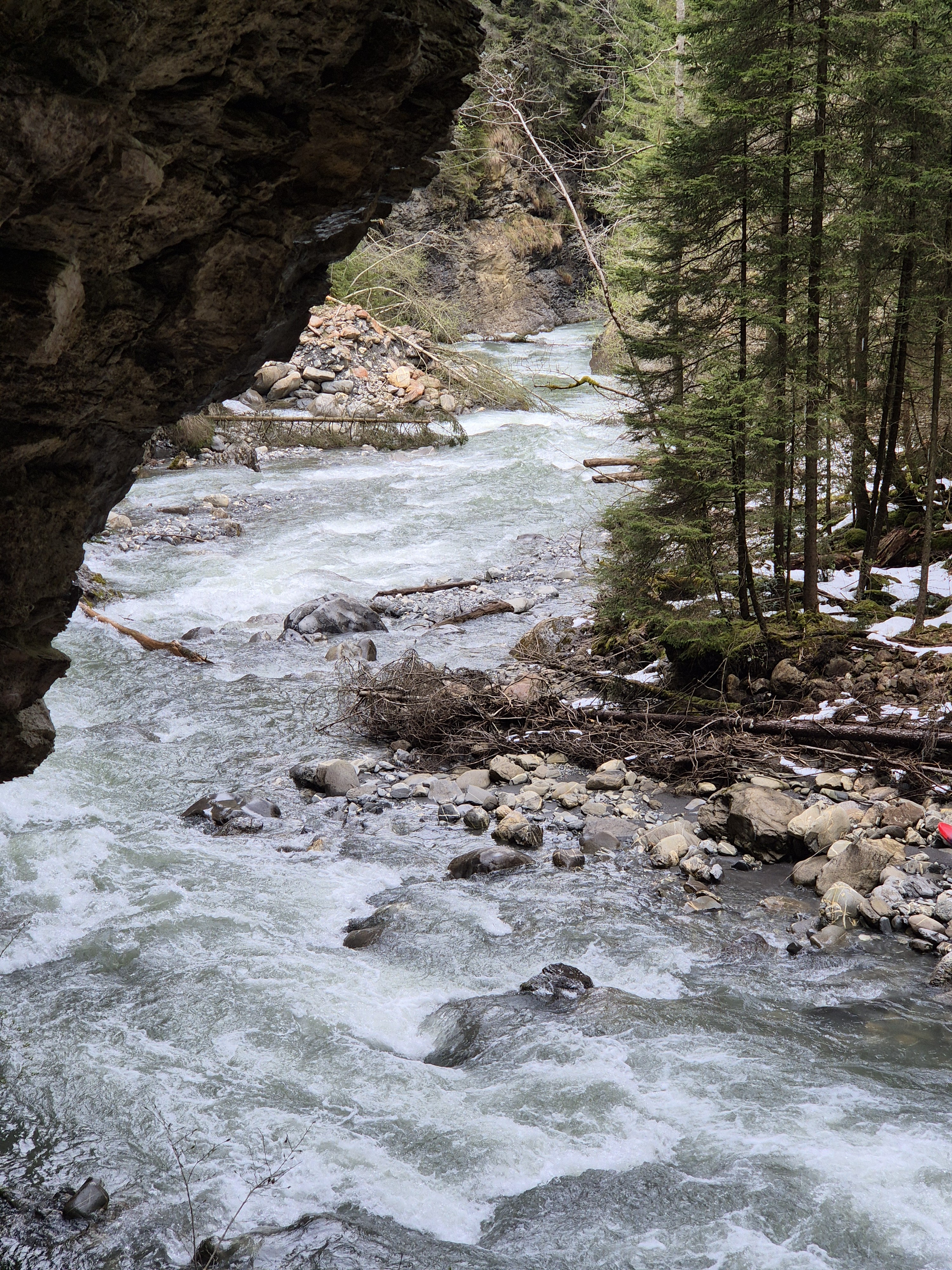
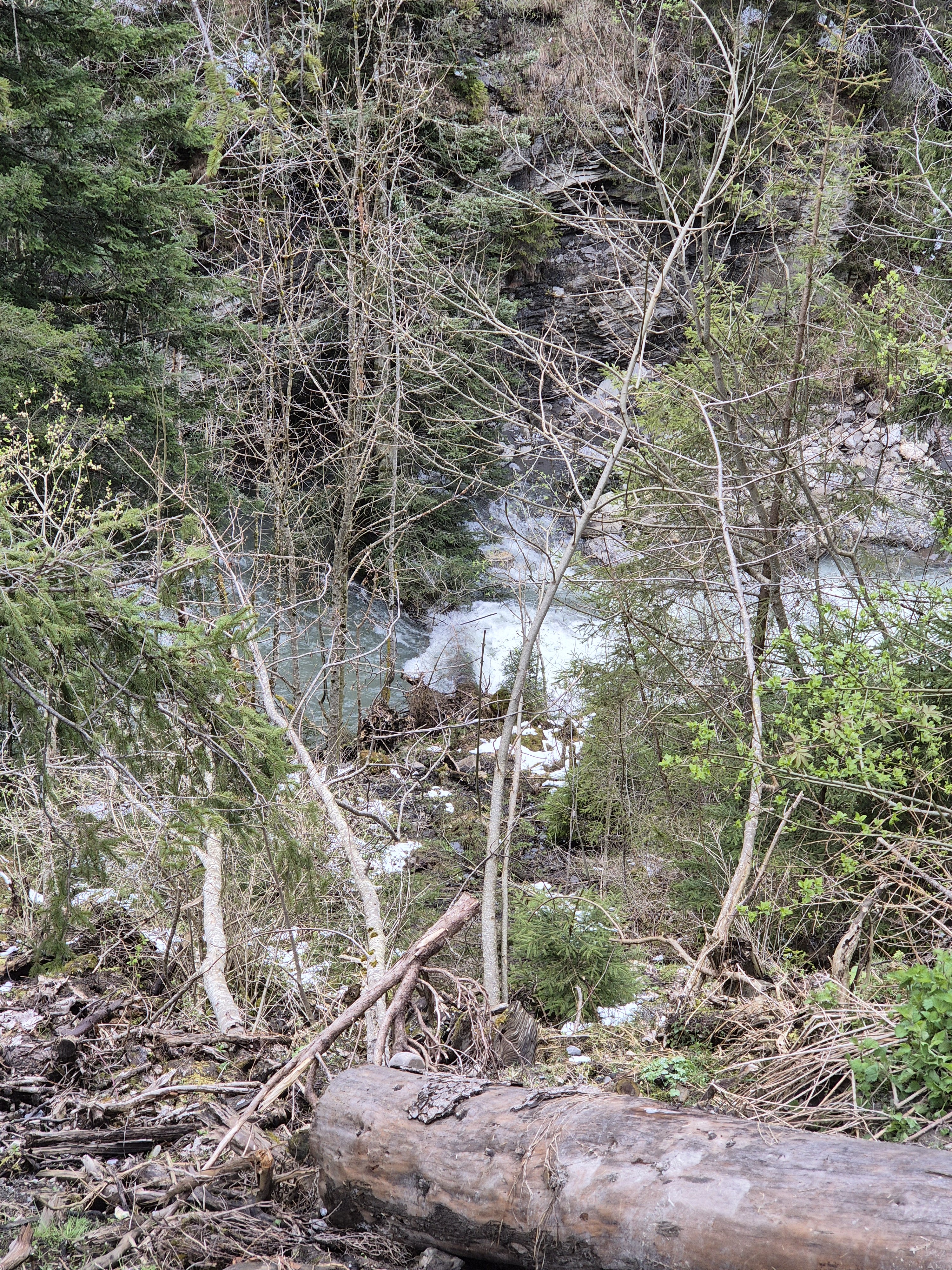
Ödenseetraun (AT),
We paddled this section today, thinking it might be a nice high water alternative to Koppentraun (and also easier than Koppentraun).
The water level in Koppentraun was around 145 cm and can be seen in the pictures attached (there's one from the takeout as well).
We had seen the artificial dams of this section in the video posted here in the comments as well, however:
! At this waterlevel, the backwash is very powerful and dangerous!
! It is really difficult to stop and get out to scout / portage because the Eddies are small and sparse (especially near the dams)!
! There are 3 dangerous dams in total, which follow in quick succession, starting with the one with the rock (First picture)!
Be very careful when you run this. Especially if your usual comfort level is WW3. In general, we would not recommend to paddle this and suggest to find sth else instead.
Shuttle can be done with the train, if you don't mind some walking. Don't paddle further than takeout. There' s another danergius old dam.


 • #6476 • 18.04.2025 20:52
Ticino (CH), Oberer 2 (Fontana - Airolo)
Befahrbarkeit
Ran it at 1.7 today. April 18.
Avalanche section seemed different but pretty much all runable with one manky drop that didn't seem worth the effort.
Long rapid towards the bottom all ran nicely.
No trees as of today.
Level was low but enough water where it matters.
Avalanche section seemed different but pretty much all runable with one manky drop that didn't seem worth the effort.
Long rapid towards the bottom all ran nicely.
No trees as of today.
Level was low but enough water where it matters.
• #6475 • 18.04.2025 17:15Lorze (CH), Rumentikon - Obfelden (Reuss)
Info
test
• #6474 • 15.04.2025 23:56Solenzara (FR), Parking de la D268 - Solenzara
Info
Today there was far too little water at 80cm, very rocky ride.
• #6473 • 15.04.2025 22:33Brenta (IT), Spot Valstagna
Bewertung NW-MW-HW
[English version below]
L'idrometro di riferimento a Barzizza include anche la portata di affluenti carsici come l'Oliero che entrano a valle dello spot. In caso di abbondanti piogge sull'altipiano questi affluenti si ingrossano e l'idrometro segna piu' acqua di quella effettivamente presente.
The reference gauge at Barzizza also includes the flow from karst tributaries such as the Oliero, which enter downstream of the spot. In case of heavy rain on the plateau, these tributaries swell and the gauge indicates more water than is actually present.
• #6472 • 15.04.2025 21:29Seite: 1 2 3 4 5 . . . 28 29 30 31 32 33 34 . . . 270 271 272
nach oben