Rivermap
HomeThe Map
List View
Befahrbarkeit
English Summary
Karte Einbetten
Systemstatus
Kontakt und Team
Datenlieferanten
Contributor Agreement
The RCSD
Public licenses
Rivermap Japan
![]() "Rivermap Supporter" Group
"Rivermap Supporter" Group
Flusshinweise
Als Grundlage dient wenn immer möglich ein Flussführer.
Seite: 1 2 3 4 5 6 7 8 . . . 278 279 280
Resultate 81 - 100 von 5596
Ötztaler Ache (AT), Obere (Sölden - Bruggen)
Steel cable still there. It spans from left to right and is under the water in the river center. It can be passed on the very right side, at our waterlevel.
Except that everything was fine at 95cm today.
Except that everything was fine at 95cm today.
 • #7328 • 26.05.2026 16:12
Weisse Lütschine (CH), Lauterbrunnen - Zweilütschinen
Befahrbarkeit
Wir sind diesen Abschnitt plus Dangelstutz über Pfingsten ein paar Mal bei Pegeln zwischen 9 bis 13.5 kubik gepaddelt. Alle Stellen waren gut fahrbar.
Die klemmgefährliche Verblockung aus Hinweis #7268 ging bei diesen Pegeln gut von links kommend nach rechts.
Die Eingangsrutsche ins Schlachthaus sah holpriger als aus als sie sich dann angefühlt hat. Hier nur aufpassen, dass man danach wieder links rüber kommt.
Schlitz ist frei und die Doppelstufe ging gut über das letzte Kehrwasser rechts. Dangelstutz so wie immer.
Bei 13 kubik war schon deutlich mehr los, daher passt die obere Grenze für MW bei 12 kubik ganz gut. 6 kubik für die untere Grenze ist wahrscheinlich etwas niedrig.
• #7327 • 26.05.2026 08:47Dora Baltea (IT), Leverogne - Chavonne
Stura di Valgrande (IT), Cantoira - Confluenza
Vorderrhein (CH), Ilanz - Versam
Gefahr aufgehoben
Tree is gone.
• #7324 • 25.05.2026 19:04Albula (CH), Waldschlucht
Dicker Baumstamm quer, ganzer Fluss versperrt. Umtragen links. Kettensäge nötig…
nach der „ersten Stelle“ der Waldschlucht.
Befahren ab Landwasser PP, bei 8.5 m3/s des Landwasser-Pegels. Unterste Grenze (!) für Befahrung der Strecke bis zur Waldschlucht.
25.5.26
nach der „ersten Stelle“ der Waldschlucht.
Befahren ab Landwasser PP, bei 8.5 m3/s des Landwasser-Pegels. Unterste Grenze (!) für Befahrung der Strecke bis zur Waldschlucht.
25.5.26
 • #7323 • 25.05.2026 14:29
Saane / Sarine (CH), Camping Le Berceau - Lac du Vernex
Gefahr aufgehoben
Der Baum ist definitv weg :) also freie Fahrt.
• #7322 • 24.05.2026 21:20Guisane (FR), Chantemerle - Briançon
Info
Ran at 5cms according to gauge, looked more like 10-15, MW. No dangerous trees.
There is no "X" on this section. There are three places marked as "weirs", but all are passable, third one actually has a purpose-built passage.
There is no "X" on this section. There are three places marked as "weirs", but all are passable, third one actually has a purpose-built passage.
• #7321 • 24.05.2026 18:54Vorderrhein (CH), Ilanz - Versam
Befahrbarkeit
Take care after the black hole, just before Versam. There is a big ugly tree over the river in main current. You can pass on the river left. See pictures.
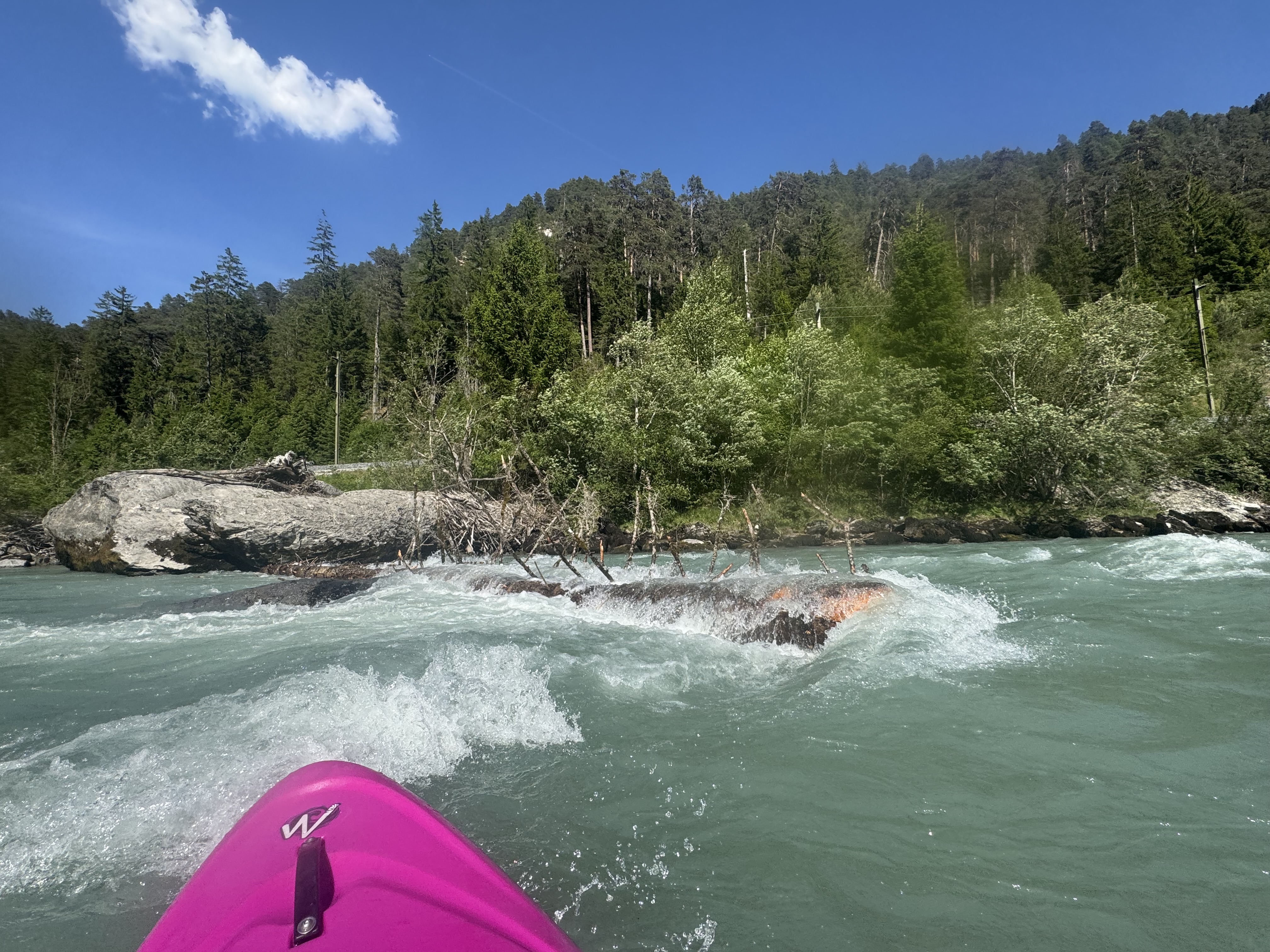
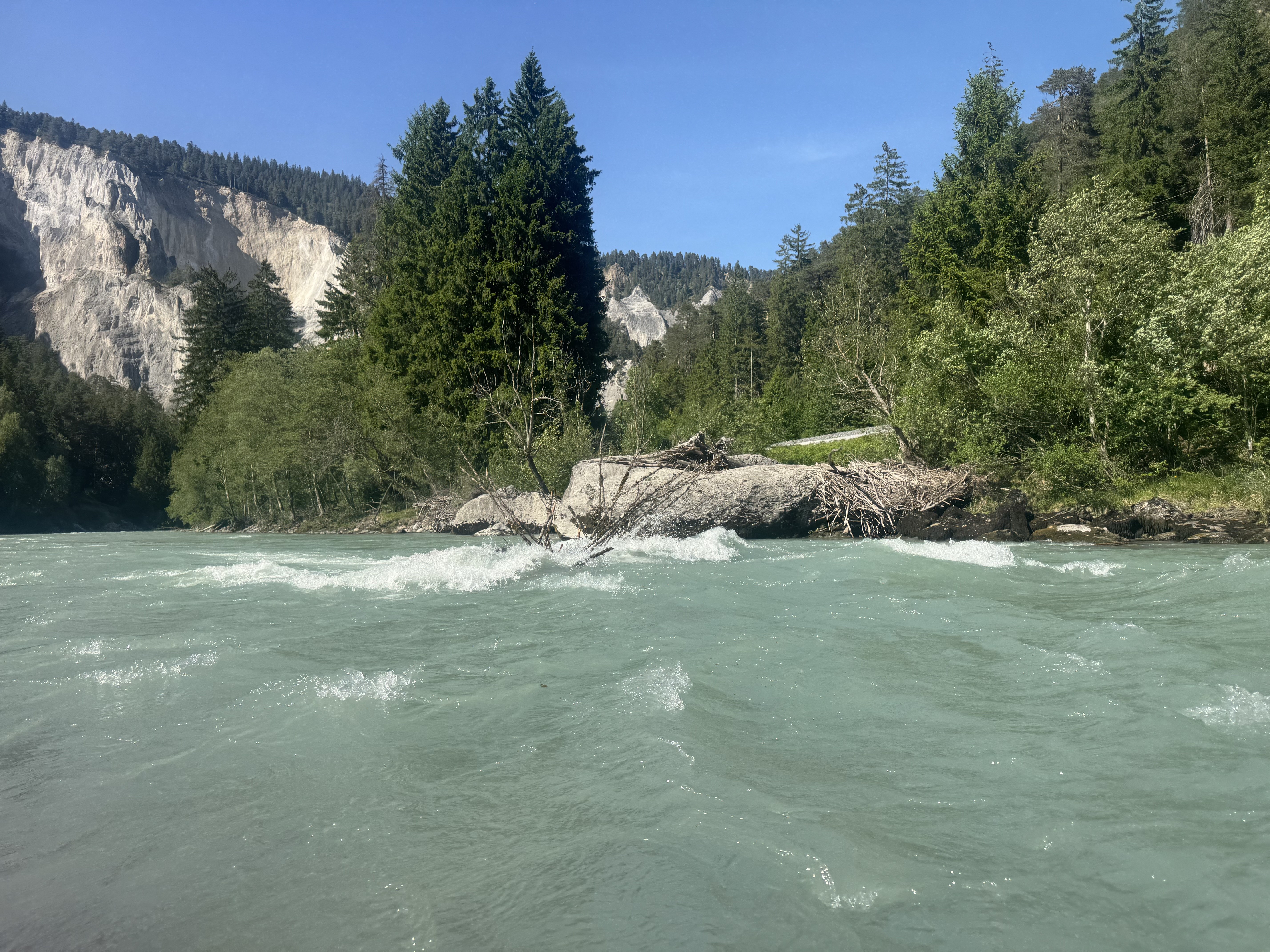
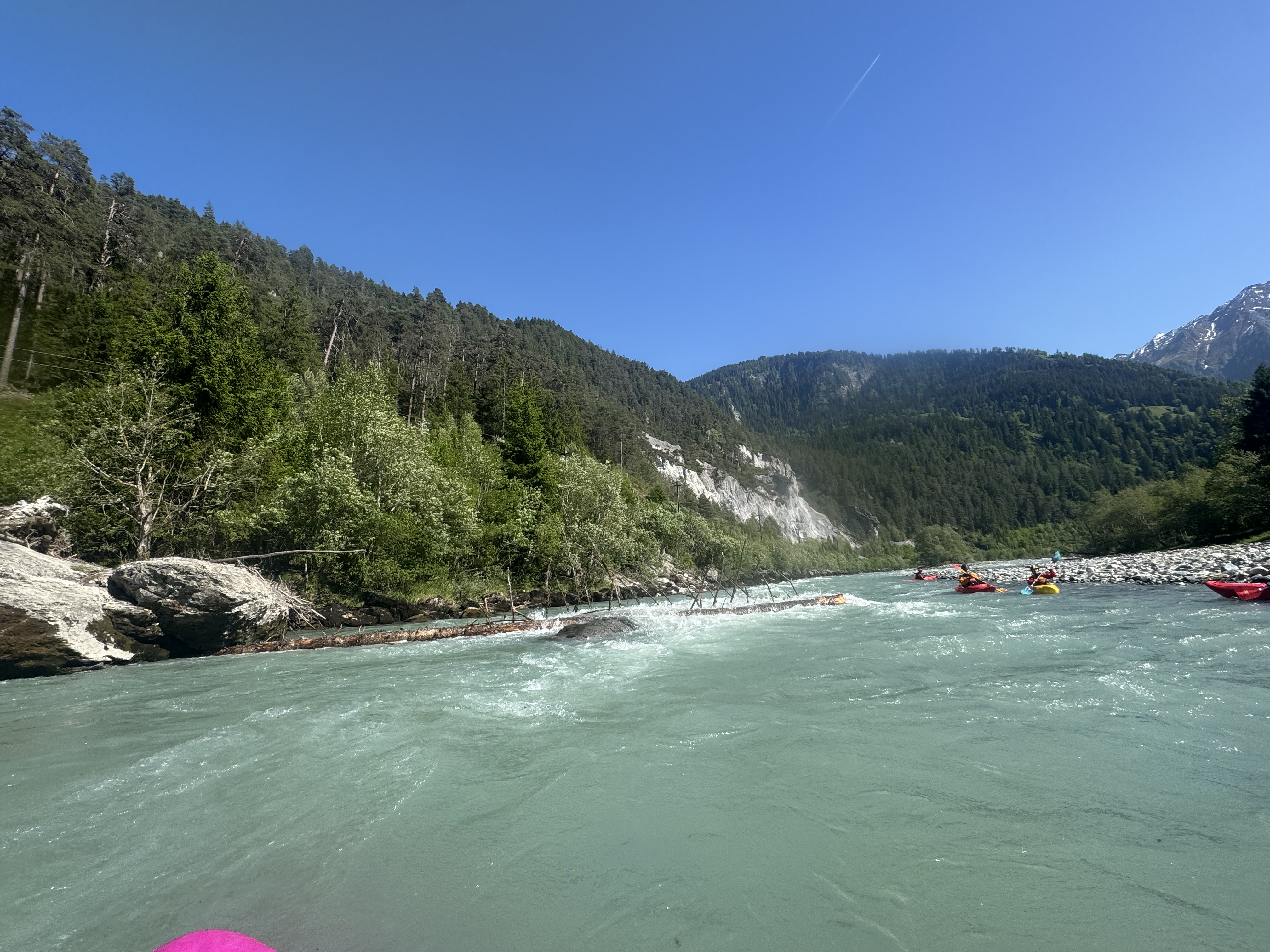 • #7320 • 24.05.2026 18:38
Kiene (CH), Kiental - Kien
Tree from last comment still there confirm there is not so much Eddies. In a pickle you could maybe squeeze by on river left (not recommended though. Portage is eqsiest on left bank but hard to find an eddy. Stop wat in time!
Rest of the run was quite clean.
Nice section although short
Rest of the run was quite clean.
Nice section although short
• #7319 • 23.05.2026 15:58Venter Ache (AT), Untere (P4 - Zwieselstein)
Am Ende von Bodeneg befindet sich eine Lawine die ein Siphon formt. Am bestens einmal bei der Anfahrt ansehen. Zum Umtragen an der ersten Brücke in Bodenegg aussteigen. (46.9276732, 10.9993442)
Alles andere ist problemlos mit langem Hals zu umfahren.
Alles andere ist problemlos mit langem Hals zu umfahren.

 • #7318 • 23.05.2026 15:35
Reuss (CH), Göschenen - Wassen
Bewertung NW-MW-HW
Messstation wurde neu positioniert. Kalibrierungswerte sind noch provisorisch und mit Vorsicht zu geniessen. Bitte hier melden, wenn Befahurngsberichte vorliegen.
• #7316 • 21.05.2026 21:26Vésubie (FR), Saint-Jean la Rivière - le Cros d'Utelle
Bewertung WW-Grad
Classe III
• #7315 • 21.05.2026 04:35Gave de Brousset (FR), Cailloux de Soques - Lac de Fabrège
Divers
The stick gauge is located here: 42,8608429, -0,3914972
• #7314 • 20.05.2026 11:43Esera (ES), Congost de Ventamillo (El Run - Seira)
Bewertung NW-MW-HW
Wrong gauge for the section.
A lot of water is diverted out of this section and comes in just above campo gauge.
At 22 cumecs on campo gauge this section was dry.
Same for the next section above campo.
Eventhough here we had just enough water to scrape down. The picture is from this lower section on 19.05.2026 at 22-25 cumecs on the gauge
 • #7313 • 20.05.2026 08:46
Arc (FR), Termignon - Bramans
Gefahr aufgehoben
Travaux finis
• #7312 • 19.05.2026 16:29Glenner (CH), Peiden - Ilanz
Info
Glenner bei ultra Niedrigwasser, 4.4 m3/s, mangels anderer Paddel-Optionen über Auffahrt. Wir sind deswegen unterhalb des Peiden-Wehrs eingestiegen. NW gemäss Rivermap ist bei 7m3... das meiste war noch grad fahrbar.
https://youtu.be/k9WMBwr3G2w
https://youtu.be/k9WMBwr3G2w
• #7311 • 19.05.2026 14:16Saane / Sarine (CH), Camping Le Berceau - Lac du Vernex
Gefahr aufgehoben
Wir sind am 14.5.26 diesen Abschnitt bei ca. 38cm gepaddelt.
Wir haben den unten beschriebenen Baum nicht finden und konnten alles befahren.
Allerdings führte die Kernstelle am Beginn der Klamm bei uns zu 2 Schwimmern. Das eine Boot rotierte lange in einem starken Kehrwasser links in der Klamm und konnte nur mit Mühe vom Boot aus wieder in die Strömung gedrückt werden.
Also: Gut vorher anschauen.

 • #7310 • 19.05.2026 13:35
Schwarze Lütschine (CH), Lütschental - Zweilütschinen
Bewertung NW-MW-HW
Der neue, direkte Pegel von Swiss Canoe ist jetzt online. Fürs künftige "Feintuning" des Pegels werden zusätzliche Hinweise sehr geschätzt.
• #7309 • 18.05.2026 22:17Mreznica (HR), Waterfall section
Fahrverbot
Natura 2000 area. Polyethylene kayaks are prohibited. Trips are only permitted with a guide.
• #7308 • 18.05.2026 17:46Seite: 1 2 3 4 5 6 7 8 . . . 278 279 280
nach oben