Rivermap
HomeThe Map
List View
Befahrbarkeit
English Summary
Karte Einbetten
Systemstatus
Kontakt und Team
Datenlieferanten
Contributor Agreement
The RCSD
Public licenses
Rivermap Japan
![]() "Rivermap Supporter" Group
"Rivermap Supporter" Group
Flusshinweise
Als Grundlage dient wenn immer möglich ein Flussführer.
Strubbach (Loferbach)
IV 0 km

Loferbach @ Lofer 151 cm @ 02:00
150 | 165 .. 175 | 210 cm
Resultate 1 - 9 von 9
Befahrbarkeit
Done yesterday with 180cm. Every line was clean after the last flood, but two trees that could potentially come into play. They are in the following 200m after the portage/weir out of the main flow.
Cheers Max
Cheers Max
 • #6780 • 31.07.2025 09:57
Befahrbarkeit
Anfangs April, 150 cm (Niedrigstwasser): Keine Baumhindernisse, alles frei.
• #6464 • 07.04.2025 17:34Bewertung NW-MW-HW
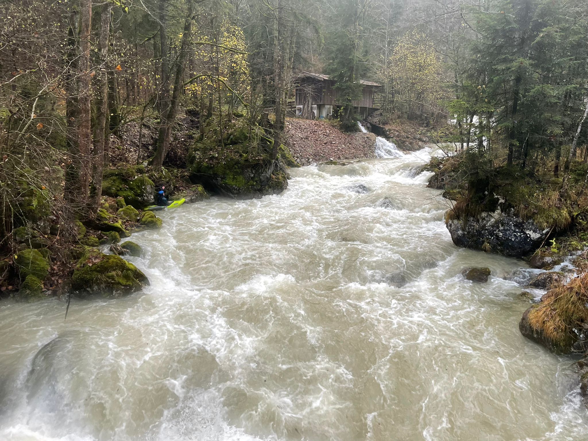
Paddled at flows ranging from 200cm to 220cm. Photo shows main cataract at 220cm, which felt like high water level already. In my opinion 210cm is the starting gauge for hw.
Different groups ran both weirs of the run (one at the take out and one before the cataract shown) and had pitons, injuries and swimmers.
Stay safe,
Max
Different groups ran both weirs of the run (one at the take out and one before the cataract shown) and had pitons, injuries and swimmers.
Stay safe,
Max
 • #5628 • 22.11.2023 14:54
Info
• #5007 • 15.12.2022 14:54Info
Frühling 2019... bei wenig Wasser eher eine III-IV.
https://vimeo.com/480022070
https://vimeo.com/480022070
• #4016 • 16.11.2020 22:08Gefahr aufgehoben
Strubbach ... in voller Länge wieder fahrbar ... es liegen zwar noch einige Äste und Bäume drin , diese stellen aber bei großer Vorsicht und gediegener Technik kein Problem dar.
Source: https://www.facebook.com/franz.puckl.7/posts/10156601553739102
Source: https://www.facebook.com/franz.puckl.7/posts/10156601553739102
• #3183 • 03.04.2019 12:29Gefahr aufgehoben
Arbeiten sind abgeschlossen
• #2865 • 02.05.2018 11:42