Rivermap
HomeThe Map
List View
Befahrbarkeit
English Summary
Karte Einbetten
Systemstatus
Kontakt und Team
Datenlieferanten
Contributor Agreement
The RCSD
Public licenses
Rivermap Japan
![]() "Rivermap Supporter" Group
"Rivermap Supporter" Group
Flusshinweise
Als Grundlage dient wenn immer möglich ein Flussführer.
Komarnica
III 0 km
Resultate 1 - 3 von 3
Info
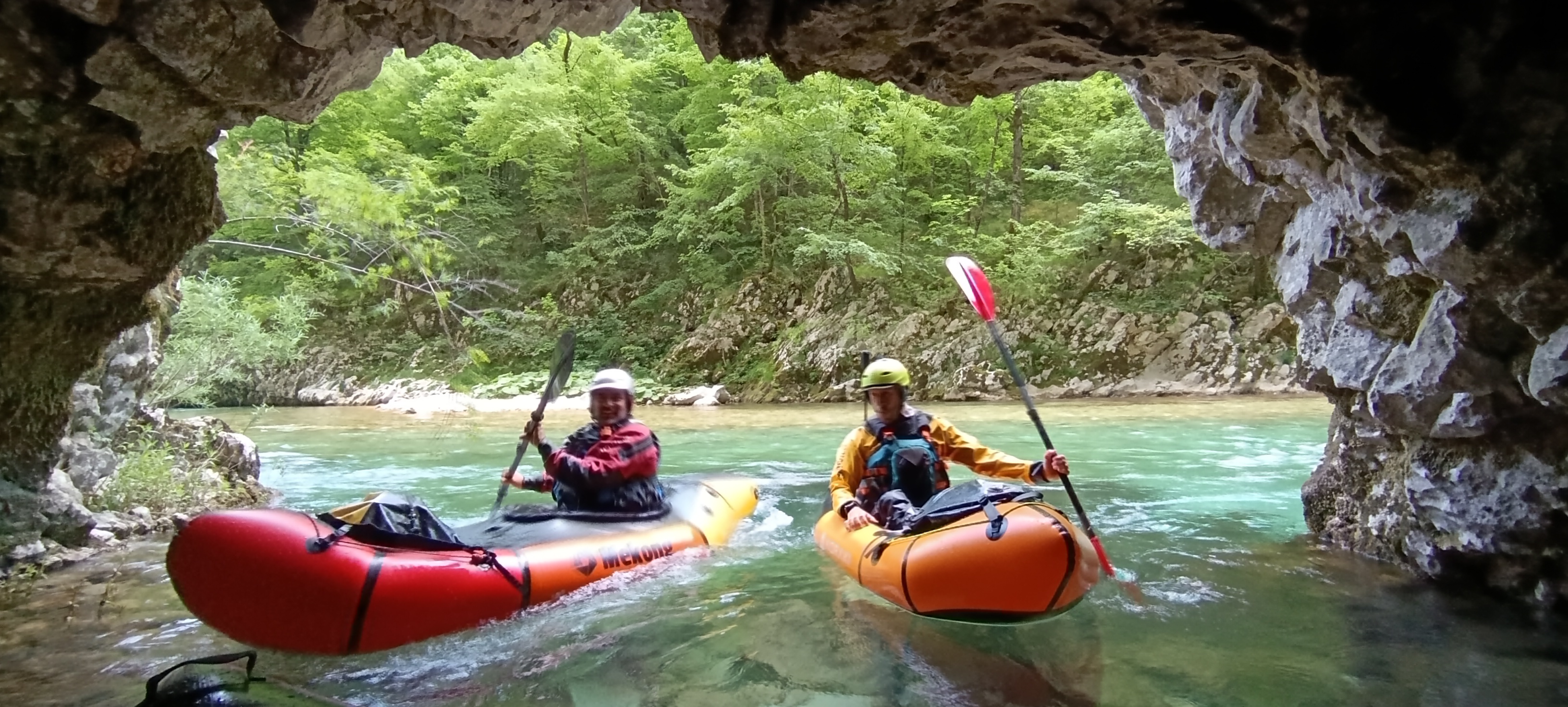
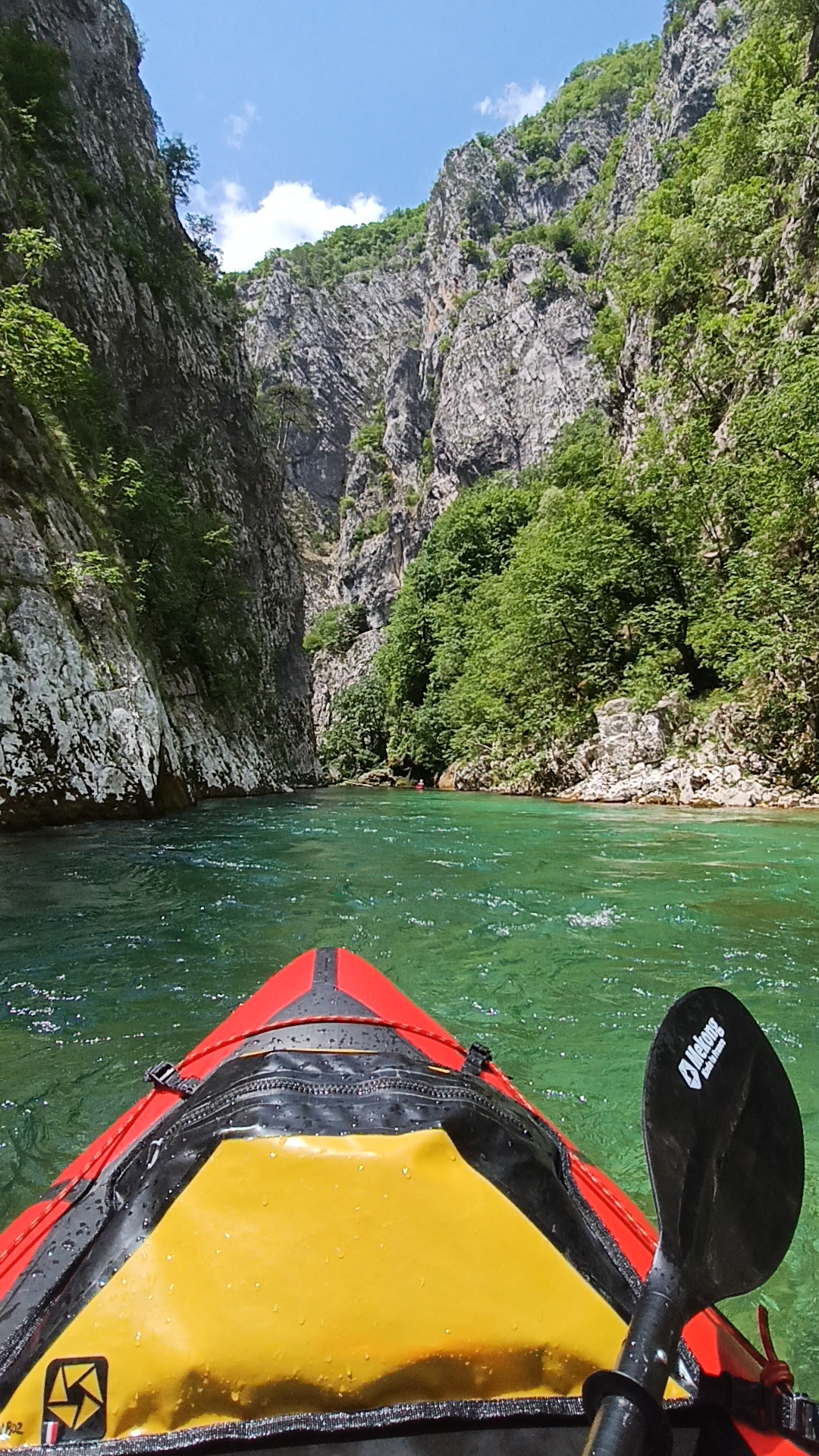
The **Komarnica River** is one of Montenegro's best-kept secrets and one of the most remote and pristine packrafting destinations in the Balkans. While it may not rival the Tara in terms of continuous whitewater or overall suitability for packrafts, its canyon is every bit as spectacular. Deep, wild and virtually untouched, the Komarnica offers a rare feeling of exploration and solitude that has disappeared from many European rivers. The canyon remains largely free from human development and provides an authentic wilderness experience in the heart of Montenegro. ([packraftmontenegro.com][1])
???? Video of the Komarnica Canyon (RoWild):
[https://www.youtube.com/watch?v=X2AiytxQmbM](https://www.youtube.com/watch?v=X2AiytxQmbM)
???? Detailed guide for this specific section:
[https://blog.packrafting.cat/packraft-en-el-canon-de-komarnica-en-montenegro](https://blog.packrafting.cat/packraft-en-el-canon-de-komarnica-en-montenegro)
For many paddlers, the true attraction of the Komarnica is not the whitewater itself but the journey through one of Europe's least explored river canyons. Crystal-clear water, dramatic limestone cliffs, waterfalls, hidden beaches and complete wilderness accompany paddlers throughout the descent. The feeling is closer to an expedition than a typical river run. ([packraftmontenegro.com][1])
????♂️ The Komarnica is also included in our **Packraft Balkans Tour 2026**, where it perfectly complements the more famous Tara River by offering a completely different experience focused on exploration, scenery and wilderness:
[https://blog.packrafting.cat/packraft-balcans-tour-2026](https://blog.packrafting.cat/packraft-balcans-tour-2026)
The river flows through one of the most beautiful and least visited canyons in Montenegro. Unlike many European rivers that have been altered by roads, dams or settlements, the Komarnica still feels genuinely wild. Long sections of the canyon can only be accessed on foot or from the river itself, making it a unique destination for adventurous paddlers seeking something beyond the usual rafting routes. ([balkanexpeditions.com][2])
???? Detailed river information, logistics, access points, maps, water levels and trip reports:
[https://go.packrafting.cat/app](https://go.packrafting.cat/app)
If you are looking for pristine wilderness, spectacular canyon scenery and the feeling of discovering a hidden corner of Europe, the Komarnica is one of the most rewarding rivers in the Balkans and a perfect complement to the legendary Tara Canyon.
[1]: https://packraftmontenegro.com/tour/komarnica-3-day-packrafting/?utm_source=chatgpt.com "Komarnica 3 Day Packrafting - Packraft Montenegro"
[2]: https://balkanexpeditions.com/2024/08/12/packrafting-the-wild-komarnica-river/?utm_source=chatgpt.com "Packrafting the Wild Komarnica River – Balkan Expeditions"
 • #7414 • 22.06.2026 11:46
Info
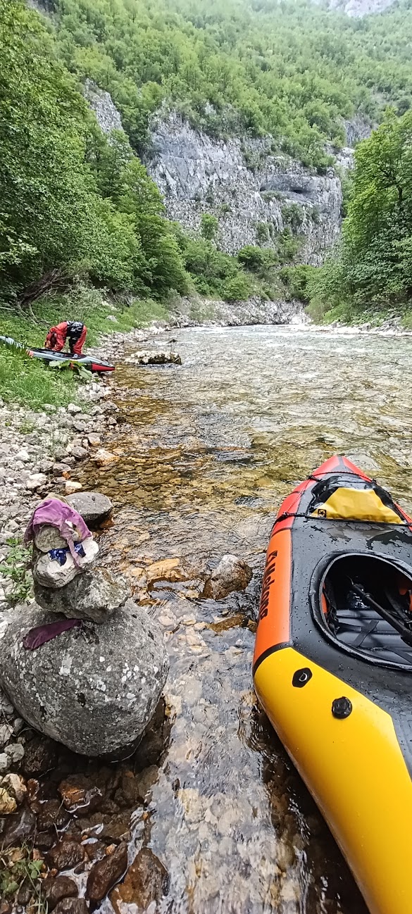
I paddled this section April 11-th 2025 at 100 cm. We drove past the Woodland cabins as far as the car took us on the dirt road (42.97433, 19.00147). From here we walked down some 300m in altitude (~1 hour when carrying kayaks) to the put in at 42.97478, 19.01853. There is a gauge right on the opposite side of the river. This is a very scenic section in a deep gorge on only moderately difficult white water. We organized ourselves a boat to pick us up at the beginning of the lake so we didn't have to paddle the remaining 10km or so on flat water.


 • #6866 • 08.09.2025 22:58
Info
Bevor die Komarnica 1976 gestaut wurde, hat sie laut Erzählungen sogar die Tara an Schönheit übertroffen. Heute ist nur noch dieser kurze Abschnitt übrig. Er ist wunderschön und bietet viel Wildwasser II und etwas Wildwasser III. Wir sind ihn am 14.6.2025 bei niedrigen, aber ausreichenden Wasserstand (Pegel Timar 8 cm) gepaddelt. Um zum Einstieg zu gelangen hat man drei Optionen: Man kann von der Ebene bei Donja Brezna 300 Höhenmeter in die Schlucht absteigen (wird meist gemacht), man kann von Duzi 300 Höhenmeter in die Schlucht absteigen (den Weg habe ich auf OpenStreetMap eingetragen) oder man kann durch die Schlucht der Bukovica ab Savnik zum Einstieg paddeln. Wir sind die Bukovica gepaddelt, sind dann ohne Ausrüstung nach Duzi aufgestiegen, haben dort übernachtet und sind am nächsten Morgen wieder zum Einstieg der Komarnica abgestiegen. Für die Komarnica haben wir mit Pausen gemütliche dreieinhalb Stunden gebraucht. Anschließend paddelt man 10 km auf dem Stausee zum Ausstieg. Das habe ich nicht als notwendiges Übel empfunden, sondern als echtes Bonus-Highlight. Wenn man Gas gibt, schafft man es in unter 2 Stunden, ich habe sehr gemütliche 2 Stunden 40 min gebraucht. Wenn man fit ist und früh startet, kann man Bukovica und Komarnica auch an einem langen Tag schaffen.
Die Komarnica ist durch Pläne für einen Staudamm in Gefahr! Aktuelles dazu findet ihr unter https://www.savekomarnica.com/
Nach 0,0 km 42.97473, 19.01834
Einstieg tief unten in der Schlucht
Nach 1,2 km 42.97975, 19.00706
Links kleine Perlenwasserfälle direkt in die Komarnica
Nach 4,0 km 42.99033, 18.98176
Rechts Schleierfälle
Nach 9,4 km 43.01008, 18.93784
Stauwurzel des großen Stausees. Nach Sattelitenbildern zu urteilen, fließt die Komarnica bei herbstlichem Niedrigwasserstand des Stausees noch bis zu 2 km weiter.
Nach 9,9 km 43.01232, 18.94180
Verfallene Hängebrücke und in die Wände gefräste Gänge. Hier wurden um das Jahr 2000 das Gestein der Wände für den geplanten Staudamm untersucht.
Nach 19,6 km 43.05898, 18.88432
Ausstieg an der Brücke Most Braće Gagović


 • #6862 • 08.09.2025 17:11