Rivermap
HomeThe Map
List View
Befahrbarkeit
English Summary
Karte Einbetten
Systemstatus
Kontakt und Team
Datenlieferanten
Contributor Agreement
The RCSD
Public licenses
Rivermap Japan
![]() "Rivermap Supporter" Group
"Rivermap Supporter" Group
Flusshinweise
Als Grundlage dient wenn immer möglich ein Flussführer.
Bukovica: Upper
II-III (V) 0 km

Bukovica @ Timar 25 cm @ 14.05.2026 12:00
? | ? cm
Resultate 1 - 2 von 2
Bewertung NW-MW-HW
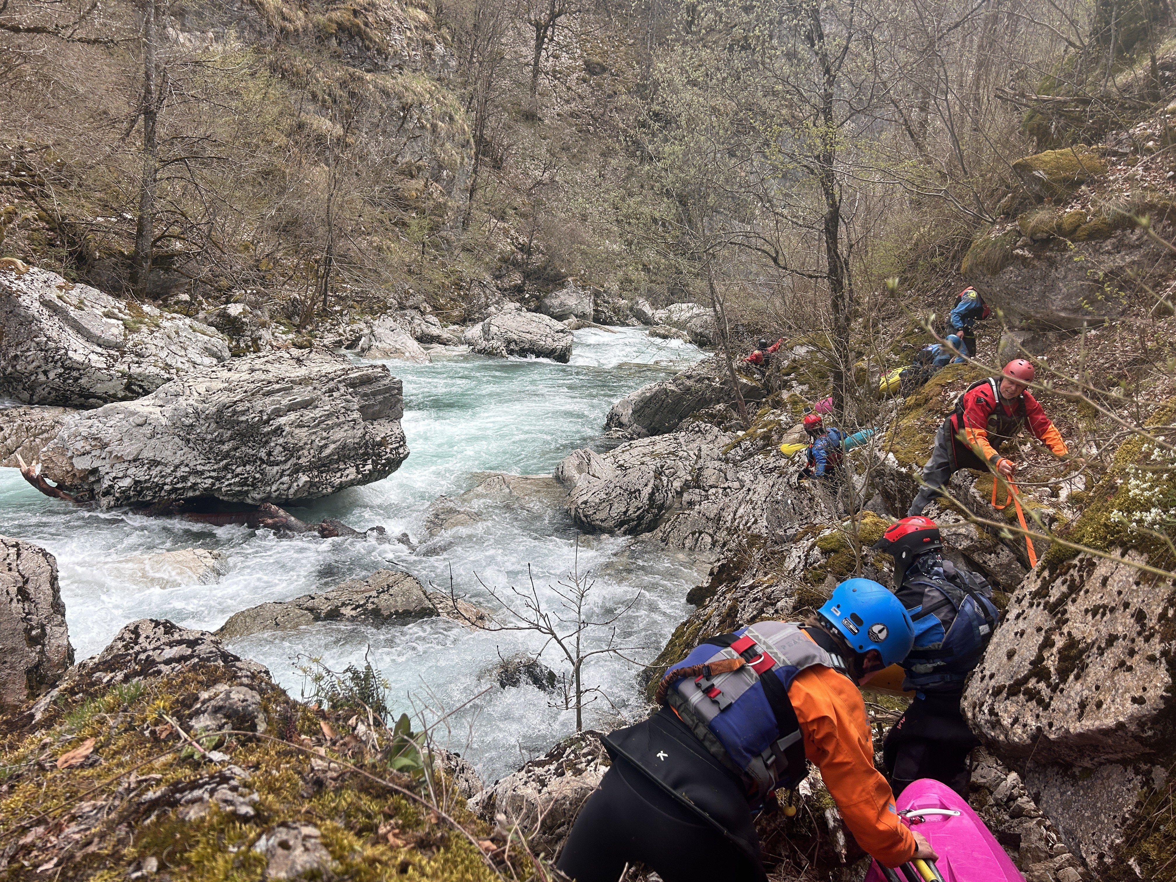
We paddled the Bukovica on April 16, 2026, at a water level of 44 cm. The classification II–III (V) is definitely misleading — such notation suggests a Class II–III river with a single Class V rapid. Unfortunately, that is not the case. The Class V section is actually an entire stretch of at least 1 km (beautiful, but very difficult to portage, if possible at all).
We started at Podmalinsko Monastery. The Class V section begins after approximately 2.5 km of Class II–III river. In our case, upon reaching the Class V section, we had to retreat upstream — the group’s skill level and the serious consequences of capsizing did not allow us to continue. This stretch runs through a canyon with no possibility of evacuation. We did a short scout of the Class V section — there are quite a few recirculating holes at 44 cm, and siphons are forming.
If possible, we kindly ask for the description and classification to be verified. This section should be rated as Class V with occasional Class II and III sections.
 • #7253 • 26.04.2026 21:57
Info
Folgende beiden Videos zeigen diesen Abschnitt:
ab 5:33: https://www.youtube.com/watch?v=Cz8RVIcIUhc&t=333s
https://www.youtube.com/watch?v=yj_6x5Yix7k
ab 5:33: https://www.youtube.com/watch?v=Cz8RVIcIUhc&t=333s
https://www.youtube.com/watch?v=yj_6x5Yix7k
• #6996 • 18.09.2025 18:51