Rivermap
HomeThe Map
List View
Befahrbarkeit
English Summary
Karte Einbetten
Systemstatus
Kontakt und Team
Datenlieferanten
Contributor Agreement
The RCSD
Public licenses
Rivermap Japan
![]() "Rivermap Supporter" Group
"Rivermap Supporter" Group
Flusshinweise
Als Grundlage dient wenn immer möglich ein Flussführer.
Neretva: Canyon
II (III) 0 km

Neretva @ Mostar 255 cm @ 13:45
150 | 200 .. 450 | 600 cm (Indirect calibration!)
Resultate 1 - 3 von 3
Info
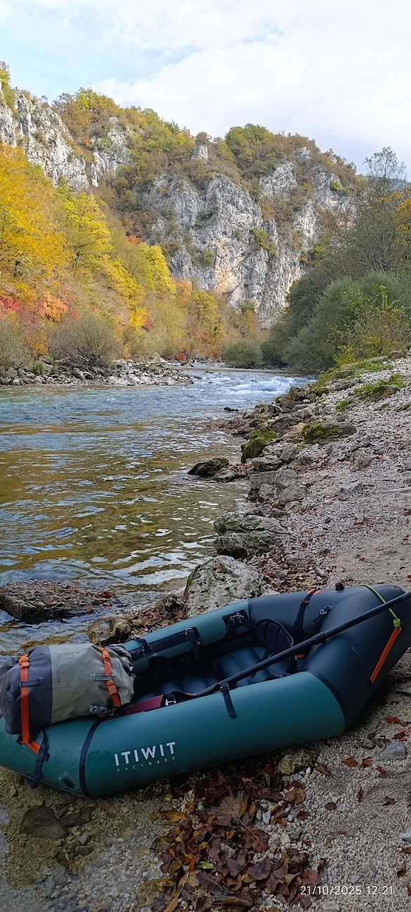
We completed this memorable descent through the Neretva Canyon during the Packrafting.cat Balkans Tour 2026, our third consecutive year exploring some of the most beautiful rivers in the Balkans.
The Neretva is one of the region’s most iconic rivers, famous for its crystal-clear turquoise water, spectacular limestone canyon, and remote wilderness setting. Paddling through this canyon offers a unique combination of scenery, adventure, and continuous whitewater that makes it a highlight of any trip to Bosnia and Herzegovina.
Surrounded by towering cliffs and untouched nature, this section showcases the Neretva at its finest. Whether you are drawn by the stunning landscapes, the clear water, or the quality of the paddling, the canyon delivers an unforgettable packrafting experience.
For more information about our Balkans expedition:
• https://blog.packrafting.cat/packraft-balcans-tour-2026
Read our full article about packrafting on the Neretva River:
• https://blog.packrafting.cat/packrafting-on-the-neretva-river-bosnia-and-herzegovina
You can also find the route, maps, logistics, and additional information in the Packrafting.cat route app:
• https://go.packrafting.cat/app
 • #7405 • 19.06.2026 10:43
Info
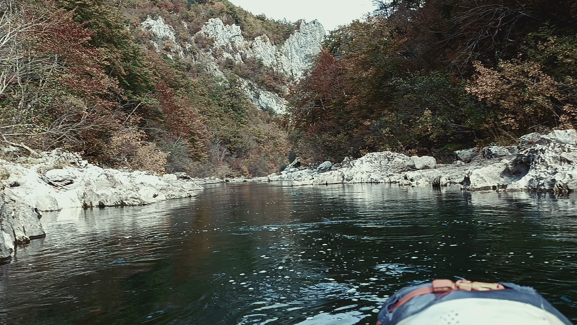
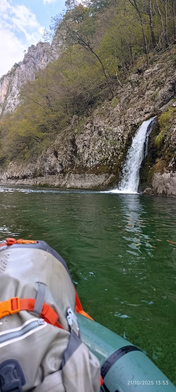
Die Neretva fließt durch eine wunderschöne Schlucht, die es landschaftlich mit Tara und Moraca aufnehmen kann. Sie bietet viel Wildwasser I und II mit vier Stellen III. Wir sind die Neretva am 19.6.2025 bei einem schönen, eher niedrigen Wasserstand gepaddelt. Für die Neretva gibt es leider keinen guten Onlinepegel (der hier angegebene Pegel befindet sich weit flussabwärts unterhalb der Stauseen) , deshalb hier zur Einschätzung die Pegel von Tara (10 cm) und Moraca (35 cm) an jenem Tag. Während das Wasser auf der Moraca bei diesem Pegel schon etwas knapp ist, hat es auf der Neretva problemlos gereicht.
33 km flussaufwärts wird seit 2010 ein Kraftwerk bei Ulog 43.45361, 18.31529 gebaut. Die Fertigstellung war für 2023 geplant, aber noch ist es nicht so weit (Stand 2025). Falls das Kraftwerk in ein paar Jahren ans Netz geht, wird es die Neretva in dieser Form nicht mehr geben.
Nach 0,0 km 43.53430, 18.06809
Einstieg, von der Straße gut zu erreichen
Nach 2,7 km 43.55425, 18.07038
Rechts Mündung der Rakitnica
Nach 5,9 km 43.57623, 18.04842
Erste Stelle III
Nach 7,0 km 43.58441, 18.04349
Beginn der 3 km langen Kernschlucht mit Wänden auf beiden Seiten
Nach 7,6 km 43.58989, 18.04408
Rechts zwei schöne Karstquellen in Form eines kleinen und eines großen Wasserfalls
Nach 8,4 km 43.59662, 18.04081
300 m bis III+ vor einer markanten Linkskurve
Nach 10,1 km 43.59961, 18.02500
Ende der Kernschlucht, das Tal öffnet sich. Hier befindet sich die dritte Stelle III
Nach 12,6 km 43.61765, 18.01222
Links burgartiges Gebäude eines Rafting-Unternehmens nach einer Stromschnelle III-
Nach 13,9 km 43.62618, 18.00515
Straßenbrücke Spiljanski Most
Nach 15,0 km 43.63428, 17.99486
Rechts Titos Bunker getarnt als gewöhnliches Wohnhaus. Wegen dieser Militäranlage war es zu Zeiten Jugoslawiens streng verboten, die Neretva zu paddeln.
Nach 17,0 km 43.63970, 17.97512
Ausstieg links an der Mündung der Bijela
")
")
") • #6863 • 08.09.2025 17:24
• #6863 • 08.09.2025 17:24Info
Put-out possible in Konjic town, which is I-II. For more information, maps and gpx tracks of the river, see local WW map of B&H: https://white-water.ba/
• #6825 • 17.08.2025 21:22