Flusshinweise
Als Grundlage dient wenn immer möglich ein Flussführer.
Landquart: Klosters - Gulfia
IV-V (V) 0 km

Landquart @ Küblis by Swiss Canoe 112 cm @ 17:11
120 | ? cm (Indirect calibration!)
Resultate 1 - 4 von 4
Bewertung NW-MW-HW
Die Strecke ist mit einer neuen Messstation vom SKV verknüpft. Der NW-Wert ist rein geschätzt. Bitte hier melden, wenn die Strecke gefahren wurde. Je mehr Erfahrungswerte, desto besser wird die Kalibrierung.
Rivermap Team
Rivermap Team
Info
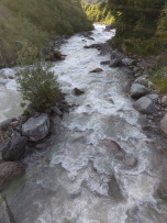
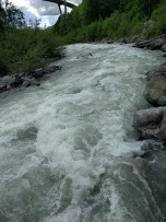
Ran it today 10.06.22 at 10.9m3/s on the upper gauge all the way to schiers. The plant takes a max of 5.5m3/s out, thus it was around 7m3/s on the river. This level is the minimum required to run the section. quite rocky at that level and max class 4+ and one portage, I asssume around 13 should be quite the good level without portages but with more it will quickly become a super steep, fast class V. It has almost 70m vertical drop in the first 500m.
At the first bridge watch out for the undercut rock in the main flow. Treesiphon quite quickly after.
At the first bridge watch out for the undercut rock in the main flow. Treesiphon quite quickly after.
Befahrbarkeit
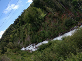
Angeschaut bei ca 60m^3/s auf der unteren Landquart. Optimaler Nidrigwasserpegel. Erstes Stück bis Zufluss Schlappinbach (46°52'58.3"N 9°51'41.2"E) sehr konstant V-VI. Ab da aber sehr lohnenswert IV-V mit sehr sehr wenigen Kehrwassern. Empfohlen als alternativer Einstieg https://goo.gl/maps/UADSeze9KtC2. Fahrbar bis Schiers! nicht bei angegebenen Austieg. Empfehlenswert, aber Achtung wegen Bäumen. Meist brauchts 50-200m zum anhalten.
Info
Wasser wird bei Klosters abgeleitet und kommt erst oberhalb Küblis wieder hinzu. Nur bei viel Regen und guter Schneeschmelze fahrbar. Es darf aber auch nicht zuviel Wasser drin haben. Visuell ca. 5m3/s


