Flusshinweise
Als Grundlage dient wenn immer möglich ein Flussführer.
Toce: Crodo - Pontemaglio
III-IV 0 km

Toce @ Pontemaglio 15 cm @ 05:00
30 | 50 .. 80 | 100 cm
Resultate 1 - 2 von 2
Bewertung NW-MW-HW
wanted to paddle it 11.10.2020, one week after the heavy floods, gauge read 62cm (medium level according to current calibration), but flow looked like in winter and not navigable at all. The flood most likely dis-calibrated the gauge.
Info
We did this section yesterday (14 June 2018), it was great, some nice, busy grade 4 rapids, some shallow grade 3 boogie and a grade 5 feature. The water level was around 90cm with a spike up to about 110cm.
Its important to know that the river can rise rapidly without warning, this happened to us, luckily at the time we were on the bridge scouting the grade 5 feature, the river came up significantly within a couple of minutes, pretty scary if you are in your boat in the middle of the river above a rapid (especially the grade 5 rapid!), so be aware of this and make sure you pull your boat up high when you get out to scout things.
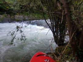
There are many small islands covered in trees on the river, and multiple times the river splits into 2,3 or 4 channels around these islands so its hard to know which channel to take, we got it wrong a couple of times and had to fight through the trees (not easy its very thick) to find a better way. You must also be careful of the water flowing into these trees.
We put in and took off in slightly different places as stated in the info, our put in was 46.231436, 8.327333, and our take out was 46.172427, 8.315399, both places are easy to find, suitable parking and easy access to the river and the take out bridge is easily seen from the river.
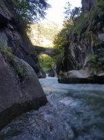
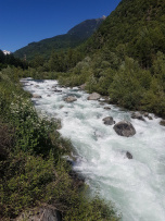
The river starts nicely with some grade 3/4 fun, all pretty clean and fun we just boat scouted and eddy hopped at this water level. Then there is a long grade 4 rapid that starts at a partial concrete weir, we could stand on the weir on river right and climb up on the wall to scout it, the water goes down a big tongue on the left but at the flow we had (90cm) it wasn't safe to run so we climbed below the weir and ran the rest of the rapid. There are a few man made weirs on the river so be careful whenever you see a horizon line. After that it became more grade 2/3 and shallow for a long time and many tree islands to navigate. Immediately after a tree island you see a stone arch bridge and directly under this is the grade 5 feature, you can easily look at it when you drive the shuttle before getting on, its location is 46.182408, 8.323171, we walked around it and seal-launched back in from river left under the bridge (thats pretty cool) into a beautiful gorge, its only 150m long and no more big rapids in it. After the gorge there is another tree island we went right but there is a small, 1 foot high (I think natural) weir towards the bottom that is hard to see, we managed to stop right above it and portage it in the tree island (not fun), if you stayed straight and kept your nose up with speed I would say you would get straight over it no problem but the boil line was about 2 or 3 meters from the weir so it would defiantly hold you in there in your boat for the rest of the day so treat it with caution, or take the left channel around the tree island.
Hope that info helps you, its a great river, enjoy
The river starts really nicely with


