Flusshinweise
Als Grundlage dient wenn immer möglich ein Flussführer.
Venter Ache: Untere (P4 - Zwieselstein)
IV 3.91 km direct

Venter Ache @ Vent (altes Feuerwehrhaus) 48 cm @ 22:30
50 | 75 | 100 cm
Resultate 1 - 20 von 22
der Baum von #6304
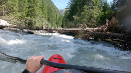
baum quer über ganzen fluss kurz nach einstieg. sichttbar von der einstiegsbrücke. pegel 62cm, 20.9.2024. umtragbar rechts, kleines kehrwasser davor
Befahrbarkeit
Gepaddelt am 2.9.23 (nach dem Hochwasser) bei 70cm. Alles gut fahrbar, wenig Holz nicht in Fahrlinie
Momentan in der zweiten Hälfte der unteren Venter noch viel Fallholz im Wasser. Bei höherem Pegel können gewisse Bäume nicht mehr unterfahren werden... Gut scouten.
There is a tree at the end of the last rapid before the take out.
No problem at 60+cm, unless swimming. Might have to pay attention at even lower flows
No problem at 60+cm, unless swimming. Might have to pay attention at even lower flows
Gefahr aufgehoben
Alles Fahrbar, keine bäume
Fahrverbot
Do NOT cross the fields when putting in. The farmer owning them is extremely angry at kayakers and is threatening to ban access.
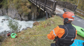
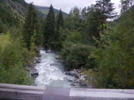
Cross the wooden bridge and lower your kayaks down to the river on the right just after the bridge. You'll see a steep and slippery, but short, path down. That's the one.
Cross the wooden bridge and lower your kayaks down to the river on the right just after the bridge. You'll see a steep and slippery, but short, path down. That's the one.
Info
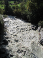
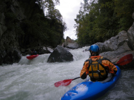
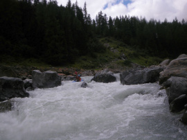
At around LW (50cm) this is an easy class III with 2 or 3 class IV-ish spots. Amazing scenery all the way down.
Befahrbarkeit
Der Baum in der Nähe vom Start aus Hinweis #3486 ist weg.
Den Baum über der letzten Stufe kurz vor Ende gibt es noch, war aber bei unserem Wasserstand nicht kritisch.
Den Baum über der letzten Stufe kurz vor Ende gibt es noch, war aber bei unserem Wasserstand nicht kritisch.
Trees in the Lower Vent.
First one is close to the start and sneaks up on you. Hard right you can get down at 120 on gauge but you don't want to be left. Which is the usual line! The second is towards the end. I would call the the last main rapid. You can get under it and it's not an issue unless at higher flows. Maybe around 140 on gauge? Didn't get this one on gopro.
Stay safe ✌️
Source: https://www.facebook.com/photo.php?fbid=3080185231999519&set=a.219825654702172&type=3&theater
Bewertung NW-MW-HW
Am 21.09.18 eingebootet bei 110cm (Vent: Feuerwehrhaus), ausgebootet bei 120cm. Noch gut zu fahren, aber deutlich anderer Charakter.
100 cm HW Marke für WW4 passt ganz gut.
100 cm HW Marke für WW4 passt ganz gut.
In der letzten Schlucht befindet sich in der linken Durchfahrt ein Baum. Bei mehr Wasser zieht das Wasser stärker darauf zu. Daher Achtung und unbedingt die rechte Durchfahrt wählen.
Befahrung 09/09/2018
Befahrung 09/09/2018
Gefahr aufgehoben
Baum vor der ersten Schlucht nicht mehr vorhanden
Befahrbarkeit
Befahren am 18.09.2015 bei Pegel 210cm Tumpen bzw 75cm Vent(altes Feuerwehrhaus)/Venter Ache. Schön rund. Freie Fahrt auf ganzer Strecke.
Info
Info
Pegel: Tumpen / Oetz
NW: 170cm
MW: 205cm
HW: 230cm, schnell, kräftige Walzen
http://www.tirol.gv.at/themen/umwelt/wasser/wasserkreislauf/wasserstand/hwpegel/
NW: 170cm
MW: 205cm
HW: 230cm, schnell, kräftige Walzen
http://www.tirol.gv.at/themen/umwelt/wasser/wasserkreislauf/wasserstand/hwpegel/


