Rivermap
HomeThe Map
List View
Befahrbarkeit
English Summary
Karte Einbetten
Systemstatus
Kontakt und Team
Datenlieferanten
Contributor Agreement
The RCSD
Public licenses
Rivermap Japan
![]() "Rivermap Supporter" Group
"Rivermap Supporter" Group
Flusshinweise
Als Grundlage dient wenn immer möglich ein Flussführer.
Saine: Montliboz - Syam
IV-V 0 km

Saine @ Syam 0.13 m³/s @ 17:00
8 | 21.5 | 35 m³/s
Resultate 1 - 10 von 10
Befahrbarkeit
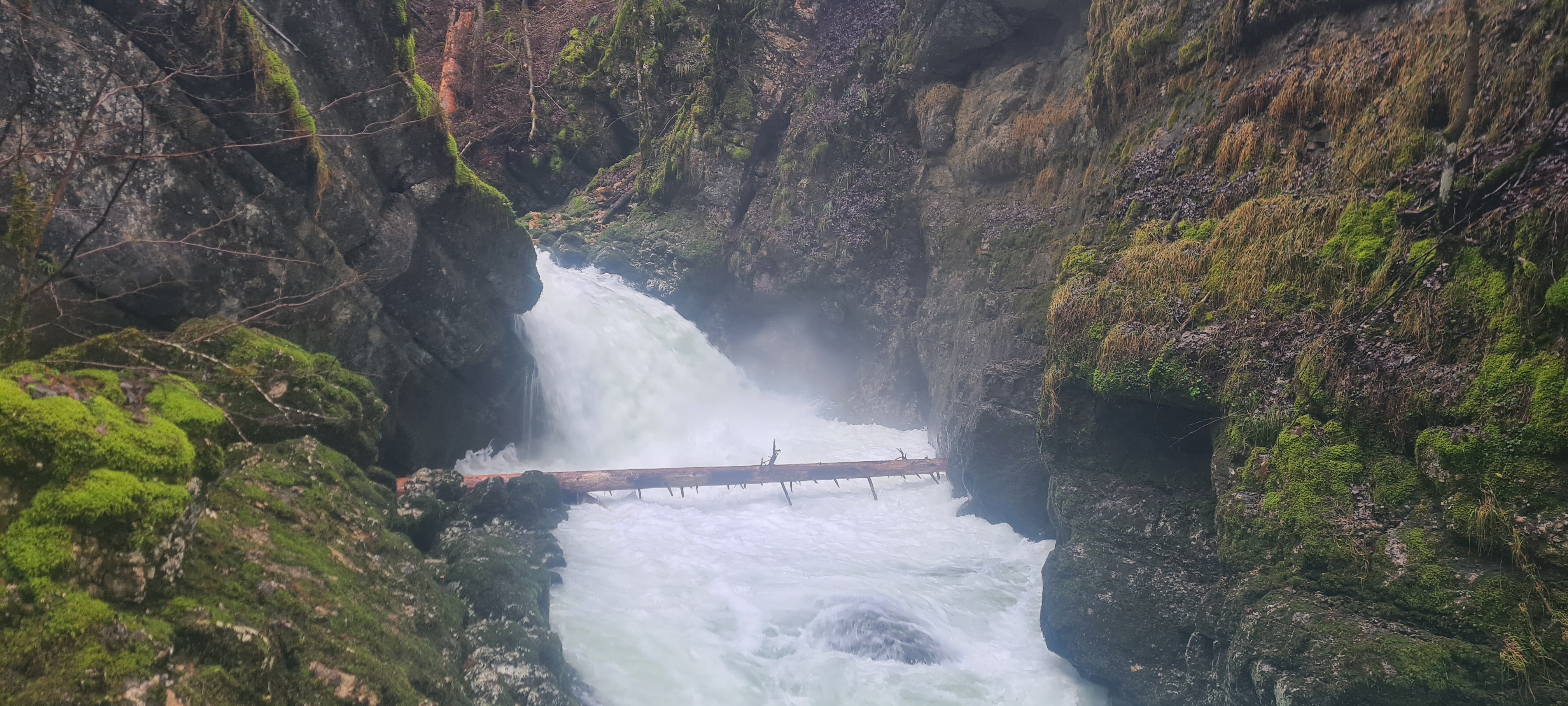
Paddled this section and the upper Saine gorge today (17 May) at 11,5 m3 (Syam). Low water, but still a fine run. Upper section all clean, lower gorge has some trees in Mikado rapid and a tree in the 4m drop. Both could be runnable but the lines are sketchy at low levels.

 • #7307 • 17.05.2026 19:47
There are a lot of trees in the lower Saine. It's not worth doing it at the moment
• #7138 • 15.02.2026 20:07Gefahr aufgehoben
Der Baum hinter dem Wasserfall Mikado ist weg. Am 29.3. War alles gut fahrbar.
• #5772 • 04.04.2024 23:09Tree at the bottom of Mikado.
 • #5687 • 05.01.2024 17:50
Info
erste Häfte:
Gorges de la Langouette - Seuil du chat perché
http://www.eauxvives.org/fr/rivieres/voir/saine/parcours:1034
zweite Hälfte:
Seuil du chat perché - pont de la D279
http://www.eauxvives.org/fr/rivieres/voir/saine/parcours:1035
Gorges de la Langouette - Seuil du chat perché
http://www.eauxvives.org/fr/rivieres/voir/saine/parcours:1034
zweite Hälfte:
Seuil du chat perché - pont de la D279
http://www.eauxvives.org/fr/rivieres/voir/saine/parcours:1035
• #1773 • 04.12.2015 14:31Bewertung NW-MW-HW
Pegel Syam: http://www.rdbrmc.com/hydroreel2/station.php?codestation=609
min. = 8 m3/s
max. = 35 m3/s, ab 30 und mehr wirds "scary"
min. = 8 m3/s
max. = 35 m3/s, ab 30 und mehr wirds "scary"
• #1418 • 22.02.2014 23:35Info
zweite hälfte kann über Forstweg (linkes Ufer) von Brücke bei Syam erreicht werden
zweite Hälfte erträgt höheren Pegel als erste:
MW = 15 m3/s
HW = 22 m3/s
zweite Hälfte erträgt höheren Pegel als erste:
MW = 15 m3/s
HW = 22 m3/s
• #534 • 27.09.2010 00:21Bewertung NW-MW-HW
Pegel Syam: http://www.rdbrmc.com/hydroreel2/station.php?codestation=609
Grafik: http://www.rdbrmc.com/hydroreel2/graphes/6091_1275862264.png
- NW: 4 m3/s (geschätzt)
- MW: 8 m3/s (geschätzt)
- HW: ?
Grafik: http://www.rdbrmc.com/hydroreel2/graphes/6091_1275862264.png
- NW: 4 m3/s (geschätzt)
- MW: 8 m3/s (geschätzt)
- HW: ?
• #271 • 07.06.2010 00:31