Rivermap
HomeThe Map
List View
Befahrbarkeit
English Summary
Karte Einbetten
Systemstatus
Kontakt und Team
Datenlieferanten
Contributor Agreement
The RCSD
Public licenses
Rivermap Japan
![]() "Rivermap Supporter" Group
"Rivermap Supporter" Group
Flusshinweise
Als Grundlage dient wenn immer möglich ein Flussführer.
Setninga: Sjøll - Mogrenda
III-IV (IV) 0 km

Atna @ Atnasjø 12.24 m³/s @ 23:00
16 | 30 | 40 m³/s (Indirect calibration!)
Resultate 1 - 3 von 3
Info
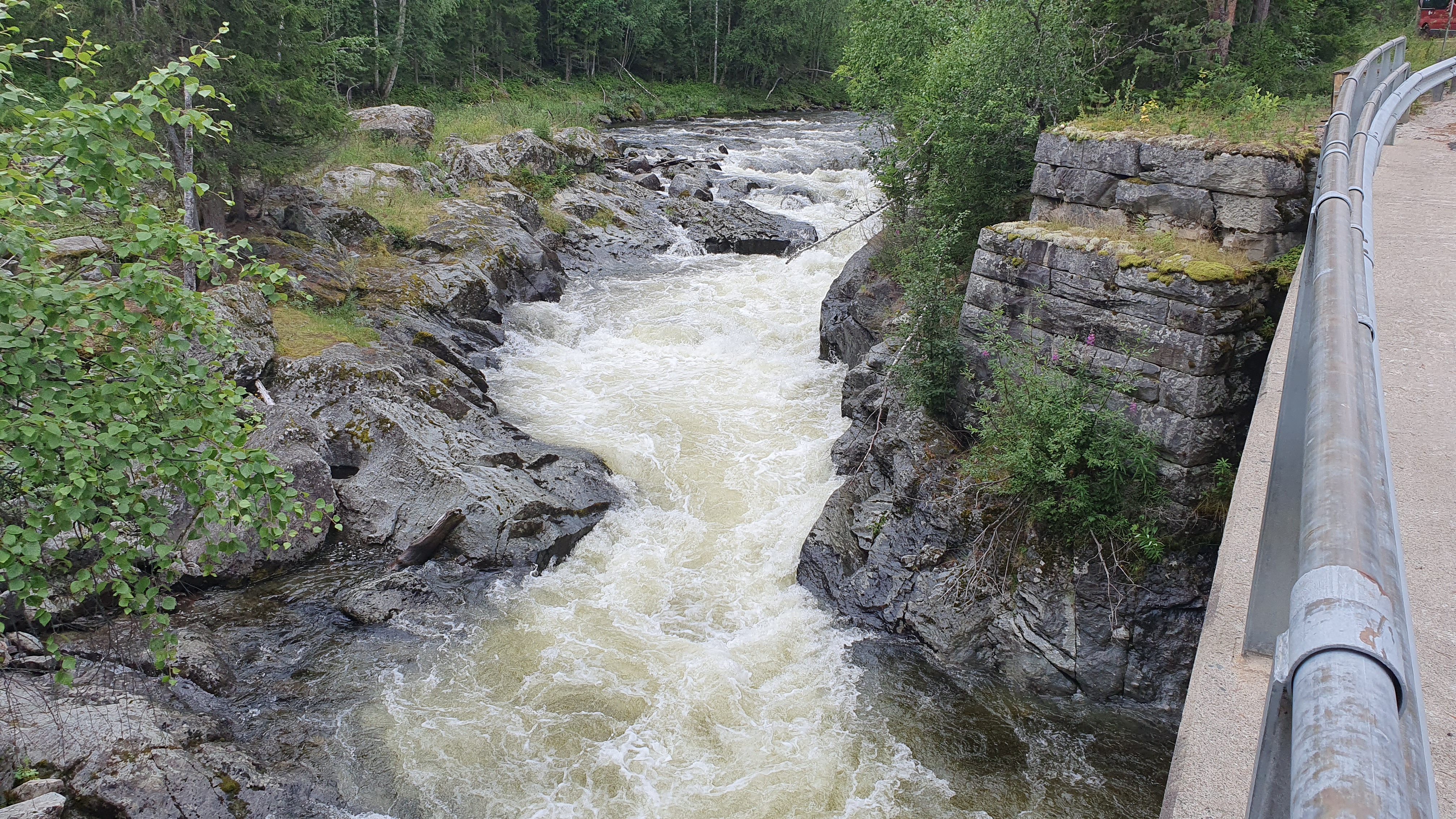
this picture is from the bridge at takeout. this is a good level for a first run (around 10m3s). the IV- rapids can be run on sight (when you are capable of quick reaction and some powerful strokes).
below that level, the class III gravel rapids in the last 2km will become scratchy. above, you better stop for some scouting as soon as you see the river getting narrow and gorgey ...
below that level, the class III gravel rapids in the last 2km will become scratchy. above, you better stop for some scouting as soon as you see the river getting narrow and gorgey ...
 • #6801 • 08.08.2025 11:54
Info
done in august 2025. after 2 days of rain the gauge at Atna was at 24m3s. the level at Setninga was approx 10m3s.
what a nice little river. it starts in a beautiful lake. here and the first kilometers the terrain is open. but it will gradually dig deeper into the valley. most of the time, you are far away from the road.
the first 2km are easy class II. then, at the second bridge, comes the first rapid which is more committing. you better hold the line, or you will be pushed into an undercut.
the following 6km are the most interesting. usually the river is about 15m wide. but when it gets narrow (like 3m), the rapids get pushier IV- and follow quickly after another, sometimes close to walls you want to stay away from.
then the river gets gradually calmer again, until in the last 2km there will be some more III+ rapids. the final rapid, at the takeout bridge, is quite heavy and does not represent the character of the section well. it can easily be portaged on river right.
for those who want to shuttle with their bike: it is not as bad as it looks. the road does climb long, but does so in a moderate angle and the asphalt is in good condition.
• #6800 • 08.08.2025 11:51Ca. 200m vor der Kernstelle Baum , rechts vorsichtig umfahrbar . Atna Pegel lag bei 38 cbm was für die Setninga auf keinen Fall zu viel war . Eine wunderschöne Fahrt am 7.8.25
• #6792 • 07.08.2025 18:16