Rivermap
HomeThe Map
List View


 Flusshinweise
Befahrbarkeit
English Summary
Karte Einbetten
Systemstatus
Kontakt und Team
Datenlieferanten
Contributor Agreement
The RCSD
Public licenses
Rivermap Japan
 "Rivermap Supporter" Group
Flusshinweise
Als Grundlage dient wenn immer möglich ein Flussführer.
 RSS-Feed
abonnieren und nichts verpassen.
RSS-Feed
abonnieren und nichts verpassen.
Maè: Canyon
III+ 0 km
Resultate 1 - 9 von 9
Befahrbarkeit
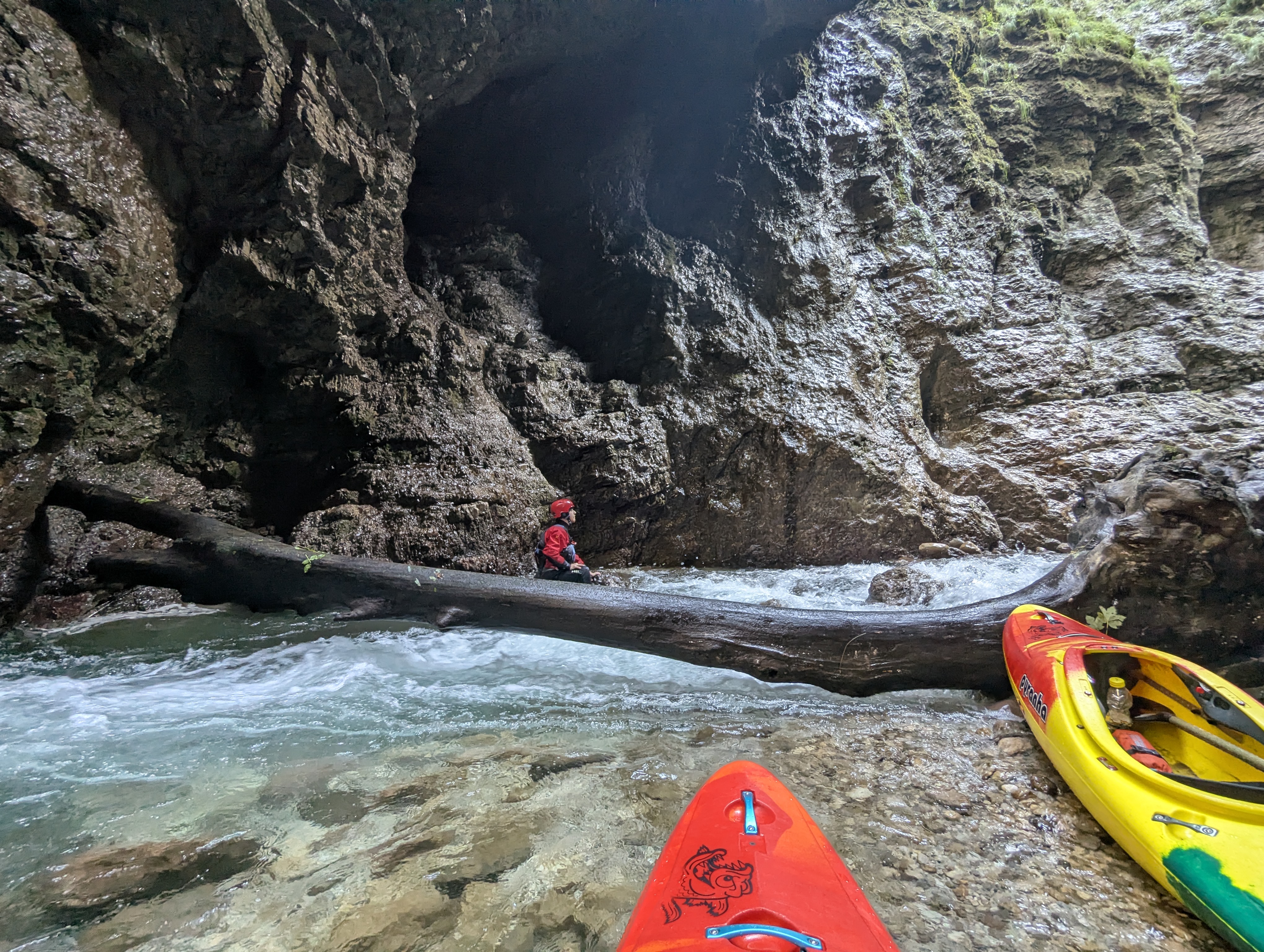
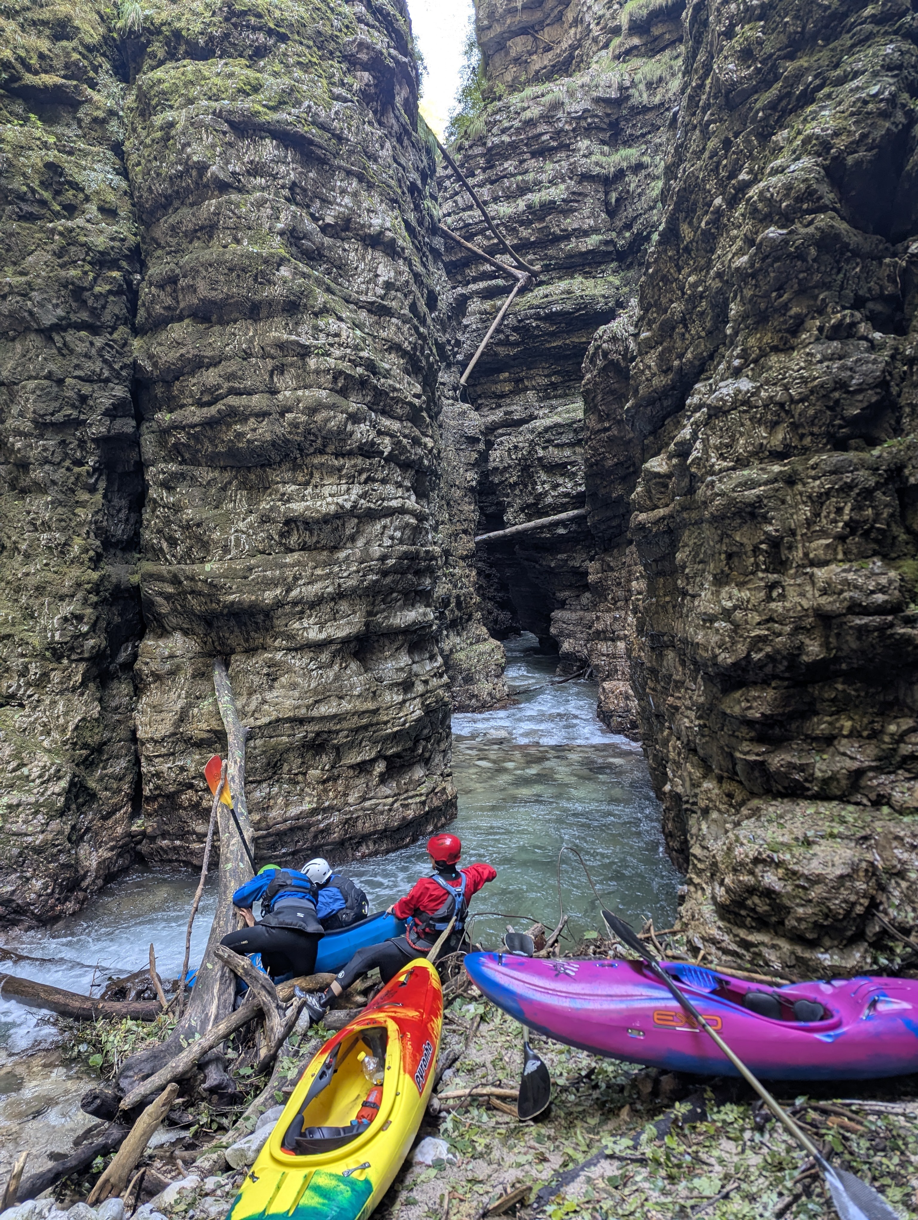
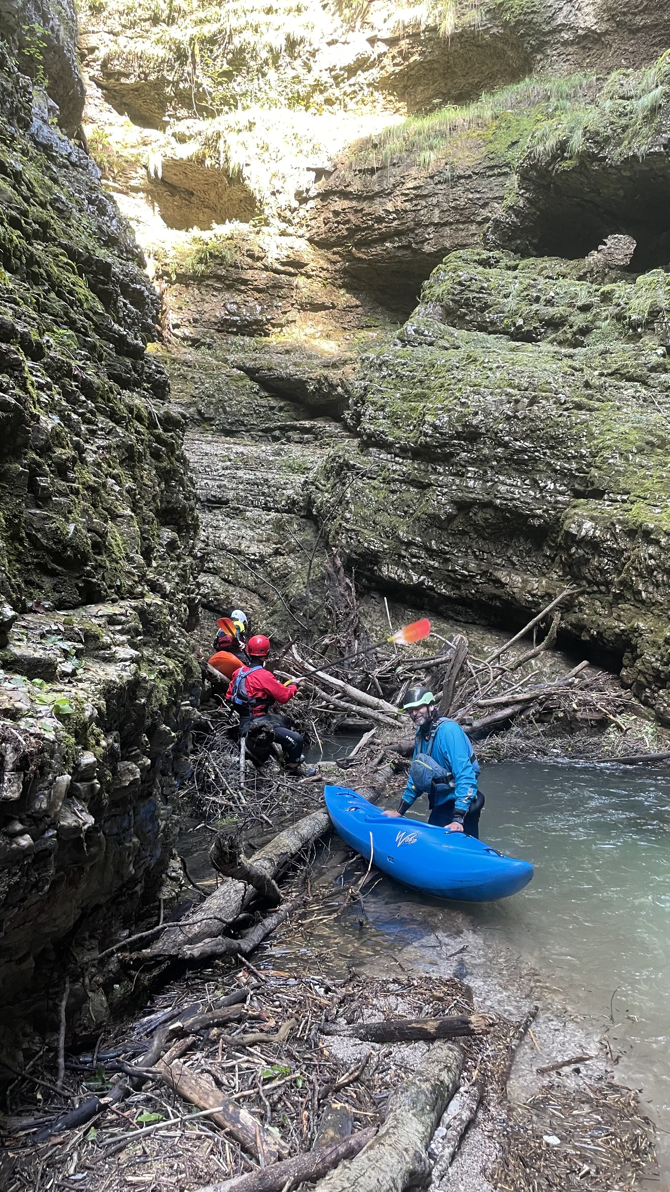
Run on 2026-08-02. Plenty of wood. Several dangerous spots where one or two kayakers had to exit their boat, set safety and help the others by stopping their boats and guiding them around the dangers. We removed one very dangerous tree (or more likely: it collapsed under us and is now out of the way) but several others are left.
5 or 6 places where the river was completely clogged with wood and we had to carry our boats balancing over the slippery half-submerged wood piles.
We had no problems and no swims, but it still took us close to 6 hours from the bridge where you walk down to the take-out. 1 hour to get to the river, 1 hour to carry around the unrunnable, 4 hours in the river. Group of 6. More people: more time.
5 or 6 places where the river was completely clogged with wood and we had to carry our boats balancing over the slippery half-submerged wood piles.
We had no problems and no swims, but it still took us close to 6 hours from the bridge where you walk down to the take-out. 1 hour to get to the river, 1 hour to carry around the unrunnable, 4 hours in the river. Group of 6. More people: more time.
 • #7478 • 03.08.2026 16:04
Info
Consider 1 hour to bring all boats down to the river.
Very soon after putting in there is the unrunnable section. Consider 1 more hour to carry around.
This can be done on river left up a steep path and then lowering the boats down to the river, or on river right by carrying the boats up, down and around boulders, then ferrying to river left and carrying some more to where you can put-in. Either way it will be exhausting.
Expect lots of wood in the gorge. Bring saws. And water to drink. And assume it will be slow going with frequent stops to scout, set safety, carry over staked trees, etc.
Treat this more as expedition style than your ordinary kayak run, but it's worth it. The gorge is absolutely stunning.
Very soon after putting in there is the unrunnable section. Consider 1 more hour to carry around.
This can be done on river left up a steep path and then lowering the boats down to the river, or on river right by carrying the boats up, down and around boulders, then ferrying to river left and carrying some more to where you can put-in. Either way it will be exhausting.
Expect lots of wood in the gorge. Bring saws. And water to drink. And assume it will be slow going with frequent stops to scout, set safety, carry over staked trees, etc.
Treat this more as expedition style than your ordinary kayak run, but it's worth it. The gorge is absolutely stunning.
• #7477 • 03.08.2026 15:37Divers
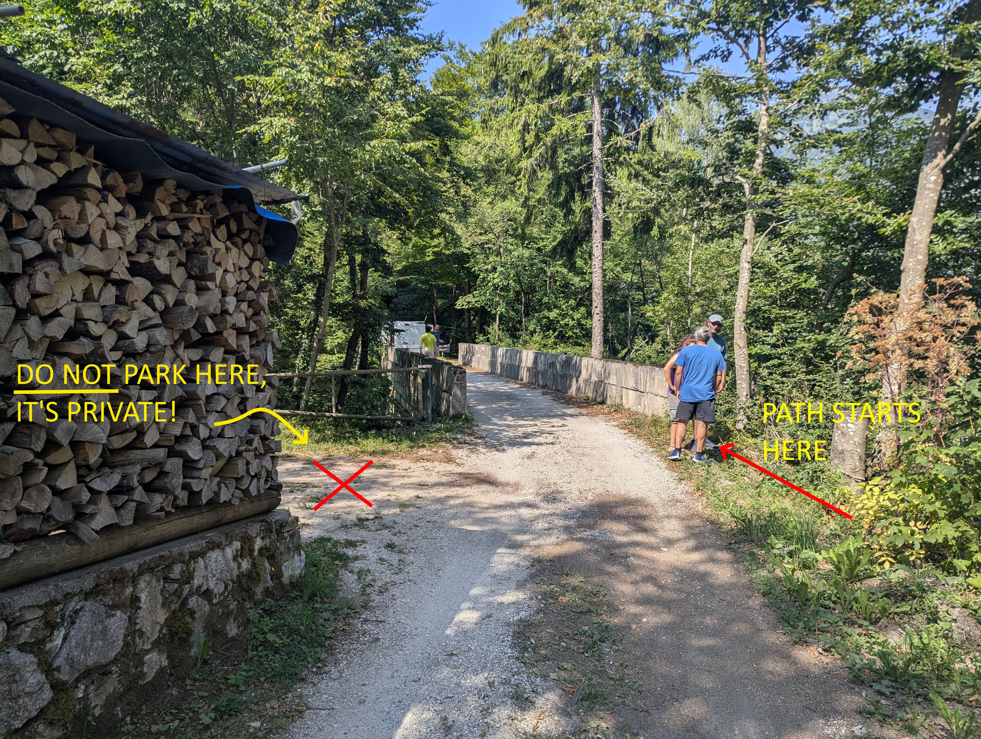
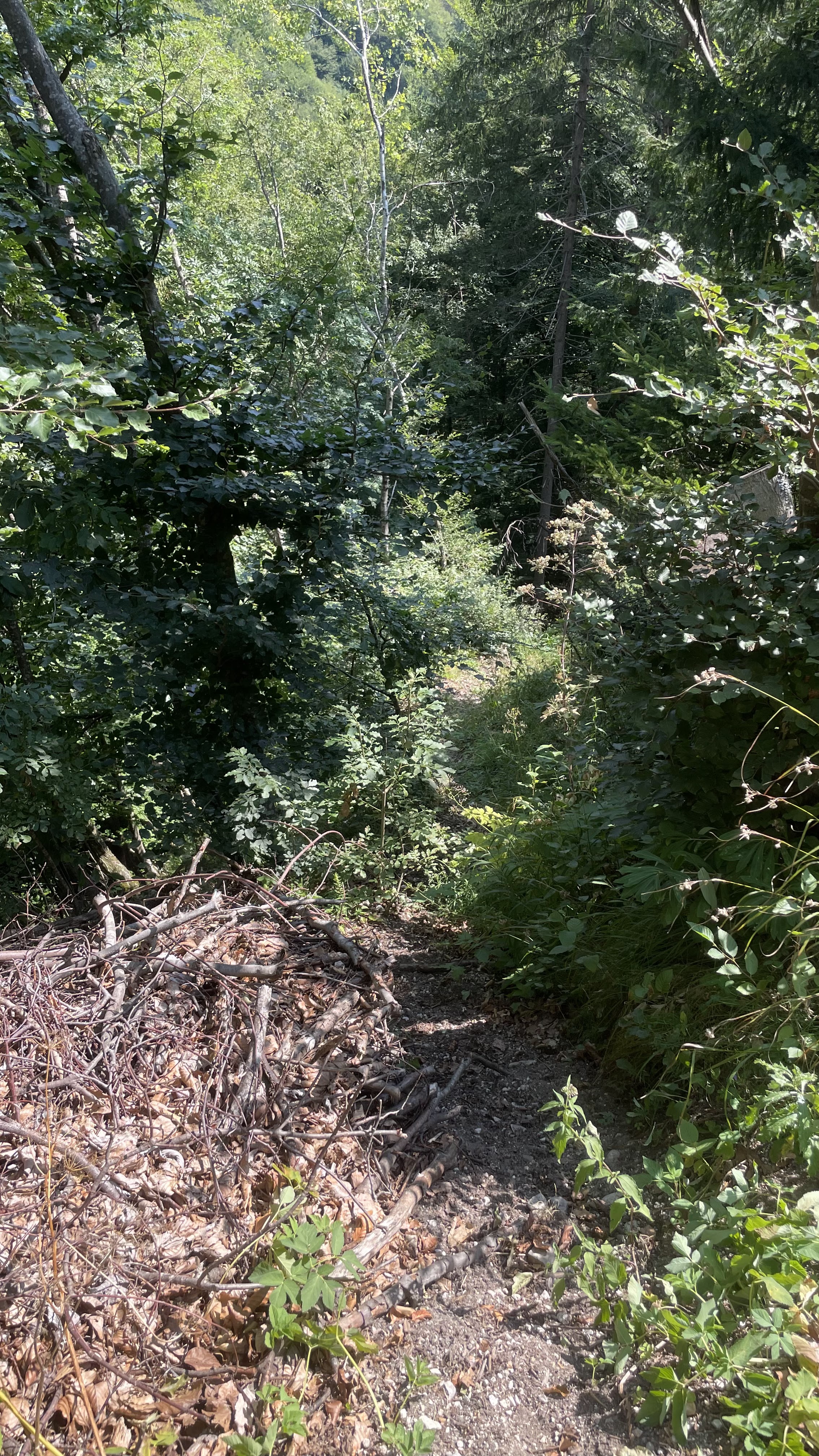
The path to the put-in is at a small bridge over a side creek some kms up a narrow, exposed and only partially paved road that runs on river right. DO NOT use google maps to navigate there because for gmaps there is no road there.
You have to drive up from Longarone, cross a bridge to Muda Mae' and then from there follow the narrow street on river right up to this location where you can park (1 car or small van, don't park like an asshole: people live there): 46.265875, 12.265017
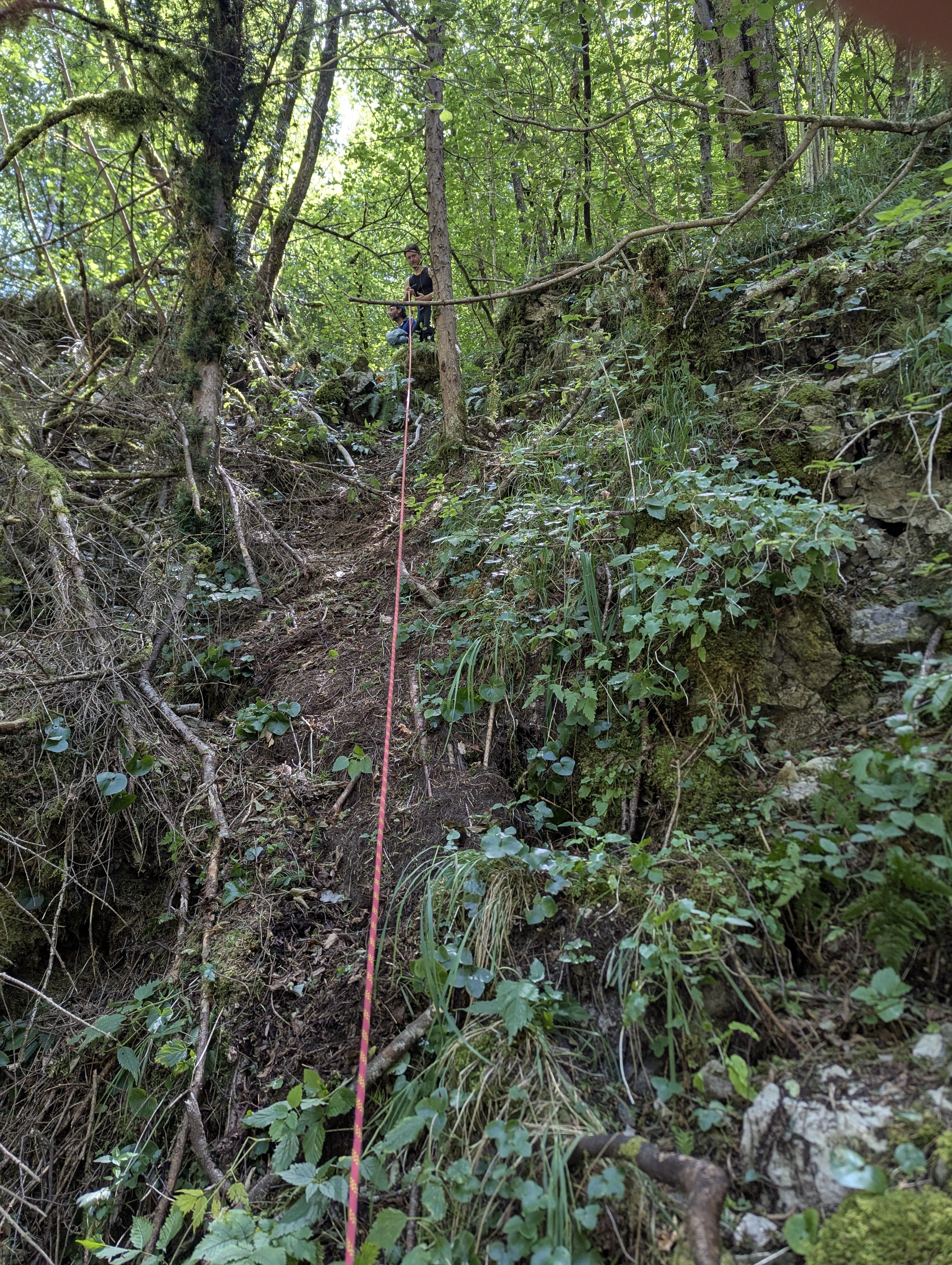
Right before the bridge on the right a steep and slippery path leads down. Prepare to lower your kayaks with ropes. For a group of 6 consider ~1 hour to bring all boats and people down to the put-in.
BRING PLENTY OF WATER TO DRINK IN SUMMER.
Check the pics for parking and the location.
You have to drive up from Longarone, cross a bridge to Muda Mae' and then from there follow the narrow street on river right up to this location where you can park (1 car or small van, don't park like an asshole: people live there): 46.265875, 12.265017
Right before the bridge on the right a steep and slippery path leads down. Prepare to lower your kayaks with ropes. For a group of 6 consider ~1 hour to bring all boats and people down to the put-in.
BRING PLENTY OF WATER TO DRINK IN SUMMER.
Check the pics for parking and the location.
 • #7476 • 03.08.2026 15:28
Bewertung NW-MW-HW
There is no viable gauge on the Mae'. The water level is the minimum vital flow released by lake Pontesei (580 l/s) + contributions below the dam.
The section is often clogged with wood making it potentially very dangerous so the water level MUST be low especially if conditions are unknown.
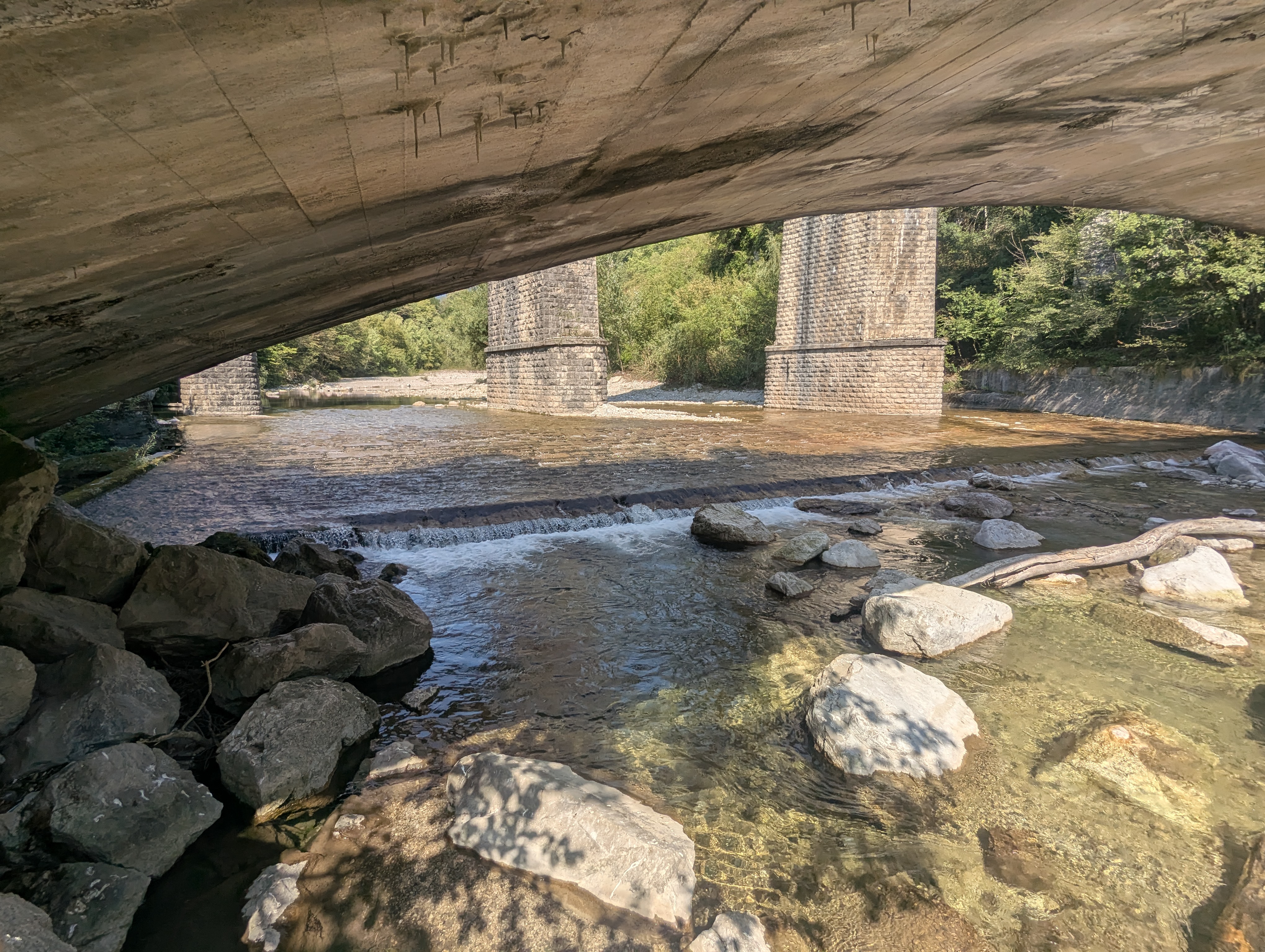
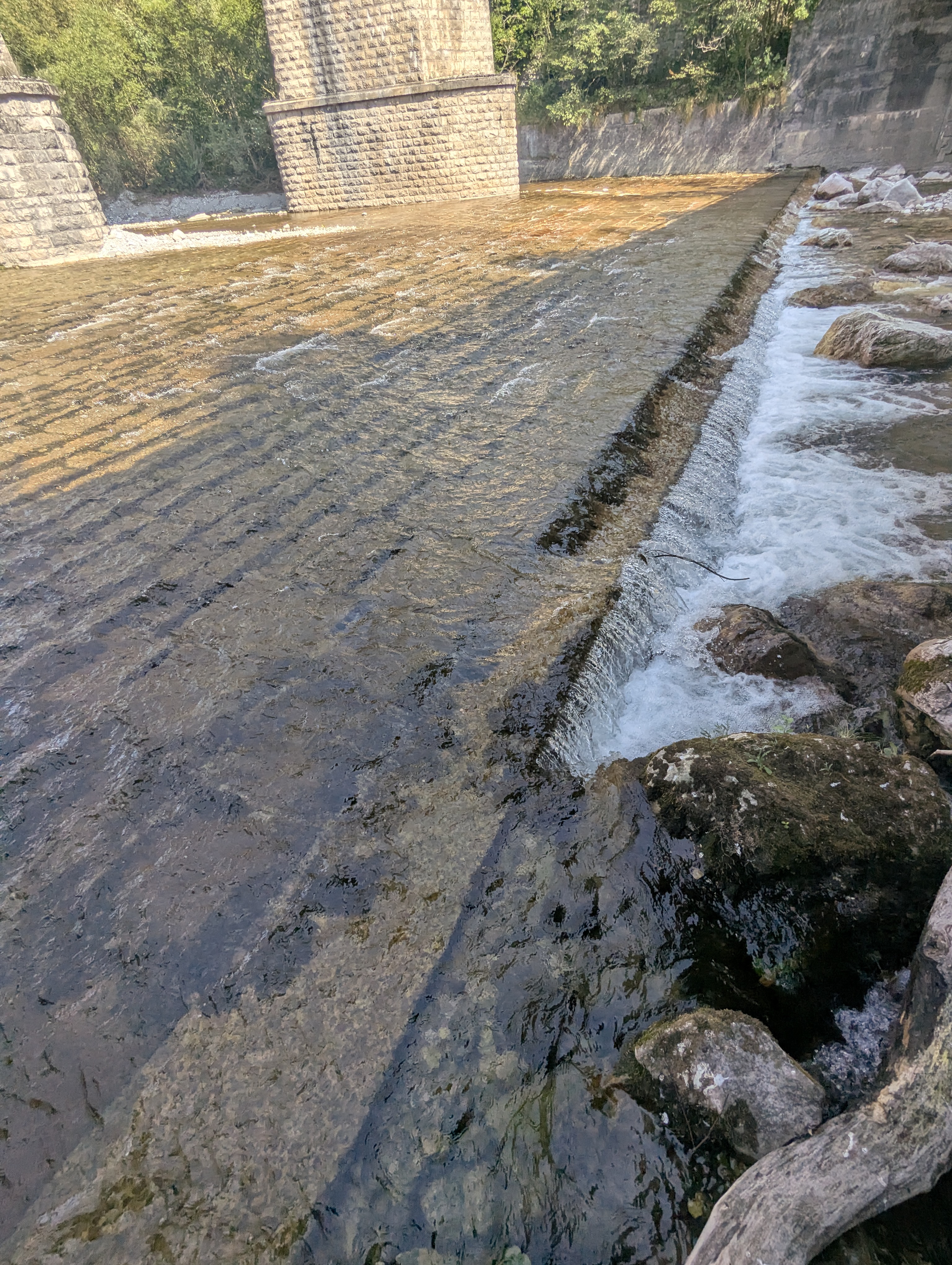
To gauge the water level head to the take out and check below the bridge: if there is water but it's too low to kayak (scraping) then it's ok in the gorge.
See the pictures for reference
The section is often clogged with wood making it potentially very dangerous so the water level MUST be low especially if conditions are unknown.
To gauge the water level head to the take out and check below the bridge: if there is water but it's too low to kayak (scraping) then it's ok in the gorge.
See the pictures for reference
 • #7475 • 03.08.2026 15:08
 Gefahr vorübergehend
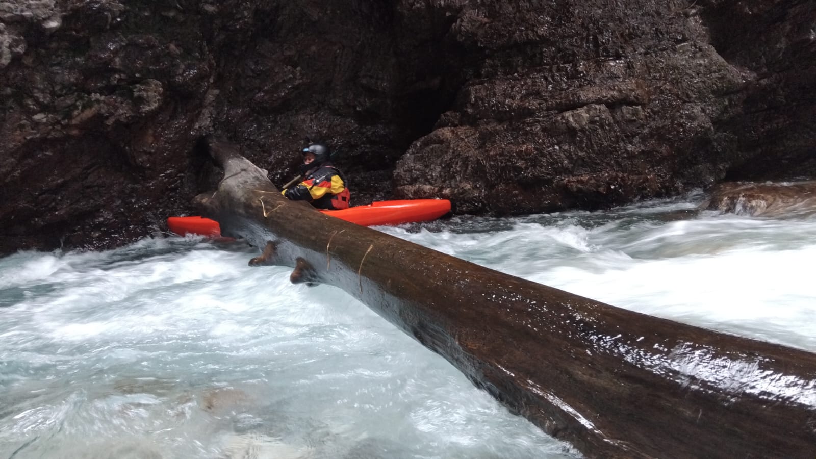
Im Eingang zum ersten Canyon (nach der Unfahrbaren) ist eine unangenehme Baumversperrung - vorsichtig herantasten und ganz rechts beim Felsen überheben.
Noch 5 oder 6 weitere Baumverhaue, die aber ohne Stress überhoben werden können (02.04.2026)
Noch 5 oder 6 weitere Baumverhaue, die aber ohne Stress überhoben werden können (02.04.2026)
 • #7231 • 13.04.2026 07:56
Befahrbarkeit
Unverständlich, dass es zur Mae kaum Meldungen gibt... Wir waren wieder dort - letzten Samstag und es ist immer ein erhebendes Gefühl. Aktuell gibt es nur eine kleine Baumversperrung, die ganz einfach überhoben werden kann. Bis auf ein paar fahrbare Bäume, wo Vorsicht geboten ist, ist der Canyon ansonsten frei.
Videolink wird demnächst folgen.
Videolink wird demnächst folgen.
• #5379 • 17.07.2023 20:27Divers
Maè got a very difficult put in and practicaly no parking available, it’s hard to spot the correct place https://www.openstreetmap.org/note/new?lat=46.26587&lon=12.26485#map=17/46.26597/12.26671&layers=N this is the little rock bridge were you can leave one car. before the bridge a little and faith path take you to the river but it’s very steep and slippery. water in Mae must be low, avoid any period of bad weather or any rainy day, avoid the period when snow is melting. best period summer till October than start to be very cold and frozen terrain does not help the take in walk.
• #2756 • 20.03.2018 11:14